Skip to content

Act I · c. 15,000 years ago to c. 2500 BCE

Villages, monuments and the first inequality

15 ka – 2,400 BCE on the whole story's log time scale

The question this page answers

Did settling down and farming create rulers?

Short answer Wealth gaps generally widened with farming, but not at once and not everywhere. Measured by house sizes, the median Gini in one large sample of 63 sites is 0.17 for hunter-gatherers, 0.27 for horticulturalists and 0.35 for agriculturalists. Gaps grew most where farming became limited by land rather than labour, with ploughs and herds worth defending and handing down. Yet many early farming villages score as low as foragers, and the largest settlements of the age show no rulers at all. 1,2,3 Debated Excavation

  • Yes, through property that could be defended. Wealth disparities generally increased with the domestication of plants and animals and with larger polities, and after the Neolithic grew larger in Eurasia than in the Americas, where there were fewer large animals to domesticate. 1,4
  • Not farming as such, but land becoming scarce. Early farming, limited by the labour of hoes and hands, was about as equal as foraging. 2
The full debate and the 5 cases behind it
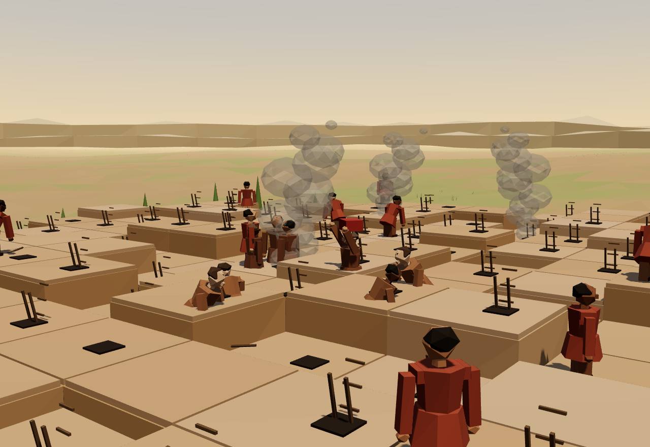
Midday on the rooftops of Çatalhöyük: flat-roofed mud-brick houses packed wall to wall with no streets between them, so people walk across the roofs and climb down ladders through hatches into their homes. Smoke rises from hearths below; beyond the mound lie fields, cattle and the river, with twin volcanic peaks on the horizon.

Çatalhöyük rooftops at midday

The evidence on the map

Where and when

9 cases in 2 regions, 15 ka to 2,400 BCE. Select a dot to jump to its case.

  • Culture
  • Site
  • under way at the slider date
  • already over
Cases on this page: place, dates and kind
CasePlaceRegionDatesKind
Natufian hamlets Ain Mallaha (Eynan), upper Jordan valley Levant & Anatolia 15 ka – 9,650 BCE Culture
Hilazon Tachtit Hilazon Tachtit cave, Galilee Levant & Anatolia 12 ka Site
Shubayqa 1 Shubayqa 1, Black Desert, north-east Jordan Levant & Anatolia 15 ka – 9,650 BCE Site
Göbekli Tepe Göbekli Tepe, near Şanlıurfa, south-east Türkiye Levant & Anatolia 9,500 BCE – 8,000 BCE Site
Jerf el Ahmar Jerf el Ahmar, Euphrates valley, Syria (now under a dam lake) Levant & Anatolia 9,200 BCE – 8,700 BCE Site
Çatalhöyük Çatalhöyük, Konya plain, central Türkiye Levant & Anatolia 7,100 BCE – 5,950 BCE Site
Linear Pottery (LBK) farmers Schöneck-Kilianstädten, Hesse, Germany Europe 5,600 BCE – 4,900 BCE Culture
Trypillia mega-sites Nebelivka, Kirovohrad region, Ukraine Europe 4,130 BCE – 3,525 BCE Culture
Durrington Walls and Stonehenge Durrington Walls, Wiltshire, England Europe 2,600 BCE – 2,400 BCE Site

Map: Natural Earth (public domain), equirectangular. Positions are approximate; dots pushed apart to stay clickable are tied to their true spot by a line.

Movement 1 of 5c. 15,000–11,600 years ago · the Levant

Settling down

3 cases: Natufian hamlets · Hilazon Tachtit · Shubayqa 1

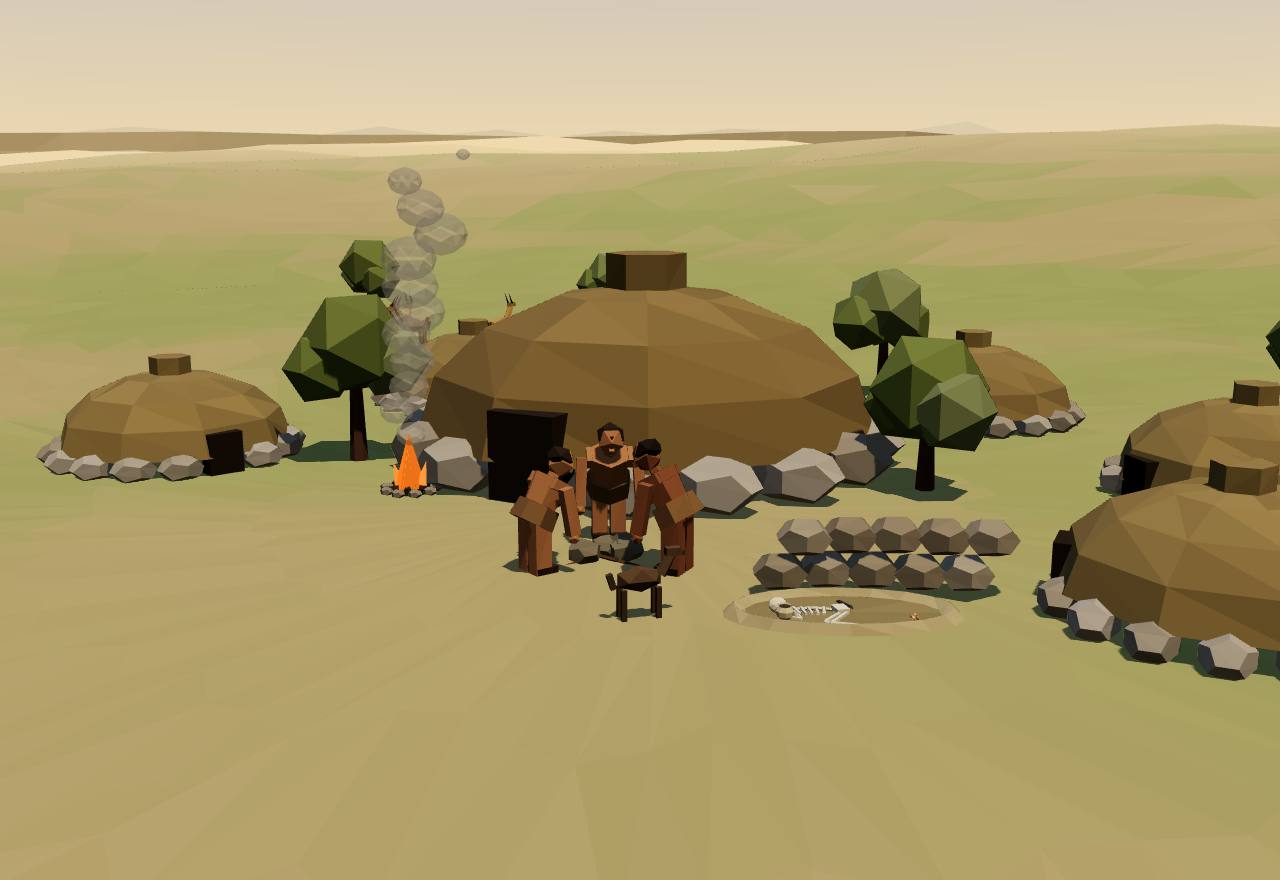
A hamlet of hunter-gatherers about 14,000 years ago: half-sunken round houses on dry-stone footings with brush roofs, one much larger than the rest, on a slope above the valley. People pound wild cereals and acorns in heavy stone mortars; a grave has been dug in the ruin of an abandoned house; gazelle graze on the hill.

A Natufian hamlet, upper Jordan valley

Culture Ain Mallaha (Eynan), upper Jordan valley 15 ka – 9,650 BCE

Natufian hamlets

Region: Levant & Anatolia

Before anyone farmed, hunter-gatherers in the Levant began to stay put. They built round houses on stone footings, pounded wild plants in stone mortars too heavy to carry, and buried their dead in their hamlets.

What the evidence says

Natufian base camps were hamlets of semi-subterranean houses on stone foundations, with an upper structure probably of brush and wood. Houses were about 3 to 6 m across; one semicircular house at Ain Mallaha is 9 m in diameter. Sites come in three sizes: 15–100 m², 400–500 m² and over 1,000 m². 5 Consensus Excavation

How settled they were is read from indirect signs: house mice, rats and sparrows living alongside people, gazelle teeth showing hunting in both winter and summer, and the work put into houses, plaster, graves and boulder mortars weighing up to 100–150 kg. Houses were also rebuilt after spells of abandonment, so hamlets were not always lived in without a break. 5 Debated Excavation Bioarchaeology

The dead were buried in abandoned houses and outside them, not under the floors of lived-in houses, often with head decorations, necklaces, belts and bracelets of shell, bone and teeth, above all in the Early Natufian. Bar-Yosef reports that reading these differences as social hierarchy has been found untenable; the jewellery that differs from site to site more likely marked group identities. 5 Debated Excavation Bioarchaeology

Ain Mallaha has a tusk shell from the Atlantic and a freshwater bivalve from the Nile, and Anatolian obsidian in a Late Natufian layer; basalt for Mount Carmel mortars came from the Golan Heights, about 100 km away. 5 Consensus Excavation

Brian Byrd argues that settling down, and then village life, came quickly rather than gradually, in good climatic conditions and in places rich in food, and brought changes in how people made a living, dealt with one another and saw the world. 6 Debated Excavation Dating

Bar-Yosef sees farming as a Late Natufian response to the cold Younger Dryas: for people who had come to rely on cereals, deliberate cultivation was the only way out, and domestication followed without anyone intending it. 5 Debated Excavation Dating

How power worked · 5 unknown

Who rules
Unknown
Why?

No ruler's house or rich centre. One small plastered building at Ain Mallaha may have been used by a leader or shaman, its excavator suggests; nothing shows an office.

How chosen
Unknown
Why?

No evidence of how anyone came to lead a Natufian hamlet.

Limits on power
Unknown
Why?

No evidence of what limited anyone's authority.

Scale
Village Debated
Claim to rule
Unknown
Why?

No evidence of what authority, if any, rested on.

Who has a say
Unknown
Why?

No evidence of who took part in decisions.

How we know

4 lines of evidence · Excavation, Bioarchaeology, Dating

  1. Excavation

    Excavation: semi-sunken houses with stone footings, plastered pits, boulder mortars and graves at base camps such as Ain Mallaha and Hayonim. 5

  2. Bioarchaeology

    Animal remains: more house mice, rats and sparrows than at forager camps, and growth rings in gazelle teeth showing hunts in winter and summer. 5

  3. Excavation

    Burials: more than 400 individuals recovered from Natufian cemeteries, with ornaments found attached to the skeletons. 7,5

  4. Dating

    Dating: radiocarbon places the Natufian at about 15,000–11,600 calibrated years ago; Bar-Yosef's 1998 summary gives its start in uncalibrated radiocarbon years, around 13,000 or 12,800 BP. 7,5

In Seshat

Not coded in Seshat. The Seshat Global History Databank (Equinox-2020) has no polity for this case.

Objects

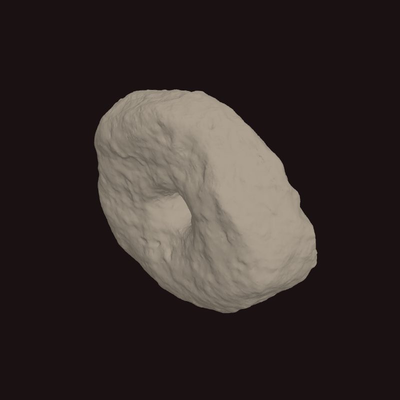
Perforated stone (st0007) from the Late Natufian site of Nahal Ein Gev II, one of the pierced pebbles read as spindle whorls
Perforated stone (st0007) from the Late Natufian site of Nahal Ein Gev II, one of the pierced pebbles read as spindle whorls, 12 ka. Nahal Ein Gev II, Jordan Valley; Hebrew University of Jerusalem excavations. 8,9 3D scan: T. Yashuv and L. Grosman, via Zenodo (source record) · CC BY 4.0

Site Hilazon Tachtit cave, Galilee 12 ka

Hilazon Tachtit

Region: Levant & Anatolia

A small burial cave on a cliff above a stream in the Galilee. About 12,000 years ago a community buried an elderly, disabled woman here with extraordinary offerings, and feasted at the graveside.

What the evidence says

The cave held at least 28 people. The earliest Natufian burial in it, dated 12,400–12,000 cal BP, is of a petite woman about 45 years old and about 1.5 m tall, whose inborn deformities of the pelvis and spine would have given her a limp and an uneven gait. 7 Consensus Bioarchaeology Dating

She was laid in an oval grave plastered with mud and lined with slabs, more than ten large stones were placed on her head, pelvis and arms, and a triangular slab sealed the grave. With her were at least 50 tortoise shells, two marten skulls, the wing tip of a golden eagle, the tail of an aurochs, the pelvis of a leopard, the forearm of a wild boar and the foot of a much larger adult. 7 Consensus Excavation

Leore Grosman and colleagues argue that she was a shaman, one of the earliest known: her special treatment fits the place shamans hold in many recorded societies, where disabled people are often credited with healing and spiritual powers, and the animals buried with her still play shamanistic roles around the world. 7 Debated Excavation Ethnography

Two structures in the cave hold the butchered, shell-roasted remains of at least 71 tortoises in the grave structure and 13 more in the second, and at least three aurochs, which would have given over 300 kg of meat. The tortoises alone could have fed at least 35 people. 10 Consensus Excavation

Natalie Munro and Leore Grosman read this as the clearest evidence of a feast before the Neolithic, and argue that such funeral feasts brought a newly settled community together: they helped people negotiate their relationships and eased the strains of living close to one another. 10 Debated Excavation

How power worked · 6 unknown

Who rules
Unknown
Why?

One woman was buried with exceptional care, which points to special standing in her community, not to an office of rule.

How chosen
Unknown
Why?

Nothing shows how she gained her position; the excavators' shaman reading rests on comparison with recorded societies.

Limits on power
Unknown
Why?

No evidence of what limited anyone's authority.

Scale
Unknown
Why?

A burial cave, not a settlement: the nearest known Natufian hamlet, Hayonim Terrace, is 10 km away.

Claim to rule
Unknown
Why?

If she was a shaman, her standing rested on spiritual powers; but that is an analogy, and nothing shows it gave anyone authority over others.

Who has a say
Unknown
Why?

No evidence of who took part in decisions.

How we know

4 lines of evidence · Dating, Bioarchaeology, Excavation

  1. Dating

    Dating: radiocarbon dates put the single Natufian occupation of the cave at 12,400–12,000 cal BP, late in the Natufian. 7

  2. Bioarchaeology

    Skeleton: sex from the pelvis and femur; age from worn teeth and spinal lipping; inborn fusion and deformation of the pelvis and lower spine. 7

  3. Excavation

    Grave construction: infrared analysis shows the grave walls were plastered with mud brought from outside the cave. 7

  4. Excavation

    Animal bones: 9,669 identified specimens from the two structures, with cut marks, spiral breaks for marrow and burning on the outside of tortoise shells. 10

In Seshat

Not coded in Seshat. The Seshat Global History Databank (Equinox-2020) has no polity for this case.

Site Shubayqa 1, Black Desert, north-east Jordan 15 ka – 9,650 BCE

Shubayqa 1

Region: Levant & Anatolia

A hunter-gatherer site in the basalt Black Desert of Jordan. Two stone fireplaces in one building preserved the oldest known bread, baked some 4,000 years before farming.

What the evidence says

In a semi-sunken building with a basalt flagstone floor, two fireplaces built one above the other and used about 14,400–14,200 years ago held at least 642 lumps of charred food. Of 49 examined under the electron microscope, 24 were bread-like: probably unleavened flat breads. 11 Consensus Excavation Dating

The bread was made from wild cereals such as wild einkorn, one of the founder crops of later farming, together with tubers of club-rush; club-rush tubers made up about 50,000 of the more than 65,000 plant remains in the fireplaces. 11 Consensus Excavation

Cereals were not a common food in the Natufian, and the authors think bread became a daily staple only once farming was firmly established. They suggest it may first have been a special food, perhaps for feasts; they do not claim that bread drove the start of farming. 11 Debated Excavation

No ovens are known from this time or place; the dough was most likely baked in the ashes of a fireplace or on a hot stone. 11 Debated Excavation

How power worked · 6 unknown

Who rules
Unknown
Why?

One building at a hunter-gatherer site: nothing shows how the group was led.

How chosen
Unknown
Why?

No evidence of how anyone came to lead.

Limits on power
Unknown
Why?

No evidence of what limited anyone's authority.

Scale
Unknown
Why?

How large the group was, and how long it stayed each year, cannot be told from this evidence.

Claim to rule
Unknown
Why?

No evidence of what authority, if any, rested on.

Who has a say
Unknown
Why?

No evidence of who took part in decisions.

How we know

3 lines of evidence · Dating, Excavation

  1. Dating

    Dating: seven radiocarbon dates on short-lived charred plants from inside the fireplaces. 11

  2. Excavation

    Plant remains: more than 65,000 charred seeds, tubers and fragments of at least 95 kinds, recovered by sieving the fireplace fills (2012–2015). 11

  3. Excavation

    Microscopy: scanning electron microscope images of 49 food lumps show crushed cereal grain, bran layers and tuber tissue in a porous, baked matrix. 11

In Seshat

Not coded in Seshat. The Seshat Global History Databank (Equinox-2020) has no polity for this case.

Movement 2 of 5c. 9500–8000 BCE · upper Mesopotamia

Monuments before farms

2 cases: Göbekli Tepe · Jerf el Ahmar

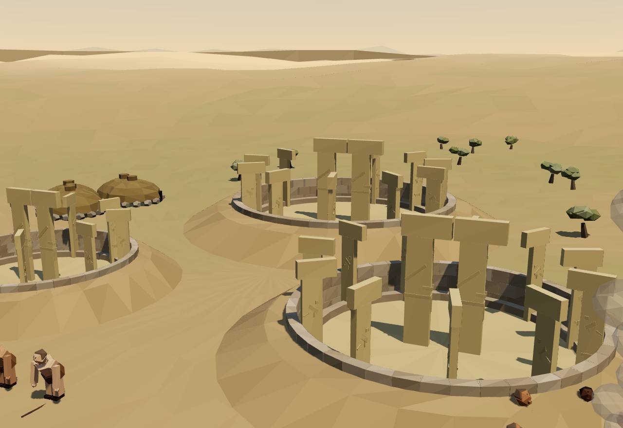
Three round enclosures sunk into a hilltop, their rubble walls set with T-shaped limestone pillars facing inward around two taller central pillars, about 5.5 m in the largest, carved with arms, hands and belts. Geometry: a red triangle links the centres of the three enclosures, as Haklay and Gopher propose. Roofed: the same enclosures read as roofed buildings. Round houses cling to the slope, and people feast and grind grain nearby.

Göbekli Tepe, south-east Anatolia

Site Göbekli Tepe, near Şanlıurfa, south-east Türkiye 9,500 BCE – 8,000 BCE

Göbekli Tepe

Region: Levant & Anatolia

On a hilltop in south-east Anatolia, people who did not yet farm raised round enclosures of carved T-shaped limestone pillars, the tallest about 5.5 m high.

What the evidence says

Enclosures B, C and D are round, partly sunken buildings about 9 to 14 m across inside, whose walls join 9 to 11 T-shaped pillars 3–4 m high around two central pillars. In Enclosure D the central pillars stand about 5.5 m tall and carry arms, hands, a belt and a loincloth in relief. Mortar in D's ring wall is dated 9745–9314 cal BC. 12,13,14 Consensus Excavation Dating

The builders were hunter-gatherers. The animal bones are of wild species, gazelle, aurochs, wild ass and wild boar among them, and no domesticated species has been identified; the cereals ground on site were wild. 15,13 Consensus Excavation Bioarchaeology

Its first excavator, Klaus Schmidt, saw a mountain sanctuary for which 'no serious claim for domestic use is tenable', built at meetings of hunter-gatherer groups who came from far around. 15 Debated Excavation

Masses of animal bones smashed for marrow, six stone vessels holding up to 160 litres, 7,268 grinding tools and cisterns holding 153 m³ point to feasting and large-scale cereal processing. The team reads the seasonal peaks as work feasts that drew people to build; chemical tests for beer residue were inconclusive. 13,14 Debated Excavation

Excavations in 2015–2019 found round houses with hearths, bead-making and domestic tool kits, a burial under a floor and a rock-cut pit 8 m across that may have held water. Dates show the round special buildings and the rectangular houses overlapped in time, and the image of the 'world's first temples' is being revised. 16 Debated Excavation Dating

Gil Haklay and Avi Gopher find that the centre points of Enclosures B, C and D lie within 25–28 cm of the corners of an equilateral triangle with sides of about 19.25 m, and argue that the three were planned and first built as a single project. 12 Debated Excavation

How power worked · 5 unknown

Who rules
Unknown
Why?

Building the enclosures took organised labour, but nothing shows who led it.

How chosen
Unknown
Why?

No evidence of how anyone came to lead.

Limits on power
Unknown
Why?

No evidence of what limited anyone's authority.

Scale
Village Debated
Claim to rule
Unknown
Why?

The carvings show a shared symbolic world of animals and human-like figures, not who claimed authority from it.

Who has a say
Unknown
Why?

No evidence of who took part in decisions.

How we know

4 lines of evidence · Dating, Excavation, Bioarchaeology

  1. Dating

    Dating: radiocarbon on organic matter in the clay mortar of Enclosure D's ring wall (9745–9314 cal BC) and on charcoal from Enclosures A and C. 14,12

  2. Excavation

    Architecture: plans of Enclosures A–D, their pillars and benches; most of the mound is still unexcavated, and at least 15 more round enclosures are thought to exist. 12

  3. Excavation

    Tools and plants: 7,268 grinding tools analysed for form and wear, and cereal phytoliths in the sediment. 14

  4. Bioarchaeology

    Animal bones: wild gazelle, aurochs and wild ass, broken for marrow, with gazelle hunted mainly between midsummer and autumn. 13,14

In Seshat

Not coded in Seshat. The Seshat Global History Databank (Equinox-2020) has no polity for this case.

Site Jerf el Ahmar, Euphrates valley, Syria (now under a dam lake) 9,200 BCE – 8,700 BCE

Jerf el Ahmar

Region: Levant & Anatolia

A village on the Euphrates whose people dug large round buildings into the ground for the whole community: first divided into cells for storage and meetings, later a single room ringed by a carved bench.

What the evidence says

Building EA 30 is an oval sunk more than 2 m into the ground, 7.40 by 6.80 m inside, its roof carried on about fifteen poplar posts. Low walls divide six small cells facing a broad bench 1.50 m wide on two levels; one closed cell with a small hatch may have been a silo. 18 Consensus Excavation

The later building EA 53 is round, 7 m across and sunk 2 m deep, with a bench that forms a regular hexagon of 2.50 m sides, faced with chalk slabs carved with friezes of triangles. Two shoulder blades of young aurochs had been placed inside the bench. 18 Consensus Excavation

Danielle Stordeur and colleagues read the early buildings as multi-purpose communal spaces for storage, meetings and rituals, and the later ones as solemn meeting places, forerunners of the sanctuaries of Early Neolithic Anatolia. 18 Debated Excavation

The communal buildings were all burnt, probably on purpose. In EA 30 a body without its skull and first four neck vertebrae lay on its back on the floor, under the burnt debris of the fallen roof; the excavators say it cannot be treated as a burial. 18 Consensus Excavation Bioarchaeology

Measured by house size, Jerf el Ahmar shows little inequality: Kohler and colleagues compute a Gini of 0.20 (80% interval 0.18–0.22) from 2 households, and Fochesato and colleagues 0.202 from 5 houses' storage space after their corrections. 1,19 Debated Excavation

How power worked · 5 unknown

Who rules
Unknown
Why?

The communal buildings show people pooling labour and perhaps stores, but not who, if anyone, directed them.

How chosen
Unknown
Why?

No evidence of how anyone came to lead.

Limits on power
Unknown
Why?

No evidence of what limited anyone's authority.

Scale
Village Consensus
Claim to rule
Unknown
Why?

No evidence of what authority, if any, rested on.

Who has a say
Unknown
Why?

The buildings were meeting places, but nothing shows who could attend or speak.

How we know

3 lines of evidence · Excavation, Dating

  1. Excavation

    Excavation: more than 1,500 m² opened in 1995–1999, before the site was flooded by a dam lake. 18

  2. Dating

    Dating: radiocarbon from test pits, 9790 ± 80 BP (9038 cal BC) and 9680 ± 90 BP (8987 cal BC). 18

  3. Excavation

    Comparison: EA 30 has the same plan as House 47 at Mureybet, 40 km downstream, only larger. 18

In Seshat

Not coded in Seshat. The Seshat Global History Databank (Equinox-2020) has no polity for this case.

Movement 3 of 5c. 7100–4900 BCE · Anatolia and central Europe

Farming towns

2 cases: Çatalhöyük · Linear Pottery (LBK) farmers

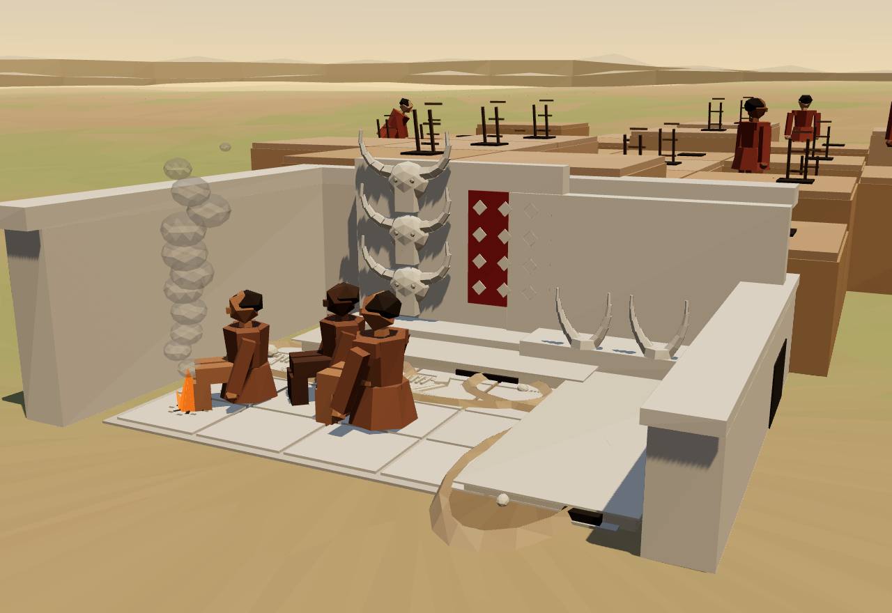
A cutaway of one room of a Çatalhöyük house, its near wall removed: whitewashed plaster walls and floor, raised clay platforms along two walls, plastered bull heads with real horn cores mounted on the wall, a ladder to the roof hatch and a hearth. Before 6500 BC: several graves lie open beneath the platforms. After 6500 BC: a single grave, and storage jars by the oven.

Inside a Çatalhöyük house

Site Çatalhöyük, Konya plain, central Türkiye 7,100 BCE – 5,950 BCE

Çatalhöyük

Region: Levant & Anatolia

A farming town of mud-brick houses packed so close on its mound that people walked across the roofs and climbed in by ladder. For about 1,150 years it had no palace, no temple district and no large public building.

What the evidence says

Çatalhöyük East is a 13-hectare mound with nearly 21 m of layered deposits from about 1,150 years of continuous settlement, c. 7100–5950 cal BCE. No large, clearly public building has been found: the town was made of houses. 20,21 Consensus Excavation Dating

At its peak in the Middle Period (6700–6500 cal BCE) it may have held about 3,500 to 8,000 people, an estimate based on the number, size and density of houses; it was also the most crowded time in the town's history. 20 Debated Excavation

Most of the dead lie beneath house floors, the majority of adults in clay platforms along the north and east walls of the main room. Walls and floors were replastered many times; when a house was abandoned it was often rebuilt on the same footprint, sometimes four or more times. 20 Consensus Excavation Bioarchaeology

People buried under the same house were often not close biological relatives. Teeth of 266 individuals show that burial in a house was only minimally related to biological affinity, and ancient genomes found close kin for only 2 of 10 children buried together in three mid-7th-millennium buildings, whereas at the earlier villages of Aşıklı and Boncuklu 4 of 5 co-buried people had a close relative nearby. 22,21 Debated Bioarchaeology Ancient DNA

Healed depressed fractures mark 25 of 93 skulls studied, slightly more often women's than men's, and women were mostly struck from behind; 12 of the 93 were injured two to five times. The authors link the rise in head injuries to the crowding of the Middle Period. 20 Debated Bioarchaeology

Its excavator, Ian Hodder, describes the crowded middle levels as an 'aggressively egalitarian community' that bore heavier work, physical stress and illness, relieved after 6500 BC by greater mobility, more economic independence of houses and a dispersing population. 23,20 Debated Excavation Bioarchaeology

How power worked · 5 unknown

Who rules
Unknown
Why?

No palace, ruler's house or temple district has been found: no sign of a ruler, but nothing shows who decided for the town.

How chosen
Unknown
Why?

No evidence of how anyone came to lead.

Limits on power
Unknown
Why?

No evidence of what limited anyone's authority.

Scale
Village Consensus
Claim to rule
Unknown
Why?

The dead buried under the floors tie authority, if any, to the house and its remembered members, but nothing shows how that turned into decisions.

Who has a say
Unknown
Why?

Houses look much alike, but nothing shows who took part in decisions.

How we know

4 lines of evidence · Dating, Excavation, Bioarchaeology, Ancient DNA

  1. Dating

    Dating: a model of radiocarbon dates puts continuous settlement at c. 7100–5950 cal BCE, split into Early (7100–6700), Middle (6700–6500) and Late (6500–5950) periods. 20

  2. Excavation

    Houses: excavation of houses, their rebuilds, platforms, hearths and wall paintings, layer by layer; no public building has been found. 20,21

  3. Bioarchaeology

    Skeletons: 470 complete individuals from primary burials and parts of 272 more, studied for health, workload, diet and injuries; teeth of 266 individuals compared house by house. 20,22

  4. Ancient DNA

    Ancient DNA: of 60 Çatalhöyük skeletons screened, 14 yielded genomes, compared with genomes from Aşıklı, Boncuklu and Barcın; only children could be tested at Çatalhöyük. 21

Midday on the rooftops of Çatalhöyük: flat-roofed mud-brick houses packed wall to wall with no streets between them, so people walk across the roofs and climb down ladders through hatches into their homes. Smoke rises from hearths below; beyond the mound lie fields, cattle and the river, with twin volcanic peaks on the horizon.

Çatalhöyük rooftops at midday

In Seshat

PhaseSettlement tiersAdmin levelsLargest settlement (people)
Konya Plain - Early Neolithic9600–7000 BCE 1 1 —
Konya Plain - Ceramic Neolithic7000–6600 BCE 1 1 —
Konya Plain - Late Neolithic6600–6000 BCE 1 1 3,500–8,000

Seshat Equinox-2020, CC BY 4.0; values and ranges as Seshat codes them; "—" = not coded. Bars: log scale. Attribution ↓

Objects

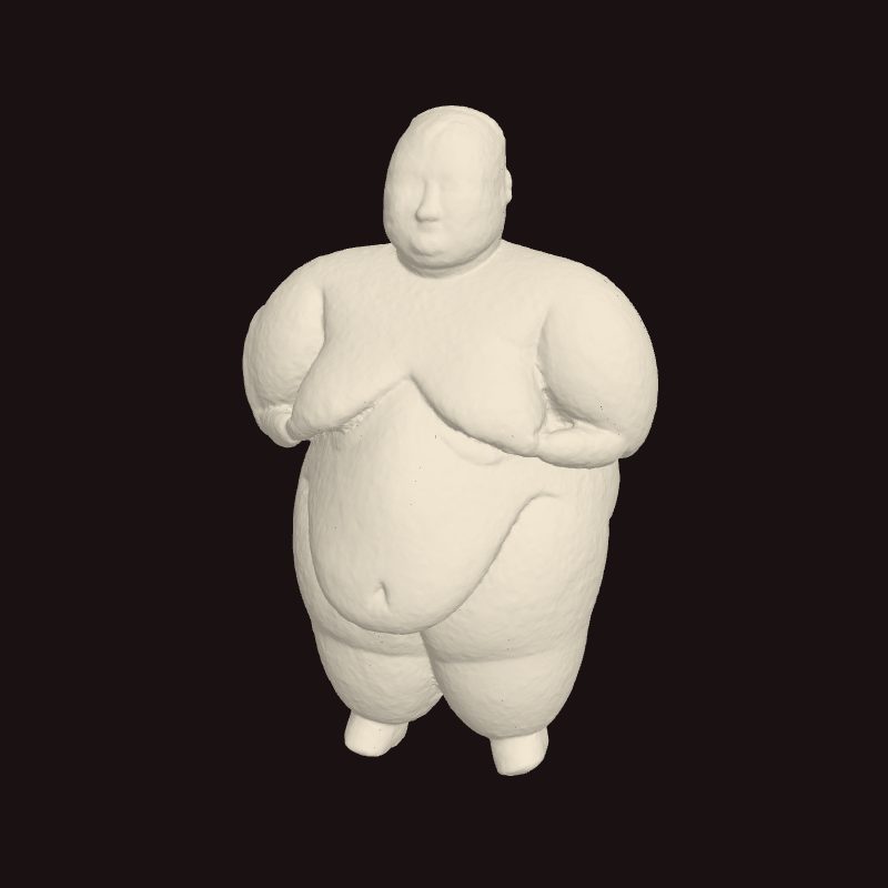
Stone figurine 20736.x1: a large standing woman with fleshy body, hands at the breasts, 17 cm high
Stone figurine 20736.x1: a large standing woman with fleshy body, hands at the breasts, 17 cm high, 6,000 BCE. Çatalhöyük, Building 150 (TPC Area), placed in a platform beside a burial; excavated 2016 by the Çatalhöyük Research Project. 24,25 3D model: S. Perry, M. M. Lara and G. Palma (EMOTIVE project), via Zenodo (source record) · CC BY 4.0

Culture Schöneck-Kilianstädten, Hesse, Germany 5,600 BCE – 4,900 BCE

Linear Pottery (LBK) farmers

Region: Europe

Central Europe's first farmers lived in villages of timber longhouses on fertile loess soils, from Hungary to eastern France. Their skeletons record both quiet differences in land and, at the end, massacres.

What the evidence says

Farming spread across central Europe with the Linearbandkeramik (LBK) within five centuries, from about 5500 cal BC to just after 5000 cal BC; other authors date these first farmers to 5600–4900 cal BC. 26,27 Consensus Dating Excavation

Strontium isotopes in more than 300 skeletons vary less among men than among women, and less among burials with ground-stone adzes than without. Alexander Bentley and colleagues infer that women married in from elsewhere and that men buried with adzes had steadier access to the best loess soils: an early, inherited inequality in land. 26 Debated Bioarchaeology Excavation

In a mass grave at Schöneck-Kilianstädten, dated 5207–4849 cal BC, at least 26 people were killed by blows and arrows and thrown in together: 13 children and 13 adults, mostly men, with no one aged 9 to 15. Over half of the shin bones had been broken around the time of death, a deliberate pattern of torture or mutilation. 27 Consensus Bioarchaeology Dating

All three certain LBK massacre sites date to its later phases. Christian Meyer and colleagues argue that whole communities were wiped out more than once, probably by neighbours, and point to population growth, drought and settled farmers' inability to move away from conflict; they call the old picture of an apocalyptic end 'somewhat exaggerated'. 27 Debated Bioarchaeology Dating

House sizes at the LBK village of Vaihingen give a Gini of 0.15 (11 households; 80% interval 0.11–0.19), among the lowest in the sample, close to that of the !Kung San. 1 Debated Excavation

How power worked · 5 unknown

Who rules
Unknown
Why?

Villages of similar longhouses with no larger house or rich centre that marks a ruler; adzes in some men's graves hint at status, not office.

How chosen
Unknown
Why?

No evidence of how anyone came to lead.

Limits on power
Unknown
Why?

No evidence of what limited anyone's authority.

Scale
Village Consensus
Claim to rule
Unknown
Why?

Strontium isotopes suggest men stayed in the land where they were born; whether descent gave authority is not known.

Who has a say
Unknown
Why?

No evidence of who took part in decisions.

How we know

4 lines of evidence · Bioarchaeology, Dating, Excavation

  1. Bioarchaeology

    Isotopes: strontium ratios in tooth enamel from seven cemeteries between the Czech Republic and Alsace, 382 individuals, compared with the loess baseline. 26

  2. Bioarchaeology

    Trauma: every bone of the Kilianstädten grave scored for injuries around the time of death; minimum number of individuals from skulls and teeth. 27

  3. Dating

    Dating: four radiocarbon dates on different individuals from the mass grave. 27

  4. Excavation

    House sizes: floor areas of 11 longhouses at Vaihingen used to compute a wealth Gini. 1

In Seshat

Not coded in Seshat. The Seshat Global History Databank (Equinox-2020) has no polity for this case.

Movement 4 of 5c. 4100–3500 BCE · the Ukrainian forest-steppe

Big without bosses?

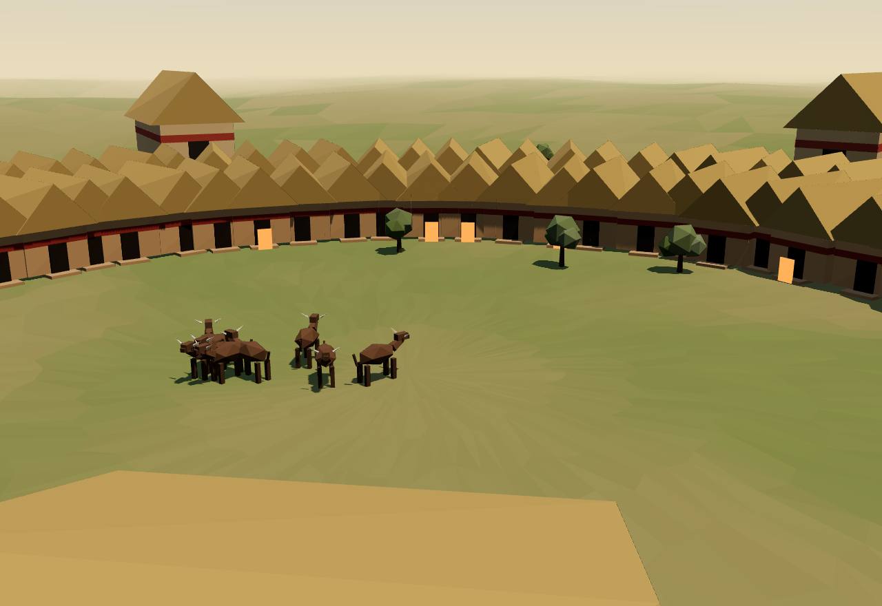
A Trypillia mega-site on the forest-steppe, drawn compressed: two great rings of long clay-walled houses around a wide empty centre, with larger assembly houses between the rings and one huge meeting hall in the gap. The houses that glow are those in use at once, as set by the population calculator; the rest stand empty.

A Trypillia mega-site, Ukrainian forest-steppe

Culture Nebelivka, Kirovohrad region, Ukraine 4,130 BCE – 3,525 BCE

Trypillia mega-sites

Region: Europe

On the forest-steppe of today's Ukraine, farmers built the largest settlements of their time: hundreds of hectares of houses in concentric rings around an empty centre, with large meeting halls but no palace.

What the evidence says

Geomagnetic survey at Nebelivka mapped 1,445 structures inside a ditch enclosing about 238 ha: two concentric circuits of houses around a large empty centre, with more houses along radial streets and around squares. Three-quarters had been burnt at the end of their lives. Maidanetske had around 2,930 buildings in nine rings. 3,28 Consensus Survey

Radiocarbon models put Nebelivka most likely at c. 3970–3770 BC, about 200 years, and the houses of Maidanetske at 3935–3640 cal BCE with a peak around 3765–3710; the largest sites were at least partly occupied at the same time. 3,28 Consensus Dating

Larger 'assembly houses' stand among the dwellings: 23 at Nebelivka. The biggest, the Mega-structure, about 56 × 20 m, held raised clay platforms, miniature vessels and figurines but no ovens or hearths. Its excavators conclude it was a public building for meetings, and that anyone expecting the remains of elites ruling over thousands 'will be disappointed'. 3,29 Consensus Excavation Survey

How many lived there at once is disputed. Older estimates for Maidanetske ran from 12,000 to 46,000. René Ohlrau, assuming 42–52% of houses in use and 4.5–7 people per house, gets about 2,600–5,000 for Nebelivka and 5,500–10,700 for Maidanetske; Bisserka Gaydarska and John Chapman's models range from 2,400–3,200 permanent residents to a few thousand visitors gathering for a month a year. 28,30,3 Debated Survey Model

Meeting buildings come in levels: for the whole settlement, for ring sectors and for quarters. Robert Hofmann and colleagues read this as decision-making shared among communities that had fused together. Later the smaller halls shrink and vanish; they argue power was being centralised, and that its rejection helped break up the mega-sites around 3600 BCE. 31 Debated Survey Excavation

Nitrogen isotopes show that some Maidanetske cattle, probably dairy cows, grazed intensively on manured pastures while others ranged widely. The authors infer that access to good pasture was negotiated between households, under a strong cooperative ethos that downplayed hierarchy. 32 Debated Bioarchaeology

How power worked · 4 unknown

Who rules
Council of elders or heads Debated
How chosen
Unknown
Why?

Nothing shows how anyone came to speak for a neighbourhood or the whole site.

Limits on power
Unknown
Why?

No evidence of what limited anyone's authority.

Scale
Village Debated
Claim to rule
Unknown
Why?

No evidence of what authority, if any, rested on.

Who has a say
Unknown
Why?

Meeting halls at several levels suggest decisions by neighbourhood and quarter, but not who took part.

How we know

5 lines of evidence · Survey, Dating, Excavation, Bioarchaeology, Model

  1. Survey

    Geophysics: magnetometry maps every burnt house, ditch and meeting hall without digging; 286 ha surveyed at Nebelivka, around 82% of Maidanetske. 3,28

  2. Dating

    Dating: 83 radiocarbon measurements on 74 samples at Nebelivka, modelled together; at Maidanetske, dates on burnt houses in each of the nine rings. 3,28

  3. Excavation

    Excavation: the Nebelivka Mega-structure dug in 2012, and test excavations of houses and meeting halls at Maidanetske. 29,31

  4. Bioarchaeology

    Isotopes: carbon and nitrogen in cattle, sheep, goat and pig bones from Maidanetske. 32

  5. Model

    Population: always a calculation from houses, people per house and the share in use, never a count; the models differ mainly on the last two. 28,3

How many lived at a mega-site?

Model, not evidence: a calculator over published parameters

How many people lived on a Trypillia mega-site at once? Everyone multiplies the same four numbers; they disagree about the last three. Pick a published scenario, or set your own low and high values, and see how wide the answer gets. 3,30,28

Nebelivka. The Distributed Governance Model: a permanent but much smaller town of about 400 houses, ten clans taking turns to lead, a few houses burnt and rebuilt every year. The source's own figure: 2,400–3,200 people (Table 6.3, p. 441). 3

Houses mapped 1,445

1,445 structures mapped (Table 4.1, p. 129) 3

People per house 6–8

"six to eight people occupied each house" (p. 488) 3

Share of houses in use at once 28%

400 houses in use at once, of 1,445 (Distributed Governance Model, p. 437) 3

Share of the year occupied 100%

permanent residents, visits "all through the year" (Table 6.3, p. 441) 3

People on the site at once: 2,400–3,200

Published scenarios: parameters stated by each source and the population they give
Scenario Houses mappedPeople per houseShare of houses in use at onceShare of the year occupied Population
Gaydarska: permanent 1,445 3 6–8 3 28% 3 100% 3 2,400–3,200
Gaydarska: radiocarbon 1,445 3 6–8 3 17%–33% 3 not stated 1,445–3,853
Ohlrau: Nebelivka 1,370 30 4.5–7 30 42%–52% 30 100% 30 2,589–4,987
Ohlrau: Maidanetske, families 2,930 28 3.9–4.7 28 52% 28 100% 30 5,942–7,161
Ohlrau: Maidanetske, households 2,930 28 4.5–7 28 52% 28 100% 30 6,856–10,665

Gaydarska and Chapman's other two models, a month-long seasonal assembly and a pilgrimage centre, count permanent residents and visitors separately, so they are not presets here: at their peaks about 300 residents with up to 3,300 visitors, and 100 guardians with up to 1,920 pilgrims a month. 3 The Trypillia stage lights the share of houses in use at the middle of the range you set.

In Seshat

Not coded in Seshat. The Seshat Global History Databank (Equinox-2020) has no polity for this case.

Objects

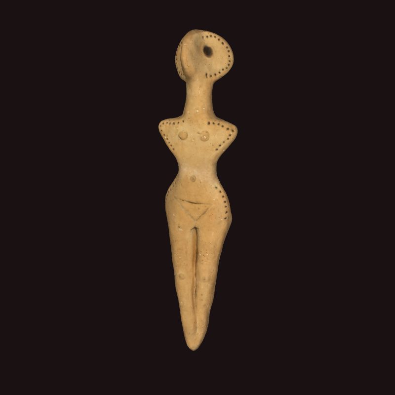
Female figurine of fired clay with pricked ornament, Trypillia culture, from near Oselivka (Chernivtsi oblast), 17 cm high
Female figurine of fired clay with pricked ornament, Trypillia culture, from near Oselivka (Chernivtsi oblast), 17 cm high, 3,000 BCE. National Museum of the History of Ukraine, Kyiv (dated by the museum 3200–2750 BCE). 33 3D scan: National Museum of the History of Ukraine, via Europeana (source record) · CC BY 4.0

Movement 5 of 5c. 2600–2400 BCE · Salisbury Plain

Monuments of farmers

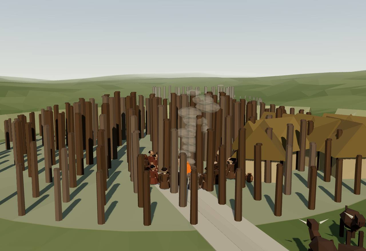
Durrington Walls about 2500 BCE: rings of tall timber posts form the Southern Circle, small square thatched houses crowd nearby, and a broad avenue runs down to the River Avon; Stonehenge's sarsen circle stands on the far ridge. Feast: fires, a long hearth by the circle's entrance and cattle driven in from afar. Solstice: a crowd gathers at the entrance, which faces the midwinter sunrise.

Durrington Walls, Wiltshire

Site Durrington Walls, Wiltshire, England 2,600 BCE – 2,400 BCE

Durrington Walls and Stonehenge

Region: Europe

Three kilometres from Stonehenge, by the River Avon, a great henge of timber circles and small houses filled for a few decades with people, pigs and pots, at the very time the sarsen stones were raised.

What the evidence says

Durrington Walls, Britain's largest henge, lies about 3 km north-east of Stonehenge near the River Avon. Its first precise dates are statistically indistinguishable from the sarsen phase of Stonehenge: the sarsen circle is dated 2580–2470 cal BC and a sarsen trilithon 2600–2400 cal BC (95% probability). 34 Consensus Dating

The two sites mirror each other: Stonehenge in stone, with Beaker pottery, cattle bones and human remains; Durrington in timber, with Grooved Ware, pig bones and almost no human remains. The Southern Circle's entrance faces the midwinter sunrise and Durrington's avenue the midsummer sunset; Stonehenge's avenue faces the midsummer sunrise and, the other way, the midwinter sunset. 34 Consensus Excavation Survey

Mike Parker Pearson and colleagues suggest the two were designed as one complex for opposed stages of a funeral process, through which the dead became ancestors. 34 Speculative Excavation

Small square houses about 5.25 m across beneath the henge's east entrance are most likely the village of the builders of Stonehenge's sarsen stage. The settlement began 2535–2475 cal BC and lasted 0–55 years. 35 Debated Excavation Dating

Masses of animal bones, many not fully used, mainly of pigs culled in late autumn and winter; pottery from pits held mostly pork fat (11 of 16 sherds), while pots near the Southern Circle and a large hall held mostly dairy (12 of 22). Oliver Craig and colleagues read this as seasonal feasting, at times on a large scale. 35 Debated Excavation Bioarchaeology

Cattle were brought on the hoof from distant parts of Britain. The authors read the feasts as voluntary work gatherings of a diverse community that probably numbered several thousand, not forced labour, and see little hierarchy in the size or shape of the houses. 35 Debated Bioarchaeology Excavation

How power worked · 6 unknown

Who rules
Unknown
Why?

Raising the sarsens and feeding the builders took organised labour on a large scale, but no ruler's house or rich burial shows who led it.

How chosen
Unknown
Why?

No evidence of how anyone came to lead.

Limits on power
Unknown
Why?

No evidence of what limited anyone's authority.

Scale
Unknown
Why?

Cattle and people came from far across Britain; nothing shows what political unit, if any, they belonged to.

Claim to rule
Unknown
Why?

Solstice alignments tie the monuments to the sun's year, but not to any claim of authority.

Who has a say
Unknown
Why?

No evidence of who took part in decisions.

How we know

4 lines of evidence · Dating, Excavation, Bioarchaeology, Survey

  1. Dating

    Dating: an antler pick from the Southern Circle and a pig bone from a house pit, the first high-precision dates for Durrington, modelled with re-dated Stonehenge samples. 34

  2. Excavation

    Pottery residues: fats from 317 Grooved Ware sherds, 151 with enough lipid to read, separated into pork, ruminant meat and dairy by their carbon isotopes. 35

  3. Bioarchaeology

    Animal bones: tooth eruption and wear give the pigs' ages at death; strontium isotopes show the cattle came from many regions of Britain. 35

  4. Survey

    Alignments: the axes of the Southern Circle and the avenue measured against the solstice sun's position in 3000–2500 cal BC. 34

In Seshat

Not coded in Seshat. The Seshat Global History Databank (Equinox-2020) has no polity for this case.

Across the cases

Threads

The questions that cut across the sites and societies above. Each gives a short, badged answer, the cases it rests on, and the positions in the debate with their sources.

Lead thread 5 cases

Did settling down and farming create rulers?

Short answer Wealth gaps generally widened with farming, but not at once and not everywhere. Measured by house sizes, the median Gini in one large sample of 63 sites is 0.17 for hunter-gatherers, 0.27 for horticulturalists and 0.35 for agriculturalists. Gaps grew most where farming became limited by land rather than labour, with ploughs and herds worth defending and handing down. Yet many early farming villages score as low as foragers, and the largest settlements of the age show no rulers at all. 1,2,3 Debated Excavation

Inequality explorer

Data: published values, transcribed with citations

The Gini coefficient of house sizes: 0 if every house is the same size, near 1 if one house is huge and the rest tiny. House size is a proxy for household wealth that archaeologists can measure on many sites. Each dot is one site or period as printed in Kohler et al.'s data table, with its 80% interval where they computed one. Compare the farming villages of the Near East and Europe before 4000 BCE with what came after, and with the Americas. 1,2,19

House-size Gini coefficients as printed in the sources
Region Site (period) Date Houses Gini 80% interval Adjusted Source
Europe and Near East Jerf el Ahmar (PPNA) c. 9,200 BCE 2 0.20 0.18–0.22 0.202 (storage) 19 Supplementary Table 2, spreadsheet row 40 1
Europe and Near East Çatalhöyük (Neolithic) c. 6,500 BCE 19 0.28 — — Supplementary Table 2, spreadsheet row 41 1
Europe and Near East Tell Sabi Abyad Burnt Village (Neolithic) c. 6,000 BCE 4 0.32 0.21–0.41 0.377 (storage) 19 Supplementary Table 2, spreadsheet row 42 1
Europe and Near East Vaihingen (LBK (Neolithic)) c. 5,200 BCE 11 0.15 0.11–0.19 0.196 19 Supplementary Table 2, spreadsheet row 44 1
Europe and Near East Tepe Gawra (Late Chalcolithic 2) c. 4,000 BCE 7 0.34 0.21–0.44 0.606 (storage) 19 Supplementary Table 2, spreadsheet row 48 1
Europe and Near East Hornstaad-Hornle 1A (Late Neolithic Hornstaad Culture) c. 3,900 BCE 30 0.17 0.15–0.18 0.179 (storage) 19 Supplementary Table 2, spreadsheet row 49 1
Europe and Near East Tell Brak Level 16 (Middle Northern Uruk/LC3) c. 3,800 BCE 4 0.36 0.24–0.38 — Supplementary Table 2, spreadsheet row 50 1
Europe and Near East S Mesopotamia (Early Dynastic) c. 2,700 BCE 21 0.37 — — Supplementary Table 2, spreadsheet row 55 1
Europe and Near East S Mesopotamia (Old Babylonian) c. 1,700 BCE 106 0.40 — — Supplementary Table 2, spreadsheet row 58 1
Europe and Near East Heuneburg phase IVb2 (Early Iron Age/Late Hallstatt) c. 600 BCE 11 0.26 0.18–0.30 0.673 (storage) 19 Supplementary Table 2, spreadsheet row 59 1
Europe and Near East S Mesopotamia (Neo-Babylonian) c. 600 BCE 14 0.40 — — Supplementary Table 2, spreadsheet row 60 1
Europe and Near East Heuneburg phase IVa1 (Early Iron Age/Late Hallstatt) c. 550 BCE 8 0.37 0.29–0.41 0.768 (storage) 19 Supplementary Table 2, spreadsheet row 61 1
Europe and Near East Herculaneum c. 79 CE 44 0.52 — 0.573 19 Supplementary Table 2, spreadsheet row 62 1
Europe and Near East Pompeii c. 79 CE 78 0.54 — 0.588 19 Supplementary Table 2, spreadsheet row 63 1
Northeast China Nantaizi (Xinglongwa) c. 5,400 BCE 32 0.15 0.12–0.20 0.157 19 Supplementary Table 2, spreadsheet row 43 1
Northeast China Zhaobaogou c. 5,150 BCE 17 0.35 0.29–0.43 0.377 19 Supplementary Table 2, spreadsheet row 45 1
Northeast China Baiyinchang (Hongshan) c. 4,250 BCE 17 0.20 0.15–0.27 0.218 19 Supplementary Table 2, spreadsheet row 47 1
Central China Jiangzhai (E. Yangshao) c. 4,550 BCE 65 0.46 0.40–0.53 0.467 19 Supplementary Table 2, spreadsheet row 46 1
Central China Wangmushan (M. Yangshao) c. 3,750 BCE 20 0.33 0.25–0.38 0.352 19 Supplementary Table 2, spreadsheet row 51 1
Central China Dadiwan (L. Yangshao) c. 3,200 BCE 30 0.53 0.46–0.61 0.550 19 Supplementary Table 2, spreadsheet row 52 1
East-coast China Jianxin (M.-L. Dawenkou) c. 3,050 BCE 10 0.35 0.32–0.40 0.396 19 Supplementary Table 2, spreadsheet row 53 1
East-coast China Yuchisi (L. Dawenkou) c. 2,700 BCE 11 0.37 0.32–0.48 0.414 19 Supplementary Table 2, spreadsheet row 54 1
East-coast China Yinjiacheng (Longshan) c. 2,300 BCE 6 0.13 0.10–0.17 0.165 19 Supplementary Table 2, spreadsheet row 56 1
Egypt Kahun (Middle Kingdom) c. 1,930 BCE 137 0.68 — 0.685 19 Supplementary Table 2, spreadsheet row 57 1
Sub-Saharan Africa !Kung San (contemporary) c. 1970 5 0.17 0.10–0.24 — Supplementary Table 2, spreadsheet row 64 1
Mesoamerica San Jose Mogote (San Jose Phase) c. 1,100 BCE 8 0.25 0.19–0.28 0.294 19 Supplementary Table 2, spreadsheet row 2 1
Mesoamerica Teotihuacan (Classic) c. 300 CE 14485 0.12 — 0.118 19 Supplementary Table 2, spreadsheet row 3 1
Mesoamerica Oaxaca (Classic) c. 700 CE 36 0.38 — — Supplementary Table 2, spreadsheet row 9 1
Mesoamerica Caracol (Late Classic) c. 700 CE 4058 0.34 — 0.338 19 Supplementary Table 2, spreadsheet row 10 1
Mesoamerica Tikal (Classic) c. 765 CE 756 0.62 — 0.619 19 Supplementary Table 2, spreadsheet row 14 1
Mesoamerica Mayapan (Postclassic) c. 1330 CE 4031 0.41 — 0.408 19 Supplementary Table 2, spreadsheet row 33 1
Mesoamerica Cuexcomate (LPC-A) c. 1370 CE 43 0.48 — — Supplementary Table 2, spreadsheet row 34 1
Mesoamerica Aztec villages (LPC) c. 1425 CE 17 0.13 — — Supplementary Table 2, spreadsheet row 35 1
Mesoamerica Cuexcomate (LPC-B) c. 1480 CE 135 0.25 — 0.252 19 Supplementary Table 2, spreadsheet row 36 1
Mesoamerica Yautepec (LPC-B) c. 1480 CE 1619 0.21 — 0.208 19 Supplementary Table 2, spreadsheet row 37 1
US Southwest Central Mesa Verde (BMIII) c. 550 CE 4 0.31 0.12–0.40 — Supplementary Table 2, spreadsheet row 5 1
US Southwest All Hohokam (Pioneer) c. 600 CE 200 0.28 0.26–0.32 — Supplementary Table 2, spreadsheet row 6 1
US Southwest Grewe (Early Pioneer) c. 600 CE 9 0.36 — 0.413 19 Supplementary Table 2, spreadsheet row 7 1
US Southwest Central Mesa Verde (BMIII) c. 650 CE 15 0.21 0.17–0.29 — Supplementary Table 2, spreadsheet row 8 1
US Southwest Central Mesa Verde (PI) c. 746 CE 11 0.30 0.27–0.36 — Supplementary Table 2, spreadsheet row 11 1
US Southwest Central Mesa Verde (PI) c. 841 CE 27 0.28 0.24–0.33 — Supplementary Table 2, spreadsheet row 15 1
US Southwest Grewe (Middle Colonial) c. 850 CE 6 0.24 — 0.297 19 Supplementary Table 2, spreadsheet row 16 1
US Southwest All Hohokam (Colonial) c. 850 CE 316 0.25 0.24–0.26 — Supplementary Table 2, spreadsheet row 17 1
US Southwest Central Mesa Verde (PII) c. 963 CE 9 0.25 0.21–0.27 — Supplementary Table 2, spreadsheet row 18 1
US Southwest All Hohokam (Sedentary) c. 1050 CE 448 0.25 0.24–0.26 — Supplementary Table 2, spreadsheet row 21 1
US Southwest Grewe (Middle Sedentary) c. 1050 CE 4 0.12 — 0.169 19 Supplementary Table 2, spreadsheet row 22 1
US Southwest Central Mesa Verde (PII) c. 1091 CE 12 0.44 0.24–0.53 — Supplementary Table 2, spreadsheet row 25 1
US Southwest Central Mesa Verde (PIII) c. 1173 CE 8 0.23 0.18–0.34 — Supplementary Table 2, spreadsheet row 28 1
US Southwest Central Mesa Verde (PIII) c. 1243 CE 15 0.36 0.32–0.44 — Supplementary Table 2, spreadsheet row 29 1
US Southwest All Hohokam (Classic) c. 1300 CE 622 0.24 0.23–0.25 — Supplementary Table 2, spreadsheet row 32 1
American Bottom (Cahokia) American Bottom (Patrick) c. 750 CE 86 0.19 0.17–0.21 — Supplementary Table 2, spreadsheet row 12 1
American Bottom (Cahokia) American Bottom (TLW) c. 975 CE 351 0.35 0.33–0.37 — Supplementary Table 2, spreadsheet row 19 1
American Bottom (Cahokia) Cahokia (Lohman) c. 1075 CE 79 0.35 0.28–0.48 0.355 19 Supplementary Table 2, spreadsheet row 23 1
American Bottom (Cahokia) Greater Cahokia (Lohman) c. 1075 CE 387 0.29 0.26–0.34 0.289 19 Supplementary Table 2, spreadsheet row 24 1
American Bottom (Cahokia) Cahokia (Stirling) c. 1150 CE 44 0.57 0.45–0.67 0.584 19 Supplementary Table 2, spreadsheet row 26 1
American Bottom (Cahokia) Greater Cahokia (Stirling) c. 1150 CE 557 0.27 0.23–0.32 0.269 19 Supplementary Table 2, spreadsheet row 27 1
American Bottom (Cahokia) Cahokia (Moorehead/Sand Prairie) c. 1300 CE 29 0.22 0.21–0.27 0.230 19 Supplementary Table 2, spreadsheet row 30 1
American Bottom (Cahokia) Greater Cahokia (Moorehead/Sand Prairie) c. 1300 CE 161 0.27 0.26–0.30 0.271 19 Supplementary Table 2, spreadsheet row 31 1
North American foragers Bridge River 2 c. 500 CE 17 0.20 0.18–0.29 0.218 19 Supplementary Table 2, spreadsheet row 4 1
North American foragers Bridge River 3 c. 750 CE 29 0.18 0.16–0.25 0.189 19 Supplementary Table 2, spreadsheet row 13 1
North American foragers Wyoming (Besant & Late Prehistoric) c. 1000 CE 144 0.16 — — Supplementary Table 2, spreadsheet row 20 1
Northwest Coast Ozette (Contact) c. 1700 3 0.14 0.14–0.15 0.219 19 Supplementary Table 2, spreadsheet row 39 1
Western Eurasia Labour-limited farming, mean of 71 Western Eurasian site-phases 9000 BCE – 79 CE — 0.230 — — OSM Table S3, column 2 (unconditional mean, 9000 BC–AD 79) 2
Western Eurasia Land-limited farming, mean of 19 Western Eurasian site-phases 9000 BCE – 79 CE — 0.546 — — OSM Table S3, column 2 (unconditional mean, 9000 BC–AD 79) 2

Thread 2 cases

Göbekli Tepe: sanctuary or settlement?

Short answer Probably both. Its first excavators saw a hilltop sanctuary where hunter-gatherers gathered to build and feast; newer excavations have found houses, hearths, domestic tools and water installations, and the same team now argues for a more integrated view of ritual and daily life. 15,16,14 Debated Excavation Dating

Thread 2 cases

Were the mega-sites egalitarian cities?

Short answer Very large, apparently without rulers, and only arguably cities. No palace or elite houses have been found, and meeting halls at several levels point to shared decision-making. Whether they were the world's first low-density cities or agglomerations of villages turns on how many people lived there and whether town and countryside did different jobs. 29,31,3,30 Debated Survey Excavation

Thread 3 cases

Who ran a Neolithic town?

Short answer No one we can see, and the house more than the family. At Çatalhöyük people were buried under the house floor whether or not they were close kin, the routines of each house built rules and memories shared by the whole town, and after about 6500 BCE houses grew more economically independent. 22,21,38,23 Debated Bioarchaeology Ancient DNA Excavation

Thread 4 cases

Did feasts make leaders?

Short answer Feasts were central to the first big gatherings: a funeral meal at Hilazon Tachtit about 12,000 years ago, the work feasts of Göbekli Tepe, the winter pig roasts of Durrington Walls. Whether they built personal power or held communities together is argued case by case. 10,14,35,39 Debated Excavation Bioarchaeology

Data

In numbers

Settlement size through time

Data: Seshat Equinox-2020 (CC BY 4.0) and published site estimates

The population of the largest settlement, on a log scale (each gridline is ten times the last). Boxes are Seshat's coded ranges for whole regions and periods; bars marked Debated are published estimates for single sites, where the authors themselves disagree. 20,3,30,28 Seshat

Largest-settlement population: every point in the chart
Region / site Dates People How known Source
Konya Plain, Early Neolithic 9,600 BCE – 7,000 BCEwhole period not coded Excavation Survey Not coded in Seshat
Southern Mesopotamia, Neolithic 9,000 BCE – 5,501 BCEwhole period suspected unknown Excavation Survey Seshat Equinox-2020 Seshat
Susiana, Pre-Ceramic 7,800 BCE – 7,200 BCEwhole period 250–500 Excavation Survey Seshat Equinox-2020 Seshat
Kachi Plain, Aceramic Neolithic (Mehrgarh I) 7,500 BCE – 5,500 BCEwhole period 400–600 Excavation Survey Seshat Equinox-2020 Seshat
Susiana, Formative 7,200 BCE – 7,000 BCEwhole period 250–500 Excavation Survey Seshat Equinox-2020 Seshat
Konya Plain, Ceramic Neolithic 7,000 BCE – 6,600 BCEwhole period not coded Excavation Survey Not coded in Seshat
Neolithic Crete 7,000 BCE – 5,900 BCE 35–70 Excavation Survey Seshat Equinox-2020 Seshat
Susiana, Muhammad Jaffar 7,000 BCE – 6,000 BCEwhole period 175–700 Excavation Survey Seshat Equinox-2020 Seshat
Yellow River, Peiligang 7,000 BCE – 5,001 BCEwhole period 1,000–4,000 Excavation Survey Seshat Equinox-2020 Seshat
Çatalhöyük, Middle Period Debated "∼3,500 to 8,000 individuals in the Middle Period", from house number, size and density (after Cessford 2005) 6,700 BCE – 6,500 BCE 3,500–8,000 Excavation Model Larsen 2019 20
Konya Plain, Late Neolithic 6,600 BCE – 6,000 BCEwhole period 3,500–8,000 Excavation Survey Seshat Equinox-2020 Seshat
Neolithic Crete 5,899 BCE – 5,300 BCE 105–160 Excavation Survey Seshat Equinox-2020 Seshat
Kachi Plain, Ceramic Neolithic (Mehrgarh II) 5,500 BCE – 4,000 BCEwhole period 400–600 Excavation Survey Seshat Equinox-2020 Seshat
Kansai, Early Jōmon 5,300 BCE – 3,500 BCEwhole period 400–500 Excavation Survey Seshat Equinox-2020 Seshat
Neolithic Crete 5,299 BCE – 4,900 BCE 210–350 Excavation Survey Seshat Equinox-2020 Seshat
Yellow River, Yangshao 5,000 BCE – 3,000 BCEwhole period 200–500 Excavation Survey Seshat Equinox-2020 Seshat
Neolithic Crete 4,899 BCE – 3,000 BCE 263–500 Excavation Survey Seshat Equinox-2020 Seshat
Nebelivka (Gaydarska et al.) Debated Permanent residents in the Distributed Governance Model, about 400 houses in use (Table 6.3, p. 441); the book's seasonal models give a few thousand visitors instead 3,970 BCE – 3,770 BCE 2,400–3,200 Survey Dating Model Gaydarska 2020 3
Nebelivka (Ohlrau) Debated 1,370 houses × 42–52% in use × 4.5–7 people (Table 5.1, p. 89); dates from Gaydarska 2020 3,970 BCE – 3,770 BCE 2,589–4,987 Survey Model Ohlrau 2022 30
Dobrovody (Ohlrau) Debated 3,102 houses × 42–52% × 4.5–7 people (Table 5.1, p. 89); no cal BC dates in the paper: phase Trypillia C1, 3900–3700 BCE after Hofmann et al. 2019 3,900 BCE – 3,700 BCE 5,863–11,291 Survey Model Ohlrau 2022 30
Maidanetske peak, family size (Ohlrau) Debated About 52% of c. 2,930 dwellings in use at the peak, 3.9–4.7 people per family (p. 284) 3,800 BCE – 3,700 BCE 5,940–7,160 Survey Dating Model Ohlrau 2020 28
Maidanetske peak, floor area (Ohlrau) Debated From floor area per person, median 6,190 people (p. 284) 3,800 BCE – 3,700 BCE 3,150–17,560 Survey Dating Model Ohlrau 2020 28
Maidanetske (Ohlrau 2022) Debated 2,930 houses × 42–52% × 4.5–7 people; Table 5.1 (p. 89) prints 5537.7–10665.2 3,800 BCE – 3,700 BCE 5,538–10,665 Survey Model Ohlrau 2022 30
Maidanetske, older maximal estimate Debated Rassmann et al. 2014, all houses in use at 5–15 m² per person, as listed in Ohlrau 2020 Table 37 (p. 232); Ohlrau 2022 calls this view obsolete 3,800 BCE – 3,700 BCE 12,000–46,000 Survey Model Ohlrau 2020 28
Talianki (Ohlrau) Debated 2,200 houses × 42–52% × 4.5–7 people (Table 5.1, p. 89); no cal BC dates in the paper: phase Trypillia C1 late, 3700–3600 BCE after Hofmann et al. 2019 3,700 BCE – 3,600 BCE 4,158–8,008 Survey Model Ohlrau 2022 30
Kansai, Middle Jōmon 3,500 BCE – 2,500 BCEwhole period 400–500 Excavation Survey Seshat Equinox-2020 Seshat

Seshat panels: Çatalhöyük

Side by side

Compare

The six axes for any two to four cases. A spoke at the centre with a "?" is unknown or not coded, not a score of zero.

Çatalhöyük Trypillia mega-sites ? = unknown or not coded
Comparison: Çatalhöyük, Trypillia mega-sites
AxisÇatalhöyükTrypillia mega-sites
Who rulesUnknownCouncil of elders or heads
How chosenUnknownUnknown
Limits on powerUnknownUnknown
ScaleVillageVillage
Claim to ruleUnknownUnknown
Who has a sayUnknownUnknown

Objects

Artefacts

What comes next

What comes next

After 2,400 BCE chiefs, temples and the first kings

Or return to the whole history of governance at chapter 4.

Sources

Bibliography

How we know: the basis tags

Excavation
Stratified archaeology: architecture, artefacts and their context in the ground.
Dating
Laboratory dates: radiocarbon, luminescence (OSL/TL), uranium series.
Bioarchaeology
Human remains: skeletons, teeth, isotopes, health and diet.
Ancient DNA
Genomes recovered from ancient human remains.
Ethnography
Societies recorded by observers in the last few centuries, used as analogy for the past.
Model
A simulation or formal model: it shows what follows from assumptions, not what happened.
Survey
Regional settlement survey and remote sensing (aerial, satellite, geophysics).

Evidence badges: ● Consensus broad agreement among specialists · ◐ Debated specialists disagree · ○ Speculative a hypothesis with limited evidence.

Peer-reviewed papers 34

  1. Kohler, T. A., Smith, M. E., Bogaard, A., et al. (2017). Greater post-Neolithic wealth disparities in Eurasia than in North America and Mesoamerica. Nature 551.
  2. Bogaard, A., Fochesato, M., Bowles, S. (2019). The farming-inequality nexus: new insights from ancient Western Eurasia. Antiquity 93. Gini estimates for 90 Western Eurasian site-phases: land-limited farming significantly more unequal than labour-limited.
  3. Bowles, S., Choi, J.-K. (2013). Coevolution of farming and private property during the early Holocene. PNAS 110.
  4. Bar-Yosef, O. (1998). The Natufian culture in the Levant, threshold to the origins of agriculture. Evolutionary Anthropology 6.
  5. Byrd, B. F. (2005). Reassessing the Emergence of Village Life in the Near East. Journal of Archaeological Research 13. Review of how village life emerged in the Near East (no abstract in Crossref/OpenAlex/Semantic Scholar; read the article).
  6. Grosman, L., Munro, N. D., Belfer-Cohen, A. (2008). A 12,000-year-old Shaman burial from the southern Levant (Israel). Proceedings of the National Academy of Sciences 105. Hilazon Tachtit grave of an elderly, disabled woman with 50 tortoise shells and animal parts, read as one of the earliest shaman burials.
  7. Yashuv, T., Grosman, L. (2024). 12,000-year-old spindle whorls and the innovation of wheeled rotational technologies. PLOS ONE 19. 3D analysis of perforated stones from Late Natufian Nahal Ein Gev II, read as spindle whorls.
  8. Munro, N. D., Grosman, L. (2010). Early evidence (ca. 12,000 B.P.) for feasting at a burial cave in Israel. Proceedings of the National Academy of Sciences 107. Feasting on wild cattle and tortoises at the Hilazon Tachtit burial cave, ca. 12,000 cal BP.
  9. Arranz-Otaegui, A., Gonzalez Carretero, L., Ramsey, M. N., et al. (2018). Archaeobotanical evidence reveals the origins of bread 14,400 years ago in northeastern Jordan. Proceedings of the National Academy of Sciences 115. Charred bread-like remains made by Natufian hunter-gatherers in northeastern Jordan, 4,000 years before farming.
  10. Haklay, G., Gopher, A. (2020). Geometry and Architectural Planning at Göbekli Tepe, Turkey. Cambridge Archaeological Journal 30. Formal analysis finding that three Göbekli Tepe enclosures were planned and first built as a single project.
  11. Dietrich, O., Heun, M., Notroff, J., Schmidt, K., Zarnkow, M. (2012). The role of cult and feasting in the emergence of Neolithic communities. New evidence from Göbekli Tepe, south-eastern Turkey. Antiquity 86.
  12. Dietrich, L., Meister, J., Dietrich, O., et al. (2019). Cereal processing at Early Neolithic Göbekli Tepe, southeastern Turkey. PLOS ONE 14. Over 7000 grinding tools and phytoliths show large-scale cereal processing at Göbekli Tepe, read as food for work feasts.
  13. Schmidt, K. (2000). Göbekli Tepe, Southeastern Turkey. A Preliminary Report on the 1995-1999 Excavations.. Paléorient 26. Preliminary report on Göbekli Tepe 1995–1999: megalithic architecture and sculpture, argued to be a religious site.
  14. Clare, L. (2020). Göbekli Tepe, Turkey. A brief summary of research at a new World Heritage Site (2015–2019). e-Forschungsberichte des DAI 2020(2), doi:10.34780/efb.v0i2.1012.
  15. Banning, E. B. (2011). So Fair a House: Göbekli Tepe and the Identification of Temples in the Pre-Pottery Neolithic of the Near East. Current Anthropology 52.
  16. Stordeur, D., Brenet, M., Der Aprahamian, G., et al. (2000). Les bâtiments communautaires de Jerf el Ahmar et Mureybet Horizon PPNA (Syrie).. Paléorient 26. Sunken round communal buildings of the PPNA at Jerf el Ahmar and Mureybet: storage, meetings and ritual (in French).
  17. Fochesato, M., Bogaard, A., Bowles, S. (2019). Comparing ancient inequalities: the challenges of comparability, bias and precision. Antiquity 93. Methods for comparable Gini estimates from houses, storage and grave goods; 150 ancient inequality estimates.
  18. Larsen, C. S., Knüsel, C. J., Haddow, S. D., et al. (2019). Bioarchaeology of Neolithic Çatalhöyük reveals fundamental transitions in health, mobility, and lifestyle in early farmers. Proceedings of the National Academy of Sciences 116. Bioarchaeology of nearly 1,200 years of Çatalhöyük: health, labour and mobility of early farmers.
  19. Yaka, R., Mapelli, I., Kaptan, D., et al. (2021). Variable kinship patterns in Neolithic Anatolia revealed by ancient genomes. Current Biology 31. 59 Neolithic Anatolian genomes: close kin buried together at Aşıklı Höyük and Boncuklu, but rarely at Çatalhöyük and Barcın.
  20. Pilloud, M. A., Larsen, C. S. (2011). “Official” and “practical” kin: Inferring social and community structure from dental phenotype at Neolithic Çatalhöyük, Turkey. American Journal of Physical Anthropology 145. Dental traits of 266 Çatalhöyük burials: house burial was only minimally related to biological kinship.
  21. Hodder, I. (2014). Çatalhöyük: the leopard changes its spots. A summary of recent work. Anatolian Studies 64.
  22. Bentley, R. A., Bickle, P., Fibiger, L., et al. (2012). Community differentiation and kinship among Europe’s first farmers. Proceedings of the National Academy of Sciences 109. Strontium isotopes of more than 300 LBK skeletons: patrilocality and differential land access (adze burials).
  23. Meyer, C., Lohr, C., Gronenborn, D., et al. (2015). The massacre mass grave of Schöneck-Kilianstädten reveals new insights into collective violence in Early Neolithic Central Europe. Proceedings of the National Academy of Sciences 112. Early Neolithic (LBK) massacre mass grave at Schöneck-Kilianstädten, with intentional mutilation of victims.
  24. Chapman, J., Videiko, M. Y., Gaydarska, B., et al. (2014). Architectural differentiation on a Trypillia mega-site: preliminary report on the excavation of a mega-structure at Nebelivka, Ukraine. Journal of Neolithic Archaeology. Excavation of a 600 m² mega-structure at Nebelivka, one of the largest buildings of prehistoric Europe.
  25. Ohlrau, R. (2022). Trypillia Mega-Sites: Neither Urban nor Low-Density?. Journal of Urban Archaeology 5.
  26. Hofmann, R., Müller, J., Shatilo, L., et al. (2019). Governing Tripolye: Integrative architecture in Tripolye settlements. PLOS ONE 14. Trypillia mega-structures as integrative buildings for joint decision-making; their loss linked to the end of the giant settlements around 3600 BCE.
  27. Makarewicz, C. A., Hofmann, R., Videiko, M. Y., et al. (2022). Community negotiation and pasture partitioning at the Trypillia settlement of Maidanetske. Antiquity 96. Isotopes of Maidanetske livestock show negotiated intensive and partitioned extensive pastures.
  28. Parker Pearson, M., Cleal, R., Marshall, P., et al. (2007). The age of Stonehenge. Antiquity 81. Redating the Stonehenge trilithons to 2600–2400 cal BC, contemporary with Durrington Walls.
  29. Craig, O. E., Shillito, L.-M., Albarella, U., et al. (2015). Feeding Stonehenge: cuisine and consumption at the Late Neolithic site of Durrington Walls. Antiquity 89. Lipid residues and fauna at Durrington Walls suggest seasonal feasting by a diverse community.
  30. Mattison, S. M., Smith, E. A., Shenk, M. K., Cochrane, E. E. (2016). The evolution of inequality. Evolutionary Anthropology 25.
  31. Hodder, I., Cessford, C. (2004). Daily Practice and Social Memory at Çatalhöyük. American Antiquity 69. Repeated house practices at Çatalhöyük built village-wide rules and social memory.
  32. Hayden, B. (2009). Funerals As Feasts: Why Are They So Important?. Cambridge Archaeological Journal 19.
  33. Hayden, B. (2020). Communal versus Competitive Feasting: Comment on Kassabaum. American Antiquity 85.
  34. Kassabaum, M. C. (2019). A Method for Conceptualizing and Classifying Feasting: Interpreting Communal Consumption in the Archaeological Record. American Antiquity 84.

Academic books 4

  1. Gaydarska, B. (2020). Early Urbanism in Europe: The Trypillia Megasites of the Ukrainian Forest-Steppe. De Gruyter (open access).
  2. Ohlrau, R. (2020). Maidanets'ke. Development and decline of a Trypillia mega-site in Central Ukraine. Sidestone Press (Scales of Transformation 7, open access).
  3. Graeber, D., Wengrow, D. (2021). The Dawn of Everything: A New History of Humanity. Farrar, Straus and Giroux.
  4. Hayden, B. (2014). The Power of Feasts: From Prehistory to the Present. Cambridge University Press. Comparative theory of feasting from prehistory to the present, and its links to power and politics.

Datasets 2

  1. Yashuv, T., Grosman, L. (2024). 3D Models and Code for the Analysis of Perforated stones from Nahal Ein Gev II. Zenodo (DataCite DOI 10.5281/zenodo.11124677). VRML scans of the Nahal Ein Gev II perforated stones; CC BY 4.0.
  2. Perry, S., Lara, M. M., Palma, G. (2020). 3D models of Catalhoyuk artifacts. Zenodo (DataCite DOI 10.5281/zenodo.3667558), EMOTIVE project. 13 Çatalhöyük objects modelled for the EMOTIVE project, including figurine 20736.x1; CC BY 4.0.

Primary sources 2

  1. Çatalhöyük Research Project (2016). Çatalhöyük 2016 Archive Report. catalhoyuk.com. Excavation of Building 150 (TPC Area) and the figurines chapter: 20736.x1, a 17 cm stone female figure set in platform F.3855 beside burial F.3867.
  2. National Museum of the History of Ukraine (2026). Female statuette (Статуетка жіноча), Trypillia culture, Oselivka. Europeana record 1540/share3d_37166faa (CARARE). Museum record for the 3D scan: fired clay, h 170 mm, 3200–2750 BCE, found near Oselivka, Chernivtsi oblast; CC BY 4.0. API link because europeana.eu blocks scripted checks.

Quantitative values from the Seshat Global History Databank (Equinox-2020), licensed CC BY 4.0. Dataset: Seshat Equinox Packaged Data (v.1). See also Seshat: The Global History Databank (Turchin et al. 2015).