Acts I–II · Mesopotamia c. 5500–3100 BCE, with parallel cases from the Nile to Hawaiʻi
Chiefs, temples and the first kings
315 ka40 ka9,600 BCE3,100 BCE1 CE150019002026
5,500 BCE – 1900on the whole story's log time scale
The question this page answers
Why did states form, and why in these places?
Short answer No single cause fits every case. War in hemmed-in valleys, taxable grain, rivers that moved, trade, and record-keeping each have evidence somewhere on this page, and each meets a case it cannot explain. The largest comparative test, on Seshat data for 373 societies, finds the best support for rising agricultural productivity combined with military technology.1,2,3,4,5,6◐ DebatedExcavationSurveyModel
AWar where no one could leave. Carneiro: where a growing population is 'tightly hemmed in by physical barriers such as mountains, deserts, and oceans', war over scarcer land welds autonomous villages into chiefdoms and then states; the theory 'explains why states arose where they did, and why they failed to arise elsewhere'.7,2
BGrain that could be taxed. Mayshar, Moav and Pascali: hierarchy arose with dependence on 'appropriable cereal grains'; across several datasets they find a causal effect of cereals on hierarchy and none of land productivity.3
Map: Natural Earth (public domain), equirectangular. Positions are approximate; dots pushed apart to stay clickable are tied to their true spot by a line.
Movement 1 of 6·Recorded 1827–1962 · Hawaiʻi c. 1000–1778 CE
A Hawaiian temple platform (heiau), Maui, c. 1600 CE
Recorded society·Melanesia and Polynesia, as Sahlins described them·1827 – 196201/13
Big-men and chiefs
Region: Pacific
Recorded 1827–1962 — analogy, not ancient evidence. Observers wrote this down in the last centuries; using it for the deep past is an inference.
Marshall Sahlins set two kinds of leader side by side: the Melanesian big-man, who builds a following by giving, and the Polynesian chief, who holds an office in a ranked pyramid. His sources were written between 1827 and 1962, mostly after colonial pacification.
What the evidence says
A Melanesian big-man's authority was personal power, not an office: big-men 'do not succeed to, nor are they installed in, existing positions'. He built a following by amassing pigs, shell money and food and giving them away, and his own faction was 'rarely over eighty men'.8● ConsensusEthnography
Polynesian chiefs were 'true office holders and title holders' in a pyramid of ranked groups. Succession followed inherited rank, the chiefly line ruled 'by virtue of its genealogical connections with divinity', and chiefs could call on the labour and crops of the households in their domains.8● ConsensusEthnography
Scale differed by an order of magnitude: Melanesian political groups 'typically include seventy to three hundred persons', while in Polynesia sovereignties of two or three thousand were 'run-of-the-mill' and the largest, in Tonga or Hawaiʻi, 'might claim ten thousand, even tens of thousands'.8● ConsensusEthnography
A Polynesian chief could place a tabu on a harvest to reserve it, and the stores he gathered paid for irrigation works, 'temple platforms of chiefly precincts' and an armed body of executioners. 'Redistribution of the fund of power was the supreme art of Polynesian politics.'8● ConsensusEthnography
Each system had a ceiling. A big-man's followers had to 'eat the leader's renown' and turned on one who was not generous enough; Polynesian chiefs who 'eat the power of the government too much' provoked rebellion. Sahlins read the Polynesian ceiling as the higher of the two.8◐ DebatedEthnography
How power worked · 1 unknown
Who rules
Chief●ConsensusWhy?
How chosen
Heredity●ConsensusWhy?
Limits on power
Custom and kin◐DebatedWhy?
Scale
UnknownWhy?
Sahlins gives areas from a few square miles to hundreds, but a chiefdom is neither a village nor a state on this scale, so it is left uncoded.
Claim to rule
Divine mandate●ConsensusWhy?
Who has a say
Lineage heads◐DebatedWhy?
How we know
3 lines of evidence · Ethnography, Texts
Ethnography
Melanesian ethnographies published 1912–1962 (Siuai, Kapauku, northern Malaita and others), 'typically undertaken after pacification, sometimes long after'.8
Texts
Polynesian accounts from early observers and Hawaiian scholars: Mariner on Tonga (1827), Fornander's traditions (1880), Malo's Hawaiian Antiquities (1903 edition), which Malo himself said were 'marred by errors' of oral tradition.8
Ethnography
Method: Sahlins's own 'method of uncontrolled comparison' between 'abstracted sociological types', not a survey of every island.8
Culture·Hawaiian Islands (Kahikinui, Maui)·1000 CE – 177802/13
Hawaiʻi: chiefs become kings
Region: Pacific
Hawaiʻi was settled around 1000 CE. By the time Cook arrived in 1778, Patrick Kirch argues, its chiefdoms had become small states ruled by divine kings, recent enough for Europeans to see them working.
What the evidence says
Kirch argues that Hawaiian polities 'had become states before the time of Captain Cook's voyage (1778-1779)', and that because the kingdoms were so recent they 'could be observed and recorded by Cook and other European voyagers'. In his co-authored papers the change from complex chiefdoms to 'emergent archaic states' falls in the two centuries before contact, ca. 1600–1800 CE.9,10,11◐ DebatedExcavationTexts
Thorium-230 dates on branch-coral offerings (±≈10 years) show that the temple system of Kahikinui, Maui, was built within 60 years, in 1580–1640 CE, 'coincided with predatory expansion and consolidation of the Maui polity to form an incipient archaic state'. A larger suite of 46 coral dates from 26 temples puts the main building phase from ca. 1550 to ca. 1700 CE.12,13● ConsensusDatingExcavation
The kingdom's economic units were ahupuaʻa, land units each controlled by a chief and divided into ʻili farmed by households under a land manager (konohiki) the chief appointed; above them sat district chiefs and priests.10,11● ConsensusSurveyTexts
This happened on root crops. The temples served the cults of Lono, 'god of dryland agriculture and sweet potato', and Kāne, 'god of irrigation and taro'; in Kahikinui population peaked in 1700–1800 CE at an estimated 43 to 57 people per km².14● ConsensusSurveyExcavation
Earle writes that Hawaiian chiefs 'were thought to be gods', dressed in feathered cloaks and helmets, and that whether the islands' polities are called chiefdoms or states 'becomes largely irrelevant'.15◐ DebatedTextsEthnography
How power worked
Who rules
Divine king◐DebatedWhy?
How chosen
Conquest or coup◐DebatedWhy?
Limits on power
Custom and kin○SpeculativeWhy?
Scale
Territorial state◐DebatedWhy?
Claim to rule
Divine mandate◐DebatedWhy?
Who has a say
A narrow elite◐DebatedWhy?
How we know
3 lines of evidence · Dating, Survey, Texts
Dating
U-series (230Th) ages on branch coral placed as dedicatory offerings in temple walls, uncertainty about ±10 years: 46 dates from 26 temples in Kahikinui.12,13
Survey
Field survey of Kahikinui: the stone platforms and terraced foundations of 30 temples, house sites and dryland field systems, with 169 radiocarbon dates.14,11
Texts
Accounts by Cook's voyage and later visitors, and Hawaiian genealogies and traditions written down in the 19th century.9,8
In Seshat
Phase
Settlement tiers
Admin levels
Largest settlement (people)
Hawaii I1000–1200 CE
1
—
—
Hawaii II1200–1580 CE
1–2
—
—
Hawaii III1580–1778 CE
2
4
—
Seshat Equinox-2020, CC BY 4.0; values and ranges as Seshat codes them; "—" = not coded. Bars: log scale. Attribution ↓
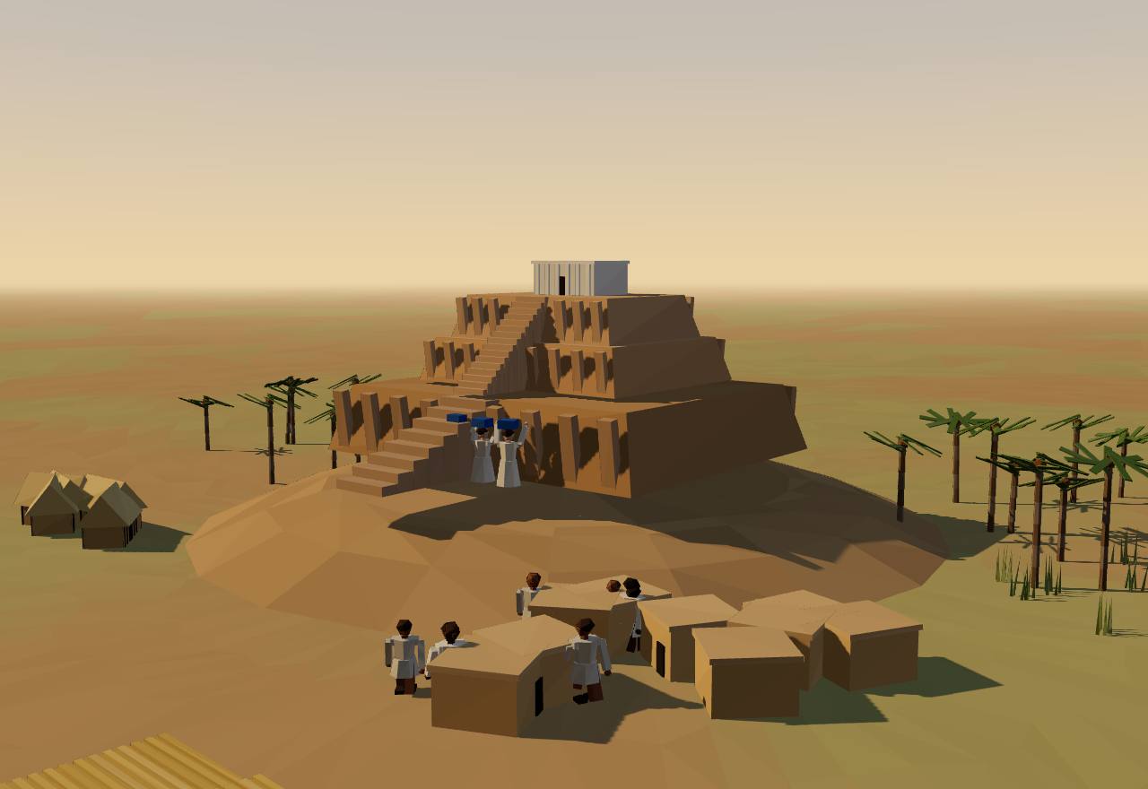
For about fifteen hundred years southern Mesopotamia was a land of small villages. At Eridu one building was rebuilt again and again on the same spot, each version larger, until it stood on a platform.
What the evidence says
The Ubaid period (about 5500–4000 BCE) and earlier were 'characterized by small and homogenous villages, rarely larger than one or two hectares'.16● ConsensusSurveyExcavation
Eridu's temple precinct holds a column of successive religious buildings, from a small shrine of the Ubaid 1 period in layer XVI up to the ziggurat of the Third Dynasty of Ur. The late Ubaid temples of layers VII–VI had a central hall, a stepped altar and an offering table, measured up to 23.5 by 12.5 m and stood on a platform up to 26.5 by 16 m.17,18● ConsensusExcavation
Jason Ur notes that the Eridu buildings read as temples because of their size and decoration, but their plans 'are otherwise indistinguishable from houses', all with the same tripartite layout: the difference between house and temple was 'one of degree, not kind'.16◐ DebatedExcavation
Shells from the mound of Eridu have AMS radiocarbon dates of 5770 cal BCE and 2291 cal BCE, bracketing the long occupation; the excavations of 1946–1949 found a pre-Ubaid shrine at the base of the sequence.18● ConsensusDatingExcavation
How power worked · 5 unknown
Who rules
UnknownWhy?
No burial, image or text singles out a ruler; even the Eridu 'temples' have the plan of a house.
How chosen
UnknownWhy?
Nothing shows how anyone came to lead an Ubaid village.
Limits on power
UnknownWhy?
No evidence of councils or other checks.
Scale
Village●ConsensusWhy?
Claim to rule
UnknownWhy?
The rebuilt shrine suggests authority tied to a sacred place, but no text says what it rested on.
Who has a say
UnknownWhy?
No evidence of who took part in decisions.
How we know
3 lines of evidence · Excavation, Dating, Survey
Excavation
Excavation of the Eridu precinct in 1946–1949 by Iraq's antiquities service: the building sequence layer by layer, from a small shrine to a platform temple.18,17
Dating
AMS radiocarbon on shells from the mound (5770 and 2291 cal BCE); the Ubaid phases themselves are dated mostly by pottery sequence.18
Survey
Regional survey and excavated villages across the plain: settlements rarely over one or two hectares.16
In Seshat
Phase
Settlement tiers
Admin levels
Largest settlement (people)
Ubaid5500–4201 BCE
2
2
750–1,250
Seshat Equinox-2020, CC BY 4.0; values and ranges as Seshat codes them; "—" = not coded. Bars: log scale. Attribution ↓
On the Susiana plain, east of Mesopotamia, Susa raised a massive stepped platform in the late fifth millennium BCE. A thousand years later Susa and Chogha Mish were full of the seals, counters and clay envelopes that came just before writing.
What the evidence says
Susa I had a 'massive step platform'. Two to three thousand painted vessels came from a cemetery near its base, dating to the latter centuries of the fifth millennium BCE, and the cemetery seems to have been used only briefly. Because of the platform, ritual scenes on seals and the extraordinary pottery, 'some think that Susa was governed by an elite group'.19◐ DebatedExcavation
Henry Wright and Gregory Johnson tested single-cause explanations against the Susiana data and concluded that 'increasing population or increasing inter-regional trade alone cannot explain the appearance of specialized governments during the fourth millennium B.C.'6◐ DebatedSurveyExcavation
By the Middle Uruk period (3500–3300 BCE) Susiana shows 'a four-tier regional settlement hierarchy plus specialized administrative facilities at key sites', and public buildings at Susa, the plain's largest Uruk site, held seals and bullae. Charles Spencer reads this as state organisation, with the plain annexed from Uruk, some 250 km to the west.20◐ DebatedSurveyExcavation
Hollow clay envelopes holding counters appear in Iran, Syria and Mesopotamia 'shortly before the Uruk IV tablets'; it was a group found at Susa that led Pierre Amiet, in the 1960s, to suggest they were precursors of writing. About 130 have been excavated and some 80 remain intact.21● ConsensusExcavation
How power worked · 5 unknown
Who rules
UnknownWhy?
Some read Susa I's platform and rich cemetery as rule by an elite group; no text names an office.
How chosen
UnknownWhy?
Nothing shows how leaders were chosen.
Limits on power
UnknownWhy?
No evidence of councils or other checks.
Scale
City-state○SpeculativeWhy?
Claim to rule
UnknownWhy?
Ritual on seals and at the platform suggests religious authority, but no text says what power rested on.
Who has a say
UnknownWhy?
No evidence of who took part in decisions.
How we know
3 lines of evidence · Excavation, Survey
Excavation
The Susa platform and its cemetery: about a thousand of its vessels have been restored and studied for how they were made.19
Survey
Regional survey of the Susiana plain: site counts and sizes by phase, the basis for the settlement tiers.6,20
Excavation
Seals, sealings, counters and envelopes from Susa and Chogha Mish; the Chogha Mish objects are dated to the Late Uruk period, 3350–3100 BCE.21
In Seshat
Phase
Settlement tiers
Admin levels
Largest settlement (people)
Susa I4300–3800 BCE
2–3
1–2
350–1,400
Susa II3800–3100 BCE
3
3
250–1,000
Seshat Equinox-2020, CC BY 4.0; values and ranges as Seshat codes them; "—" = not coded. Bars: log scale. Attribution ↓
By the end of the fourth millennium BCE Uruk was the largest settlement in the world. In its sacred precinct, Eana, people kept the first written accounts.
What the evidence says
Estimates of Uruk's size differ by date and author: some 200 ha when the Uruk state emerged around 3500 BCE; 250 ha by 3100 BCE; at its height 2.5 km², 'nearly twice the size of the next largest settlement', with 20,000 to 50,000 people.20,16,21◐ DebatedSurveyExcavation
The earliest cuneiform documents come from the Eana precinct. Script and tablets are phased Uruk IV (about 3200 BCE) and Uruk III (about 3100 BCE); some 5,000 tablets were dug up at Uruk between 1928 and 1976, and about 90 percent of the archaic corpus is administrative. The 3200 BCE date for writing 'is more or less conventional'.21● ConsensusExcavationTexts
Crude, mould-made bevelled-rim bowls are the hallmark of the Late Uruk period. They 'were mass produced, and were likely used to disperse standardized rations to workers', and the bowl's shape became the written sign for a ration of food.21,16◐ DebatedExcavationTexts
Eana's buildings were vast by any earlier standard: the central hall of 'Temple D' measured 55 by 11 m, against 10 by 3 m for the largest at the Ubaid village of Tell Abada. 'Not a single non-monumental Uruk structure has been excavated on the southern Mesopotamian plain.'16● ConsensusExcavation
Using river shifts in southern Iraq as a natural experiment on a new archaeological panel dataset, Allen, Bertazzini and Heldring find that a river moving away 'led to state formation, canal construction, and the payment of tribute', and argue that the first governments coordinated between extended households.4◐ DebatedSurveyModel
Guillermo Algaze argues that the river geography of the alluvium gave southern polities 'significant competitive advantages', above all cheap transport of goods, and that the new forms of labour organisation and record keeping that followed explain why city-states emerged here first.5◐ DebatedSurveyExcavation
How power worked · 4 unknown
Who rules
King◐DebatedWhy?
How chosen
UnknownWhy?
Uruk-period writing records accounts, not how leaders came to power.
Limits on power
UnknownWhy?
No evidence of councils or assemblies that could check Uruk's leaders.
Scale
City-state◐DebatedWhy?
Claim to rule
UnknownWhy?
A central male figure on seals is read as an early ruler (later 'en'), but no text says what his authority rested on.
Who has a say
UnknownWhy?
No evidence of who took part in decisions.
How we know
4 lines of evidence · Excavation, Texts, Dating, Survey
Excavation
German excavations at Uruk since 1912: the Eana precinct, its monumental buildings and the dumps into which the tablets were thrown.16,21
Texts
The archaic tablets themselves: about 6,000 tablets and fragments in the whole proto-cuneiform corpus, read through their numerical systems.21,22
Dating
Dating rests mostly on the building and tablet sequence; charcoal from pine beams found with some texts gives 3500–3390 BCE, 'a lone sample' to use with caution.21
Survey
Regional survey of the alluvium, recoded into a panel of settlements, river channels and canals for the river-shift test.4,5
Tokens to tablets
Data: published finds (Woods 2010)
Four steps in Mesopotamian record-keeping, all dates approximate. Step through them, or read the
list.21
3,600 BCE3,500 BCE3,400 BCE3,300 BCE
simple tokens from c. 8500 BCE; complex tokens c. 3500 BCE
Clay counters
Small clay counters, spheres, cones, discs and cylinders, are found across the Middle East from about 8500 BCE; more complex shapes appear around 3500 BCE. Most of the tokens later claimed as forerunners of written signs are not found with envelopes.21
● ConsensusExcavation
c. 3500 BCE, shortly before the first tablets
Sealed envelopes
Hollow, baseball-sized clay balls held counters and were sealed; some bear marks showing that the counters were pressed into the outside before being sealed in. They are found in Iran, Syria and Mesopotamia; of some 130 excavated, about 80 are still intact.21
● ConsensusExcavation
c. 3400 BCE
Numerical tablets
Flat tablets carried numbers only, impressed and sealed, with no signs for words. Then one or two signs for the goods counted were added beside the numbers: the bridge to writing. Late Uruk examples come from Chogha Mish in Iran (3350–3100 BCE).21
● ConsensusExcavationTexts
Uruk IV c. 3200 BCE; Uruk III c. 3100 BCE
Proto-cuneiform
At Uruk's Eana precinct writing appears as a full system of about nine hundred signs. About 90 percent of the archaic texts are administrative in nature. The 3200 BCE date is 'more or less conventional'.21,22
● ConsensusExcavationTexts
Did the written signs grow out of the tokens? ◐ Debated
Yes, number and word signs alike. Denise Schmandt-Besserat's thesis, as Christopher Woods summarises it: both the numerical and the word signs of cuneiform 'evolved directly out of the earlier token system'. (Her own work is not cited here; see the note.)21
Only the numbers. Woods: the impressions on envelopes and the numerical signs are related, and 'only these two'; many proposed token-to-sign links 'are simply not plausible', and writing as a system came 'suddenly as an integrated whole'.21
Note: Schmandt-Besserat's own books are not cited here, because only reviews of them could be found in Crossref and they did not pass this page's citation check; her thesis is given as Woods reports it.
In Seshat
Phase
Settlement tiers
Admin levels
Largest settlement (people)
Uruk4000–2900 BCE
4
—
7,000–20,000
Seshat Equinox-2020, CC BY 4.0; values and ranges as Seshat codes them; "—" = not coded. Bars: log scale. Attribution ↓
In northern Mesopotamia a city grew as early as the southern ones, and in a different way: separate clusters around a central mound that filled in toward it.
What the evidence says
Urban growth at Brak began in the LC 2 period (about 4200–3900 cal BCE): pottery of that time lies in six separate clusters of 2–4 ha, generally 200–500 m from the central mound, for a total of about 55 ha 'at a time when few contemporary settlements exceeded 3 hectares'.23● ConsensusSurveyDating
By LC 3–4 (3900–3400 cal BCE) the outer town had expanded inward and the settled area had grown to 130 ha. The largest of Brak's neighbours reached only 15 ha, and only Uruk, in the south, was larger.23● ConsensusSurvey
Because Brak's urban origins are contemporary with the first southern cities, the authors conclude that 'the emergence of urbanism in the Near East was a regionally multicentric process'.23◐ DebatedSurveyDating
'Elite coercion does not appear to be solely responsible for the initial development of urbanism at Brak. It seems likely that it was at least in part the unintended result of the actions of autonomous and non-hierarchically ranked groups.'23◐ DebatedSurvey
How power worked · 5 unknown
Who rules
UnknownWhy?
Finds on the central mound suggest social stratification, but nothing shows a ruler or office.
How chosen
UnknownWhy?
Nothing shows how leaders were chosen.
Limits on power
UnknownWhy?
No evidence of councils or other checks.
Scale
City-state○SpeculativeWhy?
Claim to rule
UnknownWhy?
An elaborately decorated temple stood on the central mound; no text survives.
Who has a say
UnknownWhy?
The authors read growth as the work of 'autonomous and non-hierarchically ranked groups', but who decided what is unknown.
How we know
3 lines of evidence · Survey, Dating, Excavation
Survey
Surface collection: 963 units of 10 × 10 m, at 50 m intervals (100 m in disturbed ground), over 55,000 sherds, covering more than 75% of the outer town.23
Dating
Dates come from chronologically sensitive surface pottery assigned to the LC 2 and LC 3–4 periods, which the authors give in cal BCE.23
Excavation
Excavation on the central mound: architecture and artefacts 'suggestive of social stratification', later industrial buildings and a decorated temple.23
In Seshat
Not coded in Seshat. The Seshat Global History Databank (Equinox-2020) has no polity for this case.
Along the Upper Nile, the Naqada culture went from village cemeteries to the tombs of kings in about seven hundred years. Hierakonpolis and Abydos show the steps, and the stops.
What the evidence says
Bayesian models of more than 100 new radiocarbon measurements reduce Naqada I–III to 'around 700 years': Naqada IA–IIB about 3800/3750(?)–3450 BCE, IIC–D 3450–3325, IIIA–B 3325–3085, and the accession of king Aha about 3080 BCE.24● ConsensusDating
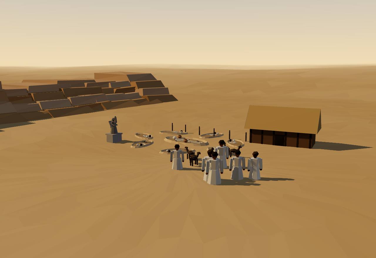
At Hierakonpolis the elite cemetery HK6 holds almost 70 tombs of Naqada IC–IIB and Naqada III. Tomb 16 (4.3 by 2.6 m, Naqada IC–IIA) was ringed by human graves and an outer ring of animal burials, among them aurochs, baboons, an elephant and 35 dogs; tomb 23, the largest of its time, lay beside the smashed remains of Egypt's earliest known life-sized stone statue.24● ConsensusExcavationBioarchaeology
Two and a half kilometres nearer the floodplain lies HK43, at least 453 modest burials. Many early HK6 graves held several people of both sexes and different ages, so Stevenson warns that 'attributing individual political roles there may be the wrong interpretive tact'.24◐ DebatedExcavationBioarchaeology
HK6 was abandoned, wooden superstructures near grave 23 were burned and the statue was smashed, which 'suggest violent conflict or some form of iconoclasm'. From Naqada IIC, Upper Egyptian material culture spread much more widely.24◐ DebatedExcavation
At Abydos the 12-chambered tomb U-j, dated to Naqada IIIA2, held some 2,000 clay vessels and the first known hieroglyphic writing, on small ivory tags. In Naqada IIIA–B, 'Dynasty 0', a group in the Abydos region gathered power over exchange, knowledge, surplus, crafts and force.24● ConsensusExcavationTexts
Charles Spencer reads Naqada II Hierakonpolis as the capital of a large southern state, with a building thought to be a palace, a temple complex with a large oval court and a thick mud-brick town wall, its pottery reaching Naqada and Abydos some 80 and 140 km away.20◐ DebatedExcavationSurvey
How power worked · 2 unknown
Who rules
King◐DebatedWhy?
How chosen
UnknownWhy?
Which rulers unified Egypt, and how they came to rule, 'may ultimately be archaeologically futile' to pin down (Stevenson).
Limits on power
UnknownWhy?
No evidence of councils or other checks on Dynasty 0 rulers.
Scale
Territorial state◐DebatedWhy?
Claim to rule
Divine mandate◐DebatedWhy?
Who has a say
A narrow elite○SpeculativeWhy?
How we know
4 lines of evidence · Dating, Excavation, Bioarchaeology, Texts
Dating
Bayesian chronology from over 100 new radiocarbon measurements on organic material in museum collections.24
Excavation
Cemeteries HK6 and HK43 at Hierakonpolis and cemetery U at Abydos (680 burials fully excavated), with tomb architecture and grave goods.24
Bioarchaeology
Skeletons from HK43 show scalping, decapitation, rearranged bones and resin-soaked linen on heads and hands; animal burials around tomb 16.24
Texts
Ivory tags from tomb U-j and royal names in serekhs, the first written words, are few: the state's formation is read mostly from graves.24
In Seshat
Phase
Settlement tiers
Admin levels
Largest settlement (people)
Naqada I3800–3550 BCE
1
1–3
50–200
Naqada II3550–3300 BCE
2–3
2–3
5,000–15,000
Egypt - Dynasty 03300–3100 BCE
2–3
2–3
5,000–15,000
Seshat Equinox-2020, CC BY 4.0; values and ranges as Seshat codes them; "—" = not coded. Bars: log scale. Attribution ↓
In the third millennium BCE farming villages along the Yellow River gave way to ranked societies with walled regional centres, competing with each other.
What the evidence says
In the third millennium BCE most societies in the densely settled Yellow and Yangzi regions 'were hierarchically organized, exchange of prestige goods was a common practice among elite individuals, and intergroup warfare intensified'.25● ConsensusExcavationSurvey
'Regional centers were frequently built with walled enclosures, and some developed early forms of urbanism with political, religious, and economic functions.' Political control, ritual power and wealth were 'concentrated in small groups of elites'.25● ConsensusExcavation
Spencer, after Li Liu's survey work, calls the Longshan period 'a time of competing chiefdoms, with no regional polity exhibiting more than a three-tiered hierarchy of site sizes'.20◐ DebatedSurvey
At Erlitou itself a small early Longshan settlement (about 3000–2500 BCE) was abandoned some 600 years before the people of the Erlitou culture arrived around 1900 BCE.26● ConsensusExcavationDating
Liu and Chen argue that Chinese sociopolitical evolution 'was multicentric and shaped by inter-polity factionalism and competition'.25◐ DebatedExcavationSurvey
How power worked · 3 unknown
Who rules
Chief◐DebatedWhy?
How chosen
UnknownWhy?
Graves show ranked elites but not how leaders were chosen.
Limits on power
UnknownWhy?
No evidence of councils or other checks.
Scale
City-state○SpeculativeWhy?
Claim to rule
UnknownWhy?
Political control, ritual power and wealth went together, but no text says what authority rested on.
Who has a say
A narrow elite◐DebatedWhy?
How we know
2 lines of evidence · Excavation, Survey
Excavation
Excavated walled centres and cemeteries with ranked graves and prestige goods across the Yellow River region.25
Survey
Full-coverage regional surveys measuring site sizes, from which settlement tiers and rank-size curves are drawn.20
In Seshat
Phase
Settlement tiers
Admin levels
Largest settlement (people)
Longshan3000–1900 BCE
3–4
3–4
5,000–20,000
Seshat Equinox-2020, CC BY 4.0; values and ranges as Seshat codes them; "—" = not coded. Bars: log scale. Attribution ↓
On the loess uplands north of the Yellow River, far from the plains long assumed to be China's heartland, a stone city of more than 400 hectares rose around 2300 BCE.
What the evidence says
Shimao was 'a massive (> 400 ha) stone walled site' of about 2300–1800 cal BCE: a central palatial terrace inside two layers of stone enclosures, with baffled gates, gate towers, bastions and corner towers.27● ConsensusExcavationDating
It was a political and ritual centre: human sacrifice was performed before the fortification was built, jades were set into the stone walls, the main gate bore polychrome murals and the walls carried anthropomorphic stone carvings.27● ConsensusExcavationBioarchaeology
Many settlements around it were stone forts on hilltops. Shimao's elites were buried with jade and bronze or copper, 'prestige and exotic goods obtained from distant areas', among agro-pastoralists of the north Loess Plateau.27● ConsensusExcavationSurvey
Jaang and colleagues argue that 'by 2000 BC, the loess highland was home to a complex society representing the political and economic heartland of China', and that symbols later tied to Central Plains civilisation 'were, in fact, created much earlier at Shimao'.28◐ DebatedExcavationSurvey
How power worked · 4 unknown
Who rules
UnknownWhy?
Elites were buried with jade and bronze; whether one ruler held an office is not known.
How chosen
UnknownWhy?
Nothing shows how leaders were chosen.
Limits on power
UnknownWhy?
No evidence of councils or other checks.
Scale
City-state◐DebatedWhy?
Claim to rule
UnknownWhy?
Shimao was a ritual centre with human sacrifice and carved faces on its walls, but no text says what authority rested on.
Who has a say
A narrow elite○SpeculativeWhy?
How we know
3 lines of evidence · Excavation, Dating, Survey
Excavation
Excavation of the main gate, the walls and the palatial terrace, with sacrificial deposits and jades in the masonry.27
Dating
Radiocarbon dates giving about 2300–1800 cal BCE for the walled site.27
Survey
Survey of hilltop stone forts across the north Loess Plateau, the network Shimao headed.27,28
In Seshat
Not coded in Seshat. The Seshat Global History Databank (Equinox-2020) has no polity for this case.
Erlitou, on the Luo River, grew into the largest city of its day in northern China, with a walled palace quarter, roads and a bronze foundry. Whether it was the capital of the legendary Xia is another question.
What the evidence says
The Erlitou culture (about 1900–1500 BCE) lasted some 360 years in four phases. In phase I the site already covered at least 100 ha, a rapid growth 'only ... explained by migration'; in phase II it reached its maximum, 300 ha, with a 12-ha palatial complex framed by four intersecting roads about 20 m wide.26● ConsensusExcavationSurvey
In phase III rammed-earth walls about 2 m wide were built along the roads around the palatial complex (10.8 ha), making a palatial town; palaces were laid out on north–south axes, 'the beginning of a highly regulated palatial pattern'.26● ConsensusExcavation
Palace no. 1 had a large courtyard and roofed galleries and covered 1 ha on a rammed-earth and stone foundation more than 3 m thick. A bronze foundry about 300 m south of the palace complex cast tools, weapons and ritual vessels. Phase III population is estimated at 18,000–30,000.20,26◐ DebatedExcavation
Around Erlitou the settlement pattern shows 'a four-tier distribution of site sizes', and from phase III the polity expanded into regions 100–250 km from the capital, which Spencer reads as a primary state expanding its territory.20◐ DebatedSurvey
Most Chinese archaeologists have tied Erlitou's phases to the Xia–Shang transition. Liu and Xu reply that with 'no pre-Yinxu writing system found up to now, we have no evidence to either prove or disprove' the textual accounts, and that archaeology and legendary history must be studied separately.26◐ DebatedExcavationTexts
How power worked · 3 unknown
Who rules
King◐DebatedWhy?
How chosen
UnknownWhy?
No writing survives to say how rulers were chosen.
Limits on power
UnknownWhy?
No evidence of councils or other checks.
Scale
Territorial state◐DebatedWhy?
Claim to rule
UnknownWhy?
Ritual bronzes were cast near the palaces, but with no texts the basis of authority is unknown.
Who has a say
A narrow elite○SpeculativeWhy?
How we know
3 lines of evidence · Excavation, Survey, Dating
Excavation
Decades of excavation since the 1950s: rammed-earth palace foundations, roads with the earliest wagon tracks in China, elite burials and workshops for bronze, turquoise, pottery and bone.26
Survey
Regional survey of the Yiluo basin: site sizes and their tiers around the capital.20
Dating
Four phases defined by the pottery sequence, about 1900–1500 BCE in all; 'it is difficult to determine the exact duration for each phase'.26
In Seshat
Phase
Settlement tiers
Admin levels
Largest settlement (people)
Erlitou1850–1600 BCE
4
3
3,500–5,800
Seshat Equinox-2020, CC BY 4.0; values and ranges as Seshat codes them; "—" = not coded. Bars: log scale. Attribution ↓
From about 3300 BCE people across the Indus basin built walled towns of up to about ten hectares. They became the planned cities of the Mature Harappan period, and the cities kept the towns' lack of palaces.
What the evidence says
By around 3300 BCE people in each Indus region built permanent settlements, 'each maximally around 10 ha', with rectilinear mud-brick buildings and mud-brick walls around part or all of the settlement. At Kalibangan thick walls enclosed small houses in neat blocks.29● ConsensusExcavation
Kot Diji's early plan has a major wall separating two clusters of houses that 'do not differ significantly in size or available amenities'. Adam Green concludes that 'Indus egalitarianism thus originated long before Indus settlements became cities'.29◐ DebatedExcavation
Around 2600–2500 BCE most Early Harappan settlements (dated here 3200–2600 BCE) were abandoned and replaced by more numerous Mature Harappan ones (2500–1900 BCE). Kot Diji, Gumla, Amri and Nausharo all show extensive burning at the end of their Early Harappan occupation.20◐ DebatedExcavationSurvey
The cities that followed were large: Mohenjo-daro some 200 ha with streets in a grid, Harappa at least 100 ha. Spencer, after Kenoyer, reads a four-tier settlement hierarchy as a state; Green finds no 'clear evidence for a ruling class' in a century of work.20,29◐ DebatedExcavationSurvey
The Indus region spans 'a very distinct environmental threshold, where winter and summer rainfall systems overlap', and was hit by climate change while the civilisation was at its height, about 2500–1900 BCE.30● ConsensusSurvey
How power worked · 5 unknown
Who rules
UnknownWhy?
No palaces, royal tombs or images of rulers: whether anyone held a ruling office is unknown.
How chosen
UnknownWhy?
No evidence of how anyone came to lead.
Limits on power
UnknownWhy?
No evidence of councils or other checks.
Scale
Village◐DebatedWhy?
Claim to rule
UnknownWhy?
No texts or images show what authority, if any, rested on.
Who has a say
UnknownWhy?
Houses of similar size suggest broad participation, but who decided is unknown.
How we know
3 lines of evidence · Excavation, Survey, Dating
Excavation
Town plans from Kalibangan, Kot Diji, Harappa, Dholavira, Farmana, Rehman Dheri and Surkotada: walls, house blocks, house sizes.29
Survey
A strong survey tradition has mapped hundreds of small settlements; the Land, Water and Settlement project surveyed northwest India in 2007–2014.29,30
Dating
Phase boundaries are conventional (about 3300 or 3200 BCE to 2600 BCE), drawn from site sequences; Seshat's panel for this case is its Kachi plain 'Pre-Urban Period', one region of several.29,20
In Seshat
Phase
Settlement tiers
Admin levels
Largest settlement (people)
Kachi Plain - Pre-Urban Period3200–2500 BCE
2–3
1–2
1,100–4,600
Seshat Equinox-2020, CC BY 4.0; values and ranges as Seshat codes them; "—" = not coded. Bars: log scale. Attribution ↓
Site·San José Mogote, Etla arm of the Valley of Oaxaca·1,550 BCE – 500 BCE12/13
San José Mogote
Region: Mesoamerica
For a thousand years San José Mogote was the largest village in the Valley of Oaxaca. Its story is one of storage pits, a palisade, a hereditary elite and, at the end, raids that burned its temple.
What the evidence says
Village life began at San José Mogote before 3600 radiocarbon years BP. By the Tierras Largas phase (3500–3100 BP) there were at least 19 villages in the valley; San José Mogote, the largest, had a few hundred people, wattle-and-daub houses and storage pits 'collectively holding up to 1,000 kg of maize per household'.31● ConsensusExcavationSurvey
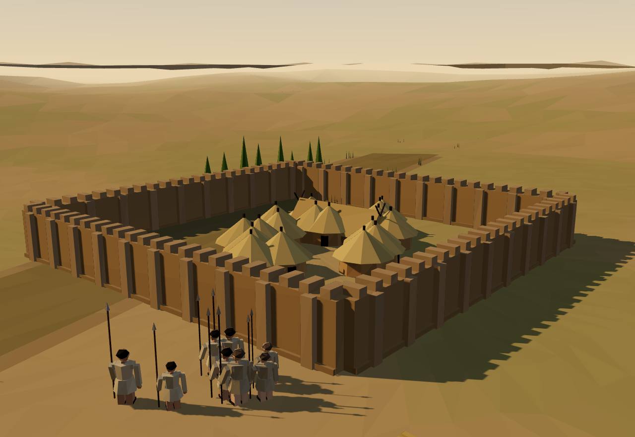
A double line of posts defended the village's west side. Charcoal from burned posts dates to 3260 ± 60, 3160 ± 130 and 3250 ± 80 BP (2σ calibrated ranges between 1720 and 1060 BCE): 'the oldest directly dated defensive work in ancient Mexico'.31● ConsensusDatingExcavation
In the San José phase (3100–2800 BP) the village grew to more than 1,000 people, wards kept separate public buildings, and 'sumptuary goods in houses and graves also indicate that a hereditary elite had emerged'.31◐ DebatedExcavation
Raiding peaked in the Rosario phase (2650–2450 BP): 75–85 communities, three chiefly centres separated by an 80-km² buffer zone 'left virtually unoccupied', and burned daub on sites seven times more often than usual. San José Mogote, at 60–65 ha, was still the largest; its rival San Martín Tilcajete had 25 ha.31,20● ConsensusSurvey
Midway through the Rosario phase raiders burned the main temple, Structure 28, so hot that its walls vitrified (2550 ± 60 BP; 820–500 BCE at 2σ). A later threshold stone, Monument 3, shows a naked captive whose heart has been removed, with his name in Zapotec glyphs between his feet.31● ConsensusExcavationDatingTexts
How power worked · 2 unknown
Who rules
Chief◐DebatedWhy?
How chosen
Heredity◐DebatedWhy?
Limits on power
UnknownWhy?
No evidence of councils or other checks on the chiefs.
Scale
UnknownWhy?
A chiefly centre ruled one arm of the valley with its satellite villages: more than a village, less than a state.
Claim to rule
Kinship and descent○SpeculativeWhy?
Who has a say
Lineage heads○SpeculativeWhy?
How we know
3 lines of evidence · Dating, Excavation, Survey
Dating
Radiocarbon on charcoal from burned houses, palisade posts and the temple roof, reported in conventional years BP and as 2σ calibrated ranges.31
Excavation
Decades of excavation at San José Mogote: houses, storage pits, the palisade, temples and carved stones.31
Survey
The Valley of Oaxaca Settlement Pattern Project's full-coverage survey: community counts, sizes and burned daub on the surface.31,20
Model: war in a hemmed-in valley (after Carneiro)
In Seshat
Phase
Settlement tiers
Admin levels
Largest settlement (people)
Oaxaca - San Jose1150 BCE–700 BCE
2
1–2
791–1,976
Oaxaca - Rosario700–500 BCE
3
1–2
1,000
Seshat Equinox-2020, CC BY 4.0; values and ranges as Seshat codes them; "—" = not coded. Bars: log scale. Attribution ↓
Site·Monte Albán, Valley of Oaxaca·500 BCE – 200 CE13/13
Monte Albán
Region: Mesoamerica
Around 500 BCE the people of San José Mogote moved to the top of a mountain in no-man's-land between the valley's chiefdoms. Within about five centuries that hilltop ruled the whole valley.
What the evidence says
Some time before 2450 BP, 'presumably seeking a more defensible location', the people of San José Mogote and its satellites moved to the summit of a 400-m mountain in the former buffer zone. At least 2,000 strong, they began building 3 km of defensive walls along its western slopes.31◐ DebatedExcavationSurvey
In Early Monte Albán I (2450–2250 BP) the valley held an estimated 8,000–10,000 people in 261 communities, and nearly a third of them lived on the defended mountaintop. Spencer finds evidence of state organisation 'lacking' for this phase (500–300 BCE).31,20◐ DebatedSurvey
By Late Monte Albán I (300–100 BCE) the city covered some 442 ha with an estimated 10,200–20,400 people and headed 'a regional site-size hierarchy of four tiers', which Spencer calls 'one of the key archaeological indicators of state organization'.20◐ DebatedSurvey
Tilcajete resisted: it doubled from 25 to 52.8 ha, had its plaza burned (2280 ± 40 BP), grew to 71.5 ha behind new walls, and was finally attacked again, its palace and temple burned (1970 ± 60 and 1980 ± 70 BP). Then Monte Albán controlled the whole 2,150-km² valley and 'had become the capital of a Zapotec state'.31● ConsensusDatingExcavation
Crema-ware pottery, made from one clay source near Monte Albán, is significantly more common at Late Monte Albán I sites in the Etla and central valley than elsewhere (Kruskal–Wallis 17.954, P < 0.001), but similar across all three arms by Monte Albán II (4.829, P = 0.089): a trace of control spreading over the valley.20◐ DebatedSurvey
Over the next two centuries the state expanded 150 km beyond the valley. One building on the Main Plaza lists hieroglyphic names of more than 40 places claimed as provinces, and in the Cuicatlán Cañada, 80 km north, the Zapotec left a skull rack and a fortress.31◐ DebatedTextsExcavationDating
How power worked · 2 unknown
Who rules
King◐DebatedWhy?
How chosen
UnknownWhy?
No text says how Monte Albán's rulers came to power.
Limits on power
UnknownWhy?
No evidence of councils or other checks.
Scale
Territorial state◐DebatedWhy?
Claim to rule
Force◐DebatedWhy?
Who has a say
A narrow elite○SpeculativeWhy?
How we know
3 lines of evidence · Survey, Dating, Texts
Survey
Regional survey of the whole valley (Kowalewski and colleagues): site sizes, counts and surface pottery, including the crema-ware counts at 48 and 40 'central places'.20,31
Dating
Radiocarbon on charcoal from the burnings at Tilcajete and the conquest sites of Cuicatlán.31
Texts
Carved stones with slain captives and glyphic place names on the Main Plaza: early Zapotec writing about war.31
In Seshat
Phase
Settlement tiers
Admin levels
Largest settlement (people)
Early Monte Alban I500 BCE–300 BCE
2–3
suspected unknown
2,000
Monte Alban Late I300 BCE–100 BCE
4
suspected unknown
17,200
Monte Alban II100 BCE–200 CE
4
suspected unknown
14,500
Seshat Equinox-2020, CC BY 4.0; values and ranges as Seshat codes them; "—" = not coded. Bars: log scale. Attribution ↓
Across the cases
Threads
The questions that cut across the sites and societies above. Each gives a short, badged answer, the cases it rests on, and the positions in the debate with their sources.
Lead thread·12 cases
Why did states form, and why in these places?
Short answer No single cause fits every case. War in hemmed-in valleys, taxable grain, rivers that moved, trade, and record-keeping each have evidence somewhere on this page, and each meets a case it cannot explain. The largest comparative test, on Seshat data for 373 societies, finds the best support for rising agricultural productivity combined with military technology.1,2,3,4,5,6◐ DebatedExcavationSurveyModel
Data: each cell cited; the valley is a model, not evidence
Each cell asks one question: does this case show what the theory predicts? Every judgement
cites the source it rests on; a dot means no source on this page tests that pair. Pick a theory
to read its evidence, what would prove it wrong, and how it fared in the largest comparative
test. The valley model on the right is a model, not evidence: it illustrates
Carneiro's idea.7,2
Cases × theories. ● fits the prediction · ◐ mixed · ○ against · · untested here
No circumscription variable among the 17. Warfare intensity and the iron-and-cavalry 'military revolution' were the best supported: external conflict, not hemmed-in valleys as such.
'Cereal crops' was not supported: selected only for hierarchy, with a negative effect that was not significant.
Nearest proxy, 'hydraulic society' (irrigation), was not selected for scale, hierarchy or government.
'Trade' (markets) was not selected for scale, hierarchy or government.
'Information system' (writing and texts) had a positive effect on scale and hierarchy that was not significant.
'Provision of public goods' was not selected; the authors find growth 'not driven by factors associated with either functionalist or internal conflict theories'.
The largest test
Turchin and colleagues tested 17 candidate drivers on Seshat data for 373 societies
(9600 BCE – 1900 CE): "The best-supported model indicates a strong causal role played by a combination of increasing agricultural productivity and invention/adoption of military technologies (most notably, iron weapons and cavalry in the first millennium BCE)."1Read the paper. Their strongest predictor, iron weapons with cavalry, spread after every case on this page, and their data run to 1900 CE: a test of how complexity grew, not only of how it began.
Predicts Farmland boxed in by desert, mountains or sea; growing villages; endemic war; the beaten cannot move away and are absorbed.
What would falsify it A primary state that formed in open country, where defeated villages could simply move on; or a sharply hemmed-in valley with growing numbers and constant war that never unified.
In the comparative test No circumscription variable among the 17. Warfare intensity and the iron-and-cavalry 'military revolution' were the best supported: external conflict, not hemmed-in valleys as such.1
◐ mixedHawaiʻi: chiefs become kings◐ DebatedIsland polities were bounded by the sea, and Maui's temple system came with 'predatory expansion and consolidation'. But war between islands, not land hunger inside one valley, is what the dating shows.12,8
◐ mixedUbaid villages and the Eridu temples◐ DebatedCarneiro himself ranks the Tigris–Euphrates plain as less tightly hemmed in than the Nile, with chiefdoms earlier but unification later.2
○ againstTell Brak◐ Debated'Elite coercion does not appear to be solely responsible' for Brak's early growth, on the open plains of northern Mesopotamia.23
◐ mixedNaqada and Hierakonpolis◐ DebatedCarneiro calls the Nile a 'narrow gash' through desert, at maximum circumscription. But Stevenson notes that population pressure in the constricted Hierakonpolis stretch should have pushed people north, and that has not been detected.2,24
◐ mixedLongshan walled towns◐ DebatedLate Neolithic societies were hierarchical, 'intergroup warfare intensified' and centres were walled, yet no Longshan polity passed a three-tier settlement hierarchy.25,20
◐ mixedShimao◐ DebatedShimao was 'a sophisticated defensive system' among many hilltop stone forts, with human sacrifice before the walls were built: war, on open loess uplands.27
● fitsSan José Mogote◐ DebatedRaiding escalated to a peak in the Rosario phase: three chiefly centres with an 80 km² buffer between them, burned houses, and San José Mogote's main temple burned.31
● fitsMonte Albán◐ DebatedThe hilltop was settled in the former buffer zone, 'presumably seeking a more defensible location', walled, and the state was made by conquering rivals such as Tilcajete.31,20
Untested here: Big-men and chiefs, Susiana: Susa I to Susa II, Uruk, Erlitou, Early Harappan towns.
Predicts Dependence on cereals that ripen at once, store and can be seen and measured: granaries, rations, grain taxes.
What would falsify it Hierarchy rising as early and as far among farmers of roots and tubers as among cereal farmers, or tracking how productive the land was rather than which crop it grew.
In the comparative test 'Cereal crops' was not supported: selected only for hierarchy, with a negative effect that was not significant.1
○ againstHawaiʻi: chiefs become kings◐ DebatedArchaic states formed in Hawaiʻi on sweet potato and taro, root crops with no cereal at all: the case the cereal theory has to explain away.14,10
● fitsUruk◐ DebatedMass-made bevelled-rim bowls were 'likely used to disperse standardized rations', and the bowl became the sign for a ration of food.21,16
◐ mixedNaqada and Hierakonpolis○ SpeculativeEmmer, wheat and barley were 'intensively cultivated around Hierakonpolis', but no granary or grain tax is shown for the period of state formation.24
◐ mixedSan José Mogote◐ DebatedEarly village storage pits held up to 1,000 kg of maize per household, long before any hereditary office.31
Untested here: Big-men and chiefs, Ubaid villages and the Eridu temples, Susiana: Susa I to Susa II, Tell Brak, Longshan walled towns, Shimao, Erlitou, Early Harappan towns, Monte Albán.
Predicts Settlements left dry when a river changed course build public canals, form governments and pay tribute.
What would falsify it Places a river abandoned being no more likely to dig canals, form states or pay tribute than places it kept watering.
In the comparative test Nearest proxy, 'hydraulic society' (irrigation), was not selected for scale, hierarchy or government.1
● fitsUruk◐ DebatedIn southern Iraq, settlements a river shifted away from were more likely to form states, dig canals and pay tribute.4
Untested here: Big-men and chiefs, Hawaiʻi: chiefs become kings, Ubaid villages and the Eridu temples, Susiana: Susa I to Susa II, Tell Brak, Naqada and Hierakonpolis, Longshan walled towns, Shimao, Erlitou, Early Harappan towns, San José Mogote, Monte Albán.
Predicts Cheap transport and unequal long-distance exchange: outposts, imported goods, a core growing on its periphery's resources.
What would falsify it Cities and administrations appearing before, or without, the long-distance trade and colonies the model needs.
In the comparative test 'Trade' (markets) was not selected for scale, hierarchy or government.1
◐ mixedSusiana: Susa I to Susa II◐ DebatedWright and Johnson's test on Susiana: rising population or inter-regional trade 'alone cannot explain' specialised government. Spencer, following Algaze, reads Susiana as annexed by Uruk.6,20
● fitsUruk◐ DebatedAlgaze's case: cheap river transport and asymmetrical trade gave the southern cities their head start, with outposts far to the north.5,20
○ againstTell Brak◐ DebatedBrak's urban growth began c. 4200–3900 cal BC, as early as the southern cities, so northern urbanism was 'regionally multicentric', not seeded by southern colonies.23
● fitsNaqada and Hierakonpolis◐ DebatedIn Naqada IIIA–B the Abydos elite extended its influence to the Levant; Stevenson lists 'domination of external exchange networks' among its sources of power.24
● fitsShimao◐ DebatedElites were buried with jade and bronze, 'prestige and exotic goods obtained from distant areas'.27
● fitsErlitou◐ DebatedFrom phase III Erlitou expanded 100–250 km from the capital; Spencer reads the move toward ore deposits as a colony.20
◐ mixedEarly Harappan towns◐ DebatedTrade was 'of central importance' to the Mature Harappan cities that followed, with colonies far away, but that evidence comes after this case.20
◐ mixedMonte Albán◐ DebatedCrema-ware pottery tracks how far Monte Albán's exchange reached; Tilcajete's defiance 'deprived it of luxury goods'. Exchange followed control.20,31
Untested here: Big-men and chiefs, Hawaiʻi: chiefs become kings, Ubaid villages and the Eridu temples, Longshan walled towns, San José Mogote.
Predicts Specialised administration handling information: seals, sealings, counters, numerical tablets, writing, offices in several levels.
What would falsify it Recording devices and specialised offices appearing only after a state is otherwise in place, or states forming with no means of keeping records.
In the comparative test 'Information system' (writing and texts) had a positive effect on scale and hierarchy that was not significant.1
○ againstHawaiʻi: chiefs become kings◐ DebatedHawaiian archaic states ran district chiefs, ahupuaʻa sub-chiefs, land managers and priests, yet Seshat codes script and written records absent for Hawaiʻi III (non-written records present).11Seshat
● fitsSusiana: Susa I to Susa II◐ DebatedBy the Middle Uruk period Susiana had specialised administrative facilities, and public buildings at Susa held seals and bullae; the envelopes that first suggested a precursor to writing came from Susa.20,21
● fitsUruk◐ DebatedAbout 90 percent of the archaic tablets from Uruk's Eana precinct are administrative: writing, in Woods's phrase, 'facilitated complex bureaucracy'.21
◐ mixedNaqada and Hierakonpolis◐ DebatedTomb U-j holds the first known hieroglyphs, on ivory tags, but the claim that writing meant elaborate administration 'has been robustly challenged'.24
◐ mixedErlitou◐ DebatedErlitou had palaces, roads and a bronze foundry, but 'no pre-Yinxu writing system' has been found; Seshat nonetheless codes a script as 'inferred present'.26Seshat
◐ mixedEarly Harappan towns◐ DebatedThe later cities had writing, weights and seals, yet 'clear evidence for a ruling class' never appears: records without rulers.29
◐ mixedSan José Mogote◐ DebatedMonument 3 carries the earliest Zapotec hieroglyph naming a captive: writing appears first in war propaganda, not accounts.31
● fitsMonte Albán◐ DebatedOne building on the Main Plaza names more than 40 places claimed as provinces, a written record of conquest.31
Untested here: Big-men and chiefs, Ubaid villages and the Eridu temples, Tell Brak, Longshan walled towns, Shimao.
Predicts Coalitions of households and lineages build the first cities and public works; central control comes later, or is resisted.
What would falsify it The earliest cities showing top-down planning imposed by a ruler from the start, or states forming slowest where people lived dispersed.
In the comparative test 'Provision of public goods' was not selected; the authors find growth 'not driven by factors associated with either functionalist or internal conflict theories'.1
◐ mixedBig-men and chiefs◐ DebatedA Melanesian big-man commanded only the faction he built by generosity; Polynesian chiefs ran a ranked pyramid. The ceiling on each came from what followers would accept.8
● fitsHawaiʻi: chiefs become kings◐ DebatedJennings and Earle's test case: Hawaiian households isolated in farmsteads 'were quickly realigned into a state structure', faster than people packed into cities.32
● fitsUbaid villages and the Eridu temples◐ DebatedUbaid villages were 'small and homogenous', rarely over one or two hectares; the Eridu 'temples' share the tripartite plan of ordinary houses.16
◐ mixedUruk◐ DebatedUr reads Uruk's institutions as households writ large, coordinating extended households; others read the same bowls and tablets as a central labour administration.16,4
● fitsTell Brak◐ DebatedBrak began as separate clusters that filled inward; the authors see 'the unintended result of the actions of autonomous and non-hierarchically ranked groups'.23
● fitsEarly Harappan towns◐ DebatedEarly Harappan towns built big walls, 'a significant form of collective action', with houses that 'do not differ significantly in size': Indus egalitarianism began before the cities.29
Untested here: Susiana: Susa I to Susa II, Naqada and Hierakonpolis, Longshan walled towns, Shimao, Erlitou, San José Mogote, Monte Albán.
SurveyExcavation Cells rest on survey and excavation reports; the comparative test is a model over Seshat codes.
Thread·4 cases
Is 'chiefdom' a real stage?
Short answer As a kind of society, many archaeologists still find it useful; as a stage every state passed through, it is widely doubted. Sahlins's Polynesian chiefs were real offices, recorded by observers, but the critics argue the label hides variation and history.8,15,34,35◐ DebatedEthnographyExcavation
Short answer Possibly. The Indus cities have no palaces, royal tombs or images of rulers, and the towns before them had houses of similar size. One reading is complexity without a ruling class; another reads their four-tier settlement hierarchy as a state.29,20◐ DebatedExcavationSurvey
Short answer The same Uruk finds, bowls and tablets and huge buildings, are read two ways: as the household writ large, a nested network of families, gods' houses and city, or as a central institution managing labour and rations. The Sumer page takes the question further.16,21,22◐ DebatedExcavationTexts
Short answer In Hawaiʻi and on the Nile the ritual of kingship was built along with the kingdom. Maui's temple system went up in 1580–1640 CE as the polity was consolidated, and Upper Egypt's ceremonial maceheads and palettes were made as rulers drew power together in Naqada III.12,24◐ DebatedDatingExcavation
How many levels of settlement size (villages, towns, a capital…) and how many levels of
officials Seshat codes for each phase. Bars span Seshat's coded range; a hatched stub means
the experts marked it unknown, a blank means it was never coded.
36Seshat
Settlement tiers
Administrative levels
Unknown
Four-tier convention
Southern MesopotamiaUbaid → UrukSusianaSusa I → IIUpper EgyptNaqada I → III → Dynasty IMiddle Yellow RiverLongshan → ErlitouValley of OaxacaTierras Largas → Monte Albán II
Dashed line: four tiers of settlement size, which Spencer (2010), citing Wright and Johnson (1975), calls 'one of the key archaeological indicators of state organization'. It is a convention archaeologists use as a sign of a state, not a law.20,6
Seshat codes behind the ladder
Region
Phase (Seshat id)
Dates
Settlement tiers
Administrative levels
Southern Mesopotamia
Ubaid IqUbaid
5,500 BCE – 4,201 BCE
2
2
Southern Mesopotamia
Uruk IqUruk*
4,000 BCE – 2,900 BCE
4
not coded
Susiana
Susa I IrSusa1
4,300 BCE – 3,800 BCE
2–3
1–2
Susiana
Susa II IrSusa2
3,800 BCE – 3,100 BCE
3–43 from 3,800 BCE; 4 from 3,500 BCE
3–4
Upper Egypt
Naqada I EgNaqa1
3,800 BCE – 3,550 BCE
1–21 from 3,800 BCE; 2 from 3,650 BCE
1–3
Upper Egypt
Naqada II EgNaqa2
3,550 BCE – 3,300 BCE
2–3
2–3
Upper Egypt
Naqada III (Dynasty 0) EgNaqa3
3,300 BCE – 3,100 BCE
2–3
2–3
Upper Egypt
Dynasty I EgDyn1*
3,100 BCE – 2,900 BCE
4–5
4
Middle Yellow River
Longshan CnLngsh
3,000 BCE – 1,900 BCE
3–4
3–4
Middle Yellow River
Erlitou CnErlit
1,850 BCE – 1,600 BCE
4
3
Valley of Oaxaca
Tierras Largas MxTieLa
1,400 BCE – 1,150 BCE
1
1
Valley of Oaxaca
San José MxSanGu
1,150 BCE – 700 BCE
2
1–2
Valley of Oaxaca
Rosario MxRosar
700 BCE – 500 BCE
3
1–2
Valley of Oaxaca
Early Monte Albán I MxAlb1E
500 BCE – 300 BCE
2–3
unknown (suspected unknown)
Valley of Oaxaca
Late Monte Albán I MxAlb1L
300 BCE – 100 BCE
4
unknown (suspected unknown)
Valley of Oaxaca
Monte Albán II MxAlb2*
100 BCE – 200 CE
4
unknown (suspected unknown)
The first cities
Data: Reba, Reitsma & Seto 2016 (Modelski ancient cities), CC BY 4.0
Every city up to 2500 BCE in George Modelski's list of ancient cities, as Reba, Reitsma and
Seto placed them on the map. Circle area follows his population estimates, mostly round
numbers; Reba and colleagues grade how sure the location is, not the population.
37,38
Every city ≤ 2500 BCE in the dataset, with Modelski's estimates by sample year
Spencer, C. S. (2010). Territorial expansion and primary state formation. Proceedings of the National Academy of Sciences 107.
Territorial-expansion model tested in six primary-state regions: state institutions appear with control beyond a day's round trip.
Ur, J. A., Karsgaard, P., Oates, J. (2007). Early Urban Development in the Near East. Science 317.
Variation from the southern Mesopotamian model of urban growth was present at the very start of Near Eastern urbanism.
Stevenson, A. (2016). The Egyptian Predynastic and State Formation. Journal of Archaeological Research 24.
Review of Predynastic Egypt: state formation as 'syncopated', with political experimentation and shifting boundaries.
Jennings, J., Earle, T. K. (2016). Urbanization, State Formation, and Cooperation: A Reappraisal. Current Anthropology 57.
Early cities as cooperative units that resisted centralisation; states formed faster where people lived dispersed (Andes, Hawai'i).
Pauketat, T. R. (2007). Chiefdoms and Other Archaeological Delusions. Rowman & Littlefield.
Critique of the 'chiefdom' type and social-evolutionary models, through Mississippian evidence.
Datasets 3
Turchin, P., Hoyer, D., Bennett, J., Reddish, J., Benam, M. (2022). Seshat Equinox Packaged Data (v.1). Zenodo, doi:10.5281/zenodo.6642230 (Equinox-2020 release).
Reba, M. (2016). Modelski Ancient Period Data. figshare (DataCite DOI 10.6084/m9.figshare.2059497.v2; not in Crossref).
CC BY 4.0 data file behind reba2016 (Modelski ancient-period cities); title and year from DataCite.