Highland empires without writing, a kingdom of palaces, and a state that counted in knots
The Andes: Wari, Tiwanaku and the Inca
500 CE – 1572 CE
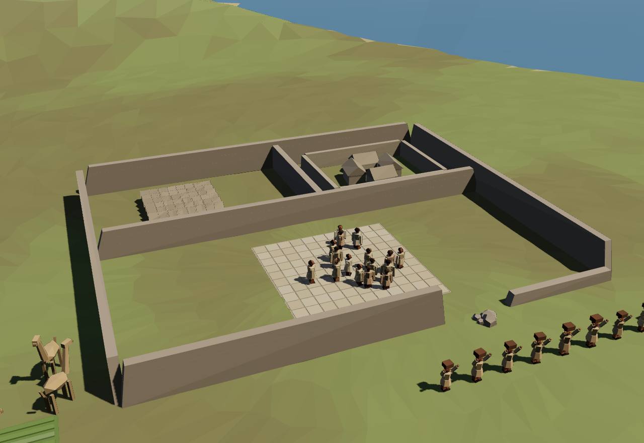
Pikillacta: a Wari compound that was never finished
500 CE – 1000 CE
Wari and Tiwanaku
Long before the Incas, two highland powers spread their goods, gods and buildings across the Andes: Wari, from a city near modern Ayacucho in Peru, and Tiwanaku, south of Lake Titicaca in Bolivia. Neither left writing, so everything here comes from excavation, survey, radiocarbon and ancient DNA, and archaeologists still argue over whether either was an empire.
The Middle Horizon is named for two highland states. Williams writes that scholars “have long debated the nature of the relationship” between Wari and Tiwanaku, and that “many assumed Tiwanaku dominated Wari and preceded Wari in time”; Valverde and colleagues call it “a major transitional period” associated with “the development and expansion of ancient Andean empires such as Wari and Tiwanaku”. 12,10 Consensus Excavation Dating
The two met in one valley. The Moquegua valley of southern Peru is “the only known region occupied by both states”, and new radiocarbon dates from the Wari centre of Cerro Baúl show that Tiwanaku “may not predate Wari” there and that “both states occupied the valley for the last three centuries of the Middle Horizon”. 12 Debated Excavation Dating
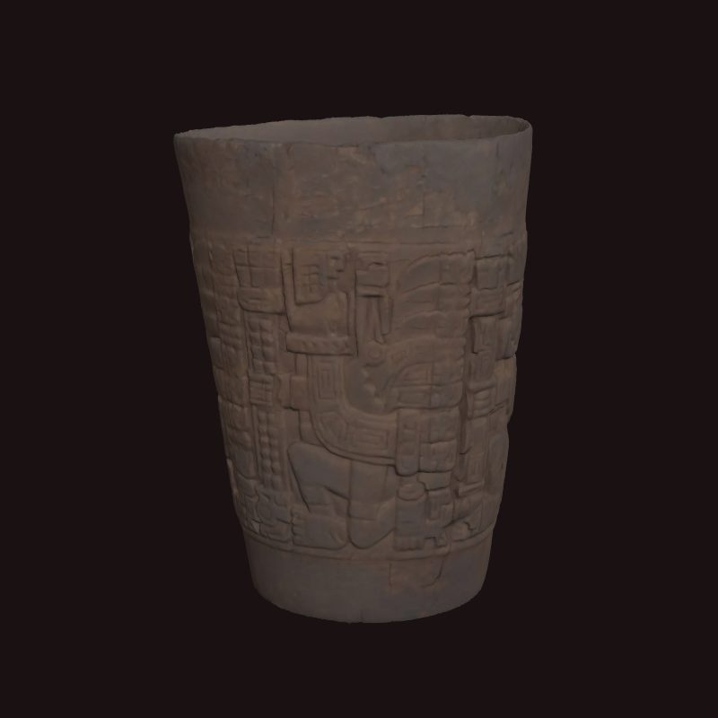
Drinking held the two worlds together. The Met's curators write that the flared beakers called keros were popular “when the cities of Wari and Tiwanaku dominated the central and southern Andes”: used for chicha, maize beer, at ceremonies and gatherings, they “played an important role in the maintenance of social and political relations”, and their material, wood, clay, gold or silver, marked the owner's status. 15 Consensus Excavation
Both powers used the same sacred figures. A Tiwanaku kero carries four winged figures with staffs in their right hands, “a symbol of status and authority in ancient Peru”; a Wari tunic repeats a winged feline with a staff, part of “a larger iconographic repertoire shared with Tiwanaku and earlier Andean cultures”. What these beings meant “remains unknown”. 15,16 Consensus Excavation
No writing survives from either. Seshat codes the Wari Empire with no script and no written records. The Met's curators credit Wari with a “knotted string recording system (khipu)” that the Incas later relied on; Hyland and colleagues date khipus from about AD 950, near the end of this period. 16,17 Seshat Debated Excavation Texts
Seshat's ranges show how little is fixed. It codes the Wari Empire (650–999) with 100,000–500,000 people over 20,000–320,000 km², a capital of 30,000–70,000, five settlement levels and two to five levels of administration; seshat-db's Late Tiwanaku (800–1149) has a territory of 275,000–600,000 km² and a largest settlement of 20,000, while its Early Tiwanaku (500–799) holds no coded values at all. SeshatDB Debated Survey
Both faded around 1000. Pikillacta, Wari's great installation near Cusco, was abandoned “sometime after AD 900”, and the largest Wari sites in the region were empty by 1000 (Covey). UNESCO puts Tiwanaku's apogee between 500 and 900; Vranich dates the city's occupation to about 500–1000. 1,18,19 Debated Excavation Dating
Wari600 CE – 1000 CEWari, near Ayacucho
From a city in the Ayacucho highlands, Wari planted walled centres hundreds of kilometres away, from Viracochapampa in the north to Cerro Baúl in the south. Pikillacta, near Cusco, is the largest: a grid of compounds that was never finished. Whether this added up to an empire, the Inca empire's forerunner, is the question.
Terms: The Andes: Wari, Tiwanaku and the Inca: Wari and Tiwanaku, Wari
- mit’a a “turn” of labour, in a system of rotating corvée; Covey suggests Pikillacta's walls were built in rounds “similar to modern mit’a” 1
Wari spread from a capital near Ayacucho. Valverde and colleagues summarise the usual view: “the first imperial state in South America”, with administrative centres from Viracochapampa and Honcopampa in the north to Cerro Baúl in Moquegua and Pikillacta near Cusco. The Met's curators write that from about 600 to 1000 “the Wari ran an empire that expanded throughout most of what is now Peru”. 10,16 Debated Excavation Survey
Wari was the first Andean polity argued to be a state on archaeological criteria. Isbell and Schreiber defined the state as “an integrative mechanism for gathering and processing information and for deliberating decisions” and concluded that “Middle Horizon Huari fulfills almost all of these criteria for statehood”. 20 Consensus Excavation Survey
Pikillacta, 25–45 km south-east of Cusco, is “a 47-hectare rectangular enclosure (745 × 630 meters)” with two areas of possible corrals, nearly 2 km² in all. Building began around 600 and went on in three phases; parts were lived in until 900 or later, but it “was still under construction at the time of its abandonment and was never fully occupied”. 1 Consensus Excavation Dating
Its sector 4, “a complex of 501 small rectangular buildings”, was long read as storehouses, but excavation found household use; Covey suggests temporary housing for assemblies where locals gave labour tribute, feasted and received exotic goods. The apparent lack of large-scale storage, he argues, means a centrally run province “was never realized”, unlike Inca practice. 1 Debated Excavation
How was it built? The wall segments are “consistent with rotational labor organized by local elites, possibly in rounds similar to modern mit’a”, and Wari colonists may have rewarded labour with obsidian, fine pottery and metal. Covey even floats a Wari “diaspora” of farmers seeking land in a century of severe climate swings. 1 Speculative Excavation
Around Cusco the Wari presence was patchy. Colonies settled in the seventh century at Pikillacta and near Huaro, placed where caravan traffic along the Vilcanota could be watched; elsewhere local people “continued to live in the same villages and farm the same fields”. Since Pikillacta was never finished, a Cusco province seems to Covey “more like an unrealized goal than an administrative reality”. 1 Debated Survey Excavation
Ancient DNA tests a conquest. Valverde and colleagues sequenced 34 complete mitochondrial genomes from people buried at Huaca Pucllana in Lima before, during and after the Wari period: “genetic diversity shifted only slightly”, ruling out a population replacement “driven by the Wari imperialist hegemony” there, though one site may not speak for the whole coast. 10 Consensus Ancient DNA
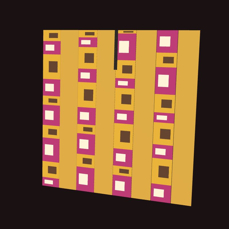
Wari tapestry tunics were “standardized in their shape, dimensions, construction, layout, and motifs”, which leads scholars to think “imperial administrators” supervised their making. Their cotton came from the coast and their camelid-wool designs from the highlands, dyed with cochineal; only an elite could have owned the finest. 16 Debated Excavation
The first written description is Cieza de León's, about 1550. By the river Viñaque near Guamanga he saw “great and very ancient edifices” in ruins, which did not look like the Incas' work, “for their buildings were square, and those of the Yncas are long and narrow”; local people said they were built “many ages before the Yncas began to reign”. 21 Consensus Texts
How power worked Empire · A narrow elite · 4 unknown
How power worked
- Who rules
- Unknown
Why?
No text names a Wari ruler, and the sources read do not say who governed Wari.
- How chosen
- Unknown
Why?
No source read says how Wari's leaders were chosen.
- Limits on power
- Unknown
Why?
Nothing read shows what limited Wari's rulers.
- Scale
- Empire Debated
Why?
- Claim to rule
- Unknown
Why?
Wari art shows staff-holding beings shared with Tiwanaku, but no text says what Wari's rulers claimed.
- Who has a say
- A narrow elite Speculative
Why?
Tiwanaku500 CE – 1000 CETiwanaku, Bolivia
South of Lake Titicaca, Tiwanaku built platforms, sunken courts and gateways cut from single blocks of stone. UNESCO calls it the capital of a powerful empire; excavators on its edges find a looser mosaic of allies and caravan routes.
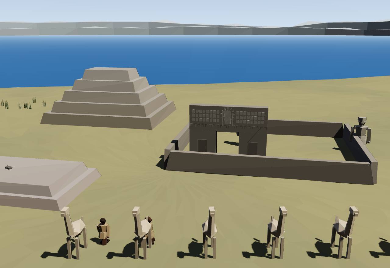
Tiwanaku: the Akapana, the Kalasasaya and the Gateway of the Sun
UNESCO describes Tiwanaku as the “capital of a powerful pre-Hispanic empire that dominated a large area of the southern Andes and beyond”, at its height between 500 and 900. Vranich dates the occupation of its ruins to about 500–1000; seshat-db's Late Tiwanaku runs from 800 to 1149, with a capital of about 20,000 people and four tiers of settlement. 18,19 Seshat DB Debated Excavation Dating
The city's monumental core lies east of the modern town: seven stone and earth structures, the Semi-subterranean Temple, the Kalasasaya, the Putuni, the Chunchukala, the Kherikala, the Kantatallita and the Akapana platform. To the south-west is the Pumapunku, “an alignment of plazas and ramps centered on a raised platform”. Colonial looting destroyed “all but the largest of features”. 19 Consensus Excavation Survey
The Pumapunku stands on 17 sandstone slabs covering 6.75 × 38.72 m; the largest measures 8.12 × 3.86 × 1.2 m and weighs an estimated 83 tons. Some 150 andesite blocks, quarried across the lake, were cut and finished before they were set, and the building was never completed. 19 Consensus Excavation
Doorways were cut from single stones. Cieza saw “many doorways, with their jambs, lintels, and thresholds, all of one stone” and thought the work unfinished; the Gateway of the Sun measures 3.82 by 2.85 m (Vranich). Cieza, unable to learn who built it, blamed “the want of letters”. 21,19 Consensus Excavation Texts
How far did Tiwanaku rule? Smith and Janusek dug at four sites in the upper Desaguadero valley, often placed in its core: Khonkho Wankane, Iruhito, Cerro Chijcha and Nazacara. Its influence there was “selective”, aimed at riverside communities on the caravan circuits; “rather than a core area of continuous control”, they find “a shifting political mosaic”. 23 Debated Excavation
Tiwanaku's style travelled. A wooden kero now at The Met, probably from the coastal desert where wood survives, carries four winged figures in “abstract carving style” with “dense ornamentation”, characteristic of Tiwanaku art; two have feline faces and two raptor heads. 15 Consensus Excavation
The Incas found Tiwanaku already ancient. Cieza was told “these edifices were commenced before the time of the Yncas” and judged it “the most ancient in all Peru”; beside the ruins stood Inca buildings and the house where Manco Inca, son of Huayna Capac, was born. 21 Consensus Texts
How power worked Empire · 5 unknown
How power worked
- Who rules
- Unknown
Why?
No text names a Tiwanaku ruler, and the excavations read do not say who governed it.
- How chosen
- Unknown
Why?
No source read says how Tiwanaku's leaders were chosen.
- Limits on power
- Unknown
Why?
Nothing read shows what limited Tiwanaku's leaders.
- Scale
- Empire Debated
Why?
- Claim to rule
- Unknown
Why?
The staff-holding figures of Tiwanaku art signal “status and authority” (The Met), but no text says what rulers claimed.
- Who has a say
- Unknown
Why?
No source read discusses who took part in decisions at Tiwanaku.
1000 CE – 1438 CE
Cuzco and Chimor
After Wari's fall the highlands broke into rival hilltop polities. In the valley of Cusco one of them, the Incas, slowly gathered its neighbours by marriage, alliance and war, terraced the valley floors and built a temple-palace at the centre of a growing town. On the north coast a larger kingdom, Chimor, ruled from the walled palaces of Chan Chan.
Wari's fall left the highlands divided. Around Cusco, Covey argues, Wari's colonists and their subjects “fragmented and dispersed throughout the region, setting up independent polities that competed with each other for regional domination”. 1 Debated Survey Excavation
Archaeologists call 1000–1400 in the Cusco region the Killke Period, after its most widespread pottery. Its end date marks “the beginning of Inca imperial expansion, rather than the end of Killke pottery”: Inca and Killke pottery lie together in layers of the fourteenth and fifteenth centuries. 1 Consensus Excavation Dating
The period long fell between two kinds of study. Until recently, Covey writes, few archaeologists worked on Cusco between 1000 and 1400, “leaving a great divide between pre-Inca archaeology and Inca studies”, while Inca history was tied to the Spanish chronicles and told as the deeds of single kings. 1 Consensus Texts Survey
Seshat sees Cusco grow. Its first Late Intermediate polity (1000–1249) covers 500–700 km², with full-time bureaucrats and roads coded as inferred absent; its second (1250–1399) covers 2,300–2,800 km² with four administrative levels, specialised government buildings and roads, and a capital at Cuzco or Choquepukio. Seshat Debated Survey
The coast had its own great power. UNESCO describes the Chimu Kingdom, with Chan Chan as its capital, reaching “its apogee in the 15th century, not long before falling to the Incas”; Correa-Trigoso dates the capital to the Late Intermediate Period and its end to the Inca conquest “alrededor del año 1470”. 24,25 Consensus Excavation Dating
Cliopatria draws both as territories: “Cuzco” from 1294 to 1439, at 8,783 km² throughout, and the “Chimu Empire” from 1188 to 1481, growing from 2,661 km² to 97,568 km² in its 1375–1474 slice (the dataset's area figures). Its outlines are a dataset's estimates, not borders anyone surveyed. 26 Debated Survey
CuzcoCuzco
The Incas began as one polity among many in the valley of Cusco. Survey and radiocarbon show a town that grew fast after 1000 and a state that drew its neighbours in by marriage, estates and war over several generations: a slower story than the chronicles' tale of one heroic king.
Terms: The Andes: Wari, Tiwanaku and the Inca: Cuzco and Chimor, Cuzco
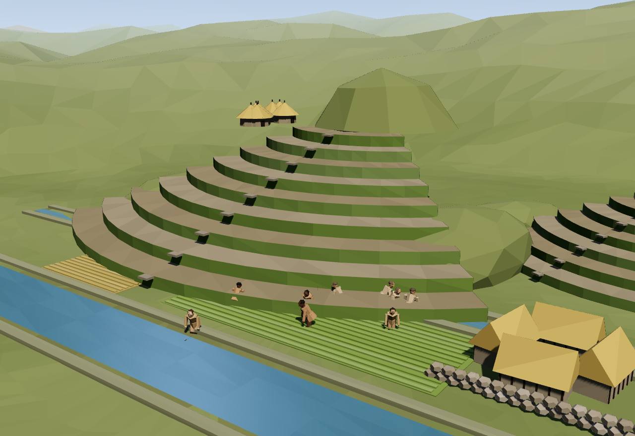
Terraces and canals in the Inca heartland
The chronicles credit the Inca empire to one man, Pachacuti. Covey reads them for “processes, rather than singular events”, and concludes that “this one Inca ruler alone could not have created the conditions for imperial expansion”: the heartland was built over centuries of ecological, social and political change after 1000. 1 Debated Survey Texts
“From approximately AD 1000 to AD 1300, the city of Cusco grew rapidly”: early Inca (Killke) layers lie under the Qorikancha and near the Haucaypata square, and the core reached “50 hectares or more”, ringed by satellite towns such as Puquin, Killke and Saqsaywaman (Covey). 1 Consensus Excavation
The earliest rulers “are said to have occupied a single elite residence, the Qorikancha, which also served as the polity's principal temple”; Sarmiento has it serve as both until Inca Rocca gave it to the state cult of the Sun. 1,3 Debated Texts
The heartland was terraced for maize. The Incas drained swamps, canalised the Vilcanota for over 23 km and built canals and terraces; Farrington's estimate, as Covey gives it, is nearly 800 hectares of new land, and the 65 hectares of terraces round Pisaq alone could have fed nearly a thousand people a year. Killke pottery on some terraces shows the work began before imperial expansion. 1 Consensus Survey Excavation
Land became royal property. Each ruler from the seventh, Yahuar Huaccac, to Huascar developed new valley lands as a personal estate, held after his death by his descent group, the panaka; the chronicles credit Inca Rocca's wife, Mama Micay, with some of the earliest works, probably done with labour from her own community. 1 Debated Texts Survey
Neighbours were brought in step by step. The Cuyos, among the first conquered, kept their own leaders under an Inca governor, and radiocarbon dates from Pukara Pantillijlla put the Inca reorganisation there in “the late thirteenth or early fourteenth century”; dates from Chokepukio, Huata and Pukara Pantillijlla suggest the Cusco region was consolidated “by the end of the fourteenth century”. 1 Debated Dating Excavation
Cieza's informants told of a ruler chosen in council. When an Inca died, “the principal people of the city considered who should be chosen for king”; some proposed “that there should be no king, but that the city should be governed by those who might be elected”, until a woman put forward Viracocha Inca and all showed “great satisfaction at the election of the new Inca”. 2 Debated Texts
Sarmiento gives the founder's own rule, as told in 1572: Manco Ccapac set the ten lineages that came with him to guard his son and “to elect the successor when he had been nominated by his father”. Sarmiento dates Manco Ccapac's death to 665, a date no archaeology supports. 3 Speculative Texts
How power worked King · Mixed · Custom and kin
How power worked
- Who rules
- King Debated
Why?
- How chosen
- Mixed Debated
Why?
- Limits on power
- Custom and kin Speculative
Why?
- Scale
- Territorial state Debated
Why?
- Claim to rule
- Divine mandate Debated
Why?
- Who has a say
- A narrow elite Debated
Why?
ChimorChan Chan, Trujillo
On the desert coast of northern Peru the kingdom of Chimor irrigated the valleys and ruled from Chan Chan, a city of walled palaces, each with courts, storerooms, a burial platform and U-shaped rooms that controlled access to goods. The Incas conquered it around 1470.
Terms: The Andes: Wari, Tiwanaku and the Inca: Cuzco and Chimor, Chimor
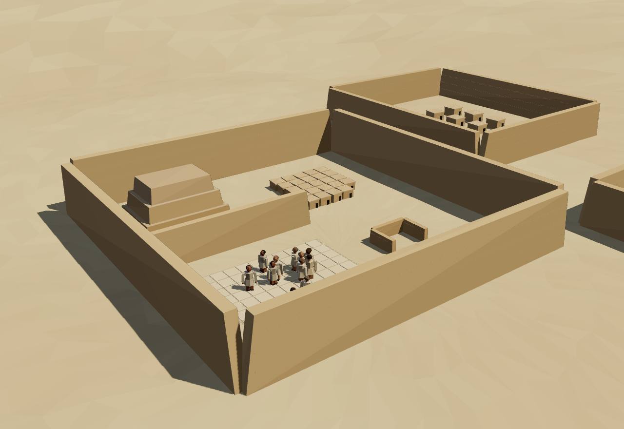
Chan Chan: a palace of the kings of Chimor
UNESCO calls Chan Chan “the largest in pre-Columbian America”, a planned city divided “into nine ‘citadels’ or ‘palaces’ forming autonomous units”. Correa-Trigoso, working for the site's special project, counts ten palaces in three groups, early (Chayhuac, Uhle, Gran Chimú), middle (Tello, Laberinto, Velarde) and late. 24,25 Debated Excavation Survey
Each palace was “la residencia oficial del soberano”, the physical and symbolic seat of a Chimú ruler's power, with a shared plan: a principal court and secondary courts, a storage area, corridors, a funerary platform, and U-shaped rooms called audiencias (Correa-Trigoso). 25 Consensus Excavation
Keatinge and Day found audiencias in both city and countryside and argued they are “crucial to an interpretation of the Chimu administration of production, distribution, and storage of goods”. Correa-Trigoso finds the storerooms subordinate to them: the collection of goods “estuvo organizada desde puntos de control denominados ‘audiencias’”. 28,25 Consensus Excavation Survey
The storerooms were measured in six palaces. The largest single room is 27.09 m² (22.76 m³); the Uhle palace had the most storage, 1,852.68 m² and 1,671.50 m³. Grains such as beans, peanuts and maize, the raw material of chicha, seem to have been stored loose, without jars. 25 Consensus Excavation
Chimor rested on four supports, as Correa-Trigoso summarises them: irrigated farming with aqueducts and canals, the sea, exchange with the highlands, the forest and as far as the Ecuadorian coast, and crafts in feathers, textiles, metal, wood, shell and stone. 25 Consensus Excavation Survey
The storage tells of rulers' politics: Correa-Trigoso concludes that growing resources shaped “las políticas de restricción que tomó cada gobernante Chimú”, and that rulers kept goods near the courts and platforms where ceremonies were held, so their part in the people's imagination would not suffer. 25 Speculative Excavation
Cieza heard of “a powerful lord in this valley, who was called Chimu”, who “did great things” before the Incas came; the Incas held the valley “in great estimation” and ran the royal road through it, and gold and silver were found in its chiefs' tombs. 21 Consensus Texts
The chronicles tell the conquest differently. In Cieza, Tupac Inca's army fought “a fierce war” in the valley and was nearly beaten; he pardoned the survivors, left a delegate, had the valley send tribute to Caxamalca and sent its metalworkers to Cuzco and provincial capitals. Sarmiento makes “Chimu Ccapac” a tributary of the lord of Caxamarca, captured with him by Pachacuti's brother. 2,3 Debated Texts
How power worked King · Empire · A narrow elite · 3 unknown
How power worked
- Who rules
- King Debated
Why?
- How chosen
- Unknown
Why?
No source read says how Chimú rulers succeeded one another; the palaces suggest separate seats for successive rulers, but the texts read do not say so.
- Limits on power
- Unknown
Why?
No source read describes any limit on the Chimú ruler.
- Scale
- Empire Debated
Why?
- Claim to rule
- Unknown
Why?
Correa-Trigoso writes of the ruler's place “dentro del imaginario colectivo”, but no source read says what Chimú rulers claimed.
- Who has a say
- A narrow elite Speculative
Why?
1438 CE – 1532 CE
Tawantinsuyu
In roughly a century the Incas came to rule the Andes from today's Ecuador and Colombia to Chile and Argentina: a hundred or more peoples, millions of subjects, joined by roads, storehouses and relay runners. Households paid in labour, counted in units of ten up to ten thousand and recorded on knotted cords. The Spanish who arrived in 1532 wrote most of what is known about how it was governed.
Terms: The Andes: Wari, Tiwanaku and the Inca: Tawantinsuyu
- Tawantinsuyu the Inca realm; the empire of the four suyus (Pärssinen's spelling) 29,1
- Sapa Ynca the sovereign, “which means sole lord” (Garcilaso; Covey writes sapa inka) 4,1
- mit’a a “turn”, as in a system of rotating corvée labour 1
- mink’a the Andean idiom Gose uses for the state feeding its tributaries (his abstract prints “mink a”); Covey glosses mink’a as “festive or wage labor that is not reciprocated” 1,30
- khipu a record of knotted cords; Cieza writes quipus 31,2
- khipukamayuq a specialist in recording and remembering with khipus 1
- mitimaes people moved by the Incas from one land to another (Cieza; Covey: mitmaqkuna) 2,1
- qollqa “an Inca imperial storage structure” 1
- chaski a runner who carried messages along the roads (Cieza: Chasqui) 1,2
- kuraka a local lord; the Spanish wrote cacique or curaca 1,4
- pachacas “one-hundreds”, census units that “usually coincided with ayllus” 32
- Haucaypata the great square at the centre of Cusco 1
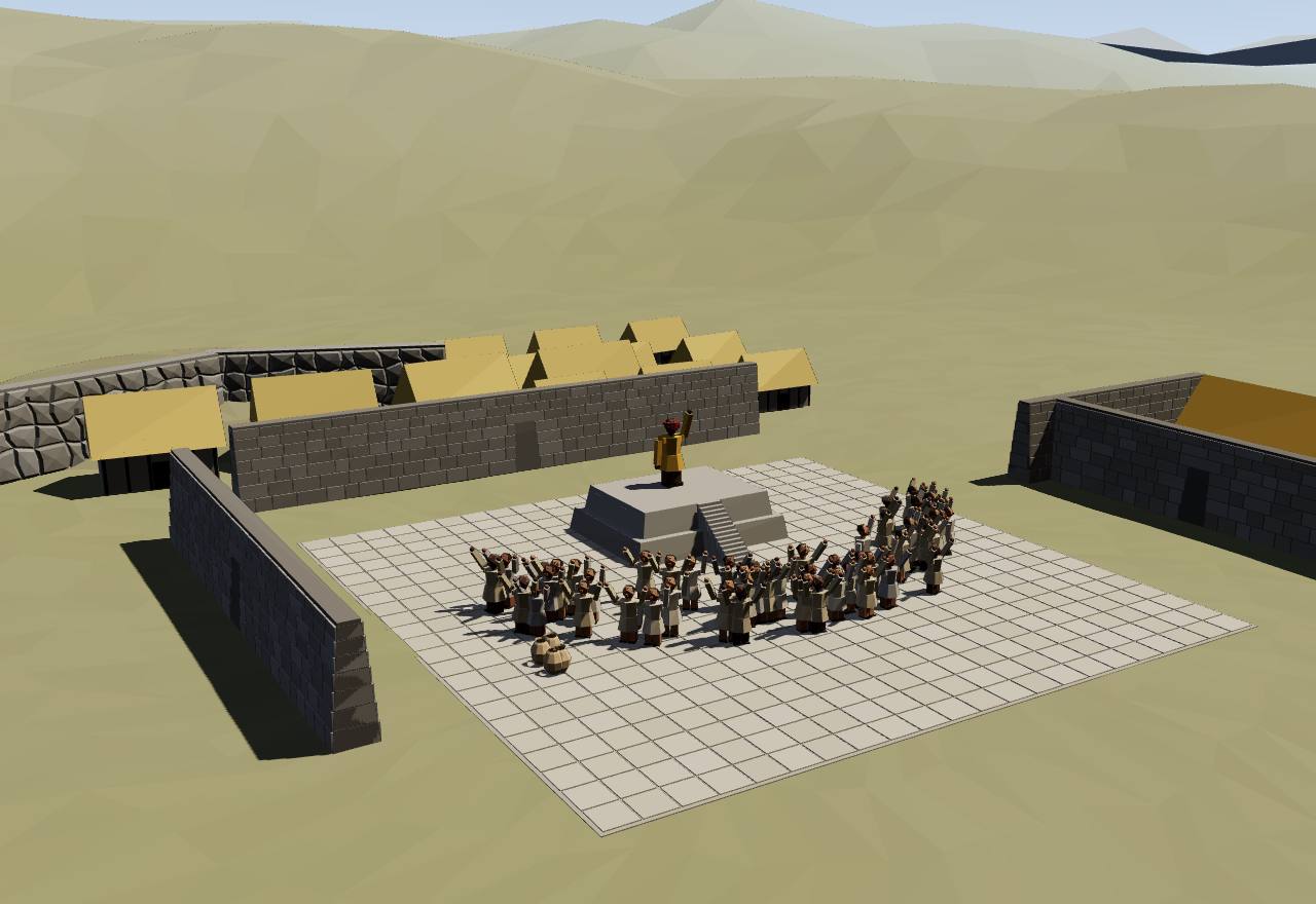
Cusco: the Haucaypata and the Qorikancha
In 1532 the Inca empire “was the largest native polity to develop in the Americas”, reaching into today's Peru, Bolivia, Chile, Argentina, Ecuador and Colombia and ruling “a hundred or more distinct ethnic groups” (Covey). Its population is guessed, not counted: Seshat codes 6–14 million, Hyland and colleagues write fourteen million, and published estimates run from two to 37 million (Pärssinen). 1,17,29 Seshat Debated Survey Texts
The chronicles' story: the Chancas attacked Cusco “around AD 1438”, the ruler Viracocha Inca fled, and a young prince, Inca Yupanqui, won with the help of the creator god, then took the title Pachacutic, “The One Who Brings a New Universal Cycle”, and is credited with rebuilding the capital, the conquests, a legal code and a new religion. Covey reads this as the compression of a longer process. 1 Debated Texts
UNESCO's record: under Pachacutec, Cuzco “developed … into a complex urban centre with distinct religious and administrative functions”, ringed by areas for farming, crafts and industry; the Spanish kept its plan but built churches and palaces “over the ruins of the Inca city”. 33 Consensus Excavation
The sovereign stood apart. Garcilaso writes that the Incas called him “Sapa Ynca, which means sole lord”; Cieza that he married his full sister, the Coya, so that “the succession of the kingdom might by that means be confirmed in the royal house”, and that during his coronation fast a chosen noble governed “as if he were the lord himself”. 4,2 Consensus Texts
Households were counted in tens. Julien notes that the decimal units were “not doubted by sixteenth-century Spanish writers”; Garcilaso describes registers “by decades of ten”, a decurion over each ten and officers over 50, 100, 500 and 1,000, and Guaman Poma counts on to the huno, ten thousand. The “classic presentation”, Pärssinen writes, runs from 10 to 10,000 households. 34,4,5,35 Consensus Texts
In practice the numbers were looser. A group said to be ten thousand households in the Chincha valley had about six thousand (Pärssinen); a census of 1670 found 132 tributaries in six pachacas, “one-hundreds”, which “usually coincided with ayllus” (Medrano and Urton). Covey finds local lords kept “low- and mid-level administrative positions”. 35,32,1 Debated Texts
Subjects paid in work. Garcilaso says the counts let governors apportion “the dues and services for the public works … bridges, roads, royal edifices” and choose men for war; Covey thinks it likely that the Inca elite already used “a rotational corvée system (mit’a)” to build their terraces and canals. Gose sees the state acting as a host, “providing food, drink, and clothing to dependent tributaries”. 4,1,30 Consensus Texts
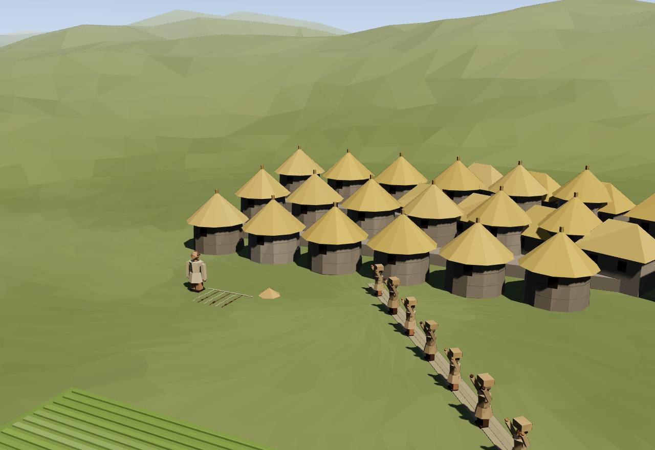
Storehouses held the product. Cieza was told that each province had “a great number of storehouses” for war; in peace their stores were divided “amongst the poor and the widows” and opened in years of dearth. D'Altroy and colleagues studied the “massive state storage system” of the upper Mantaro valley as state finance; Seshat codes food storage sites as present. 2,36 Seshat Debated Texts Excavation
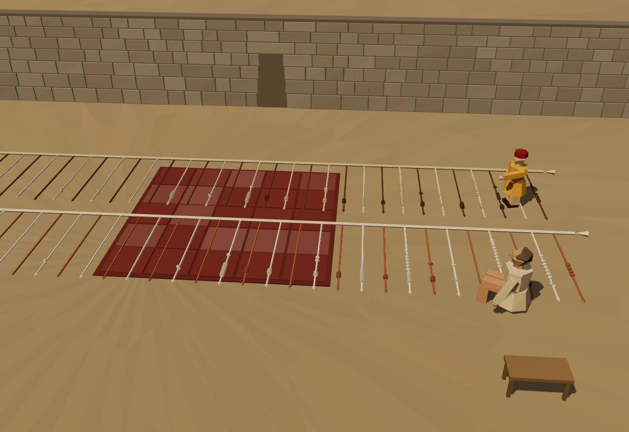
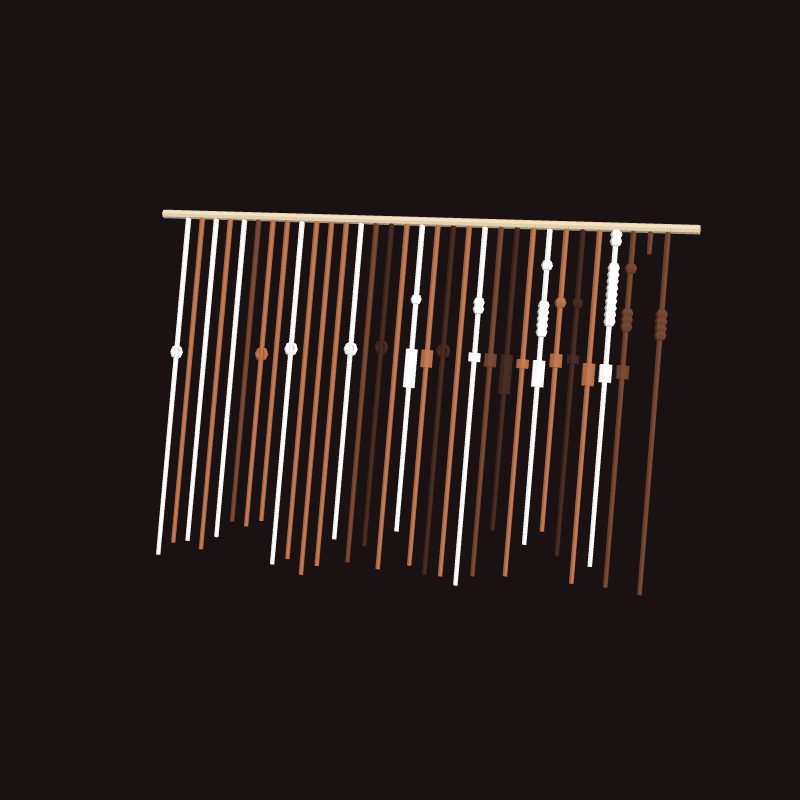
Accounts were kept on khipus. Cieza was told each province's quipucamayos recorded tribute “with respect to silver, gold, cloth, flocks, down to fire-wood”, and at Xauxa the lord Guacarapora showed him knotted records of everything delivered to the Spaniards since Pizarro came. Urton and Brezine's study of 21 khipus from Puruchuco finds “census and tribute data” moved “between different accounting levels”. 2,31 Consensus Texts Excavation
Two Puruchuco khipus are nearly copies of each other. In the Open Khipu Repository's data, 28 of the 32 pendant cords of UR066 find a cord of the same value in the same order on UR067, including 2,904, 156 and 133; UR064 and UR068 share 61 cord values in order. The reader below sets them side by side. 37 Consensus Excavation Model
Roads tied it together. UNESCO's Qhapaq Ñan is “an extensive Inca communication, trade and defence network of roads covering 30,000 km”, “partly based on pre-Inca infrastructure”, from peaks over 6,000 m to the coast; Seshat codes roads, bridges, couriers and post stations as present. 38 Seshat Consensus Survey
Cieza describes the relays: small houses every half league along the roads, each with two runners sent in turn by the neighbouring villages; each ran his half league at full speed and shouted the message to the next, so that news crossed hundreds of leagues, faster, he thought, than a rider on a horse. 2 Consensus Texts
People were moved as well as counted. Cieza's mitimaes were settlers taken from newly conquered lands to older provinces of the same climate, while loyal settlers went the other way “to instruct their neighbours”; Covey finds Sacred Valley estates worked by mitmaqkuna, labour colonists who kept their ethnic identity, and yanakuna, retainers settled for good. 2,1 Consensus Texts Survey
Administrative centres reordered the provinces. Covey describes the northern campaigns building major sites as far as Huánuco that reorganised local economies “under the decimal system in a way that used local elite networks”. Cieza called Huánuco's palace “the chief place in the provinces of the Andes”, with a temple of the Sun and “more than 30,000 Indians” set apart to serve it. 1,21 Debated Texts Excavation
Was there a royal council? Many scholars give the Inca four apos, heads of the four suyus, forming a Supreme Council; Pärssinen calls this a myth, since early sources such as Cieza, Betanzos and Sarmiento do not describe a permanent council and later accounts sound much like Spain's own Council of the Indies. 39 Debated Texts
Seshat codes the empire as a unitary state with four to six administrative levels, full-time bureaucrats inferred, a formal legal code and merit promotion, but judges and courts inferred absent; elite status was hereditary and rulers were legitimated by the gods. It codes writing as absent and non-written records, the khipus, as present. Seshat Debated Texts
How power worked King · Mixed · Custom and kin
How power worked
- Who rules
- King Consensus
Why?
- How chosen
- Mixed Debated
Why?
- Limits on power
- Custom and kin Debated
Why?
- Scale
- Empire Consensus
Why?
- Claim to rule
- Divine mandate Consensus
Why?
- Who has a say
- A narrow elite Consensus
Why?
Reading a khipu: two copies of one account
Data: Open Khipu Repository, four Puruchuco khipus recorded by Urton and Brezine (2004); the reading is the Locke–Ascher decimal scheme
Each cord is a number. Read down a cord: single knots near the top cord are thousands, then hundreds, then tens; at the bottom a long knot of two to nine turns gives the ones, a figure-eight knot a single one, and no knot a zero. The drawing sets each knot at its decimal place; the cords' colours are those recorded. 37 Urton and Brezine read the Puruchuco archive as census and tribute data “transferred between different accounting levels”. 31 What each cord counted is not known.
28 of 32 pendant cords on UR066 (KH0303) find a cord of the same value, in the same order, on UR067 (KH0304), which has 32. Cords marked have no such partner.
Every cord of UR066 beside UR067 (aligned)
| UR066 cord | value | UR067 cord | value |
|---|---|---|---|
| 1 | 1 | 1 | 1 |
| 2 | 0 | 2 | 0 |
| 3 | 0 | 3 | 0 |
| 4 | 0 | 4 | 0 |
| – | – | 5 | 1 |
| 5 | 0 | 6 | 0 |
| 6 | 0 | 7 | 0 |
| 7 | 1 | – | – |
| 8 | 0 | 8 | 0 |
| 9 | 1 | 9 | 1 |
| 10 | 0 | 10 | 0 |
| 11 | 0 | 11 | 0 |
| 12 | 0 | 12 | 0 |
| 13 | 6 | – | – |
| 14 | 0 | 13 | 0 |
| – | – | 14 | 0 |
| 15 | 1 | 15 | 1 |
| 16 | 0 | 16 | 0 |
| 17 | 19 | 17 | 19 |
| 18 | 4 | 18 | 4 |
| 19 | 3 | 19 | 3 |
| 20 | 0 | 20 | 0 |
| 21 | 22 | 21 | 22 |
| 22 | 3 | 22 | 3 |
| 23 | 9 | 23 | 9 |
| 24 | 2 | 24 | 2 |
| 25 | 156 | 25 | 156 |
| 26 | 13 | 26 | 13 |
| 27 | 12 | 27 | 12 |
| 28 | 5 | – | – |
| – | – | 28 | 0 |
| 29 | 2,904 | 29 | 2,904 |
| 30 | 133 | 30 | 133 |
| 31 | 0 | – | – |
| – | – | 31 | 161 |
| 32 | 40 | 32 | 40 |
61 of 71 pendant cords on UR064 (KH0301) find a cord of the same value, in the same order, on UR068 (KH0305), which has 73. Cords marked have no such partner.
Every cord of UR064 beside UR068 (aligned)
| UR064 cord | value | UR068 cord | value |
|---|---|---|---|
| 1 | 1 | 1 | 1 |
| 2 | 0 | 2 | 0 |
| 3 | 0 | 3 | 0 |
| 4 | 0 | 4 | 0 |
| 5 | 0 | 5 | 0 |
| 6 | 0 | 6 | 0 |
| 7 | 0 | 7 | 0 |
| 8 | 1 | 8 | 1 |
| 9 | 0 | 9 | 0 |
| 10 | 1 | 10 | 1 |
| 11 | 0 | 11 | 0 |
| 12 | 0 | 12 | 0 |
| 13 | 0 | 13 | 0 |
| 14 | 3 | 14 | 3 |
| 15 | 0 | 15 | 0 |
| 16 | 0 | 16 | 0 |
| 17 | 0 | 17 | 0 |
| 18 | 7 | – | – |
| – | – | 18 | 8 |
| 19 | 2 | 19 | 2 |
| 20 | 1 | 20 | 1 |
| 21 | 0 | 21 | 0 |
| 22 | 8 | 22 | 8 |
| 23 | 1 | 23 | 1 |
| 24 | 0 | – | – |
| – | – | 24 | 3 |
| 25 | 1 | 25 | 1 |
| 26 | 56 | 26 | 56 |
| 27 | 5 | 27 | 5 |
| 28 | 0 | – | – |
| – | – | 28 | 4 |
| 29 | 1 | 29 | 1 |
| 30 | 1,212 | – | – |
| – | – | 30 | 1,213 |
| 31 | 43 | 31 | 43 |
| 32 | 64 | 32 | 64 |
| 33 | 16 | – | – |
| – | – | 33 | 17 |
| 34 | 2 | 34 | 2 |
| 35 | 0 | 35 | 0 |
| 36 | 1 | 36 | 1 |
| – | – | 37 | 0 |
| 37 | 8 | 38 | 8 |
| 38 | 1 | 39 | 1 |
| 39 | 1 | 40 | 1 |
| 40 | 0 | 41 | 0 |
| 41 | 8 | 42 | 8 |
| 42 | 1 | 43 | 1 |
| 43 | 3 | 44 | 3 |
| 44 | 1 | 45 | 1 |
| 45 | 57 | 46 | 57 |
| 46 | 5 | 47 | 5 |
| 47 | 6 | 48 | 6 |
| 48 | 2 | 49 | 2 |
| 49 | 1,236 | 50 | 1,236 |
| 50 | 46 | 51 | 46 |
| 51 | 57 | – | – |
| 52 | 12 | – | – |
| – | – | 52 | 59 |
| – | – | 53 | 10 |
| 53 | 1 | 54 | 1 |
| 54 | 0 | 55 | 0 |
| 55 | 0 | 56 | 0 |
| 56 | 0 | 57 | 0 |
| 57 | 3 | 58 | 3 |
| 58 | 1 | 59 | 1 |
| 59 | 1 | 60 | 1 |
| – | – | 61 | 0 |
| 60 | 6 | 62 | 6 |
| 61 | 1 | 63 | 1 |
| 62 | 3 | 64 | 3 |
| 63 | 0 | 65 | 0 |
| 64 | 43 | 66 | 43 |
| 65 | 3 | 67 | 3 |
| 66 | 2 | 68 | 2 |
| 67 | 0 | – | – |
| – | – | 69 | 2 |
| 68 | 459 | 70 | 459 |
| 69 | 44 | 71 | 44 |
| 70 | 38 | – | – |
| 71 | 0 | – | – |
| – | – | 72 | 39 |
| – | – | 73 | 13 |
Data: Open Khipu Repository (MIT licence), khipus KH0301, KH0303, KH0304, KH0305, recorded at Puruchuco by Gary Urton and Carrie Brezine in July 2004. Two figure-eight knots on UR067's thirteenth cord were recorded with no value and count as zero; a few clusters recorded as mixed knots keep the recorded value. 37
Counting households by tens: the decimal ladder
Model, not evidence
Garcilaso describes the scheme: households “registered by decades of ten”, one man of each ten its decurion, and officers over fifty, a hundred, five hundred and a thousand, each drawn from the men below him. 4 Guaman Poma counts on to the huno, ten thousand, and Covey glosses hunu as “a unit of ten thousand”. 5,1 Julien reconstructs how the units worked from two native accounting records; only her abstract was read. 34
| Unit | Title, as printed | Officers |
|---|---|---|
| 10 | Chunca-camayu decurion, “he who has charge of ten men” | 100 |
| 50 | Pichca-chunca camayu officer over 50 | 20 |
| 100 | Pachac-camayu officer over 100 | 10 |
| 500 | Pichca-pachac-camayu officer over 500 | 2 |
| 1,000 | Huaranca-camayu “a general commanding a thousand” | 1 |
| 10,000 | huno ten thousand (Guaman Poma's count; Covey: hunu, “a unit of ten thousand”) | 0 |
| All office holders | 133 | |
In practice
-
six pachacas (“one-hundreds”), Santa valley, 1670
A revisita of 1670 counted 132 tributaries in six pachacas, census units that usually coincided with ayllus: the names were decimal, the numbers were not. 32
-
a “10 mil” (ten thousand) of the Chincha valley
Pärssinen notes that a group said to be ten thousand households in the Chincha valley had in fact about six thousand. 35
The model fills the ladder exactly; Pärssinen calls this the “classic presentation” of a hierarchy from 10 to 10,000 households, which the counts did not follow. 35 6 rungs: Garcilaso's five to a thousand, and the ten thousand from Guaman Poma.
How each Sapa Inca came to power
Data: Ogburn's table of Cabello Balboa's dates; Sarmiento, Cieza, Covey, Markham and Oviedo, as cited
Garcilaso's rule: “the eldest son always inherited the kingdom”. 4 The strip shows how the sources read say each of the last Sapa Incas actually came to power. None of these years was counted by the Incas themselves: the imperial ones are Cabello Balboa's, as Ogburn tabulates them, and radiocarbon puts the empire's start earlier. 6 Atahualpa's reign overlaps Huascar's because the two fought for the throne.
- Seized the fringe
- Took the royal fringe against the reigning Inca's wishes (Sarmiento; Ogburn's “deposes”).
- Named by the ruler
- Named by the reigning Inca (or said to have been) before the royal kin, not by birth order alone.
- Won against a faction
- Came to power after a rival faction's candidate was put down (Covey).
- Proclaimed by the army
- Recognised by his father's army captains in the north (Cieza).
- Crowned under the Spanish
- Crowned with the conquerors' acknowledgment (Markham).
- Succeeded in Vilcabamba
- Succeeded inside the Vilcabamba refuge, beyond Spanish control.
9 accessions: 1 seized the fringe, 2 named by the ruler, 1 won against a faction, 1 proclaimed by the army, 1 crowned under the spanish, 3 succeeded in vilcabamba; median reign 11 years. Ended: 4 died in office, 3 killed, 1 abdicated, 1 conquered.
Marks at the end of a bar: ○ died in office · × killed · ▽ deposed · | abdicated · □ conquered
Show the table: Sapa Incas, 1438–1572
| Ruler | Years | Came to power | Reign ended | Source |
|---|---|---|---|---|
| Pachacuti (Inca Yupanqui) | 1438 CE – 1471 CE | Seized the fringe | died in office (“Pachacuti deposes his father Viracocha” (Ogburn's table); Sarmiento: he took the fringe “without the consent of his father”, who wanted Inca Urco; Covey dates these events decades before 1438) | 6,3,1 |
| Topa Inca Yupanqui | 1471 CE – 1493 CE | Named by the ruler | died in office (Sarmiento: Pachacuti named him before his kin, passing over Amaru Tupac Inca, whom “some propose”; Sarmiento has him die in 1528) | 6,3 |
| Huayna Capac | 1493 CE – 1525 | Won against a faction | died in office (Covey: two of Topa Inca's secondary wives rallied his kin for Ccapac Huari, and “a rival faction and its candidate, Huayna Capac, suppressed this attempt”; Sarmiento: he died at Quito in 1524) | 6,1,3 |
| Huascar | 1525 – 1533 | Named by the ruler | killed (Sarmiento: the omens were against both heirs; his mother was told “his father named him”; killed by Atahualpa's captains in 1533) | 6,3,2 |
| Atahualpa | 1525 – 1532 | Proclaimed by the army | conquered (Cieza: his father's captains at Quito agreed to recognise him; Ogburn's table dates the contested succession from 1525 and Atahualpa's capture by Pizarro at Cajamarca to 1532 (the year of his proclamation is not given in the sources read)) | 6,2 |
| Manco Inca | 1534 – 1544 | Crowned under the Spanish | killed (Markham: acknowledged by Pizarro and crowned on 24 March 1534; besieged Cuzco, withdrew to Vilcapampa, and was killed by Almagro's partisans in 1544) | 3 |
| Sayri Tupac | 1544 – 1557 | Succeeded in Vilcabamba | abdicated (Markham: left Vilcapampa on 7 October 1557 on terms with the viceroy, was invested at Lima in January 1558 and died at Yucay in 1560) | 3 |
| Titu Cusi Yupanqui | 1560 – 1571 | Succeeded in Vilcabamba | died in office (Markham: took the sovereignty on Sayri Tupac's death “owing to the youth” of Tupac Amaru; Oviedo: dead “for nearly a year” when the viceroy's troops arrived in 1572) | 3,13 |
| Tupac Amaru | 1571 – 1572 | Succeeded in Vilcabamba | killed (Oviedo: fled, was captured by Captain Loyola, brought into Cuzco on St Matthew's day 1572 and beheaded; Markham dated the execution December 1571) | 13,14 |
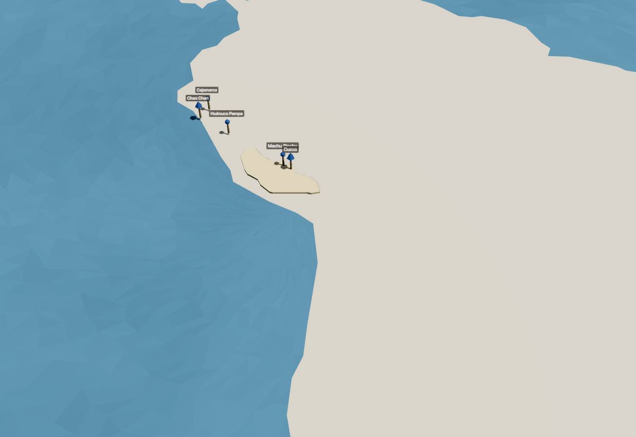
Tawantinsuyu in Cliopatria, 1450–1530
Places: 5 cited sites over Cliopatria (CC BY 4.0) territories, drawn flat and low. Cuzco · Machu Picchu · Huánuco Pampa · Cajamarca · Chan Chan 33,41,7,42,21,43,6,24
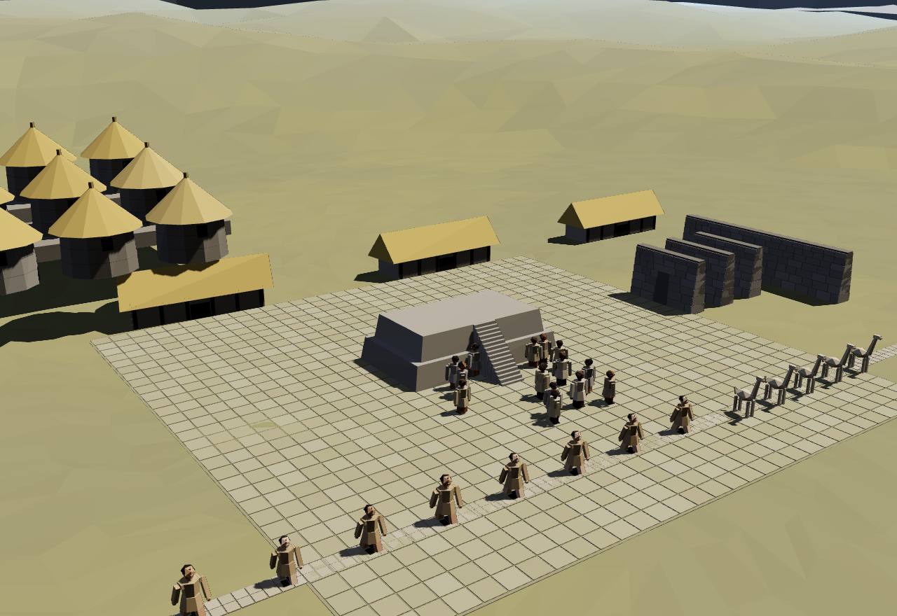
Huánuco Pampa: an administrative centre with its platform
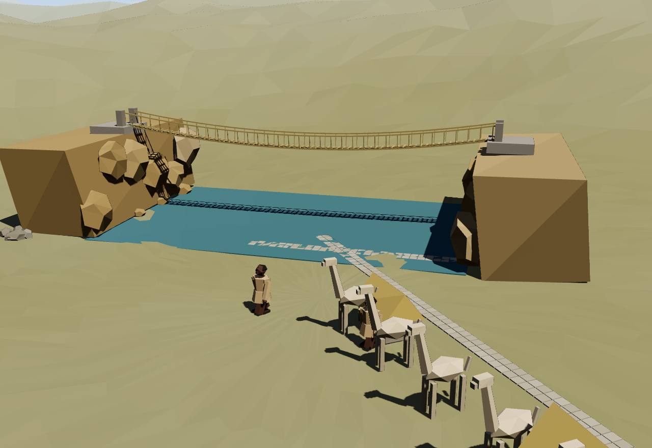
The royal road: a bridge, a post house and the runners
Qollqa: rows of state storehouses
A khipukamayuq reads two copies of one account
1532 – 1572
Conquest and Vilcabamba
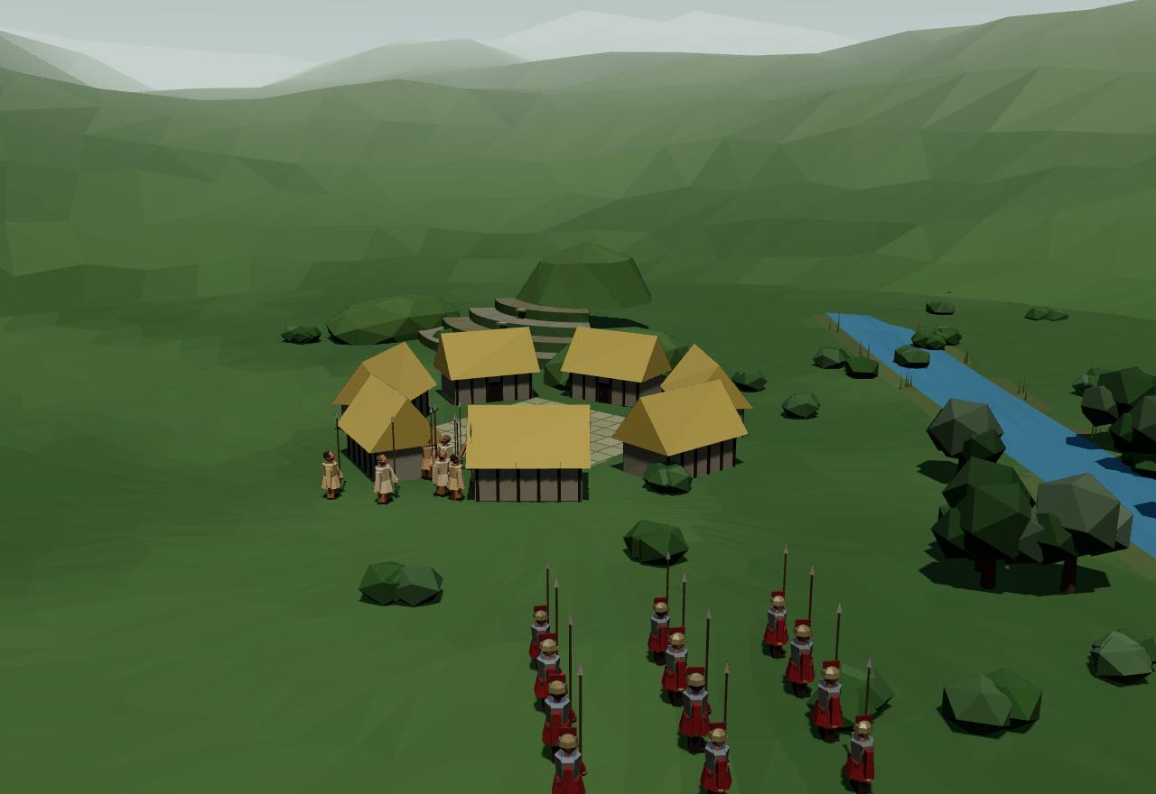
Spaniards under Pizarro seized Atahualpa in 1532, in the middle of a civil war between two of Huayna Capac's sons. The Inca Manco, crowned with their consent, turned against them and withdrew into the forested mountains of Vilcabamba, where he and his sons kept an independent Inca state for nearly forty years, until a viceroy's army took it in 1572 and executed the last of them in Cuzco.
Vilcabamba: the last Inca refuge, 1572
Spaniards led by Francisco Pizarro and Diego de Almagro invaded the Andean highlands in 1532 (Covey), and Pizarro captured Atahualpa at Cajamarca that year (Ogburn's chronology). Atahualpa's captains had just taken Huascar prisoner; Sarmiento says they killed him on Atahualpa's order in 1533. 1,6,3 Consensus Texts
Markham's summary of the chronicles: Pizarro “acknowledged Manco Inca as the legitimate successor of his brother Huascar”, and Manco was crowned on 24 March 1534; he then escaped, besieged the Spaniards in Cuzco, repulsed Hernando Pizarro at Ollantaytambo, and after a defeat took refuge in Vilcapampa, until in 1544 he was accidentally killed by one of the Spanish fugitives he had sheltered. 3 Consensus Texts
From Vilcabamba “the last independent Incas waged a nearly forty year-long war (AD 1536–1572) against Spanish control of the Andes”. Bauer, Fonseca and Aráoz excavated its two chief Inca cities, Vitcos and Espíritu Pampa, in three years of fieldwork, “the first large scale, scientific research conducted in the region”. 14 Consensus Excavation Texts
Manco's son Sayri Tupac came to terms: offered 17,000 castellanos of rent and the valley of Yucay, he left Vilcapampa with 300 followers on 7 October 1557, was received by the viceroy at Lima in January 1558, was baptised Diego and died at Yucay in 1560 (Markham). 3 Consensus Texts
His brother Titu Cusi Yupanqui then ruled in Vilcabamba “owing to the youth of the legitimate brother Tupac Amaru” (Markham). When the viceroy Toledo's troops arrived in 1572 they learned that he had been dead “for nearly a year”, a death the Indians had kept from them (Oviedo). 3,13 Debated Texts
Oviedo tells the end. The troops took Vilcabamba; Tupac Amaru fled towards the Mañaries and was overtaken by Captain Loyola; on St Matthew's day 1572 the captains entered Cuzco with the captive Incas and the bodies of Manco and Titu Cusi. After three days of instruction Tupac Amaru was baptised, condemned, and beheaded on a scaffold before “an immense assemblage of Indians”. 13 Debated Texts
Markham calls the execution a “judicial murder”: churchmen begged the viceroy on their knees to send the young Inca to Spain, and Philip II is said to have told Toledo on his return, “I sent you to serve kings; and you went to kill kings”. Markham's editorial view, written in 1907. 3 Debated Texts
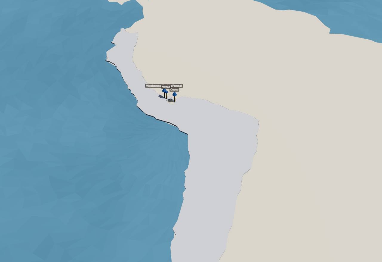
Cliopatria keeps drawing an “Inca Empire” after 1532: at its full extent, about 2.08 million km² by the dataset's own area figure, until 1539, then from 1540 to 1571 a territory of 4,864 km² round Vilcabamba. The page's map shows those outlines with Vitcos and Vilcabamba marked. 26 Debated Survey
How power worked King · Heredity · Territorial state · 1 unknown
How power worked
- Who rules
- King Consensus
Why?
- How chosen
- Heredity Debated
Why?
- Limits on power
- Unknown
Why?
No source read describes what limited the Vilcabamba Incas; the texts read are Spanish accounts of their war and capture.
- Scale
- Territorial state Debated
Why?
- Claim to rule
- Kinship and descent Debated
Why?
- Who has a say
- A narrow elite Speculative
Why?
Artefacts
 Model, not a scan
 Model, not a scan
 Model, not a scan
In numbers
- Marks, by Seshat polity:
- Wari Empire
- Late Tiwanaku
- Cuzco - Late Intermediate I
- Cuzco - Late Intermediate II
- Inca Empire
- Background bands, by phase:
- Wari and Tiwanaku
- Cuzco and Chimor
- Tawantinsuyu
- Conquest and Vilcabamba
| Seshat polity | Years | Value |
|---|---|---|
| Wari Empire | 650 CE – 999 CE (whole period) | 20,000–320,000 |
| Late Tiwanaku | 800 CE – 1149 CE (whole period) | 275,000–600,000 |
| Cuzco - Late Intermediate I | 1000 CE – 1250 CE (whole period) | 500–700 |
| Cuzco - Late Intermediate II | 1250 CE – 1400 CE (whole period) | 2,300–2,800 |
| Inca Empire | 1375 CE – 1532 (whole period) | 500,000–2,000,000 |
| Seshat polity | Years | Value |
|---|---|---|
| Wari Empire | 650 CE – 999 CE (whole period) | 100,000–500,000 |
| Cuzco - Late Intermediate I | 1000 CE – 1250 CE (whole period) | suspected unknown |
| Cuzco - Late Intermediate II | 1250 CE – 1400 CE (whole period) | suspected unknown |
| Inca Empire | 1532 | 6,000,000–14,000,000 |
| Seshat polity | Years | Value |
|---|---|---|
| Wari Empire | 650 CE – 999 CE (whole period) | 30,000–70,000 |
| Late Tiwanaku | 800 CE – 1149 CE (whole period) | 20,000 |
| Cuzco - Late Intermediate I | 1000 CE – 1250 CE (whole period) | unknown |
| Cuzco - Late Intermediate II | 1250 CE – 1400 CE (whole period) | suspected unknown |
| Inca Empire | 1375 CE – 1532 (whole period) | 20,000–100,000 |
| Seshat polity | Years | Value |
|---|---|---|
| Wari Empire | 650 CE – 999 CE (whole period) | 2–5 |
| Cuzco - Late Intermediate II | 1250 CE – 1400 CE (whole period) | 4 |
| Inca Empire | 1375 CE – 1532 (whole period) | 4–6 |
| Seshat polity | Years | Value |
|---|---|---|
| Wari Empire | 650 CE – 999 CE (whole period) | 5 |
| Late Tiwanaku | 800 CE – 1149 CE (whole period) | 4 |
| Cuzco - Late Intermediate I | 1000 CE – 1250 CE (whole period) | 4 |
| Cuzco - Late Intermediate II | 1250 CE – 1400 CE (whole period) | 4 |
| Inca Empire | 1375 CE – 1532 (whole period) | 5 |
| Seshat polity | Years | Value |
|---|---|---|
| Wari Empire | 650 CE – 999 CE (whole period) | 3–4 |
| Cuzco - Late Intermediate II | 1250 CE – 1400 CE (whole period) | 4 |
| Inca Empire | 1375 CE – 1532 (whole period) | 6 |
Values as Seshat codes them: bands are ranges, dots single values, flat bars values given for a whole period, hatching “unknown”; from one Seshat polity to the next, marks alternate between a light tone and a darker one with dashed joining lines (the key above names each polity). Source: Seshat Global History Databank (Equinox-2020), CC BY 4.0; and the Seshat Databank, seshat-db.com (no licence stated; attribution).
Governance fingerprint
Seshat's institutional variables, phase by phase. Hover or focus a cell for the values and years.
- Present
- Inferred present
- Absent
- Inferred absent
- Unknown
- Not coded in Seshat
- Mixed: present in one Seshat polity or period, absent in another
Not coded in Seshat: Cuzco and Chimor: Chimor, Conquest and Vilcabamba. The Seshat Databank has no polity for them, so their six axes rest on the cited scholarship alone.
The axes against Seshat
2 agree, 0 disagree.
Show the 2 pairs that agree
- Agree Cuzco and Chimor: Cuzco: claim to rule coded “Divine mandate”, which implies rulers legitimated by gods present; Seshat has it inferred present.
- Agree Tawantinsuyu: claim to rule coded “Divine mandate”, which implies rulers legitimated by gods present; Seshat has it present.
Only pairs where an axis value on its own implies a Seshat variable are compared; the rest is not counted as disagreement.
Source: Seshat Global History Databank (Equinox-2020), CC BY 4.0; Seshat Databank, seshat-db.com (no licence stated; attribution).
Compare
| Axis | The Andes: Wari, Tiwanaku and the Inca | Central Mexico: Teotihuacan | The Maya: Holy lords and Teotihuacan | Rome: The kings |
|---|---|---|---|---|
| Who rules | Unknown | Unknown | King | King |
| How chosen | Unknown | Unknown | Heredity | Mixed |
| Limits on power | Unknown | Council | Custom and kin | Council |
| Scale | Empire | Territorial state | City-state | City-state |
| Claim to rule | Unknown | Divine mandate | Divine mandate | Divine mandate |
| Who has a say | A narrow elite | Unknown | A narrow elite | Unknown |
Legacy
The Inca roads are now a World Heritage site: UNESCO inscribed the Qhapaq Ñan in 2014 with “273 component sites spread over more than 6,000 km”, chosen to show the network's “associated infrastructure for trade, accommodation and storage, as well as sites of religious significance”. 38 Consensus Survey
Khipus did not end with the empire. Andeans kept making them “for over four hundred years after the Spanish defeat of the Inkas”, and the villagers of San Pedro de Casta used khipu boards in their yearly water ceremony until the 1950s (Hyland, Bennison and Hyland). The Open Khipu Repository now publishes the recorded khipus as open data, and its board notes that native speakers of Andean languages “have so far had little involvement in collecting the data”. 17,37 Consensus Texts Ethnography
Tiwanaku belongs to its neighbours again: in 2001 the indigenous communities took over the ruins and expelled the central government's workers; Vranich's team gave the local site managers a full printed copy of the Pumapunku's reassembled stones for their own research and visitors. 19 Consensus Texts
See also forms of government.
Sources
Bibliography
46 sources, numbered as cited: 19 papers · 7 books · 14 datasets · 6 primary sources
- Book Covey, R. A. (2006). How the Incas Built Their Heartland: State Formation and the Innovation of Imperial Strategies in the Sacred Valley, Peru. University of Michigan Press (open access, CC BY-NC-ND 4.0, on Fulcrum). Full text read (Fulcrum PDF), 16 Nov 2026, chiefly: the Pachacutic story (ch. 1, pp. 1–2); Wari colonies and Pikillacta (pp. 69–73) and its abandonment (pp. 84–85); the Qorikancha and early Cusco (pp. 116–117, 122–123); consolidation dates (pp. 180–181); decimal administration in the provinces (pp. 194–195); royal wives and succession (pp. 230–231); the radiocarbon argument against 1438 (pp. 232–233); the Quechua glossary (pp. 241–244), the Cusco chronology (pp. 246–247) and note 6 on king lists (p. 249).
- Primary Cieza de León, P. de (trans. C. R. Markham) (1883). The second part of the Chronicle of Peru. Hakluyt Society (written c. 1550; archive.org scan). Read 16 Nov 2026 (djvu text): the regent during the coronation fast (p. 20); the Coya (ch. 10, pp. 26–27); songs and quipus (ch. 12, pp. 32–34); yearly counts and storehouses (pp. 57–58); post runners (pp. 64–66); mitimaes (ch. 22, pp. 67–68); Viracocha's election (pp. 120–121); the war in the Chimu valley (pp. 185–186); Atahualpa proclaimed and Huascar's answer (pp. 227–228).
- Primary Sarmiento de Gamboa, P. (trans. and ed. C. R. Markham) (1907). History of the Incas. Hakluyt Society (written 1572); Project Gutenberg e-book 20218. Read 16 Nov 2026: Markham's introduction (the Incas of Vilcapampa, the execution of Tupac Amaru); Sarmiento on Manco Ccapac's death in 665, Inca Yupanqui taking the fringe without his father's consent, Pachacuti nominating Tupac Inca (ch. 42) and dying in 1191 (ch. 47), Huayna Ccapac's accession (ch. 56–57), Huascar named after the omens, and Huascar's death in 1533.
- Primary Garcilaso de la Vega, Inca (trans. C. R. Markham) (1869). First part of the Royal commentaries of the Yncas, vol. I. Hakluyt Society (published 1609; archive.org scan). Read 16 Nov 2026 (djvu text): Sapa Ynca (p. 91); the decurions (pp. 143–144) and Markham's note on their titles (p. 152); the succession of the kings and of the curacas (pp. 310–311).
- Primary Guaman Poma de Ayala, F. (Royal Danish Library, GKS 2232 4º) (1615). El primer nueva corónica y buen gobierno: Chief accountant (pp. 360–363). The Guaman Poma Website, Det Kgl. Bibliotek (facsimile and transcription). Read 16 Nov 2026: pp. 360–361 [360–363] ('The Inka's secretaries', drawing 142; 'Chief accountant', drawing 143, with the transcription's Quechua counting words and the editors' notes).
- Paper Ogburn, D. E. (2012). Reconceiving the Chronology of Inca Imperial Expansion. Radiocarbon 54(2): 219–237. Full text read (Cambridge Core, free PDF), 16 Nov 2026: Table 1, 'The traditional chronology based on Cabello Balboa', and pp. 221–222, 233–234 on why its dates are uncertain.
- Paper Burger, R. L., Salazar, L. C., Nesbitt, J., Washburn, E., Fehren-Schmitz, L. (2021). New AMS dates for Machu Picchu: results and implications. Antiquity 95(383): 1265–1279. Abstract read (Cambridge Core), 16 Nov 2026.
- Paper Marsh, E. J., Kidd, R., Ogburn, D., Durán, V. (2017). Dating the Expansion of the Inca Empire: Bayesian Models from Ecuador and Argentina. Radiocarbon 59(1): 117–140. Abstract read (Cambridge Core), 16 Nov 2026.
- Book Pärssinen, M. (2003). II. La cronología y el área de la expansión incaica. Tawantinsuyu: el estado inca y su organización política (IFEA / OpenEdition). The free extract (§ 1, 'Problema general') read on OpenEdition, 16 Nov 2026: Means's gradual conquest from the second Inca (after Garcilaso) against Rowe's rapid one from Pachacuti (after Cieza, Sarmiento and Cabello Balboa).
- Paper Valverde, G., Barreto Romero, M. I., Flores Espinoza, I., Cooper, A., Fehren-Schmitz, L., Llamas, B., Haak, W. (2016). Ancient DNA Analysis Suggests Negligible Impact of the Wari Empire Expansion in Peru’s Central Coast during the Middle Horizon. PLOS ONE 11(6): e0155508. Full text read (CC BY), 16 Nov 2026: abstract, introduction (the Wari centres and the two readings of the coast) and discussion.
- Paper Jennings, J. (2006). Understanding Middle Horizon Peru: Hermeneutic Spirals, Interpretative Traditions, and Wari Administrative Centers. Latin American Antiquity 17(3): 265–285. Abstract read (OpenAlex), 16 Nov 2026.
- Paper Williams, P. R. (2001). Cerro Baúl: A Wari Center on the Tiwanaku Frontier. Latin American Antiquity 12(1): 67–83. Abstract read (OpenAlex), 16 Nov 2026.
- Primary Oviedo, G. de (trans. C. R. Markham) (1907). A narrative of the vice-regal embassy to Vilcabamba, 1571, and of the execution of the Inca Tupac Amaru. In Markham (ed.), History of the Incas, Hakluyt Society, pp. 403–407 (archive.org scan). Read 16 Nov 2026 (djvu text): the taking of Vilcabamba, the capture of Tupac Amaru, the entry into Cuzco and the execution.
- Book Bauer, B. S., Fonseca Santa Cruz, J., Aráoz Silva, M. (2015). Vilcabamba and the Archaeology of Inca Resistance. Cotsen Institute of Archaeology Press (Monographs 81). Publisher description read (OpenAlex record), 16 Nov 2026.
- Dataset The Metropolitan Museum of Art (2026). Kero (beaker), Tiwanaku, 500–1000 CE (1978.412.214). The Met Collection, object 310659. Object page and Collection API record read 16 Nov 2026: isPublicDomain true, 'View in 3D', H. 11.4 cm; the curatorial text on keros.
- Dataset The Metropolitan Museum of Art (2026). Tunic, Wari, 650–1000 CE (2021.146). The Met Collection, object 675980. Object page and Collection API record read 16 Nov 2026: isPublicDomain true, L. 103.5 × W. 101 cm, no 3D; the curatorial text by Louise Deglin (2022).
- Paper Hyland, S., Bennison, S., Hyland, W. P. (2021). Khipus, Khipu Boards, and Sacred Texts: Toward a Philology of Andean Knotted Cords. Latin American Research Review 56(2): 400–416. Full text read (Cambridge Core, CC BY 4.0), 16 Nov 2026: the abstract and the introduction on what Inka khipus recorded.
- Dataset UNESCO World Heritage Centre (2000). Tiwanaku: Spiritual and Political Centre of the Tiwanaku Culture (World Heritage List no. 567). UNESCO open data, World Heritage List dataset whc001. Short description and coordinates read 16 Nov 2026.
- Paper Vranich, A. (2018). Reconstructing ancient architecture at Tiwanaku, Bolivia: the potential and promise of 3D printing. Heritage Science 6: 65. Full text read (CC BY), 16 Nov 2026: the site's dates and monuments, the Pumapunku's slabs and andesite blocks, the Gateway of the Sun's size, the 2001 handover to the communities.
- Paper Isbell, W. H., Schreiber, K. J. (1978). Was Huari a State?. American Antiquity 43(3): 372–389. Abstract read (OpenAlex), 16 Nov 2026.
- Primary Cieza de León, P. de (trans. C. R. Markham) (1864). The travels of Pedro de Cieza de León, A.D. 1532-50, contained in the first part of his Chronicle of Peru. Hakluyt Society (written 1553; archive.org scan). Read 16 Nov 2026 (djvu text): the valley of Chimu (p. 242); Huánuco and Markham's note on its ruins (p. 284); the ruins by the river Viñaque near Guamanga (p. 309); Tiahuanaco (ch. 105, pp. 374–379, with Markham's notes).
- Paper Deglin, L., Nash, D. J., Williams, P. R. (2022). Wari Imperial Motives: the Variety of Decorated Ceramics at Cerro Baúl. Ñawpa Pacha 43(1): 1–26. Abstract read (OpenAlex), 16 Nov 2026.
- Paper Smith, S. C., Janusek, J. W. (2014). Political mosaics and networks: Tiwanaku expansion into the upper Desaguadero Valley, Bolivia. World Archaeology 46(5): 681–704. Abstract read (OpenAlex), 16 Nov 2026.
- Dataset UNESCO World Heritage Centre (1986). Chan Chan Archaeological Zone (World Heritage List no. 366). UNESCO open data, World Heritage List dataset whc001. Short description and coordinates read 16 Nov 2026.
- Paper Correa-Trigoso, D. E. (2021). Los depósitos y las áreas de almacenamiento en la urbe Chimú: Chan Chan, Trujillo, Perú. SPAL 30(1): 310–333. Full text read (institucional.us.es PDF, CC BY-NC-ND), 16 Nov 2026: introduction (the capital, its ten palaces, the Inca conquest c. 1470), the palace plan, the storage figures and the conclusions.
- Dataset Bennett, J. S., Mutch, E., Tollefson, A., et al. (2025). Cliopatria - A geospatial database of world-wide political entities from 3400BCE to 2024CE. Scientific Data 12. Cliopatria: open geospatial dataset of over 1600 political entities, 3400 BCE–2024 CE.
- Book Pärssinen, M. (2003). V. La organización sociopolítica del Cuzco. Tawantinsuyu: el estado inca y su organización política (IFEA / OpenEdition). The free extract read on OpenEdition, 16 Nov 2026: a class society; the order of Cuzco's ayllus and lineages credited by Toledo's witnesses to Pachacuti.
- Paper Keatinge, R. W., Day, K. C. (1973). Socio-Economic Organization of the Moche Valley, Peru, during the Chimu Occupation of Chan Chan. Journal of Anthropological Research 29(4): 275–295. Abstract read (OpenAlex), 16 Nov 2026.
- Book Pärssinen, M. (2003). III. La población total del Tawantinsuyu. Tawantinsuyu: el estado inca y su organización política (IFEA / OpenEdition). The free extract read on OpenEdition, 16 Nov 2026: population estimates 'oscilan entre dos millones y 37 millones'; Rowe's five million from five sample cases; the Chincha case. Also the source for the spelling Tawantinsuyu.
- Paper Gose, P. (2000). The State as a Chosen Woman: Brideservice and the Feeding of Tributaries in the Inka Empire. American Anthropologist 102(1): 84–97. Abstract read (OpenAlex), 16 Nov 2026. The abstract prints the reciprocity term as 'mink a'.
- Paper Urton, G., Brezine, C. J. (2005). Khipu Accounting in Ancient Peru. Science 309(5737): 1065–1067. Abstract read (OpenAlex), 16 Nov 2026. The paper's sums and figures were not read; the page's khipu numbers come from the cord-level data in the Open Khipu Repository (okr2026).
- Paper Medrano, M., Urton, G. (2018). Toward the Decipherment of a Set of Mid-Colonial Khipus from the Santa Valley, Coastal Peru. Ethnohistory 65(1): 1–23. Abstract read (OpenAlex), 16 Nov 2026.
- Dataset UNESCO World Heritage Centre (1983). City of Cuzco (World Heritage List no. 273). UNESCO open data, World Heritage List dataset whc001. Short description and coordinates read 16 Nov 2026.
- Paper Julien, C. J. (1988). How Inca Decimal Administration Worked. Ethnohistory 35(3): 257. Page copy of the shared core entry with `access` (abstract read on OpenAlex, 16 Nov 2026); request filed to set it on the shared entry.
- Book Pärssinen, M. (2003). IX. Organización decimal: la teoría y la práctica. Tawantinsuyu: el estado inca y su organización política (IFEA / OpenEdition). The free extract (§ 1, 'La teoría y sus problemas') and the chapter's notes read on OpenEdition, 16 Nov 2026 (note 10: the '10 mil' households of Chincha were about six thousand). The hierarchy table itself is an image behind the paywall and was not read.
- Paper D'Altroy, T. N., Earle, T. K., et al. (1985). Staple Finance, Wealth Finance, and Storage in the Inka Political Economy [and Comments and Reply]. Current Anthropology 26(2): 187–206. Abstract read (OpenAlex), 16 Nov 2026.
- Dataset Open Khipu Repository Team (FitzPatrick, M., et al.) (2026). The Open Khipu Repository (khipu.db and okr-kh-numbers.csv; Zenodo 10.5281/zenodo.18025748). GitHub khipulab/open-khipu-repository (MIT licence). README, licence (MIT), contributors list and the data read 16 Nov 2026. The khipus used are the Puruchuco group recorded by Urton and Brezine in 2004 (KH0301, KH0303, KH0304, KH0305; investigator numbers UR064, UR066, UR067, UR068); each cord's value is the sum of its knots' values as recorded in the knot table.
- Dataset UNESCO World Heritage Centre (2014). Qhapaq Ñan, Andean Road System (World Heritage List no. 1459). UNESCO open data, World Heritage List dataset whc001. Short description read 16 Nov 2026.
- Book Pärssinen, M. (2003). VII. Estructuras administrativas de los Suyus incas hacia las provincias. Tawantinsuyu: el estado inca y su organización política (IFEA / OpenEdition). The free extract (§ 1, 'El mito del consejo inca') read on OpenEdition, 16 Nov 2026.
- Paper Medrano, M., Khosla, A. (2024). How Can Data Science Contribute to Understanding the Khipu Code?. Latin American Antiquity 36(2): 497–516. Abstract read (Crossref record and the OSF preprint record, osf.io/rsa95), 16 Nov 2026.
- Dataset UNESCO World Heritage Centre (1983). Historic Sanctuary of Machu Picchu (World Heritage List no. 274). UNESCO open data, World Heritage List dataset whc001. Short description and coordinates read 16 Nov 2026.
- Dataset Wikidata contributors (2026). Huánucopampa (Wikidata Q9005560). Wikidata, entity data (CC0). Read 16 Nov 2026 for its coordinates (P625) only: a modern point for the site.
- Dataset Wikidata contributors (2026). Cajamarca (Wikidata Q205119). Wikidata, entity data (CC0). Read 16 Nov 2026 for its coordinates (P625) only: a modern point for the site.
- Dataset Wikidata contributors (2026). Vitcos (Wikidata Q2045814). Wikidata, entity data (CC0). Read 16 Nov 2026 for its coordinates (P625) only: a modern point for the site.
- Dataset Wikidata contributors (2026). Vilcabamba (Espíritu Pampa) (Wikidata Q827432). Wikidata, entity data (CC0). Read 16 Nov 2026 for its coordinates (P625) only: a modern point for the site.
- Dataset The Metropolitan Museum of Art (2026). Urpu (jar), Inca, 1400–1535 CE (1978.412.68). The Met Collection, object 310520. Object page and Collection API record read 16 Nov 2026: isPublicDomain true, H. 21.9 × W. 18.8 × D. 14.6 cm, no 3D; the curatorial text on urpus.
Quantitative values from the Seshat Global History Databank (Equinox-2020), licensed CC BY 4.0. Dataset: Seshat Equinox Packaged Data (v.1). See also Seshat: The Global History Databank (Turchin et al. 2015).
Values for polities Equinox-2020 does not cover come from the Seshat Databank at seshat-db.com (Seshat: Global History Databank), snapshotted from its API on 2026-11-16. No licence is stated on seshat-db.com; used with attribution. Snapshot: Seshat Databank API (seshat-db.com), social-complexity and general variables.