Kings of rivers, reservoirs and oaths, from the Mekong delta to the Spice Islands, 225–1518
Southeast Asia: Funan to Angkor and Majapahit
225 CE – 1518 CE
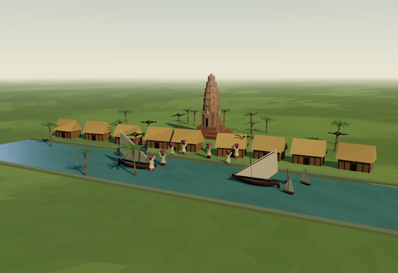
A port of Funan on a delta canal, 3rd–6th century (a model of the kind of place)
225 CE – 802 CE
Funan, Chenla and the first kingdoms
The first kingdoms of the region appear in other people’s writing: Chinese envoys describing Funan in the Mekong delta, Chinese annals on Chenla, and then, from the 680s, inscriptions of their own in Sanskrit, Old Khmer and Old Malay. On the mainland, river-plain kingdoms built in brick; on the islands, Srivijaya bound the ports of the Straits by oath, and Central Java’s kings raised Borobudur.
For three centuries the evidence is Chinese: Pelliot calls it ‘d’un caractère partiellement légendaire’ (partly legendary) and warns that data ‘qui reposent chacune sur un témoignage unique’ (each resting on one witness) must be taken with a margin of error. Vickery sets out to deconstruct ‘not just Cœdès and Pelliot, but also the Chinese records of Funan’. 1,2 Consensus Texts
The first Chinese envoys, Zhu Ying and Kang Tai, brought back information on ‘plus de cent royaumes’ (more than a hundred kingdoms) of the southern seas: the region was already full of small polities when it enters the record. 1 Consensus Texts
Kulke’s ‘Early Kingdom’ is ‘characterized by a strong centre and surrounded by a number of subdued but not yet annexed (or “provincialized”) smaller polities’; at this stage ‘“state deities” were still unknown’, and even later cults such as Angkor’s devarāja ‘remained primarily a personal ritual of the king rather than a state cult’. 16 Consensus Texts
The region began to write about itself: Sanskrit and Old Khmer on Chenla’s temples, and in Sumatra four Old Malay inscriptions ‘dans l’espace de quatre ans, entre 683 et 686 A. D.’ (within four years, 683–686), the first texts in Malay. 17,3 Consensus Texts
Cliopatria (bennett2025) draws Funan from 51 to 640, Chenla from 555 (split into Land and Water Chenla from 718), Srivijaya from 674 and the Mataram kingdom of Central Java from 741, as solid outlines: Chenla and Srivijaya at about 430,000 and 480,000 km² in 700. Vickery and Kulke both doubt that these polities had edges of that kind. 15,2,16 Debated Survey
Seshat codes every early polity on this page as decentralised: Funan and Chenla ‘confederated’, Medang ‘nominal’; Srivijaya’s record is empty. 18 Seshat Debated Survey
Funan225 CE – 550 CEAngkor Borei
Funan is known almost only from what Chinese envoys and chroniclers were told: a kingdom of the Mekong delta, founded when a foreigner married its queen, that sent tribute to China from the third century to the sixth. How much of that story is history, and whether Funan was one kingdom at all, is the question.
Terms: Southeast Asia: Funan to Angkor and Majapahit: Funan, Chenla and the first kingdoms, Funan
- Fou-nan Funan, in the French transcription of the Chinese name Pelliot used 1
- poñ Vickery’s ‘ancient group of chiefs recorded as fan by the Chinese’, the title of 7th-century local lords 2
- Kauṇḍinya the brahman the Chinese texts say came from India to reign in Funan; Vickery denies ‘that any “Kaundinya” ever came to Funan from India’ 1,2
‘Du IIIe au VIIe siècle, les textes chinois parlent fréquemment de cet état hindouisé’ (from the 3rd to the 7th century Chinese texts often speak of this Hinduised state), ‘une étape presque obligatoire entre l’Inde et la Chine’ (an almost obligatory stop between India and China); ‘Au VIIe siècle, le nom disparaît sans laisser de traces’ (in the 7th century the name disappears without trace) (Pelliot). 1 Consensus Texts
The Chinese founding story: ‘Leur souverain était originairement une femme’ (their ruler was originally a woman), Willow Leaf; a foreigner, Houen-t’ien, ‘la prit pour femme et s’empara du royaume’ (took her as wife and seized the kingdom). Vickery reads such tales, told to the first Chinese envoys, as ‘oral traditions’ and finds ‘no evidence that the initial foreign conqueror came from India’. 1,2 Debated Texts
A later king, Fan Shiman, ‘par la force de ses troupes, … attaqua et soumit les royaumes voisins; tous se reconnurent ses vassaux. Lui-même prit le titre de grand roi du Fou-nan’ (by force of arms he subdued the neighbouring kingdoms, which all became his vassals, and took the title great king of Funan), extending his lands ‘à cinq ou six mille li’. Pelliot hedges: he ‘aurait pris’ (is said to have taken) the title. 1 Debated Texts
Vickery reads the same lists as matrilineal: Fan Shiman’s ‘right to his status would have come, not from his sister, but from his mother’s brother, and his own legitimate successor would have been, not his own son, but his nephew, son of his sister’. 2 Debated Texts
Funan’s kings sent missions to the Chinese court and took Chinese titles: ‘En 503, Jayavarman envoie une autre ambassade à l’empereur de Chine, qui lui confère en retour le titre de « Général du Sud pacifié, roi du Fou-nan »’ (in 503 Jayavarman sent another embassy and received the title ‘General of the Pacified South, King of Funan’); his successor Rudravarman sent homage in 519, 520, 530, 535 and 539 (Pelliot). 1 Consensus Texts
Trade ‘in the early centuries A.D. went across the Gulf of Siam from the Funanese port of Oc-eo, then proceeded across the Kra Isthmus’ (Hall). Vickery doubts that ‘the several ports constituted a unified state, much less an “empire”’. 8,2 Debated Texts
Seshat codes Funan as a ‘confederated state’ from 225 to 640 in two periods, with its capital at ‘Vyadhapura/Angkor Borei’, three administrative levels and a territory of about 257,000 km²; it codes rulers legitimated by gods ‘present’ and rulers as gods ‘inferred absent’. Seshat Debated Survey
How power worked King · Heredity · Custom and kin
How power worked
- Who rules
- King Debated
Why?
- How chosen
- Heredity Debated
Why?
- Limits on power
- Custom and kin Debated
Why?
- Scale
- Confederation Debated
Why?
- Claim to rule
- Divine mandate Debated
Why?
- Who has a say
- A narrow elite Debated
Why?
Chenla550 CE – 802 CESambor Prei Kuk
Chinese annals say Chenla, inland up the Mekong, was once Funan’s vassal and swallowed its overlord around 600. Its kings built a brick capital at Īśānapura with more than a hundred temples, before the kingdom broke into rival halves that the Chinese called Land and Water Chenla.
Terms: Southeast Asia: Funan to Angkor and Majapahit: Funan, Chenla and the first kingdoms, Chenla
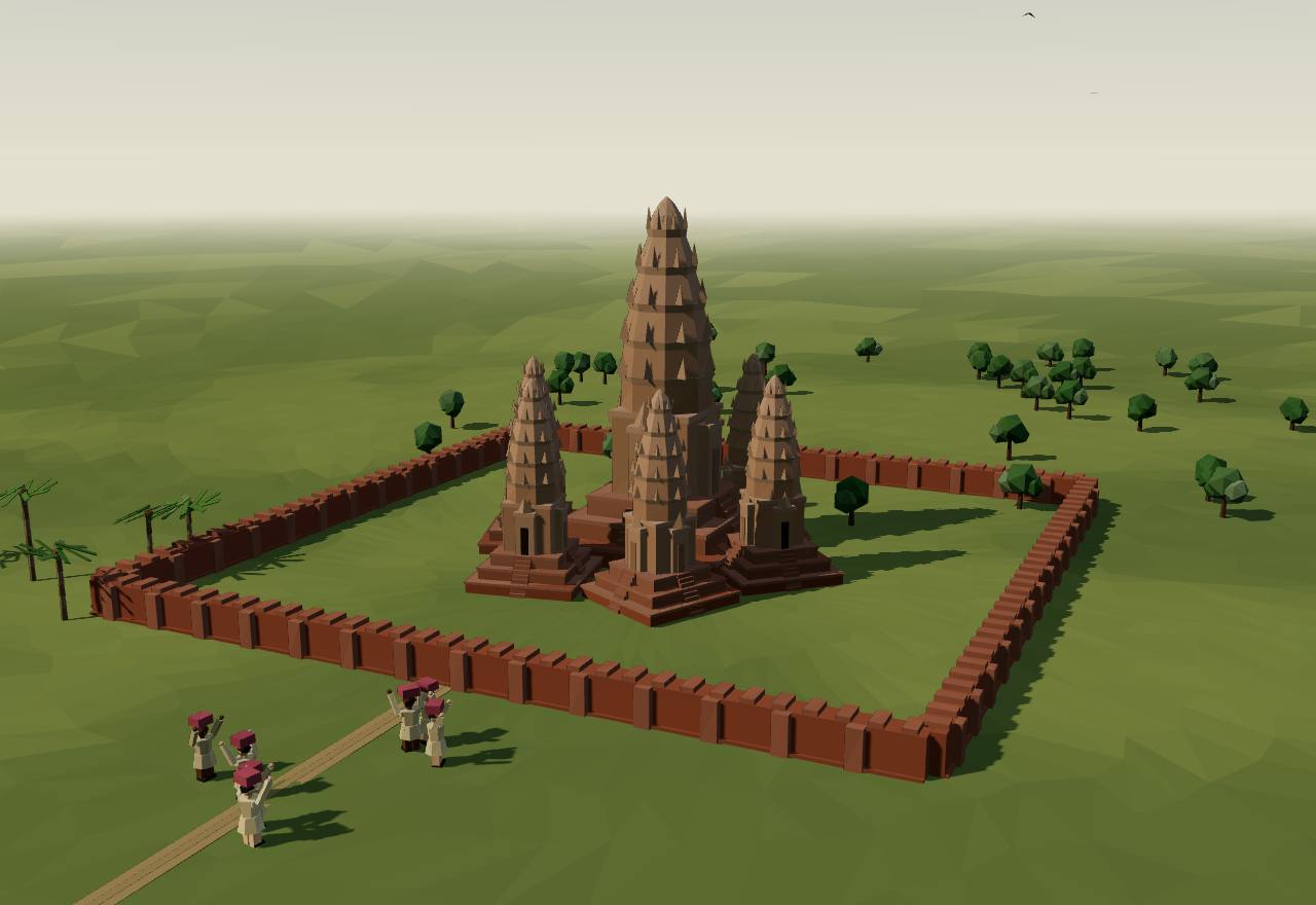
Sambor Prei Kuk (Īśānapura), 7th century (a model)
The Sui annals say of Chenla: ‘C’était originairement un royaume vassal du Fou-nan’ (it was originally a vassal kingdom of Funan); its kings’ ancestors had slowly grown stronger, and ‘Citrasena s’empara du Fou-nan et le soumit’ (Citrasena seized Funan and subdued it). 19 Consensus Texts
Pelliot dates the conquest from the Chinese embassies: Funan ‘fut réduit par Citrasena, roi du Tchen-la, dont le fils Içânasena envoya une ambassade à la cour des Souei en 616-617’ (was subdued by Citrasena, whose son Īśānasena sent an embassy to the Sui court in 616–617); Funan’s capital ‘fut brusquement conquise’ (was suddenly taken), and ‘la nuit se fait sur eux’ (night falls on them). 1 Debated Texts
Vickery doubts the conquest: ‘If Chenla had conquered Funan, it seems unusual that the Chenla king Jayavarman would show respect to an old king of Funan’; the Chinese, ‘mainly interested in trade and ports, were poorly informed about internal politics’. 2 Debated Texts
UNESCO identifies Sambor Prei Kuk as ‘Ishanapura, the capital of the Chenla Empire that flourished in the late 6th and early 7th centuries AD’: a Temple Zone of 840 hectares east of ‘the moated city’, ‘186 fired brick temples with sandstone detailing’, ‘ten of which are octagonal’, joined to the river by ‘three earthen causeways between 600 and 700 metres in length’. 17 Consensus Excavation
Inscriptions ‘in Sanskrit and old Khmer on some of the temples’ record ‘the names of kings and other individuals, details of religious and political life’ (UNESCO). The Khmer later adopted Funan’s founding legend ‘in an attempt to link the reigning Khmer kings with all the dynasties ever to have reigned over the land’ (Aeusrivongse). 17,5 Consensus Texts Excavation
Unity did not last: Cliopatria splits Chenla into ‘Land Chenla’ and ‘Water Chenla’ from 718 to 805, and Aeusrivongse speaks of a ‘“universal” power’ that ‘had been absent from the experience of the Khmers for generations since the decline of Chenla’; Cœdès and Dupont explained Jayavarman II’s claim by ‘l’état anarchique du Cambodge’ (Cambodia’s anarchic state). 15,5,4 Debated Texts Survey
Seshat codes Chenla (550–825) as a ‘confederated state’ of about 531,000 km² with capitals at ‘Isanapura’ and ‘Sambhupura’, four administrative levels and a largest settlement of 60,000, and codes its rulers as gods (‘present’), where Funan’s are ‘inferred absent’. Seshat Debated Survey
How power worked King · Conquest or coup · Custom and kin
How power worked
- Who rules
- King Consensus
Why?
- How chosen
- Conquest or coup Debated
Why?
- Limits on power
- Custom and kin Debated
Why?
- Scale
- Confederation Debated
Why?
- Claim to rule
- Divine mandate Debated
Why?
- Who has a say
- A narrow elite Debated
Why?
Srivijaya670 CE – 802 CEPalembang
In 683 a king set out by boat from the Musi river with twenty thousand men ‘to seek magical power’, and within three years his inscriptions stood from Palembang to the island of Bangka, cursing anyone who betrayed him. They are the first texts in Malay, and the whole case for Srivijaya’s early power rests on a handful of them.
Terms: Southeast Asia: Funan to Angkor and Majapahit: Funan, Chenla and the first kingdoms, Srivijaya
- dātu a lord or chief: ‘A dātu … held a parddātuan, a dātu province, which was distinguished from land belonging to the king personally, called kādātuan’ 8
- kadātuan ‘the place of the dātu’: Cœdès rendered it ‘royaume’ (kingdom) in 1918 and ‘province’ in 1930; Kulke reads it as the ruler’s palace, the kraton 9,3,16,20
- Çrīvijaya ‘le district de la fortune, le pays fortuné’ (the fortunate land), with its variant Çrīvisaya (Cœdès) 9
- niminumāmu ‘which is drunk by you’: the oath water of the imprecation inscriptions, as Hall quotes it 8
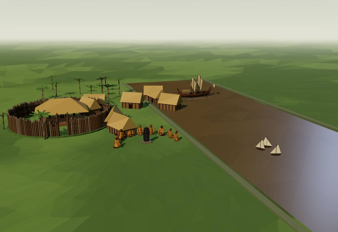
Srivijaya on the Musi river, late 7th century (a model of the kind of place)
Kedukan Bukit, 683: ‘En çaka 605 … Sa Majesté monta en bateau pour aller chercher la puissance magique. Il conduisit une armée de vingt mille (hommes)’ (in Śaka 605 His Majesty boarded a boat to seek magical power; he led an army of twenty thousand), with ‘deux cents’ (two hundred) by boat and ‘mille trois cent douze’ (1,312) on foot, and ‘made the country’ Śrīvijaya, ‘doué de puissance magique, riche’ (endowed with magical power, rich). 3 Consensus Texts
The Kota Kapur stone of 686 calls on the deities ‘qui protégez (cette) province (kadatuan) de Çrīvijaya’ (who protect the kadatuan of Śrīvijaya): those who ‘ne seront pas fidèles envers moi et envers ceux qui sont investis par moi de la charge de dâtu’ (are not loyal to me and to those I have made datu) shall be ‘tués par l’imprécation’ (killed by the imprecation), and an expedition sent against them and ‘leur clan et leur famille’ (their clan and family). 3,8 Consensus Texts
The same stone ‘a été gravée au moment où l’armée de Çrīvijaya venait de partir en expédition contre la terre de Java qui n’était pas soumise à Çrīvijaya’ (was engraved when Śrīvijaya’s army had just left against the land of Java, which was not subject to it). Manguin reads Kota Kapur as set up ‘precisely to signify the incorporation of this formerly autonomous polity into the bhūmi of Sriwijaya’. 3,21 Consensus Texts
In 684 the Talang Tuwo inscription records a garden, Śrīkṣetra, made ‘sous la direction de S. M. Çrī Jayanāça’ (under the direction of His Majesty Śrī Jayanāśa) to ‘servir au bien de tous les êtres’ (serve the good of all beings); Cœdès concluded that ‘dès 684 le Mahâyâna était pratiqué à Çrīvijaya’ (by 684 Mahāyāna Buddhism was practised there). 3 Consensus Texts
From another oath stone Hall lists the court: ‘Immediately below the king in importance was the crown prince, the yuvarāja’, then the pratiyuvarāja and the princes; royal judges (daṇḍanāyaka), ‘revenue collectors’ (nāyaka) and managers of royal property (pratyaya). ‘Since he was of royal blood a royal dātu was a threat to the king’s rule’, and the king promised ‘the immediate execution’ of any who challenged him. 8 Consensus Texts
Hall stresses the river and the sea: ‘the king held a magical control over the waters of the Sungai Musi’, and the heartland ‘was supported by a group of sea nomads whose power was measured in the number of ships under their control’. 8 Debated Texts
Excavation scales the capital down: Manguin places ‘a political centre resolutely situated at Palembang at foundation times in the late 7th century’ and draws ‘a scaled-down image of its centre’; Kulke thinks the ruler’s residence ‘would not have been a “walled city” but it might have been fortified by wooden palisades’. 21,16 Debated Excavation Texts
Srivijaya spread along the coast: Cœdès dates its annexation of Malāyu (Jambi) from the Chinese pilgrim Yijing, ‘un fait accompli en 690’, and noted that the four Malay inscriptions ‘ont donc été gravées dans l’espace de quatre ans, entre 683 et 686’ (were engraved within four years, 683–686). 3 Consensus Texts
How power worked King · Heredity · Custom and kin
How power worked
- Who rules
- King Consensus
Why?
- How chosen
- Heredity Debated
Why?
- Limits on power
- Custom and kin Debated
Why?
- Scale
- Confederation Debated
Why?
- Claim to rule
- Divine mandate Consensus
Why?
- Who has a say
- A narrow elite Consensus
Why?
Medang (Central Java)732 CE – 802 CEBorobudur
In the volcanic plains of Central Java, kings of the Śailendra house and their rivals raised the greatest Buddhist and Śaiva monuments of the age, Borobudur and Prambanan, without, it seems, a great city. Power ran through lords who each held a share of the villages and their taxes.
Terms: Southeast Asia: Funan to Angkor and Majapahit: Funan, Chenla and the first kingdoms, Medang (Central Java)
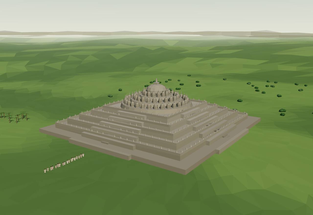
Borobudur, late 8th to 9th century (a model at reduced scale)
Borobudur ‘was built in the 8th and 9th centuries AD during the reign of the Syailendra Dynasty’, ‘in three tiers around a hill’: five square terraces, three circular platforms with ‘72 openwork stupas’ and a great stupa at the top, its reliefs covering some 2,500 m² (UNESCO). 23 Consensus Excavation
About 30 kilometres east stand the Śaiva temples of Prambanan, ‘the largest temple compound dedicated to Shiva in Indonesia’, beside the Buddhist Sewu; UNESCO’s record dates them both to the 10th century and to the Śailendra heyday in the 8th, a sign of how loosely these monuments are dated. 24 Debated Excavation
Round Borobudur ‘some 207 sites of the eighth to early tenth centuries have been found to date, including the remains of 43 temples and small shrines’, but no city: ‘the heads of the various watek tax groupings appear to have maintained their own residences away from the palace settlement’ (Christie). 22 Consensus Survey Excavation
‘In Java, the kingdom was divided into a large number of autonomous areas each governed by a rakryan, and the sons of kings were placed in key rakryan positions’; to bind followers and open new land, kings issued grants ‘known as sīma (“freehold”)’ (Hall). An inscription of 860 has state administrators asked ‘to intervene in a local dispute’. 7 Consensus Texts
Seshat codes Kalingga (500–732) and Medang (732–1019) separately: Medang’s centralisation ‘nominal’, its territory 100,000–150,000 km², its largest settlement about 1,000 people, its rulers as gods (‘present’) and no constraint on them, by government or anyone else, coded ‘inferred absent’. Seshat Debated Survey
Before Medang, Seshat codes a Kalingga kingdom in Central Java from 500 to 732, with three or four administrative levels and hereditary elite status, and no constraint on its rulers coded (‘inferred absent’); whether its rulers were seen as gods it leaves ‘suspected unknown’. Seshat Speculative Survey
How power worked King · Heredity · Custom and kin
How power worked
- Who rules
- King Consensus
Why?
- How chosen
- Heredity Debated
Why?
- Limits on power
- Custom and kin Debated
Why?
- Scale
- Confederation Debated
Why?
- Claim to rule
- Divine mandate Debated
Why?
- Who has a say
- A narrow elite Debated
Why?
802 CE – 1220 CE
Angkor and the island kingdoms
From the ninth century to the thirteenth three kinds of kingdom shared the region: a land empire round the reservoirs of Angkor, a trading power on the Straits whose capital was sacked from India in 1025, and the rice kingdoms of Java. Historians still argue whether to call any of them a state with borders, or a circle of power that faded with distance from its king.
Terms: Southeast Asia: Funan to Angkor and Majapahit: Angkor and the island kingdoms
Tambiah’s ‘galactic polity’ takes its name from the maṇḍala, ‘composed of two elements—a core (manda) and a container or enclosing element (la)’: a centre with satellites that copy it, ‘center-oriented but centrifugally fragmenting’, ‘a far cry from a bureaucratic hierarchy in the Weberian sense’. 25 Consensus Texts
In such kingdoms ‘the name of a kingdom was synonymous with the name of the capital city (Sukhothai, Ayutthaya, Pagan, Pegu, Majapahit). The Javanese analogy was that of a torch with its light radiating outward with decreasing intensity’ (Tambiah). 25 Consensus Texts
Kulke proposes stages instead: ‘state formation in Southeast Asia took place in three consecutive phases, which correspond with chiefdom (or local principality), the early kingdom, and finally the imperial kingdom’; the last ‘required a considerable enlargement of the original nuclear area’ of the ruling dynasty. 20 Consensus Texts
Oaths held these realms together. At Angkor ‘A similar oath was administered to Sūryavarman’s Khmer subordinates in 1011, nine years after he had actually claimed the Khmer throne’ (Hall), as Srivijaya’s kings had bound their dātu three centuries before. 7 Consensus Texts
Who could crown a king mattered when succession was disputed. Sūryavarman I won the throne against a rival branch and ‘married his daughter to the major Brahman family which controlled the devarāja cult’; in such crises, Hall argues, the ‘administrative and religious elite’ came ‘to hold the key to legitimacy’ through their control of court ritual. 7 Debated Texts
Cliopatria (bennett2025) draws these kingdoms with hard outlines that never overlap: about 400,000 km² for the Khmer Empire in 1025 and 830,000 km² by 1200, 540,000 km² for Srivijaya, under 75,000 km² for Kediri. A mandala reading expects overlapping, fading claims instead; the interactive below sets the two side by side. 15,25 Debated Survey
Lieberman and Buckley argue that ‘wide cyclic fluctuations in the reach and volume of monsoon rains contributed substantially to both the genesis and the collapse of the charter civilizations of Angkor, Pagan, and Dai Viet’. 26 Debated Survey
To the north-east a new kingdom took shape: the founder of the Lý dynasty, ‘Seven months after his accession to the throne’, ‘founded the new capital of Thăng-long at the site of modern Hanoi’, and through two centuries ‘the Lý Dynasty’s most conspicuous source of legitimacy was its Buddhist piety’ (Taylor). Đại Việt and Champa are not drawn by Cliopatria. 27,15 Consensus Texts
Angkor802 CE – 1220 CEAngkor Wat
In 802, by a much later inscription’s account, Jayavarman II had himself proclaimed the one ‘lord’ of Kambuja on a sacred mountain. His successors built capital after capital on the plain north of the great lake, each with a temple at its centre and a vast reservoir beside it, until the ‘hydraulic city’ covered some thousand square kilometres.
Terms: Southeast Asia: Funan to Angkor and Majapahit: Angkor and the island kingdoms, Angkor
- devarāja ‘god-king’ by the letters, but in the Sdok Kak Thom inscription ‘primarily the name of a god’, in Khmer kamrateṅ jagat ta rāja, ‘Lord of the universe who is royalty’ 5,28
- baray the great rectangular reservoirs held by earth dykes: ‘reservoir — ou baray, pour employer le terme moderne’ (reservoir, or baray, to use the modern term) 29,30
- Kambujadeśa the land of Kambuja, the Khmer kingdom; the 802 ceremony was to keep ‘this land of Kambuja’ from depending on ‘Javā’ 28
- Yaśodharapura Yaśovarman’s city round the Bakheng (889–c. 910), which ‘some modern historians see’ as ‘the first “Angkor” properly speaking’ 29
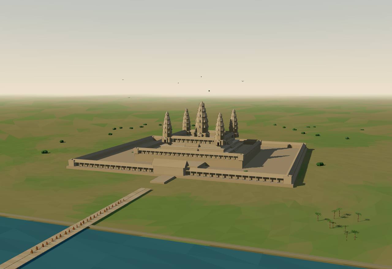
Angkor Wat, 12th century (a model at reduced scale)
Jayavarman II ‘arrived at the royal power in the year’ 802 and had a cult performed ‘on Mount Mahendra’ (Phnom Kulen), a ceremony meant to keep ‘this land of Kambuja from ever being dependent (āyatta) on Javā’ and to make him ‘only one single “Lord of the lower earth”’. The account is that of the Sdok Kak Thom inscription, written by a priestly family some 250 years later. 5,28,4 Debated Texts
The same inscription gives one family a monopoly of the royal cult: ‘the family line of the Steṅ añ Śivakaivalya should officiate in the presence of the kamrateṅ jagat ta rāja, forbidding that other people should officiate’; Cœdès and Dupont add that this office was ‘distincte de celle de chapelain royal, purohita’ (distinct from the royal chaplain’s). Kulke reads the cult object itself as ‘nothing else but a bronze image of Śiva’, standing for the liṅga set up in 802. 28,4 Consensus Texts
Groslier dates the first ‘hydraulic city’ to the end of the ninth century at Hariharālaya (Roluos): Indravarman began its reservoir, the Indrataṭāka, ‘dès son accession au pouvoir en 877’ (from his accession in 877), some 300 hectares holding ‘au minimum, dix millions de m3’ (at least ten million cubic metres). Yaśovarman (889–c. 910) then founded a new city, Yaśodharapura, round a reservoir of 7,120 by 1,700 metres. 29 Consensus Texts Excavation
Groslier: ‘Le Baray occidental et le Baphuon existaient certainement sous Udayâdityavarman II (1050-1066)’ (the West Baray and the Baphuon certainly existed under Udayādityavarman II): about 8 by 2.1 kilometres, with a capacity he puts at 42 to 70 million cubic metres. Fletcher and colleagues call it ‘probably the largest single artefact created before the mid-nineteenth century’; at its centre stood a water temple, the West Mebon, with a six-metre bronze Vishnu. 29,31 Consensus Excavation
Mapping by radar, air photographs and ground survey covered ‘nearly 3,000 km2’ and found ‘an elaborate water management network covering >1,000 km2, the most extensive urban complex of the preindustrial world’. The urban area ‘encloses ≈900–1,000 km2 compared with the ≈100–150 km2 of Tikal’. 30 Consensus Survey
A ‘370 km2 lidar survey’ flown in April 2012 showed that ‘the formalized, urban center of the city of Angkor extends over at least 35 km2, rather than simply the 9 km2 conventionally recognized within the walls of Angkor Thom’, and found on Phnom Kulen the ‘8th- to 9th-century city named Mahendraparvata, one of the first capitals of the Khmer Empire’. 32 Consensus Survey
Angkor Wat is believed to have been ‘built in the early 12th century by King Suryavarman II, who began his reign in 1113’. The temple sits in a fourth enclosure of about 1,000 by 815 metres, ‘surrounded by a 200-m wide moat that measures 1,300 × 1,500 m’. 14 Consensus Excavation Texts
The reservoirs were not only works of engineering. Fletcher and colleagues follow Goloubew’s ‘double aspect’, ritual and useful at once, and conclude that ‘Separating ritual and mundane functions in Angkor is not meaningful’; Groslier too allowed for ‘des considérations religieuses’ behind ‘travaux colossaux’ (religious considerations behind colossal works) that technique alone cannot explain. 31,29 Consensus Texts Excavation
How many lived there is an estimate. Groslier added up six modern districts to ‘1.900.000 habitants’ (1,900,000 inhabitants); Seshat codes Classical Angkor’s largest settlement at 750,000–1,000,000 people and the polity at 1,500,000, and codes the state ‘unitary’ with five administrative levels. 29 Seshat Speculative Survey
Angkor could be struck at its centre. Hall notes that ‘the major Cham raid on Angkor in 1177’ eliminated a group of the administrative elite; Jayavarman VII (1181–c. 1219) then built a new city, Angkor Thom, ‘superimposed’ on three centuries of works (Groslier). 7,29 Consensus Texts
How power worked King · Heredity · None in practice
How power worked
- Who rules
- King Consensus
Why?
- How chosen
- Heredity Debated
Why?
- Limits on power
- None in practice Debated
Why?
- Scale
- Empire Consensus
Why?
- Claim to rule
- Divine mandate Debated
Why?
- Who has a say
- A narrow elite Debated
Why?
Angkor’s capitals, reservoirs and channels, reign by reign
Data: Groslier 1979, Fletcher et al. 2008, Evans et al. 2007 and 2013; points from Wikidata
Each place sits where Wikidata puts it; each reservoir is drawn to the size Groslier gives between its dykes, on the same scale as the map. Lines join the places a source says a channel joined; they are not the channels’ courses. Capacities are Groslier’s ranges, which depend on how deep he allowed the water to be. 29,31,37
| Place | From | Source’s words, shortened |
|---|---|---|
| Phnom Kulen (Mahendraparvata) | 800 | the 8th- to 9th-century city of Mahendraparvata, found by lidar 37,32 |
| Hariharālaya (Roluos) | 877 | the first ‘hydraulic city’, end of the 9th century 37,29 |
| Indrataṭāka (Lolei) | 877 | Indravarman’s reservoir, begun at his accession in 877: about 300 ha; 10 million m³ 37,29 |
| East Baray (Yaśodharataṭāka) | 889 | Yaśovarman’s reservoir (reigned 889–c. 910): 7,120 × 1,700 m between dykes; 36–60 million m³ 37,29 |
| West Baray | 1050 | existed under Udayādityavarman II (1050–1066): 8 × 2.1 km; 42–70 million m³ 37,29,31 |
| Angkor Wat | 1113 | built in the early 12th century under Sūryavarman II (from 1113); moat 1,300 × 1,500 m 37,14 |
| Angkor Thom (Bayon) | 1181 | Jayavarman VII’s city (1181–c. 1219), built in the late 12th century 37,29,31 |
| Jayataṭāka (North Baray) | 1181 | the late-12th-century reservoir by Preah Khan 37,31 |
- East Baray (Yaśodharataṭāka) to Hariharālaya (Roluos): the Krol Romeas outlet, from the East Baray’s east bank into the Roluos river system 30,31
- West Baray to Tonle Sap (lake, centre point): a channel from near the West Baray’s south-west corner southwards to the lake 31
- West Baray to Hariharālaya (Roluos): an embankment and channel running at least 40 km east-south-east to south of Roluos 31
- Phnom Kulen (Mahendraparvata) to Angkor Thom (Bayon): the Great North Channel, 25 km from the northern hills to Angkor Thom’s north gate 31
- Phnom Kulen (Mahendraparvata) to Jayataṭāka (North Baray): part of the Great North Channel’s water delivered to the Jayataṭāka 31
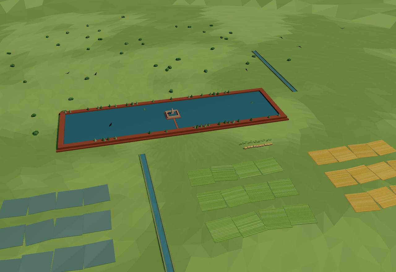
The West Baray and its fields, 11th–12th century (a model)
Srivijaya and the Chola raid of 1025802 CE – 1220 CEPalembang
For three centuries the kings at Palembang drew the shipping of the Straits to their river. Then, in 1025, a fleet from the Chola country of South India sacked their capital and a dozen other ports; trade moved to Jambi and to Java, and ‘Srivijaya’ became a name others claimed.
Terms: Southeast Asia: Funan to Angkor and Majapahit: Angkor and the island kingdoms, Srivijaya and the Chola raid of 1025
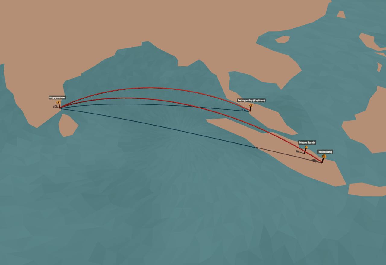
The Chola raid of 1025: Nagapattinam to Kaḍāram and Srivijaya
Places, not borders: 4 cited sites and 2 cited links; Cliopatria draws no territory here. Nagapattinam · Bujang valley (Kaḍāram) · Palembang · Muaro Jambi 39,7,21,8,38
‘During the period 670–1025 A.D., the southern Sumatra thalassocracy of Srivijaya appears to have been the power which dominated maritime commerce passing through Southeast Asia’ (Hall). In 992 the Javanese attacked it, and in 1016 they ‘suffered a devastating raid’, after which its ruler styled himself ‘king of the ocean lands’ in a mission to China. 8,7 Consensus Texts
Within a decade ‘the Cōl̤a power of the Coromandel coast had sacked the legendary riches of the Srivijaya capital’: thirteen ports fell to Rājēndra Cola I’s fleet in 1024–25, and of them ‘only Srivijaya-Palembang was noted for its “golden gates” and royal treasury filled with gold’. The raid is known only from the Tamil side. 7,8,38 Consensus Texts Read more: Rajendra’s eulogy on the Tamil page
Hall suggests the blow was felt as ritual as much as material: if Srivijaya saw itself in Sumatran terms, ‘the “destruction of the center” would have had a tremendous psychological impact’. He also warns that ‘the decay of Srivijaya may well have predated the 1025 raid’. 8 Debated Texts
After 1025 ‘No longer were Palembang and its subordinate harbors the single focus of the international route’; ‘the ports of east Java began to surpass them in wealth’. The Cholas struck again in 1067, and the Isthmus of Kra passed to the mainland powers, Khmer and then Burmese, ‘to fill the resulting power vacuum’ (Hall and Whitmore). 7 Consensus Texts
The archaeology agrees: at Palembang ‘the volume of trade declined sharply … during and after the 11th century, and increased conversely in the Batang Hari sites’, the river of Jambi (Manguin). 21 Consensus Excavation
Kulke locates the weakness in the polity itself: Srivijaya’s ‘major problem’ was its ‘“failure” either to integrate at least some of the more powerful datu chiefs of the mandala into its own central court or to obliterate and replace them’. 20 Debated Texts
The king’s hold rested on sharing trade: ‘Commercial revenues came into the center and were redistributed to the loyal following. Port wealth was shared by alliances with local land-based chiefs as well as with sea nomads.’ Even so the monarch ‘still faced the problem of political fragmentation’ (Hall). 8 Consensus Texts
Seshat has no data for Srivijaya: its seshat-db record (id_srivijaya_emp) is empty. Cliopatria (bennett2025) draws Srivijaya from 674 to 1293 over southern Sumatra and the Peninsula, with an area of about 540,000 km² from the eighth century; on Manguin’s and Kulke’s reading the solid outline is a generous guess. 15,18,21 Debated Survey
How power worked King · Heredity · Custom and kin
How power worked
- Who rules
- King Consensus
Why?
- How chosen
- Heredity Debated
Why?
- Limits on power
- Custom and kin Debated
Why?
- Scale
- Confederation Debated
Why?
- Claim to rule
- Divine mandate Debated
Why?
- Who has a say
- A narrow elite Debated
Why?
Java: from Medang to Kediri802 CE – 1220 CEKediri
Kings in Central Java still raised temples in the ninth century, but they were driven from their palaces in quick succession, and after 928 no inscription is found there: the court and many of its people had moved east to the Brantas valley. Kings there made themselves great for a lifetime, Siṇḍok in the tenth century and Airlangga in the eleventh, but their realms did not hold; from the twelfth century the kings of Kaḍiri (Kediri) were the strongest in the island, until a usurper from Tumapĕl overthrew them in 1222.
Terms: Southeast Asia: Funan to Angkor and Majapahit: Angkor and the island kingdoms, Java: from Medang to Kediri
- Mḍaṅ Medang, the Javanese kingdom; the name occurs on a copper plate from Luzon dated 900 40
- watĕk a lord’s jurisdiction and its tax grouping; Christie counts ‘120 or so watek tax-groupings (the precursors to later appanage holdings)’ 20,22
- rakryan a Javanese lord at the head of an autonomous area; ‘the sons of kings were placed in key rakryan positions’ 7,20
- Pangjalu the kingdom of Kaḍiri (Kediri); king Jayabhaya’s seal read ‘pangjalu jayati’ (Pangjalu is victorious) 41
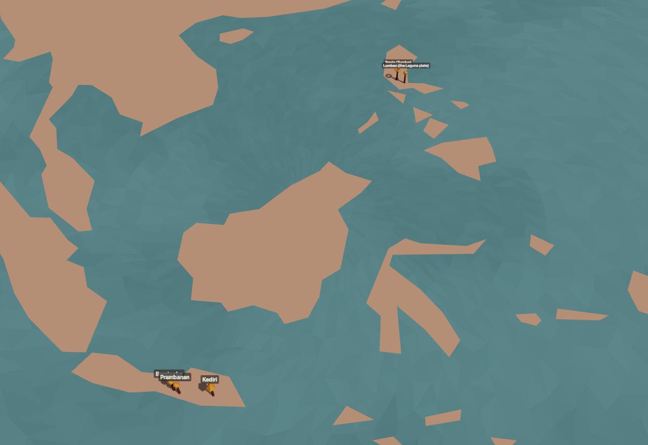
Java from Medang to Kediri (Cliopatria), 900–1200
Places, not borders: 5 cited sites; Cliopatria draws no territory here. Borobudur · Prambanan · Kediri · Lumban (the Laguna plate) · Tondo (Tundun) 23,24,39,40
Kings did not sit securely. The Wanua Tengah charter of 908 records that between 884 and 898 ‘two rulers were driven out of the palace within a year of taking the throne, a third “fled the palace” after eight years in power, and a fourth survived only four years’ (Christie). 22 Consensus Texts
Medang’s reach shows, before the move east, on a copper plate dredged from the Lumbang river in Luzon, ‘issued … precisely on 21 April, in the year 900 CE’ to record ‘the clearance of a debt’ in ‘an early form of the Malay language’, in the Kawi script of Javanese charters. It names an official ‘of Mdang’, which Clavé and Griffiths call ‘an undeniable piece of evidence for a direct connection’ with Java, and Tundun, ‘convincingly identifiable as modern Tondo’. 40,42 Consensus Texts
‘Since no inscription dating to the period after 928 C.E. has been found in central Java, it is assumed that a large proportion of the population followed the political center east to the Brantas delta’ (Christie). 22 Consensus Texts
Javanese kings ruled through lords. ‘The king (mahārāja, ratu) kept his own watĕk land under his direct control’, while villages stayed ‘under the jurisdiction’ of local chiefs, some of whom ‘slowly rose to high administrative or even “ministerial” positions’; the rakryan of Kanuruhan came to hold ‘the highest administrative position at the central court’ for centuries (Kulke). 20 Consensus Texts
There was no single great city. ‘The heads of the various watek tax groupings appear to have maintained their own residences away from the palace settlement’, so that ‘administration, patronage, and trade wealth did not converge on the same settlement, as was the case in the contemporary states of the Malacca Straits’ (Christie). 22 Consensus Texts Excavation
Siṇḍok in the early tenth century and Airlangga in the early eleventh built large realms, Airlangga the first Javanese king to take the title ratu cakravartin; ‘But their personal, most likely military, success did not survive their demise’. Kulke reads the famous division of the realm by Airlangga himself as a later ‘myth’ covering that failure. 20 Debated Texts
Kaḍiri (Kediri), or Pangjalu, was the strongest kingdom of the twelfth century: king Jayabhaya (r. c. 1135–1157) sealed his charters with a man-lion and the words ‘pangjalu jayati’ (Pangjalu is victorious). Seshat codes Kediri’s centralisation as ‘nominal’ and its territory at 50,000–70,000 km². 41 Seshat Consensus Texts
Its end came from below. Ken Angrok ‘rose to power after murdering Tunggul Amětung, the local ruler of Tumapěl (Singhasāri), and marrying the latter’s widow’, had himself proclaimed king as Rājasa, and established his supremacy ‘after his defeat of Kṛtajaya of Kaḍiri in 1222’ (Hadi Sidomulyo, after the Deśawarṇana and the Pararaton). 41 Consensus Texts
East Java profited from Srivijaya’s fall: after the raid of 1025 its ports ‘began to surpass’ Palembang’s in wealth, and by the twelfth century ‘Java and the northern Sumatra ports drew the major international route south and west’ (Hall and Whitmore). 7 Consensus Texts
How power worked King · Conquest or coup · Custom and kin
How power worked
- Who rules
- King Consensus
Why?
- How chosen
- Conquest or coup Debated
Why?
- Limits on power
- Custom and kin Debated
Why?
- Scale
- Territorial state Debated
Why?
- Claim to rule
- Divine mandate Debated
Why?
- Who has a say
- A narrow elite Debated
Why?
Borders or circles? The same kingdoms drawn two ways
Model, not evidence: Cliopatria’s outlines (data) beside circles round each centre (a model)
Left, the outlines Cliopatria draws for the year (data): they never overlap. Right, the same kingdoms as circles round their capitals, each reaching as far as the kingdom’s outline (a model): the overlaps are where a mandala reading expects shared or contested loyalty, the zone Tambiah calls ‘center-oriented’ rather than ‘bounded’. 15,25,39,37
| Kingdom | Outline (Cliopatria) | Circle reaches |
|---|---|---|
| Chenla | 427,000 km² | 490 km from its capital |
| Srivijaya | 484,000 km² | 1200 km from its capital |
| Kingdom | Outline (Cliopatria) | Circle reaches |
|---|---|---|
| Srivijaya | 538,000 km² | 1570 km from its capital |
| Mataram Kingdom | 60,000 km² | 240 km from the outline’s centre (no capital pinned) |
| Khmer Empire | 398,000 km² | 560 km from its capital |
| Pagan Kingdom | 27,000 km² | 140 km from its capital |
Circles that overlap: Srivijaya and Mataram Kingdom; Srivijaya and Khmer Empire.
| Kingdom | Outline (Cliopatria) | Circle reaches |
|---|---|---|
| Srivijaya | 538,000 km² | 1570 km from its capital |
| Khmer Empire | 398,000 km² | 560 km from its capital |
| Pagan Kingdom | 45,000 km² | 170 km from its capital |
Circles that overlap: Srivijaya and Khmer Empire.
| Kingdom | Outline (Cliopatria) | Circle reaches |
|---|---|---|
| Srivijaya | 457,000 km² | 1070 km from its capital |
| Khmer Empire | 830,000 km² | 860 km from its capital |
| Kediri Kingdom | 73,000 km² | 320 km from its capital |
| Pagan Kingdom | 440,000 km² | 1160 km from its capital |
Circles that overlap: Srivijaya and Khmer Empire; Srivijaya and Kediri Kingdom; Khmer Empire and Pagan Kingdom.
| Kingdom | Outline (Cliopatria) | Circle reaches |
|---|---|---|
| Khmer Empire | 516,000 km² | 660 km from its capital |
| Majapahit | 405,000 km² | 1790 km from its capital |
| Sukhothai Kingdom | 395,000 km² | 1110 km from its capital |
Circles that overlap: Khmer Empire and Sukhothai Kingdom.
| Kingdom | Outline (Cliopatria) | Circle reaches |
|---|---|---|
| Khmer Empire | 304,000 km² | 560 km from its capital |
| Majapahit | 1,002,000 km² | 2400 km from its capital |
| Sukhothai Kingdom | 278,000 km² | 1110 km from its capital |
| Ayutthaya Kingdom | 7,000 km² | 110 km from its capital |
Circles that overlap: Khmer Empire and Majapahit; Khmer Empire and Sukhothai Kingdom; Khmer Empire and Ayutthaya Kingdom; Majapahit and Sukhothai Kingdom; Sukhothai Kingdom and Ayutthaya Kingdom.
1220 CE – 1518 CE
Late Angkor, Majapahit and the new kingdoms
The thirteenth century broke the old order. Mongol armies reached Pagan and Java; Tai kingdoms rose at Sukhothai and then Ayutthaya on Angkor’s western edge; in East Java a new dynasty built Majapahit and claimed the islands. Angkor itself was not stormed in a day: its people drifted away over a century of drought and flood.
Terms: Southeast Asia: Funan to Angkor and Majapahit: Late Angkor, Majapahit and the new kingdoms
- Ayodhyapura Ayutthaya, listed in the Nāgara-Kṛtāgama as ‘Syangkayodhyapura’ (Pigeaud: ‘Syangka: Siam. Ayodhyapura: Ayuthia’) 44
In the second month of 1292 the Yuan emperor ordered an army ‘to subdue Java’; Pagan received the Mongols’ ‘coup de grâce’ in the same decades. In Java the expedition ended by helping Vijaya found Majapahit (Groeneveldt’s translation of the Yuan shi; Kulke; Aung Thwin). 45,20,46 Consensus Texts
Tai kingdoms replaced Khmer rule in the west: Sukhothai in the thirteenth century, then Ayutthaya, to which Sukhothai’s ruler was ‘reduced to a vassal’ in 1378 and whose kingdom absorbed its provinces ‘by 1438’ (Tambiah). 25,47 Consensus Texts
Kulke’s imperial kingdoms belong here: kings who ‘had succeeded in extending their uncontested political authority by eliminating all sorts of potential putschists in their extended core region’, though ‘actual political control remained fragmented’. 20 Debated Texts
Seshat dates Late Angkor’s peak to 1220–1353 and still codes it a ‘unitary state’ of about 1,000,000 km², but with rulers no longer coded as gods (‘absent’), where Early and Classical Angkor have ‘present’. Seshat Debated Survey
Cliopatria (bennett2025) draws Majapahit at about 1,000,000 km² from 1363, larger than any polity on this page, and the Khmer Empire shrinking to about 300,000 km² by then; its outlines follow the poem’s claims more than the doubts of the poem’s translator. 15,44 Debated Survey
Seshat dates Majapahit 1292–1518 and Cliopatria’s last Majapahit outline ends in 1518; no source read for this page gives a closer date for its end, so the page stops there. 15 Seshat Debated Survey
Late Angkor1220 CE – 1431 CEAngkor Thom
A Chinese envoy’s companion, Zhou Daguan, spent the year 1296–97 at Angkor and left the only eyewitness description of the city: a king at a golden window, parasols by rank, ordeals for justice, and a countryside wasted by war with the Siamese. A century and a half later the court had moved south; what ended the city is argued from mud cores and tree rings.
Terms: Southeast Asia: Funan to Angkor and Majapahit: Late Angkor, Majapahit and the new kingdoms, Late Angkor
- Tcheou Ta-kouan Zhou Daguan, in the French transcription of the 1902 translation; he went with the embassy of 1296 and ‘held no official post’ (n’occupait pas d’emploi officiel) 19
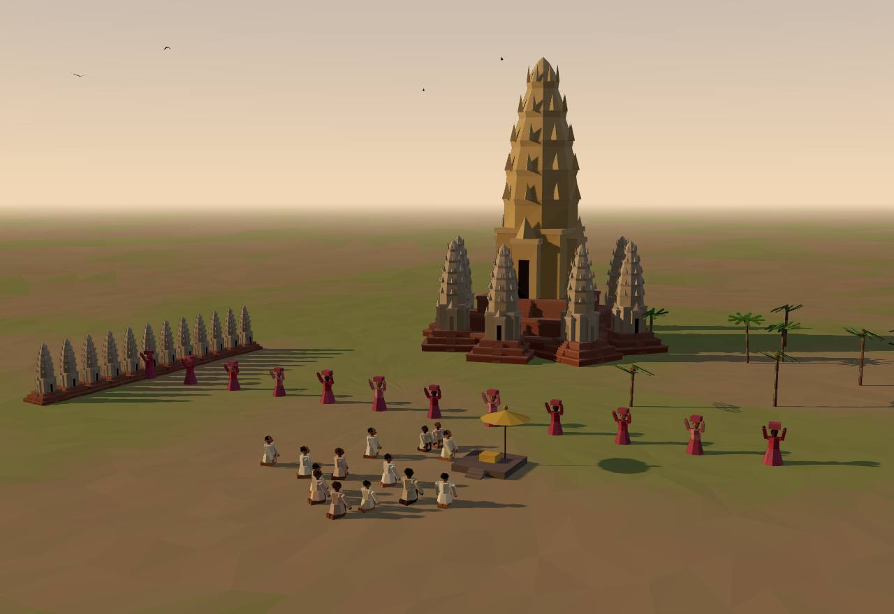
Angkor in 1296, after Zhou Daguan (a model; the Bayon’s faces are not drawn)
In 1295 an ambassador was ordered to Cambodia; ‘il partit en 1296, accompagné de Tcheou Ta-kouan … en 1297 ils étaient de retour en Chine’ (he left in 1296 with Zhou Daguan, and they were back in China in 1297). Zhou held no office, and ‘il est curieux qu’il ne nomme pas la capitale, qu’il décrit en détail’ (curiously, he does not name the capital he describes in detail). 19 Consensus Texts
‘La muraille de la ville a environ 20 li de tour. Elle a cinq portes’ (the city wall is about 20 li round, with five gates); ‘Marquant le centre du royaume, il y a une tour d’or, flanquée de plus de vingt tours de pierre’ (marking the centre of the kingdom is a golden tower flanked by more than twenty stone towers), which the translation’s annotator took to be ‘presque certainement le Bayon’ (almost certainly the Bayon). 19 Consensus Texts
‘Chaque jour, le roi tient audience deux fois pour les affaires du gouvernement’ (every day the king holds audience twice for government business): two palace girls lift a curtain and ‘le roi, tenant en main l’épée, apparaît à la fenêtre d’or’ (the king, sword in hand, appears at the golden window); all who see him ‘doivent se prosterner et toucher la terre du front’ (must prostrate themselves, forehead to the ground). 19 Consensus Texts
When the king went out, ‘trois à cinq cents’ palace women carried great candles, and behind them came ‘le prince, debout sur un éléphant, et tenant à la main la précieuse épée’ (the prince, standing on an elephant, holding the precious sword), under ‘plus de vingt parasols blancs garnis d’or’ (more than twenty white parasols trimmed with gold). The highest officials had ‘quatre parasols à manche d’or’ (four gold-handled parasols) of red Chinese taffeta. 19 Consensus Texts
Zhou heard how the reigning king came to power: ‘Le nouveau prince est le gendre de l’ancien ; il avait adopté la carrière des armes’ (the new prince is the old one’s son-in-law, a soldier). The old king’s daughter stole the golden sword for her husband; the son ‘dépouillé de la succession’ (cut out of the succession) plotted, and the new king ‘lui coupa les doigts de pied et le relégua dans une chambre obscure’ (cut off his toes and shut him in a dark room). 19 Debated Texts
‘La plupart du temps on choisit des princes pour les emplois ; sinon, les élus offrent leurs filles comme concubines royales’ (most often princes are chosen for office; otherwise those chosen offer their daughters as royal concubines). Disputes could go to ordeal: a suspect plunged a hand into boiling oil, or two parties sat on two of ‘douze petites tours de pierre’ (twelve small stone towers) before the palace, ‘le « jugement céleste »’ (heavenly judgment). 19 Consensus Texts
The embassy found the countryside ‘dévastée par la récente guerre siamoise’ (devastated by the recent Siamese war); it was said that in that war ‘ils ont obligé tout le peuple à combattre’ (they forced the whole people to fight). Zhou also noted that ‘ce sont les femmes qui s’entendent au commerce’ (it is the women who understand trade) and that ‘on fait en ce pays de trois à quatre récoltes par an’ (three to four harvests a year). 19 Consensus Texts
Cores from the moat of Angkor Thom show ‘a protracted decline in land use intensity during the 14th century rather than an abrupt demographic collapse’; ‘the moat of Angkor Thom was no longer being maintained by the end of the 14th century’ (Penny and colleagues, 2019). 13 Consensus Excavation
Excavated house mounds inside Angkor Wat’s enclosure give an occupation that ‘most likely extends from the late 12th or early 13th centuries to the late 14th or early 15th centuries’, then a gap, then use again ‘in the late 14th–early 15th centuries until the 17th or 18th centuries’ (Carter and colleagues). 14 Consensus Excavation Dating
A 979-year tree-ring record from cypresses in Vietnam’s highlands shows ‘a multidecadal scale period of weakened monsoon in the mid to late fourteenth century and a shorter though at times more severe drought in the early fifteenth century’; ‘the single driest year of the entire record is 1403’, while ‘6 of the 20 wettest years’ fell around the turn of the fifteenth century (Buckley and colleagues). 48 Consensus Survey Dating
Penny and colleagues modelled the water network and found ‘extensive and cascading damage to infrastructure’ in response to flooding: ‘The abrupt transition, in the middle of the 14th century CE, from prolonged drought to particularly wet years, meant that the network was disequilibrated with prevailing weather.’ 6 Debated Survey
Tradition dates the end to 1431: ‘the sack of Angkor by Thai forces from Ayutthaya in 1431 CE’ as ‘the coup de grâce’, or ‘the abandonment of Angkor for new capitals further south in 1431 by the last Angkorian king, Ponhea Yat’. Penny and colleagues find attributing the change ‘primarily to the sack of Angkor by the Siamese in 1431 CE’ to be ‘problematic’. 13,14,6 Debated Texts Dating
How power worked King · Heredity · None in practice
How power worked
- Who rules
- King Consensus
Why?
- How chosen
- Heredity Debated
Why?
- Limits on power
- None in practice Debated
Why?
- Scale
- Empire Debated
Why?
- Claim to rule
- Divine mandate Debated
Why?
- Who has a say
- A narrow elite Debated
Why?
Majapahit1293 CE – 1518Trowulan
Majapahit was founded in 1293 by a Javanese prince who turned a Mongol army against his enemy and then drove it out. Seventy years later its court poet described the capital, the king’s officers and a list of islands from Sumatra to New Guinea ‘getting ready to show obedience’: the fullest picture of any kingdom on this page, and the hardest to take at its word.
Terms: Southeast Asia: Funan to Angkor and Majapahit: Late Angkor, Majapahit and the new kingdoms, Majapahit
- Nāgara-Kṛtāgama the court poem of 1365 by Prapañca, which named itself Deśawarṇana, ‘Description of the Country’ 49
- Wilwa Tikta the poem’s Old Javanese name for Majapahit (‘bitter wood-apple’) 49
- patih the king’s chief minister: Gajah Mada was ‘patih (vizir) in Wilwa Tikta’ 49
- dharmādhyakṣa superintendent of a clergy: the court had two, one Śiwaite and one Buddhist (Pigeaud: ‘bishops’) 49
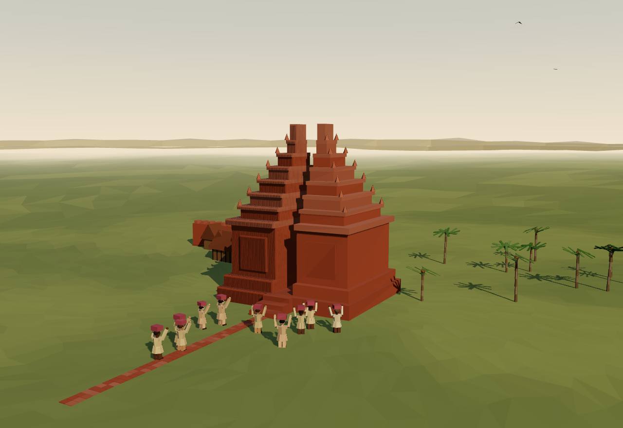
A split gate at Trowulan (Majapahit), 14th century (a model)
In 1292 King Jayakatwang of Kaḍiri ‘attack[ed] and defeat[ed] Singasari’, and King Kṛtanagara died. Then ‘Kṛtanagara’s son-in-law, Raden Vijaya, with the help of a Chinese expeditionary army, defeated Jayakatwang’s army and established himself as the first ruler in the newly founded city of Majapahit’ (Kulke). The Yuan history has the emperor order ‘20000’ soldiers and ‘a thousand ships’ to ‘subdue Java’. 20,41,45 Consensus Texts
The poem was finished in ‘Shaka mountains-elephants-sun (1287 = 1365 A.D.)’ and named ‘Desha-Warnana (Description of the Country)’. Its author, Prapañca, was ‘Dharmadhyaksha (bishop) of the Sogata (Buddhist) clergy’, an office he had from his father; he followed King Rājasanagara on his tour of 1359. 49 Consensus Texts
The king’s kin ruled the towns: a princess ‘is obeyed in Daha’, others reside ‘in Lasém’ and ‘in Pajang’. ‘All Illustrious Javanese Kings and Queens … each having one [town] for his or her own, / in one place, in Wilwa Tikta (Majapahit), they hold in their lap the honoured Prince-Overlord.’ The king himself had been ‘inaugurated already as Prabhu’ at his birth in 1334. 49 Consensus Texts
The royal compound’s ‘wall is red brick, going round, thick, high’, its north gate ‘splendid’ with iron doors; ‘every month Caitra (March-April) it is the meeting-place of the Royal servants’ assembly’. Officers are listed in rank, the mapatih, démung, kanuruhan, rangga and tuménggung, with ‘two’ dharmadhyakṣas and ‘seven’ assessors at law; Gajah Mada, ‘patih (vizir) in Wilwa Tikta’, is ‘discerning in management, reliable, faithful’. 49 Consensus Texts
Once a year the realm came to court. At the Phalguna festival ‘Bali etcetera, the other islands’ joined in ‘with prabhérti (first fruits tribute)’; at the new moon of Caitra the lairds of manors and ‘juru buyuts (chiefs of rural communities’ elders)’ attended, and the ‘Teachings of the Raja Kapa-kapa (Kings of yore)’ were read to them. 49 Consensus Texts
Cantos 13–15 list 106 names: Malayu (Sumatra), Tañjung-Nagara (Borneo), Pahang and the Peninsula, and the islands east of Java to Timor and New Guinea, ‘the numerous islands that are mindful’; then Siam, Ligor, Martaban, Champa and Kamboja ‘protected by the Illustrious Prince’, and Yawana, ‘a friend, regular’. ‘Ecclesiastical officers and mandarins are sent to fetch the produce regularly’, and ‘commandment-breakers’ are ‘visited by expeditionary forces and annihilated’. 49,44 Consensus Texts
Pigeaud doubted the list as a map of power: ‘it is very doubtful whether Majapahit authority at any time has been of much consequence in most of the countries mentioned’, and ‘the poet’s knowledge of geography seems chaotic’. He read canto 15.3 as ‘international trade’, its officers as ‘traders with a Royal patent’ dealing ‘chiefly’ in spices. 44 Debated Texts
On the ground the capital at Trowulan ‘seems to have been little more than a series of large royal and elite compounds with attached religious monuments, surrounded by a cluster of large villages’ (Christie). Seshat codes Majapahit’s centralisation as ‘loose’, and estimates its territory at 500,000 km² and its people at 5,000,000. 22 Seshat Debated Excavation Survey
How power worked King · Heredity · Council
How power worked
- Who rules
- King Consensus
Why?
- How chosen
- Heredity Debated
Why?
- Limits on power
- Council Debated
Why?
- Scale
- Empire Debated
Why?
- Claim to rule
- Divine mandate Debated
Why?
- Who has a say
- A narrow elite Debated
Why?
The lands the poet lists as Majapahit’s, 1365
Data: the Nāgara-Kṛtāgama, cantos 13–15, in Pigeaud’s translation; 106 names and his identifications
The poem names 106 places in cantos 13–15; Pigeaud identifies most of them with modern places, ‘some’ only tentatively, and 64 can be pinned to a Wikidata point. A hollow pin stands for a whole district, island or kingdom. The translator himself doubted that Majapahit’s authority ‘at any time has been of much consequence in most of the countries mentioned’. 49,44,50
- Malayu (Sumatra), canto 13.1–13.2
- Tañjung-Nagara (Borneo), canto 13.2–14.1
- Pahang (the Peninsula), canto 14.2
- East of Java, canto 14.3–14.5
- ‘Protected’ countries and a friend, canto 15.1
- a district, island or kingdom, not a town
Malayu (Sumatra): 25 names, 14 pinned
| No. | In the poem | Pigeaud’s identification |
|---|---|---|
| 1 | Malayu | Sumatra (not pinned) |
| 2 | Jambi | Jambi. |
| 3 | Palembang | Palembang. |
| 4 | Karitang | Karitang, South Indragiri. (not pinned) |
| 5 | Téba | Upper Jambi. (not pinned) |
| 6 | Dharmashraya | Pulau Puñjung, Siguntur, on the upper course of the river Batanghari. |
| 7 | Kandis | Kandis, a tributary of the Kwantan (Rouffaer), or Kandi (Westenenk) (not pinned) |
| 8 | Kahwas | Kawai, between Kandi and Tanjung (according to Westenenk). (not pinned) |
| 9 | Manangkabwa | Ménangkabau. (not pinned) |
| 10 | Siyak | Siak. (pinned to the whole unit) |
| 11 | Rékan | Rokan. (pinned to the whole unit) |
| 12 | Kampar | Kampar. (pinned to the whole unit) |
| 13 | Pane | Panei. (not pinned) |
| 14 | Kampé | Kampei (Rouffaer), in Pĕtapahan, Upper Siak (not pinned) |
| 15 | Haru | Aru, East coast of Sumatra. (not pinned) |
| 16 | Mandahiling | Mandailing. (pinned to the whole unit) |
| 17 | Tumihang | Tamiang. (pinned to the whole unit) |
| 18 | Parlak | Pĕrlak. |
| 19 | Barat | West coast of Achin (according to van Hasselt), Daya (not pinned) |
| 20 | Lwas | Padang Lawas or Gayu Luas. (pinned to the whole unit) |
| 21 | Samudra | near Lho’ Seumawe, Achin. |
| 22 | Lamuri | in Great Achin (pinned to the whole unit) |
| 23 | Batan | Batam(?) (Rouffaer: Butun) (not pinned) |
| 24 | Lampung | Lampung. (pinned to the whole unit) |
| 25 | Barus | Barus. |
Tañjung-Nagara (Borneo): 24 names, 12 pinned
| No. | In the poem | Pigeaud’s identification |
|---|---|---|
| 26 | Tañjung-Nagara | Borneo (not pinned) |
| 27 | Kapuhas | Kapuas. (pinned to the whole unit) |
| 28 | Katingan | Katingan, river Mĕndawei, in Sampit. (not pinned) |
| 29 | Sampit | Sampit. |
| 30 | Kuta-Lingga | Lingga, where the rivers Lingga and Batang Lupar meet, Sĕrawak. (not pinned) |
| 31 | Kuta-Waringin | Kotawringin. |
| 32 | Sambas | Sambas. |
| 33 | Lawai | Muara Labai, mouth of the river Labai, or Mĕlawi (not pinned) |
| 34 | Kadangdangan | Kĕndawangan. |
| 35 | Landa | Landak. (pinned to the whole unit) |
| 36 | Samédang | Semandang in Simpang(?). (not pinned) |
| 37 | Tirém | Pĕniraman on the river Kapuas kĕcil, or Tidung (not pinned) |
| 38 | Sédu | Sadong in Serawak, or Sedua in Langgau, or Siduh in Matan. (not pinned) |
| 39 | Burunéng | Brunei. (pinned to the whole unit) |
| 40 | Kalka | not identified (Rouffaer’s references to Kalakah, an outer province of Brunei) (not pinned) |
| 41 | Saludung | Maludu Bay (Rouffaer) or Sadong (not pinned) |
| 42 | Solot | Solok or Sulu. (pinned to the whole unit) |
| 43 | Pasir | Pasir. (pinned to the whole unit) |
| 44 | Baritu | Baritu. (not pinned) |
| 45 | Sawaku | island of Sebuku. |
| 46 | Tabalung | Tabalong, in Amuntai (van Eerde). (pinned to the whole unit) |
| 47 | Tuñjung-Kute | Kutei. (pinned to the whole unit) |
| 48 | Malano | Milanau (Juynboll), or Malanau in N.-W. Borneo (not pinned) |
| 49 | Tañjung-Puri | Tañjung-Pura, above Matan on the river Pawan (Rouffaer). (not pinned) |
Pahang (the Peninsula): 16 names, 10 pinned
| No. | In the poem | Pigeaud’s identification |
|---|---|---|
| 50 | Pahang | Malaya (?), Pahang (de J. de J.). (pinned to the whole unit) |
| 51 | Hujung-Medini | Johore. (pinned to the whole unit) |
| 52 | Léngkasuka | Langkasuka-Patani (de J. de J.) |
| 53 | Saimwang | Semong in Nĕgĕri Sĕmbilan, or Sai (Saiburi) mwang (not pinned) |
| 54 | Kalantén | Kalantan. (pinned to the whole unit) |
| 55 | Tringgano | Trĕngganu. (pinned to the whole unit) |
| 56 | Nashor | Nishor, north of Sai, Patani (not pinned) |
| 57 | Pakamuwar | Muar or Pĕkĕn Muar(?), or Paka, Muwar (not pinned) |
| 58 | Dungun | North Cape in Kĕmaman. (not pinned) |
| 59 | Tumasik | Singapura (Gerini), Johore (Pelliot). |
| 60 | Sanghyang Hujung | Sĕning Ujung, between Malaka and Sĕlangor (not pinned) |
| 61 | Kélang | Kĕlang. |
| 62 | Kéda | Kĕdah. (pinned to the whole unit) |
| 63 | Jéré | Jĕrai, Kedah Peak |
| 64 | Kañjap | Kañjab (Gerini; Singkep?) (not pinned) |
| 65 | Niran | Karimun(?). |
East of Java: 33 names, 22 pinned
| No. | In the poem | Pigeaud’s identification |
|---|---|---|
| 66 | Bali | Bali. (not pinned) |
| 67 | Badahulu | Bĕdahulu, Bĕdulu, in Giañar. |
| 68 | Lwa-Gajah | Lo-Gajah, in Bangli (not pinned) |
| 69 | Gurun | Nusa Pĕnida (van Eerde). |
| 70 | Sukun | Sukun, on the island of Nusa Penida. (not pinned) |
| 71 | Taliwang | Taliwang, on the island of Sumbawa. |
| 72 | Dompo | Dompo, on the island of Sumbawa. |
| 73 | Sapi | Sapi, on the island of Sumbawa. (not pinned) |
| 74 | Sanghyang Api | Gunung Api or Sangeang. |
| 75 | Bhima | Island of Bima. |
| 76 | Séran | Island of Ceram. (pinned to the whole unit) |
| 77 | Hutan Kadali | the islands Buru and Sula (Rouffaer) (pinned to the whole unit) |
| 78 | Gurun | Gorong archipelago. (not pinned) |
| 79 | Lombok-Mirah | West Lombok (Rouffaer), or North and East Lombok (pinned to the whole unit) |
| 80 | Saksak | East Lombok (Rouffaer) (not pinned) |
| 81 | Bantayan | Bonthain. |
| 82 | Luwuk | Luwu, or Luwuk. (pinned to the whole unit) |
| 83 | Uda | Talaud-archipelago (pinned to the whole unit) |
| 84 | Makasar | Makasar. |
| 85 | Butun | Buton. (pinned to the whole unit) |
| 86 | Banggawi | Banggaai. (pinned to the whole unit) |
| 87 | Kunir | Pulau Kuñit, south of Pulau Laut (van Eerde). (not pinned) |
| 88 | Galiyao | Kangean, or Lomblem (Rouffaer) (not pinned) |
| 89 | Salaya | Saleier. (pinned to the whole unit) |
| 90 | Sumba | Sumba. (pinned to the whole unit) |
| 91 | Solot | Solor. |
| 92 | Muar | Muar, Kei, or Honi-Moa, Saparua (Rouffaer) (not pinned) |
| 93 | Wandan | Banda (Rouffaer) (pinned to the whole unit) |
| 94 | Ambwan | Ambon. (pinned to the whole unit) |
| 95 | Maloko | Ternate, Moluccos proper. (pinned to the whole unit) |
| 96 | Wwanin | Onin, North-West New-Guinea, Mc Cluer gulf. (not pinned) |
| 97 | Séran | Kowiai, South New-Guinea (Rouffaer). (not pinned) |
| 98 | Timur | Timor. (pinned to the whole unit) |
‘Protected’ countries and a friend: 8 names, 6 pinned
| No. | In the poem | Pigeaud’s identification |
|---|---|---|
| 99 | Syangkayodhyapura | Syangka: Siam. Ayodhyapura: Ayuthia. |
| 101 | Dharmanagari | Dharmarajanagara: Ligor, Lakhon. |
| 102 | Marutma | Martaban (Kern, Gerini), or Mergui (Gerini). |
| 103 | Rajapura | Rajpuri in Southern Siam (Gerini) |
| 104 | Singhanagari | Singhapuri on a branch of the river Menam (Gerini) (not pinned) |
| 105 | Campa | Campa. (pinned to the whole unit) |
| 106 | Kamboja | Kamboja. (pinned to the whole unit) |
| 107 | Yawana | Annam (Kern) (not pinned) |
Sukhothai1240 CE – 1438 CESukhothai
In the thirteenth century Tai lords took Sukhothai, on the edge of the Khmer world, and made it the capital of the first Siamese kingdom. One stone inscription, dated 1292, describes its king as a judge any subject could call by ringing a bell; whether that stone is as old as it says is still argued.
Terms: Southeast Asia: Funan to Angkor and Majapahit: Late Angkor, Majapahit and the new kingdoms, Sukhothai
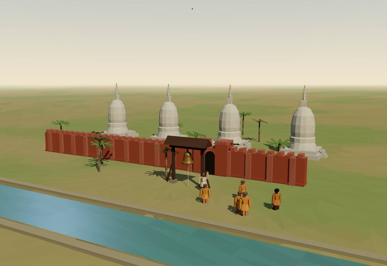
The bell at the gate, Sukhothai, late 13th century (a model)
UNESCO calls Sukhothai ‘the capital of the first Kingdom of Siam in the 13th and 14th centuries’ (elsewhere in the same record, ‘the 13th and 15th centuries’), with Si Satchanalai as ‘the spiritual center’ and the centre of ‘the all-important ceramic export industry’, and Kamphaeng Phet guarding the southern frontier. 47 Consensus Excavation Texts
Inscription One says the king ‘has hung a bell in the opening of the gate’: a commoner with a grievance ‘goes and strikes the bell’, and the king ‘goes and questions the man, examines the case, and decides it justly for him’. ‘When commoners or men of rank differ and disagree, [the King] examines the case to get at the truth and then settles it justly’. 10 Debated Texts
The same text praises free trade and secure inheritance: ‘The lord of the realm does not levy toll on his subjects for traveling the roads … whoever wants to trade in elephants, does so’; and a dead man’s estate, ‘his elephants, wives, children, granaries, rice, retainers and groves of areca and betel’, ‘is left in its entirety to his son’. 10 Debated Texts
The inscription claims the Thai script as the king’s invention: ‘Formerly these Dai letters did not exist. In 1205 saka … King Rama Gaṃhèṅ set his mind and his heart on devising these Dai letters’ (1283 CE); the stone throne it records was set up in 1292. 10 Debated Texts
It lists a realm reaching south to ‘Sri Dharmaraja, and the seacoast’ and west to Hansabati, ‘the seas being their limit’: a king ‘able to subdue a throng of enemies who possessed broad kingdoms and many elephants’, whose people ‘have been reared by him in accordance with the Dharma, every one of them’. 10 Debated Texts
Tambiah reads Sukhothai as a galactic polity: the capital, then ‘At the four cardinal points were the muang, each ruled by a son of the king’, then an outer ring of kingdoms ‘in a tributary relation’. It did not last: ‘by 1438 the Sukhothai provinces were decisively and irrevocably incorporated into the kingdom of Ayutthaya’, after Lu Tai’s son had been ‘reduced to a vassal of Ayutthaya in 1378’. 25 Consensus Texts
UNESCO credits the three towns with ‘a common infrastructure to control water resources’, dams, reservoirs and canals, and the kingdom with institutions ‘remarkably egalitarian for the time, based on the patron-client relationships’; Seshat codes six to seven military levels, from the king down. 47 Seshat DB Debated Excavation
How power worked King · Heredity · Custom and kin
How power worked
- Who rules
- King Consensus
Why?
- How chosen
- Heredity Debated
Why?
- Limits on power
- Custom and kin Debated
Why?
- Scale
- Confederation Debated
Why?
- Claim to rule
- Ideology Debated
Why?
- Who has a say
- A narrow elite Debated
Why?
Pagan1220 CE – 1287 CEBagan
On a bend of the Irrawaddy the kings of Pagan ruled the Burmese plain from the eleventh century and covered it with temples. By the thirteenth so much land and labour had been given to the monks that, on Aung Thwin’s reading, the Mongol invasions only finished a state that was already hollow.
Terms: Southeast Asia: Funan to Angkor and Majapahit: Late Angkor, Majapahit and the new kingdoms, Pagan
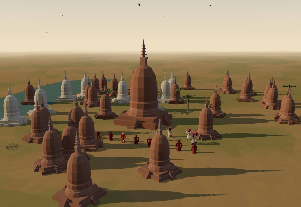
The temple plain of Pagan, 13th century (a model)
‘In the eleventh century, Aniruddha provided the kingdom with additional labor from Thaton in lower Burma and began the process of centralization’ (Aung Thwin). UNESCO dates ‘the peak of Bagan civilization’ to the 11th–13th centuries, ‘when the site was the capital of a regional empire’. 46,51 Consensus Texts Excavation
The plain holds ‘3,595 recorded monuments – including stupas, temples and other structures’; temple building peaked ‘in the 13th century’, when ‘redistributional Buddhism became a mechanism of political control, with the king effectively acting as the chief donor’ (UNESCO). 51 Consensus Excavation
Kingship was measured in gifts: ‘The spiritual worth of a person was equal to his dānā (donation). Since the king was superior to all people, he was expected to surpass everyone in dānā’, and ‘the king’s own legitimacy as a Buddhist king depended upon sanction by the Religious Order’. 46 Consensus Texts
The inscriptions record the scale: ‘In 1196 A.D., Narapatisithu’s dedication came to 44,027 klap of silver’; ‘In 1248 A.D., a noble lady dedicated 5830 klap of silver’; one donor in 1265 gave ‘1459 pay of land and 458 persons’ (one pay about three-quarters of an acre). 46 Consensus Texts
Kings tried to take wealth back by ‘purifying’ the Order: ‘All those properties without valid proof of their tax exempt status were confiscated by King Klacwā in the mid-thirteenth century.’ The court Aung Thwin reconstructs had queens, princes, ministers (amat), officials, officers and senior monks, the king’s preceptor at the head of the religious side. 46 Consensus Texts
Narathihapade (1255–1287), remembered as a ‘bad king’ for his defeat by the Mongols, ‘had a long and, on the surface, secure reign of thirty-two years’. ‘When the Mongols, Mons, and Shans gave Pagan the coup de grâce in the thirteenth and fourteenth centuries, the state was already weak and the temples and monasteries were gorged with wealth.’ 46 Debated Texts
Pagan also reached south: Hall and Whitmore report Luce’s view that ‘Pagan controlled the Kra from 1060 until roughly 1200’, after the Khmer withdrew from the Isthmus. Seshat has no Pagan polity among this page’s ids; Cliopatria draws a Pagan Kingdom from 850 to 1293. 7,15 Debated Texts
How power worked King · Heredity · Custom and kin
How power worked
- Who rules
- King Consensus
Why?
- How chosen
- Heredity Debated
Why?
- Limits on power
- Custom and kin Debated
Why?
- Scale
- Empire Debated
Why?
- Claim to rule
- Divine mandate Debated
Why?
- Who has a say
- A narrow elite Debated
Why?
Artefacts
 Model, not a scan
In numbers
- Marks, by Seshat polity:
- Funan I
- Funan II
- Chenla
- Kalingga Kingdom
- Medang Kingdom
- Early Angkor
- Classical Angkor
- Kediri Kingdom
- Late Angkor
- Majapahit Kingdom
- Sukhotai
- Background bands, by phase:
- Funan, Chenla and the first kingdoms
- Angkor and the island kingdoms
- Late Angkor, Majapahit and the new kingdoms
| Seshat polity | Years | Value |
|---|---|---|
| Funan I | 225 CE – 540 CE (whole period) | 257,034 |
| Funan II | 540 CE – 640 CE (whole period) | 264,200 |
| Chenla | 550 CE – 825 CE (whole period) | 531,000 |
| Medang Kingdom | 732 CE – 1019 CE (whole period) | 100,000–150,000 |
| Early Angkor | 802 CE – 1100 CE (whole period) | 916,847 |
| Kediri Kingdom | 1049 CE – 1222 CE (whole period) | 50,000–70,000 |
| Classical Angkor | 1100 CE – 1220 CE (whole period) | 939,245 |
| Late Angkor | 1220 CE – 1432 CE (whole period) | 1,000,000 |
| Majapahit Kingdom | 1292 CE – 1518 (whole period) | 500,000 |
| Seshat polity | Years | Value |
|---|---|---|
| Funan II | 540 CE – 640 CE (whole period) | 120,000–210,000 |
| Medang Kingdom | 732 CE – 1019 CE (whole period) | 250,000–350,000 |
| Classical Angkor | 1100 CE – 1220 CE (whole period) | 1,500,000 |
| Kediri Kingdom | 1100 CE | 200,000–300,000 |
| Kediri Kingdom | 1200 CE | 250,000–350,000 |
| Late Angkor | 1220 CE – 1432 CE (whole period) | 1,500,000 |
| Majapahit Kingdom | 1292 CE – 1518 (whole period) | 5,000,000 |
| Seshat polity | Years | Value |
|---|---|---|
| Funan I | 225 CE – 540 CE (whole period) | 2,000 |
| Funan II | 540 CE – 640 CE (whole period) | 2,000 |
| Chenla | 550 CE – 825 CE (whole period) | 60,000 |
| Medang Kingdom | 732 CE – 1019 CE (whole period) | 1,000 |
| Early Angkor | 800 CE | 300,000 |
| Early Angkor | 900 CE | 400,000 |
| Classical Angkor | 1100 CE – 1220 CE (whole period) | 750,000–1,000,000 |
| Late Angkor | 1220 CE – 1432 CE (whole period) | 750,000–1,000,000 |
| Majapahit Kingdom | 1292 CE – 1518 (whole period) | 100,000–200,000 |
| Seshat polity | Years | Value |
|---|---|---|
| Funan I | 225 CE – 540 CE (whole period) | 3 |
| Kalingga Kingdom | 500 CE – 732 CE (whole period) | 3–4 |
| Funan II | 540 CE – 640 CE (whole period) | 3–4 |
| Chenla | 550 CE – 825 CE (whole period) | 4 |
| Medang Kingdom | 732 CE – 899 CE | 3 |
| Early Angkor | 802 CE – 1100 CE (whole period) | 5 |
| Medang Kingdom | 899 CE – 1019 CE | 4 |
| Kediri Kingdom | 1049 CE – 1222 CE (whole period) | 4–5 |
| Classical Angkor | 1100 CE – 1220 CE (whole period) | 5 |
| Late Angkor | 1220 CE – 1432 CE (whole period) | 5 |
| Sukhotai | 1238 CE – 1419 CE (whole period) | 3–4 |
| Majapahit Kingdom | 1292 CE – 1518 (whole period) | 4–5 |
| Seshat polity | Years | Value |
|---|---|---|
| Funan I | 225 CE – 540 CE (whole period) | 3 |
| Kalingga Kingdom | 500 CE – 732 CE (whole period) | 1–2 |
| Funan II | 540 CE – 640 CE (whole period) | 3–4 |
| Chenla | 550 CE – 825 CE (whole period) | 3–4 |
| Medang Kingdom | 732 CE – 1019 CE (whole period) | 2–3 |
| Early Angkor | 802 CE – 1100 CE (whole period) | 5 |
| Kediri Kingdom | 1049 CE – 1222 CE (whole period) | 3 |
| Classical Angkor | 1100 CE – 1220 CE (whole period) | 6 |
| Late Angkor | 1220 CE – 1432 CE (whole period) | 6 |
| Sukhotai | 1238 CE – 1419 CE (whole period) | 3–4 |
| Majapahit Kingdom | 1292 CE – 1518 (whole period) | 3 |
| Seshat polity | Years | Value |
|---|---|---|
| Funan I | 225 CE – 540 CE (whole period) | 2 |
| Funan II | 540 CE – 640 CE (whole period) | 2 |
| Chenla | 550 CE – 825 CE (whole period) | 4 |
| Medang Kingdom | 732 CE – 1019 CE (whole period) | 4–5 |
| Early Angkor | 802 CE – 1100 CE (whole period) | 6 |
| Kediri Kingdom | 1049 CE – 1222 CE (whole period) | 5 |
| Classical Angkor | 1100 CE – 1220 CE (whole period) | 6 |
| Late Angkor | 1220 CE – 1432 CE (whole period) | 6 |
| Sukhotai | 1238 CE – 1419 CE (whole period) | 6–7 |
| Majapahit Kingdom | 1292 CE – 1518 (whole period) | 5 |
Values as Seshat codes them: bands are ranges, dots single values, flat bars values given for a whole period, hatching “unknown”; from one Seshat polity to the next, marks alternate between a light tone and a darker one with dashed joining lines (the key above names each polity). Source: Seshat Global History Databank (Equinox-2020), CC BY 4.0; and the Seshat Databank, seshat-db.com (no licence stated; attribution).
Governance fingerprint
Seshat's institutional variables, phase by phase. Hover or focus a cell for the values and years.
- Present
- Inferred present
- Absent
- Inferred absent
- Unknown
- Not coded in Seshat
- Mixed: present in one Seshat polity or period, absent in another
Not coded in Seshat: Funan, Chenla and the first kingdoms: Srivijaya, Angkor and the island kingdoms: Srivijaya and the Chola raid of 1025, Late Angkor, Majapahit and the new kingdoms: Pagan. The Seshat Databank has no polity for them, so their six axes rest on the cited scholarship alone.
The axes against Seshat
13 agree, 0 disagree.
Show the 13 pairs that agree
- Agree Funan, Chenla and the first kingdoms: Funan: claim to rule coded “Divine mandate”, which implies rulers legitimated by gods present; Seshat has it present.
- Agree Funan, Chenla and the first kingdoms: Funan: how chosen coded “Heredity”, which implies elite status hereditary present; Seshat has it present.
- Agree Funan, Chenla and the first kingdoms: Chenla: claim to rule coded “Divine mandate”, which implies rulers legitimated by gods present; Seshat has it present.
- Agree Funan, Chenla and the first kingdoms: Medang (Central Java): claim to rule coded “Divine mandate”, which implies rulers legitimated by gods present; Seshat has it inferred present.
- Agree Funan, Chenla and the first kingdoms: Medang (Central Java): how chosen coded “Heredity”, which implies elite status hereditary present; Seshat has it present.
- Agree Angkor and the island kingdoms: Angkor: claim to rule coded “Divine mandate”, which implies rulers legitimated by gods present; Seshat has it present.
- Agree Angkor and the island kingdoms: Angkor: limits on power coded “None in practice”, which implies executive checked by government absent; Seshat has it absent.
- Agree Angkor and the island kingdoms: Angkor: how chosen coded “Heredity”, which implies elite status hereditary present; Seshat has it present.
- Agree Angkor and the island kingdoms: Java: from Medang to Kediri: claim to rule coded “Divine mandate”, which implies rulers legitimated by gods present; Seshat has it inferred present.
- Agree Late Angkor, Majapahit and the new kingdoms: Late Angkor: claim to rule coded “Divine mandate”, which implies rulers legitimated by gods present; Seshat has it present.
- Agree Late Angkor, Majapahit and the new kingdoms: Late Angkor: how chosen coded “Heredity”, which implies elite status hereditary present; Seshat has it inferred present.
- Agree Late Angkor, Majapahit and the new kingdoms: Majapahit: claim to rule coded “Divine mandate”, which implies rulers legitimated by gods present; Seshat has it inferred present.
- Agree Late Angkor, Majapahit and the new kingdoms: Majapahit: how chosen coded “Heredity”, which implies elite status hereditary present; Seshat has it present.
Only pairs where an axis value on its own implies a Seshat variable are compared; the rest is not counted as disagreement. 3 more pairs have no Seshat value.
Source: Seshat Global History Databank (Equinox-2020), CC BY 4.0; Seshat Databank, seshat-db.com (no licence stated; attribution).
Compare
| Axis | Southeast Asia: Funan to Angkor and Majapahit | The Tamil kingdoms: The Pallavas of Kanchi | Sui, Tang and Song China: Reunification and the early Tang | India: After the cities: the Vedic age |
|---|---|---|---|---|
| Who rules | King | King | Emperor | Chief |
| How chosen | Heredity | Heredity | Heredity | Mixed |
| Limits on power | Custom and kin | Council | Written law | Council |
| Scale | Confederation | Territorial state | Empire | Confederation |
| Claim to rule | Divine mandate | Divine mandate | Divine mandate | Divine mandate |
| Who has a say | A narrow elite | A narrow elite | A narrow elite | A narrow elite |
Legacy
Angkor is still lived in: UNESCO counts ‘more than 100,000 inhabitants distributed over 112 historic settlements’ in the park, ‘some of whom the ancestors are dating back to the Angkor period’, who farm rice, and ‘most of these “barays” and canals still exist today’. 33 Consensus
Sukhothai’s king of Inscription One is now ‘considered the Founding Father of the Thai Nation’, and the stones of the three towns hold ‘the earliest examples of Thai writing’ (UNESCO), which is why the date of Inscription One matters beyond scholarship. 47 Consensus
Kulke called Majapahit ‘Indonesia’s first truly “Imperial Kingdom”’, and the poem of 1365 that lists its claimed lands from Sumatra to New Guinea is the fullest description of any kingdom on this page; how far its list was a map of power is still argued. 20,44 Debated
Borobudur was used ‘until sometime between the 10th and 15th centuries when it was abandoned’, rediscovered in the 19th century and ‘restored with UNESCO’s help in the 1970s’. 23 Consensus
The Laguna copperplate, found by dredgers around 1986, is now in the National Museum of the Philippines (accession 1990-B-1): the oldest dated document from the Philippines, written in Old Malay with words of Javanese. 40,42 Consensus
At Bagan the giving that built Pagan goes on: UNESCO describes ‘living Buddhist beliefs and traditions of merit making, expressed through the remarkable number of surviving stupas, temples and monasteries’. 51 Consensus
See also forms of government and the country edition.
Sources
Bibliography
51 sources, numbered as cited: 31 papers · 3 books · 11 datasets · 6 primary sources
- Paper Pelliot, P. (1903). Le Fou-nan. Bulletin de l’École française d’Extrême-Orient 3: 248–303 (Persée, open). Read in full (Persée page text, OCR): the Chinese texts on Funan in translation and Pelliot’s synthesis.
- Paper Vickery, M. (2003). Funan Reviewed : Deconstructing the Ancients. Bulletin de l’École française d’Extrême-Orient 90–91: 101–143 (Persée, open). Read in full (Persée page text, OCR): Kaundinya as folktale, the poñ chiefs, uncle-to-nephew succession, the Funan–Chenla transition.
- Primary Cœdès, G. (1930). Les inscriptions malaises de Çrīvijaya. Bulletin de l’École française d’Extrême-Orient 30: 29–80 (Persée, open). Read in full (Persée page text, OCR): Kedukan Bukit (683), Talang Tuwo (684), Karang Brahi and Kota Kapur (686) in Old Malay and French.
- Primary Cœdès, G. and Dupont, P. (1943). Les stèles de Sdŏk Kǎk Thom Phnom Sandak et Práah Vihār. Bulletin de l’École française d’Extrême-Orient 43: 56–154 (Persée, open). The Sdok Kak Thom inscription (974 Śaka, 1052 CE) in edition and French translation, pp. 56–112, read in Persée’s page text (OCR).
- Paper Aeusrivongse, N. (1976). Devarāja Cult and Khmer Kingship at Angkor. In Hall and Whitmore (eds), Explorations in Early Southeast Asian History (DOI 10.3998/mpub.19404), pp. 107–148. Read in full (open EPUB): the devarāja of the Sdok Kak Thom inscription as a god’s name, not the king’s.
- Paper Penny, D., Zachreson, C., Fletcher, R., Lau, D., Lizier, J., Fischer, N., Evans, D., Pottier, C., Prokopenko, M. (2018). The demise of Angkor: Systemic vulnerability of urban infrastructure to climatic variations. Science Advances 4(10): eaau4029. Read in full (PMC6192684): the cascade model of the water network’s failure.
- Book Hall, K. R. and Whitmore, J. K. (eds) (1976). Explorations in Early Southeast Asian History. The Origins of Southeast Asian Statecraft. Ann Arbor: University of Michigan Center for South and Southeast Asian Studies (open edition, CC BY-NC-ND 4.0). The open EPUB was read in full; the chapters used are listed under hall1976, aeusrivongse1976, aungthwin1976 and taylor1976. Cited under this id: Hall’s introduction (pp. 1–24) and Hall and Whitmore, “Southeast Asian Trade and the Isthmian Struggle, 1000–1200 A.D.” (pp. 303–340).
- Paper Hall, K. R. (1976). State and Statecraft in Early Srivijaya. In Hall and Whitmore (eds), Explorations in Early Southeast Asian History (DOI 10.3998/mpub.19404), pp. 61–105. Read in full (open EPUB): Wolters’s description of Srivijaya, the dātu and the kādātuan, the oath and imprecation inscriptions, port wealth, the 1025 raid.
- Paper Cœdès, G. (1918). Le royaume de Çrīvijaya. Bulletin de l’École française d’Extrême-Orient 18(6): 1–36 (Persée, open). Read in full (Persée page text, OCR): the Kota Kapur oath naming kadatuan Çrīvijaya, the Chola conquest of Kaḍāram (1023–24).
- Primary Griswold, A. B. and Prasert na Nagara (1971). The Inscription of King Rāma Gaṃhèṅ of Sukhodaya (1292 A.D.). Epigraphic and Historical Studies no. 9, Journal of the Siam Society 59(2): 179–246. Edition and translation read in full (Siam Society PDF; the Thai script in the notes is not legible in the text layer, so none is reproduced).
- Paper Vickery, M. (1991). The Ram Khamhaeng Inscription: A Piltdown Skull of Southeast Asian History?. In J. R. Chamberlain (ed.), The Ram Khamhaeng Controversy, Bangkok: The Siam Society, pp. 3–51 (Zenodo, DOI 10.5281/zenodo.3907307). Read in full.
- Paper Diller, A. (1988). Consonant Mergers and Inscription One. Journal of the Siam Society 76: 46–63. Read in full: the kho khai / kho khuat spellings as evidence for the traditional date.
- Paper Penny, D., Hall, T., Evans, D., Polkinghorne, M. (2019). Geoarchaeological evidence from Angkor, Cambodia, reveals a gradual decline rather than a catastrophic 15th-century collapse. Proceedings of the National Academy of Sciences 116(11): 4871–4876. Read in full (PMC6421400): the Angkor Thom moat cores and a 14th-century decline.
- Paper Carter, A. K., Stark, M. T., Quintus, S., Zhuang, Y., Wang, H., Heng, P., Chhay, R. (2019). Temple occupation and the tempo of collapse at Angkor Wat, Cambodia. Proceedings of the National Academy of Sciences 116(25): 12226–12231. Read in full (PMC6589680): Angkor Wat’s enclosure and moat, the occupation of the mounds and its gap.
- Dataset Bennett, J. S., Mutch, E., Tollefson, A., et al. (2025). Cliopatria - A geospatial database of world-wide political entities from 3400BCE to 2024CE. Scientific Data 12. Cliopatria: open geospatial dataset of over 1600 political entities, 3400 BCE–2024 CE.
- Paper Kulke, H. (1993). “Kadātuan Śrīvijaya” - Empire or kraton of Śrīvijaya ? A Reassessment of the Epigraphical Evidence. Bulletin de l’École française d’Extrême-Orient 80: 159–180 (Persée, open). Read in full (Persée page text, OCR): kadātuan as the ruler’s palace, Srivijaya as an ‘Early Kingdom’.
- Dataset UNESCO World Heritage Centre (2017). Temple Zone of Sambor Prei Kuk, Archaeological Site of Ancient Ishanapura (World Heritage List no. 1532). UNESCO open data, World Heritage List dataset whc001. Record read 16 Nov 2026: Īśānapura as the Chenla capital, 186 brick temples, the causeways and the moated city; coordinates 12.8726 N, 105.0431 E.
- Dataset Seshat: Global History Databank (2026). Seshat Databank API (seshat-db.com), social-complexity and general variables. Snapshot of the API responses taken 15 Nov 2026; the site states no licence. Used where Equinox-2020 has no polity for a page's period.
- Primary Tcheou Ta-kouan (Zhou Daguan); French translation unsigned (usually credited to P. Pelliot; the article names no translator) (1902). Mémoire sur les coutumes du Cambodge. Bulletin de l’École française d’Extrême-Orient 2: 123–177 (Persée, open). Read in full (Persée page text, OCR): the translator’s introduction (the Sui shu on Chenla, the embassy of 1296–97) and Zhou Daguan’s account of Angkor.
- Paper Kulke, H. (1991). Epigraphical References to the “City” and the “State” in Early Indonesia. Indonesia 52: 3–22 (Cornell eCommons, open). Read in full: the three phases (chiefdom, early kingdom, imperial kingdom), kadātuan and maṇḍala in the Srivijaya inscriptions, Java’s watĕk, Majapahit as the ‘first truly Imperial Kingdom’.
- Paper Manguin, P.-Y. (2002). The Amorphous Nature of Coastal Polities in Insular Southeast Asia: Restricted Centres, Extended Peripheries. Moussons 5: 73–99 (OpenEdition, CC BY-NC-ND 4.0). Read in full on OpenEdition (quoted by paragraph): Palembang’s restricted centre, kadātuan as the ‘place of the datu’, Kota Kapur in 686, the shift of trade to the Batang Hari.
- Paper Christie, J. W. (1991). States without Cities: Demographic Trends in Early Java. Indonesia 52: 23–40 (Cornell eCommons, open). Read in full: the watek tax groupings, the Wanua Tengah charter of 908, the move east after 928, Majapahit’s capital as a set of compounds.
- Dataset UNESCO World Heritage Centre (1991). Borobudur Temple Compounds (World Heritage List no. 592). UNESCO open data, World Heritage List dataset whc001. Record read 16 Nov 2026: the Syailendra dynasty, the three tiers, 72 openwork stupas; coordinates 7.6061 S, 110.2196 E.
- Dataset UNESCO World Heritage Centre (1991). Prambanan Temple Compounds (World Heritage List no. 642). UNESCO open data, World Heritage List dataset whc001. Record read 16 Nov 2026: the Shiva temple compound and Sewu; coordinates 7.7522 S, 110.4917 E.
- Paper Tambiah, S. J. (2013). The galactic polity in Southeast Asia. HAU: Journal of Ethnographic Theory 3(3): 503–534 (reprint of the 1977 essay; CC BY-NC-ND 3.0). Read in full (Wayback copy of the journal PDF): the mandala’s core and container, the pulsating ‘galactic’ polity, Sukhothai’s four provinces and the tributary outer ring.
- Paper Lieberman, V. and Buckley, B. (2012). The Impact of Climate on Southeast Asia, circa 950–1820: New Findings. Modern Asian Studies 46(5): 1049–1096. Abstract read (Crossref).
- Paper Taylor, K. (1976). The Rise of Đại Việt and the Establishment of Thăng-long. In Hall and Whitmore (eds), Explorations in Early Southeast Asian History (DOI 10.3998/mpub.19404), pp. 149–191. Read in the open EPUB: the founding of Thăng-long and the Lý dynasty’s Buddhist legitimacy.
- Book Kulke, H. (trans. I. W. Mabbett) (1978). The Devarāja Cult. Ithaca: Cornell University Southeast Asia Program, Data Paper 108 (eCommons, open). Read on eCommons (typescript scan): the devarāja as a bronze image of Śiva, the Sdok Kak Thom inscription of 1052, the ceremony against dependence on ‘Javā’, the priestly family’s office.
- Paper Groslier, B.-P. (1979). VII. La cité hydraulique angkorienne : exploitation ou surexploitation du sol ?. Bulletin de l’École française d’Extrême-Orient 66: 161–202 (Persée, open). Read in full (Persée page text): the hydraulic city, the Indratataka and West Baray capacities, his population estimate and the ‘asphyxia’ of the system.
- Paper Evans, D., Pottier, C., Fletcher, R., Hensley, S., Tapley, I., Milne, A., Barbetti, M. (2007). A comprehensive archaeological map of the world’s largest preindustrial settlement complex at Angkor, Cambodia. Proceedings of the National Academy of Sciences 104(36): 14277–14282. Read in full (PMC1964867): the map of nearly 3,000 km², the water network, Groslier’s thesis and its critics (refs 11–14).
- Paper Fletcher, R., Penny, D., Evans, D., Pottier, C., Barbetti, M., Kummu, M., Lustig, T., APSARA team (2008). The water management network of Angkor, Cambodia. Antiquity 82(317): 658–670. Abstract (Crossref); the full text was read in an unofficial copy, so quotations from it are kept short.
- Paper Evans, D. H., Fletcher, R. J., Pottier, C., et al. (2013). Uncovering archaeological landscapes at Angkor using lidar. Proceedings of the National Academy of Sciences 110(31): 12595–12600. Read in full (PMC3732978): the 370 km² lidar survey of 2012, the urban grid round Angkor Wat, Mahendraparvata on Phnom Kulen.
- Dataset UNESCO World Heritage Centre (1992). Angkor (World Heritage List no. 668). UNESCO open data, World Heritage List dataset whc001. Record read 16 Nov 2026: the park’s 400 km², capitals ‘from the 9th to the 15th century’, the barays and canals.
- Paper van Liere, W. J. (1980). Traditional water management in the lower Mekong Basin. World Archaeology 11(3): 265–280. Abstract read in OpenAlex’s index (W2062922912); the publisher’s page could not be read.
- Paper Acker, R. (1998). New Geographical Tests of the Hydraulic Thesis at Angkor. South East Asia Research 6(1): 5–47. Abstract read in OpenAlex’s index (W2728789901); the publisher’s page could not be read.
- Paper Bourdonneau, É. (2010). Pour en finir avec la « cité hydraulique » ? Note de lecture de l’ouvrage de Didier Pillot, Jardins et rizières du Cambodge. Les enjeux du développement agricole, 2007. Bulletin de l’École française d’Extrême-Orient 97–98: 409–437 (Persée, open). Read in full (Persée page text): van Liere as ‘Groslier’s main opponent’, and Bourdonneau’s own view that no distribution system to the fields has been shown.
- Dataset Wikidata contributors (2026). Coordinates (P625) of Angkor’s barays, temples and capitals. Wikidata Query Service (CC0); items Q1074982 West Baray, Q599465 West Mebon, Q307080 East Baray, Q307181 East Mebon, Q43473 Angkor Wat, Q223665 Angkor Thom, Q654024 Bayon, Q944217 Preah Khan, Q1805560 Jayatataka (North Baray), Q1066013 Neak Pean, Q1092265 Lolei, Q1015194 Roluos, Q957050 Hariharalaya, Q788982 Bakong, Q956515 Phnom Kulen, Q13473659 Mahendraparvata, Q199938 Tonle Sap, Q1778458 Koh Ker. Query run 16 Nov 2026; coordinates rounded to three decimals. The Tonle Sap point is the lake’s centre, not its northern shore.
- Paper Kulke, H. (2009). Introduction. In H. Kulke, K. Kesavapany and V. Sakhuja (eds), Nagapattinam to Suvarnadwipa: Reflections on the Chola Naval Expeditions to Southeast Asia, ISEAS, Singapore, xiii–xviii. Read in full in ISEAS's free prelims PDF (bookshop.iseas.edu.sg/component/get/10511): the three readings of the 1025 raid, the single Tamil source, the silence of Chinese sources, the 'armada' of trading ships. Crossref lists no author; the prelims name Kulke.
- Dataset Wikidata contributors (2026). Coordinates (P625) of capitals, ports and sites for the Southeast Asia page. Wikidata Query Service (CC0); items Q14202163 Angkor Borei, Q2344822 Óc Eo, Q1818746 Sambor Prei Kuk, Q8131 Palembang, Q7366388 Kota Kapur, Q2725535 Muaro Jambi, Q3181128 Bujang Valley, Q42798 Borobudur, Q47721 Prambanan, Q11443 Kediri, Q12522398 Trowulan, Q12483513 Wringin Lawang, Q423654 Sukhothai, Q1395364 Si Satchanalai, Q29317 Bagan, Q69824 Lumban, Q1287698 Tondo, Q695585 Nagapattinam, Q16572 Guangzhou, Q391406 Mỹ Sơn, Q206219 Thăng Long citadel, Q1025100 Ayutthaya, Q61089 Malacca. Query run 16 Nov 2026; coordinates rounded to three decimals. Kota Kapur is the village where the inscription was found (the inscription’s own item has no coordinate).
- Paper Clavé, E. and Griffiths, A. (2022). The Laguna Copperplate Inscription: Tenth-Century Luzon, Java, and the Malay World. Philippine Studies: Historical and Ethnographic Viewpoints 70(2): 167–242 (open copy: HAL halshs-03779017). Read in full: the new edition and translation, the date (21 April 900), the plate’s size, Tundun (Tondo) and Mḍaṅ.
- Paper Hadi Sidomulyo (2010). From Kuṭa Rāja to Singhasāri: Towards a Revision of the Dynastic History of 13th Century Java. Archipel 80: 77–138 (Persée, open). Read in Persée’s page text: Rājasa (Ken Angrok), the defeat of Kaḍiri in 1222, Janggala and Pangjalu, the fall of Singhasāri in 1292 and Wijaya.
- Paper Postma, A. (1991). [LATER PREHISTORIC DEVELOPMENTS IN SOUTHEAST ASIA] The Laguna copper-plate inscription: a valuable Philippine document. Bulletin of the Indo-Pacific Prehistory Association 11: 160–171. Pages 160–165 read (scan): the find in the Lumbang river delta, the plate’s ten lines, the script and language.
- Paper Kulke, H. (1986). 1. The Early and the Imperial Kingdom in Southeast Asian History. In D. G. Marr and A. C. Milner (eds), Southeast Asia in the 9th to 14th Centuries, ISEAS / ANU, pp. 1–22 (Crossref lists no author; the publisher’s pages name Kulke). Only the first-page summary on Cambridge Core could be read; Kulke’s own wording of the early and the imperial kingdom is quoted from kulke1991.
- Book Pigeaud, Th. G. Th. (1962). Java in the 14th Century. A Study in Cultural History. Vol. IV: Commentaries and Recapitulation, 3rd edn. The Hague: Martinus Nijhoff (Internet Archive scan). Read in the archive.org scan: chapter 3, the commentary on cantos 13–16 and the numbered place list (nos. 1–107, pp. 29–37), which summarises Krom’s identifications.
- Primary Groeneveldt, W. P. (1876). Notes on the Malay Archipelago and Malacca Compiled from Chinese Sources. Batavia: W. Bruining (Internet Archive scan); translations from the Yuan shi. Read in the archive.org text layer: the Yuan expedition to Java of 1292–93 (pp. 20–34).
- Paper Aung Thwin, M. (1976). Kingship, the Saṅgha, and Society in Pagan. In Hall and Whitmore (eds), Explorations in Early Southeast Asian History (DOI 10.3998/mpub.19404), pp. 205–256. Read in full (open EPUB): merit and donation, the flow of land to the saṅgha, purifications and confiscations, the Mongol ‘coup de grâce’.
- Dataset UNESCO World Heritage Centre (1991). Historic Town of Sukhothai and Associated Historic Towns (World Heritage List no. 574). UNESCO open data, World Heritage List dataset whc001. Record read 16 Nov 2026: Sukhothai, Si Satchanalai and Kamphaeng Phet, the inscriptions, the waterworks; coordinates of the three towns.
- Paper Buckley, B. M., Anchukaitis, K. J., Penny, D., Fletcher, R., Cook, E. R., Sano, M., et al. (2010). Climate as a contributing factor in the demise of Angkor, Cambodia. Proceedings of the National Academy of Sciences 107(15): 6748–6752. Read in full (PMC2872380): the Fokienia tree-ring record 1030–2008, the droughts of the 14th and early 15th centuries, 1403 the driest year.
- Primary Pigeaud, Th. G. Th. (1960). Java in the 14th Century: A Study in Cultural History. The Nāgara-Kěrtāgama by Rakawi Prapañca of Majapahit, 1365 A.D. Vol. III: Translations. 3rd edn. The Hague: Martinus Nijhoff (KITLV Translation Series 4, 3); Internet Archive scan (IGNCA). Cantos 1–17, 79, 83, 85 and 94 read in the text layer, checked against a second scan of the same edition (Internet Archive).
- Dataset Wikidata contributors (2026). Coordinates (P625) of the places Pigeaud identifies in the Nāgara-Kṛtāgama’s cantos 13–15. Wikidata Query Service (CC0); 65 items, from Q7578 Jambi to Q12522398 Trowulan (each named in the table under the Nāgara-Kṛtāgama map). Query run 16 Nov 2026; coordinates rounded to three decimals. Where Pigeaud’s place is a district or island, the point is that unit’s centre and the page says so.
- Dataset UNESCO World Heritage Centre (2019). Bagan (World Heritage List no. 1588). UNESCO open data, World Heritage List dataset whc001. Record read 16 Nov 2026: 3,595 recorded monuments, merit-making and the king as ‘chief donor’; coordinates of the components.
Quantitative values from the Seshat Global History Databank (Equinox-2020), licensed CC BY 4.0. Dataset: Seshat Equinox Packaged Data (v.1). See also Seshat: The Global History Databank (Turchin et al. 2015).
Values for polities Equinox-2020 does not cover come from the Seshat Databank at seshat-db.com (Seshat: Global History Databank), snapshotted from its API on 2026-11-16. No licence is stated on seshat-db.com; used with attribution. Snapshot: Seshat Databank API (seshat-db.com), social-complexity and general variables.