Stone towns on the plateau, coral towns on the coast, and the gold that joined them
Great Zimbabwe and the Swahili coast
900 CE – 1550 CE
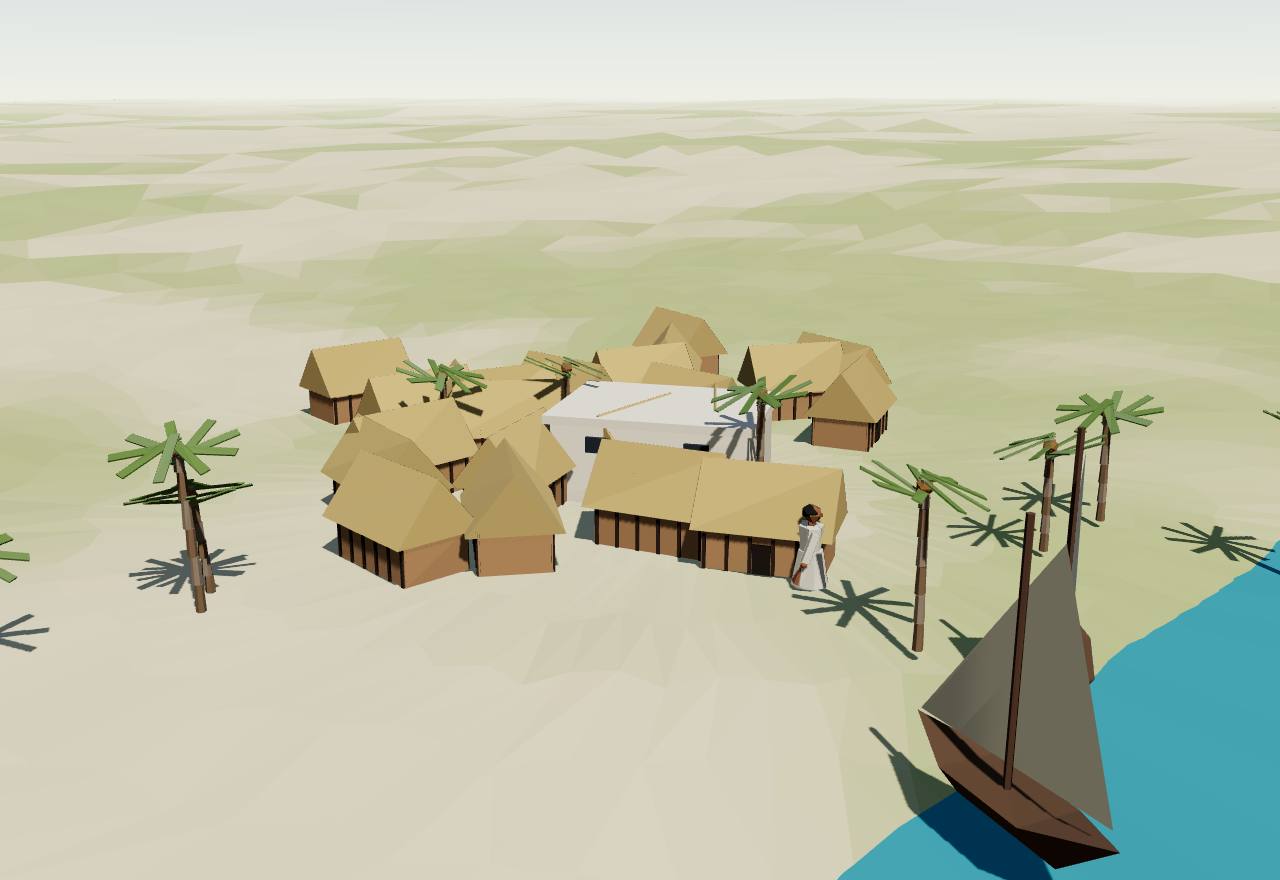
An early Swahili town: timber houses round a coral mosque
900 CE – 1220 CE
Coast and plateau take shape
Around 1000, two worlds were taking shape. On the coast, fishing and farming villages of timber and clay were turning into Muslim towns that built in coral stone and looked out to sea. Inland, in the valley where the Shashe meets the Limpopo, farmers and herders grew rich on ivory and gold traded towards that coast, and their capital at K2 became the first town of a new kind.
The trade was older than the towns. Huffman notes that imported glass beads in several Early Iron Age sites show the network “had extended to southern Africa by the 8th and 9th centuries”; Wood’s study of the beads follows them from the Indian Ocean to the farming villages of the interior. 11,17 Consensus Excavation
Ivory drew people into the Limpopo basin. Huffman and Woodborne count “over 500 Middle Iron Age sites (AD 900–1320)” in the valley, and read the ivory and imported beads at Schroda as a sign that the Zhizo people “may have purposefully moved into the basin to hunt elephants for the ivory trade”. 12 Debated Survey Excavation
The first ports did not last. Fleisher and colleagues note that three important settlements, Unguja Ukuu on Zanzibar, Chibuene in southern Mozambique and Tumbe on Pemba, “were abandoned or depopulated by C.E. 1000”, while new towns grew elsewhere on the coast. 18 Consensus Excavation Dating
Imports were never the bulk of what people used. Brielle and colleagues write that imports “typically comprise less than 5% of total assemblages” at coastal sites; LaViolette and colleagues put them at often 2–4 % of ceramics, and Zhao finds sherds from the Far East under 1 % at most Swahili ports. 2,19,20 Consensus Excavation
Ancient DNA dates a meeting of peoples to these centuries. Brielle and colleagues find that “Peoples of African and Asian origins began to mix by about ad 1000, coinciding with the large-scale adoption of Islam”, with confidence intervals of AD 795–1085 for the northern towns sampled and AD 708–1219 for Kilwa and Songo Mnara. 2 Consensus Ancient DNA Dating
Inland, the archaeologists’ name for these farmers is the Leopard’s Kopje culture, dated CE 900–1400 and named after the site of Leopard’s Kopje; its centres were K2, then Mapungubwe, near the Shashe–Limpopo confluence, and, as Chirikure and colleagues showed, Mapela Hill, 90 km to the north-west. 10 Consensus Excavation Dating
The early Swahili towns900 CE – 1220 CEChwaka, Pemba Island
From the Lamu islands in the north to Kilwa in the south, the towns of this coast spoke an African language and buried their dead as Muslims. They grew from villages of wattle-and-daub houses round a small mosque, and only slowly turned to the sea and to building in coral stone.
Terms: Great Zimbabwe and the Swahili coast: Coast and plateau take shape, The early Swahili towns
Islam came early and spread slowly. Fleisher and colleagues write that it is “first attested at Shanga (Lamu archipelago, Kenya) in the eighth century” and was practised widely along the coast by the twelfth; Brielle and colleagues think Muslims there were at first “probably a minority”, with a major change in the eleventh century. 18,2 Consensus Excavation Dating
At Shanga eight mosques were built one on top of another, “with first-millennium compact wattle-and-daub structures giving way to larger stone ones after 1100 CE” (LaViolette and colleagues). Its earliest Chinese stoneware, nineteen fragments of Changsha ware, dates to the ninth and tenth centuries (Zhao). 19,20 Consensus Excavation
Chwaka on Pemba shows a town growing round its mosques. Settled from about 1050, it grew to 8 ha in its first century and to 12 ha of “densely packed wattle-and-daub neighborhoods” by 1300. Its first congregational mosque, about 1050, had a prayer hall of 6.25 by 3.65 m, which Horton has suggested may reflect Ibadi Islam. 19 Debated Excavation Dating
The first well-documented Friday mosques date to the early twelfth century, with dated inscriptions at Barawa in Somalia and Kizimkazi on Zanzibar. About 1116 a leading Ibadi scholar, al-Awatabi, wrote a polemic letter “to two brothers at Kilwa, Ali bin Ali and Hasan bin Ali” (Horton and colleagues). 19,13 Consensus Excavation Texts
The towns turned to the sea late. Fleisher and colleagues argue the coast should be called maritime “only after circa C.E. 1000”: sharks were fished in earnest at Shanga only after 1100, and Manda, by 1100, covered 20–25 ha with imports at ten per cent of its pottery, “the highest occurrence on the coast”. 18 Debated Excavation
The towns struck their own money. Perkins dates Swahili coins “probably from as early as the mid-9th century”, small silver and copper pieces naming a ruler, but not the caliph, a mint or a date. A hoard buried at Mtambwe Mkuu on Pemba after 1066 held more than 2,000 local silver coins, 30 of them of Ali b. al-Hasan. 21,13 Consensus Excavation
Kilwa’s first stone and its first coins come from this period. Excavating there, Horton and colleagues date “the first coral buildings and coins at the end of the tenth century”, and found coins of Ali bin al-Hasan, the founder in the Chronicle, in a context that “dates firmly to the tenth century”. The Portuguese version of the Chronicle sets the founding “nearly four hundred years after the era of Mohamed”, about AD 1000 (Barros). 13,3 Consensus Excavation Dating
Why did the towns become Muslim? One argument holds that “early conversion to Islam was a practical step by coastal dwellers to gain recognition and secure economic trustworthiness in the Indian Ocean world”; LaViolette, Fleisher and Horton accept that this “was certainly part of the story”, but expect scholars to keep debating a top-down history of Sunni Islam against “agent-centered, heterodoxic spiritualities”. 19 Debated Excavation Texts
The genetic study tested the old idea of foreign founders directly. Brielle and colleagues sampled elite Muslim burials near mosques and concluded that “the elite inhabitants of Mtwapa and other sites developed from admixed populations and were not foreign migrants or colonists”; the language, Kiswahili, “is an African Bantu language with Asian loanwords”. 2 Consensus Ancient DNA
How power worked King · City-state · 4 unknown
How power worked
- Who rules
- King Debated
Why?
- How chosen
- Unknown
Why?
Coins name the rulers, but how they came to power is told only by the Kilwa Chronicle, written down five centuries later.
- Limits on power
- Unknown
Why?
No source from these towns says what limited their rulers.
- Scale
- City-state Debated
Why?
- Claim to rule
- Unknown
Why?
The rulers minted coins in Muslim towns, but no text read says on what they rested their claim.
- Who has a say
- Unknown
Why?
No source read says who took part in decisions in the early towns.
K2 and the Limpopo valley1000 CE – 1220 CEMapungubwe Cultural Landscape (K2 lies 2 km from the hill)
K2, also called Bambandyanalo, lay at the foot of a sandstone hill near where the Shashe meets the Limpopo. For two centuries it was the capital of the valley: a farming town that grew rich on the coastal trade and was ruled by hereditary leaders who still lived among everyone else.
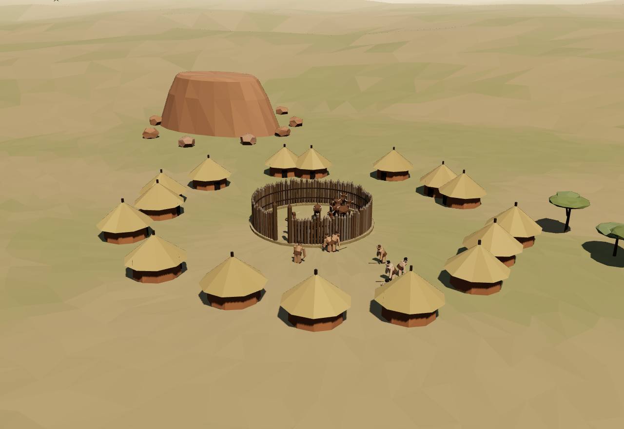
K2: a town round its cattle byre
K2 flourished from about 1000. Chirikure and colleagues date it CE 1000–1200, Woodborne and colleagues “between AD 1000 and AD 1220”, and Huffman and Woodborne’s new dates have its pottery turning into a transitional style “around AD 1150”. 10,24,12 Debated Dating
At first K2 was laid out round its cattle. Wood describes a town built on the Central Cattle Pattern, the byre in the middle, until “in about 1150 the cattle kraal was removed from the centre”; Huffman reads that shift as “the beginning of class”. 17,11 Debated Excavation Ethnography
K2 was the valley’s capital and it was rich: it “became the capital and achieved substantial wealth from the trade carried on with the coast, as the tens of thousands of glass beads found there attest” (Wood). 17 Consensus Excavation
Its craftsmen remade the imports. Wood found that K2 had glass workers who melted small imported beads into large “Garden Roller” beads, a sign of specialists attached to the town’s leaders; the imported beads themselves were “soda-alumina glass of south Asian origin” (Chirikure and colleagues). 17,10 Consensus Excavation Read more: South India in the same centuries, on the Tamil kingdoms page
Huffman calls K2 a ranked society: in his reading, trade and farming helped “transform a ranked-based society with hereditary leadership at the capital K2 into a classbased society with sacred leadership at Mapungubwe”. The leader lived in the town, among the people. 12,11 Debated Excavation Ethnography
How many lived there is estimated, not counted. Huffman and Woodborne assign “50 people (half of them adults) to each homestead”, a formula that gives “general populations in relative terms rather than as an absolute census”: by it K2’s valley held more people than the Zhizo settlements before it. 12 Speculative Survey Model
Around 1220 the capital moved two kilometres. In Woodborne and colleagues’ account, the valley’s first state “shifted its capital in AD 1220 from K2 to the site of Mapungubwe Hill, only 2 km away”; Wood writes that K2 was abandoned and its people moved to Mapungubwe. 24,17 Debated Excavation Dating
How power worked Chief · Heredity · Territorial state · 3 unknown
How power worked
- Who rules
- Chief Debated
Why?
- How chosen
- Heredity Debated
Why?
- Limits on power
- Unknown
Why?
No text survives, and the excavations read do not say what limited K2’s leaders.
- Scale
- Territorial state Speculative
Why?
- Claim to rule
- Unknown
Why?
Huffman reads K2 as ranked by kinship before the sacred kings of Mapungubwe, but no source read says what its leaders claimed.
- Who has a say
- Unknown
Why?
Who took part in K2’s decisions is not known from any source read.
1220 CE – 1450 CE
The gold age
For two centuries gold from the Zimbabwe plateau went down to the coast at Sofala and north to Kilwa, and from there across the Indian Ocean. Inland, a king withdrew to the top of a hill at Mapungubwe, and then Great Zimbabwe raised what Ndoro calls the largest prehistoric structure in sub-Saharan Africa. On the coast, Kilwa’s sultans built a palace and domed a great mosque in coral stone.
Gold tied the plateau to the coast. Fleisher and colleagues write that Kilwa “flourished from the 11th century onward as the endpoint of trade routes reaching from the interior, especially controlling gold from the Zimbabwe plateau”; UNESCO’s record says Mapungubwe harvested “gold and ivory” from its hinterland. 18,25 Consensus Excavation
At Kilwa in about 1331 Ibn Baṭṭūṭa was told by a merchant that Sofala lay a fortnight’s journey south and that “gold dust is brought to Sufála from Yufi in the country of the Limis”, a month further. His translator Gibb notes that Yufi has been identified with Nupe on the Niger: if so, the traveller placed the source of this coast’s gold in West Africa. 4 Debated Texts Read more: Ibn Baṭṭūṭa in Mali, twenty years later, on the Ghana, Mali and Songhai page
Chinese stoneware reached the plateau, but only a little. Zhao counts “around 20 bowl and plate sherds of Longquan green-glazed stoneware” and three Jingdezhen blue-and-white sherds at Great Zimbabwe, and three fragments of one small Longquan vessel at Mapungubwe; between the 13th and early 16th centuries Kilwa “played a role in local distribution of Chinese imports”. 20 Consensus Excavation
Coins travelled too, but stayed rare inland. Perkins lists Kilwa-type coins found at Mogadishu and “one from Great Zimbabwe”, and five more on Marchinbar Island off northern Australia; the coins carry no date, no mint and no caliph’s name. 21 Consensus Excavation
The centres overlapped. Chirikure and colleagues’ Bayesian chronology argues that Great Zimbabwe’s occupation “must have overlapped with that at Mapungubwe” and calls for “a polycentric model”; a 2026 review by Manyanga and colleagues argues for state formation flowing “from interacting regional polities instead of a single core”. 6,26 Debated Dating
A drought marks the turn from Mapungubwe to Great Zimbabwe. Huffman and Woodborne date it by baobab rings to “about AD 1310±5” and write that, with Mapungubwe’s leadership “in turmoil, Great Zimbabwe was able to seize control of the gold belt”; their earlier study adds that the abandonment “owed as much to cultural factors as to environmental pressures”. 12,27 Debated Dating Excavation
Seshat codes Great Zimbabwe’s polity at about 50,000 km², with 5 levels of administration taken from later Shona chiefship; it codes professional soldiers and full-time bureaucrats as inferred absent and markets as inferred present, and its notes stress that where the territory ended “may never be known”. Seshat DB Debated Survey
Mapungubwe1220 CE – 1290 CEMapungubwe Cultural Landscape
In the 1220s the leaders of the Limpopo valley left K2 and moved up onto Mapungubwe, a flat-topped sandstone hill two kilometres away. For a few decades a king lived on the summit, apart from his people, and was buried there with gold; then the valley emptied.
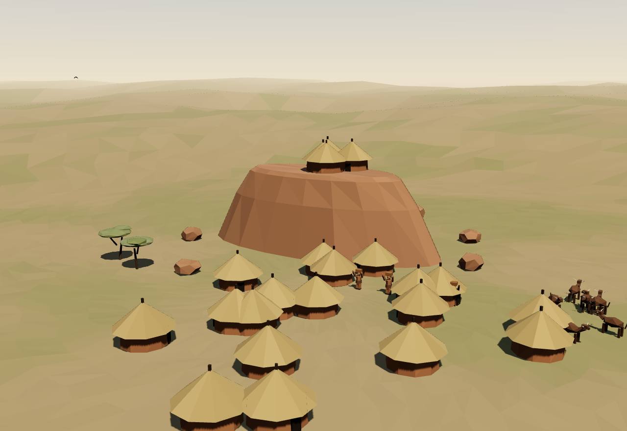
Mapungubwe: the king above, the town below
Mapungubwe’s dates differ by author. Chirikure and colleagues give CE 1220–1290; Huffman dates classic Mapungubwe pottery “between 1250 and 1300 AD”; Huffman and Woodborne’s new radiocarbon dates put the Mapungubwe phase at AD 1270–1320, and Meyer and Cloete date the hilltop’s last occupation to 1250–1290. The page uses 1220–1290. 10,11,12,28 Debated Dating
The king moved above his people. Wood writes that “the ruler/king and entourage established themselves on top of Mapungubwe Hill while the elite settled on its slopes”; UNESCO describes “an elite class with a sacred leadership where the king was secluded from the commoners located in the surrounding settlements”. 17,25 Consensus Excavation
Huffman explains the move by sacred leadership: trade wealth and intensive farming helped turn a kin-based society “to social classes and sacred leadership”, and the king, responsible “for the fertility of both the land and people”, no longer lived among them (Wood, following Huffman). He reads the seclusion through a Venda saying for a chief: “the crocodile does not leave its pool”. 11,17 Debated Excavation Ethnography
The hilltop graves held the first gold work known in southern Africa’s Iron Age. Gold lay in three of the twenty-seven graves excavated there: a gold-plated rhinoceros, a sceptre, a bowl, a headdress, at least 100 coiled anklets, about 12,000 gold beads and about 26,000 glass beads; “No gold has been found in Iron Age sites from southern Africa that pre-date Mapungubwe Hill” (Woodborne and colleagues). 24 Consensus Excavation
Radiocarbon dates the gold. Fibres inside the anklets gave cal AD 1179–1243 and 1243–1278 (one sigma), showing the objects “were manufactured in the 13th century AD”. Woodborne and colleagues argue that gold, once traded away for glass beads, became here “a symbol of wealth, status and power”. 24 Debated Dating Excavation
Beads came by the hundred thousand. Excavators found “hundreds of thousands” of glass beads on the hill, and a new series, the Mapungubwe Oblates, arrived about the time the capital moved and soon became the only imported beads (Wood); their glass was “high-alumina, low-calcium plant-ash glass of south or south-east Asian origin” (Chirikure and colleagues). 17,10 Consensus Excavation
By Huffman and Woodborne’s homestead formula, “over 10 000 people lived in the valley during the Mapungubwe phase”, about 5,000 of them at the capital; they stress that the formula gives relative, not absolute, numbers. 12 Speculative Survey Model
Then the valley emptied. UNESCO writes that “when rainfall decreased after 1300 AD, the land could no longer sustain a high population”; Huffman and Woodborne have Mapungubwe’s people stay until about 1320, “the same date as the drought”, and power move north to Great Zimbabwe. 25,12 Debated Dating Survey
How power worked King · Territorial state · Divine mandate · 2 unknown
How power worked
- Who rules
- King Debated
Why?
- How chosen
- Unknown
Why?
No source read says how Mapungubwe’s kings came to power; Huffman calls K2’s leadership hereditary, but nothing read says the same of the hill.
- Limits on power
- Unknown
Why?
No text survives, and nothing read shows what limited the king on the hill.
- Scale
- Territorial state Debated
Why?
- Claim to rule
- Divine mandate Debated
Why?
- Who has a say
- A narrow elite Debated
Why?
Great Zimbabwe1220 CE – 1450 CEGreat Zimbabwe, near Masvingo
On a granite hill and in the valley below it, the Shona-speaking people of the plateau built a city of stone enclosures without mortar, and round them houses of dhaka, the local clay. It is one of more than 200 such sites in southern Africa. Archaeologists agree it was an African achievement; they disagree on how it was ruled.
Terms: Great Zimbabwe and the Swahili coast: The gold age, Great Zimbabwe
- dzimbahwe “houses of stone”, the Shona word behind the name Zimbabwe; in the sixteenth century, Huffman writes, it meant “the home, court, and grave of a leader” 10,8
- mambo king: the title of a leader at the top of a large hierarchy (Huffman) 8
- Symbaoe Barros’s spelling in about 1552: the name the people gave such buildings, “which according to their language signifies court” 3
- nyika the territory, the largest Shona political unit, “overseen by rulers known as madzimambo (kings)” (Nyamushosho) 30
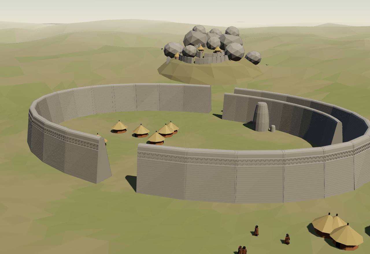
The Great Enclosure, Great Zimbabwe
When were the walls built? Chirikure and colleagues’ Bayesian model puts the start of stone building at “the end of the twelfth or beginning of the thirteenth century AD, reaching its peak in the fourteenth and fifteenth centuries”, with people living there into the sixteenth and probably the seventeenth. Huffman argues that stone walling began only after 1300, a chronology Pikirayi and Chirikure view “with considerable scepticism”. 6,7 Debated Dating
The Great Enclosure’s outer wall is “11 metres tall at its highest point and approximately 252 metres long, making it by far the largest single prehistoric structure in sub-Saharan Africa” (Ndoro). The walls are dressed granite laid without mortar, as the Portuguese historian Barros already heard in the sixteenth century: “there appears to be no mortar joining them”. 31,3 Consensus Excavation Survey
Inside stands the solid conical tower: Hall measured it in 1902–4 at 31 ft high on its south-east face and about 57 ft 6 in round its base. Outside, “the chevron design richly adorning the exterior girdle wall of the Great Enclosure” is, for Chirikure and Pikirayi, “perhaps the most spectacular decoration” of the site. 32,1 Consensus Survey
The oldest walls are on the hill. Chirikure and Pikirayi trace the seat of power from “the Western Enclosure on the hill in the twelfth century, to the Great Enclosure, the Upper Valley and finally the Lower Valley in the early sixteenth century”; the founder’s homestead kept “a religious significance”, which may be why the Hill Complex “has always remained the site of an important shrine”. 1 Debated Excavation Ethnography
Most people lived beyond the walls. Ndoro writes that the house floors round the hills show “where most of the population lived”, the stone-built core being only about ten per cent of the estate. Imports turn up in every major area, “some form of equal access to resources” for Chirikure and Pikirayi, and in their later study “the categories of ‘elite’ and ‘commoner’ were situational and transient”. 31,1,33 Debated Excavation Ethnography
How many people lived there is disputed. UNESCO’s record says the population “exceeded 10,000”; Seshat codes the largest settlement at 1,000 to 20,000 and notes that Chirikure and colleagues argue the often-quoted 20,000 is unrealistic for the land around it. 9 Seshat DB Debated Survey
Eight birds carved in soapstone were found at the site, seven of them on the Hill Complex (Chirikure and Pikirayi, after Matenga); UNESCO’s record describes six on upright stone posts in the hill’s eastern enclosure. One became the national symbol of Zimbabwe (Ndoro). They are not reproduced on this page. 1,9,31 Consensus Excavation
Water mattered as much as stone. Pikirayi and colleagues study the springs and wetlands that fed the city, “a source and resource of the past where traditions of lineage, ownership and ancestry are embedded”, and argue that from about 1550 “drying climate, land overexploitation, and changing regional trading patterns” led to its decline. 34 Debated Survey Ethnography
For decades white settlers refused to believe Africans had built it. Bent in 1892 credited Arabian gold-diggers, Hall and Neal in 1904 the “South Arabian Himyarites” and the Phoenicians, and Hall’s digging destroyed most of the African dhaka buildings (Ndoro). Randall-MacIver’s Mediæval Rhodesia answered in 1906 that the buildings were “unquestionably African in every detail”; from 1965 to 1980 the Rhodesia Front censored what the public could read about the site. 35,36,31,37 Consensus Texts Excavation
How power worked King · Heredity · Custom and kin
How power worked
- Who rules
- King Debated
Why?
- How chosen
- Heredity Debated
Why?
- Limits on power
- Custom and kin Debated
Why?
- Scale
- Territorial state Debated
Why?
- Claim to rule
- Divine mandate Debated
Why?
- Who has a say
- A narrow elite Debated
Why?
Who built Great Zimbabwe? What was claimed, and what was found
Data: the writers’ own books, and the historians who studied them
From Bent’s book of 1892 to the Rhodesia Front’s censorship, which lasted until 1980, settler writers and governments claimed that someone other than Africans had built Great Zimbabwe. Archaeologists answered them from 1906 on. The argument among archaeologists today is about how the city was governed, not who built it.
- c. 1552
João de Barros, Portuguese historian, from traders’ reports Claimed outside builders
Described the stone “Symbaoe” and wondered whether it was Ptolemy’s Agysymba; the people of the country, he wrote, “say they are the work of the devil”. 3
- 1892
J. Theodore Bent, after digging in 1891 Claimed outside builders
“The cumulative evidence is greatly in favour of the gold diggers being of Arabian origin”; he also reported Mauch’s view that the hill fortress copied Solomon’s temple and the lower ruins the Queen of Sheba’s palace. Cecil Rhodes, Ndoro writes, “was convinced that the site of Great Zimbabwe had been constructed by Phoenicians”, and Bent’s findings reinforced the myth. 35,31
- 1904
R. N. Hall and W. G. Neal Claimed outside builders
Repeated that the ruins were erected “by the South Arabian Himyarites, who were followed … by the Phoenicians”, and claimed the local people had “no tradition concerning the ruins”, while noting that some believed their buried ancestors haunted them. 36
- 1902–05
- 1906
David Randall-MacIver, archaeologist Showed African builders
Found the houses inside the walls “unquestionably African in every detail” and dated the Great Enclosure to “not earlier than the fourteenth or fifteenth century”: “Where are the traces of this foreign race?” 37
- 1931
G. Caton-Thompson, as Ndoro quotes her Showed African builders
Ndoro quotes her conclusion that “No other than our happy-go-lucky Bantu could be accused of erecting them”: African builders, in words that were themselves demeaning, for she also called the site “essentially the product of an infantile mind”. 31
- 1965–1980
- 1986
UNESCO Politics and the site
Inscribed Great Zimbabwe on the World Heritage List; its record notes that the site is still used “by contemporary communities for spiritual reasons”. 9
- 2008
S. Chirikure and I. Pikirayi Today’s debate
Argued that Great Zimbabwe “emerged from local farming communities as a series of aristocratic centres succeeding each other in a manner consistent with Shona systems of political succession”, against Huffman’s single sacred palace. 1
- 2013
Chirikure, Pollard, Manyanga and Bandama Today’s debate
A Bayesian chronology: stone walling began at “the end of the twelfth or beginning of the thirteenth century AD”, earlier than Randall-MacIver or Huffman placed it. 6
- 2021
T. N. Huffman and M. Main Today’s debate
Restated the Zimbabwe culture as “institutionalized class distinction linked to the ideology of sacred leadership”, noting that its critics have offered no “comprehensive alternative”. 8
- 2026
R. T. Nyamushosho Today’s debate
Wrote against the newer picture of tyrants and forced labour, describing Shona units from the nyika, “overseen by rulers known as madzimambo (kings)”, down to the homestead. 30
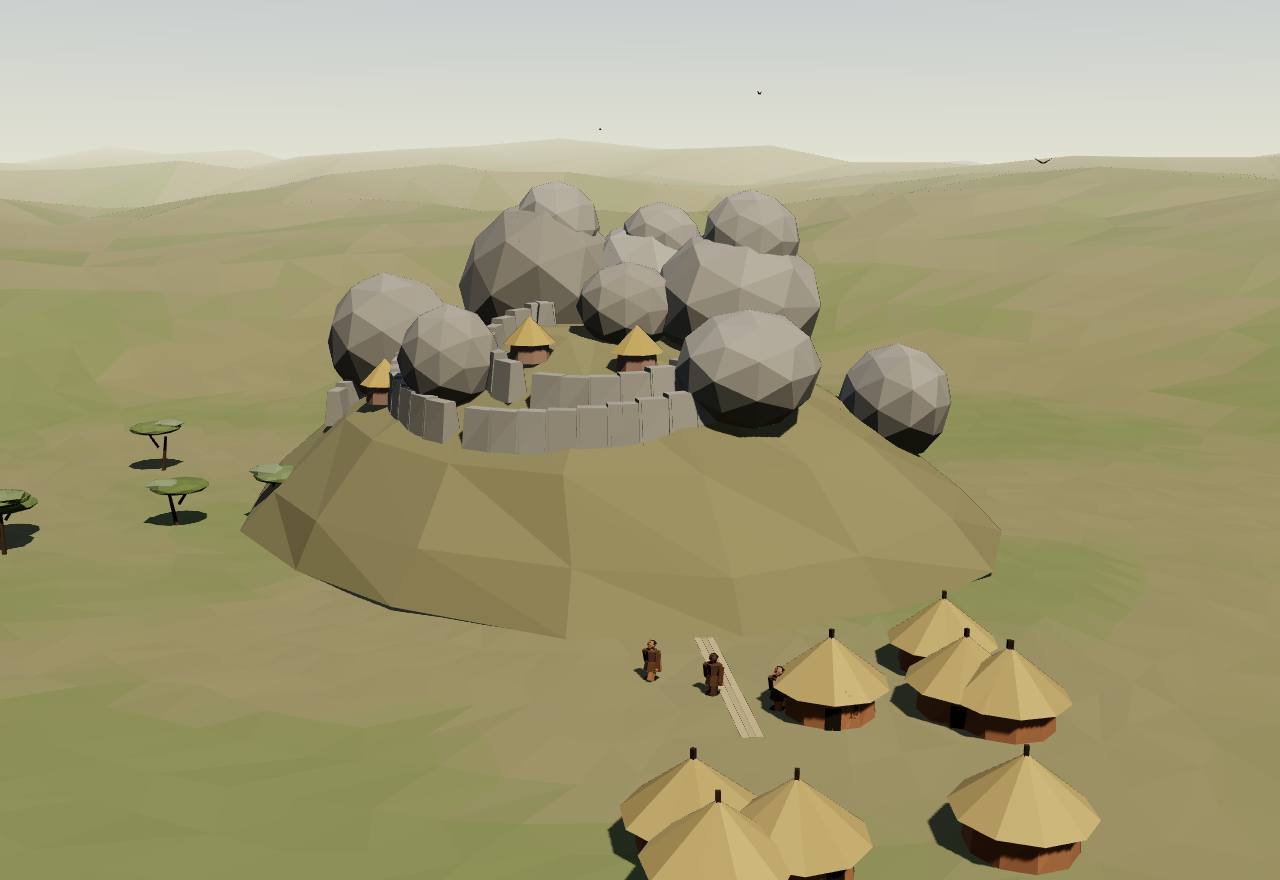
The Hill Complex: walls woven between the boulders
Kilwa1220 CE – 1450 CEKilwa Kisiwani, Tanzania
On a small island off the coast of today’s Tanzania, Kilwa grew by controlling the gold that came up the coast from Sofala. Its sultans, who traced their line to a founder from Shiraz, struck coins, raided the mainland, and built in coral stone.
Terms: Great Zimbabwe and the Swahili coast: The gold age, Kilwa
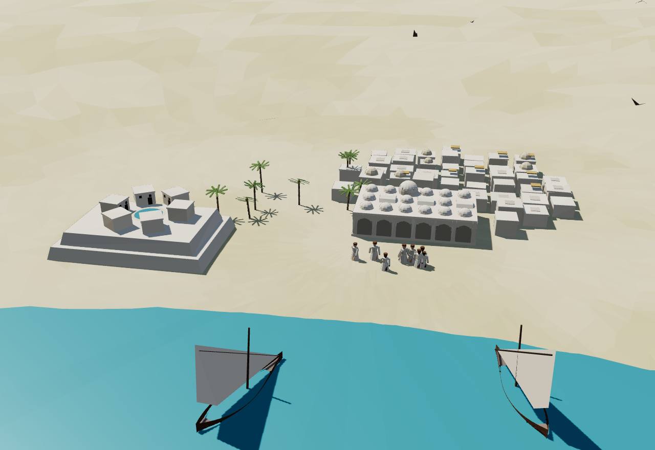
Kilwa: the Great Mosque and the palace on the headland
Ibn Baṭṭūṭa reached Kilwa in about 1331. He found “a very fine and substantially built town”, most of its people “Zanj, jet-black in colour, and with tattoo-marks on their faces”, and a sultan, Abu’l-Muzaffar Hasan, who raided the mainland and gave “the fifth part of the booty” to pious causes. His brother Dawid, who followed him, gave so little that people “gave up going to his gate”. 4 Consensus Texts
Of at least 20,000 Swahili coins known, more than 13,000 are Kilwa copper, which Perkins dates from the late 11th or early 12th century into the 14th (Horton and colleagues have since found the founder’s coins in a tenth-century layer). Three gold coins, all in the name of al-Hasan ibn Sulaiman, weigh 3.58, 4.33 and 4.71 g (Perkins); one is dated in the 720s of the Hijra, AD 1320–29 (Horton and colleagues). 21,13 Consensus Excavation
The same sultans built on a grand scale. UNESCO’s record dates the palace of Husuni Kubwa to “c1310 and 1333 with its large octagonal bathing pool”, and Horton and colleagues credit these rulers, “mostly likely al-Hasan bin Sulaiman”, with three great projects: the Great Mosque extension, Husuni Kubwa and Husuni Ndogo. 40,13 Consensus Excavation Dating
The Great Mosque, first built in the eleventh century, was “considerably enlarged in the 13th century”, with “sixteen domed and vaulted bays”, and its great dome was “the largest dome in East Africa until the 19th century” (UNESCO). The Arabic History remembers a time when the mosque had decayed so far that people “were obliged to worship in tents”. 40,14 Consensus Excavation Texts
Kilwa wrote its own history. The Chronicle survives in two versions: a Portuguese one that Barros summarised in his Da Asia of about 1552, which Saad thinks may have been composed for the Portuguese during their occupation of 1505–12, and an Arabic History whose author says he was born in AH 904 (1498–99), known from a copy of 1877. Both tell of a founder from Shiraz who bought the island for cloth. 3,14,41 Debated Texts
The Chronicle credits one king, Soleiman Hacen, with turning Kilwa from timber to stone: he “made himself lord of the commerce of Sofala” and Pemba, Mafia and Zanzibar, and built “a stone fortress there, and walls, towers, and noble houses, for until his time the town was constructed of wood” (Barros). Ibn Baṭṭūṭa still wrote that “all its buildings are of wood”. 3,4 Debated Texts
Kilwa’s ships sailed the ocean. Fleisher and colleagues cite a ship “from Kilwa”, loaded with rice, reaching Aden in 1336, and date building in coral and lime “on any significant scale” to the fourteenth century; at nearby Songo Mnara three mosques stood along the shore and a fourth “was constructed in the sea itself”. 18 Consensus Texts Excavation
UNESCO’s record lists what Kilwa’s merchants dealt in from the 13th to the 16th century: “gold, silver, pearls, perfumes, Arabian crockery, Persian earthenware and Chinese porcelain”. At Kilwa in about 1331, Ibn Baṭṭūṭa noted, gifts were mostly ivory and “l’on donne rarement de l’or”, one rarely gave gold (the French of Defrémery and Sanguinetti). 40,42 Consensus Texts
How power worked Sultan · Heredity · Custom and kin
How power worked
- Who rules
- Sultan Consensus
Why?
- How chosen
- Heredity Debated
Why?
- Limits on power
- Custom and kin Speculative
Why?
- Scale
- City-state Consensus
Why?
- Claim to rule
- Divine mandate Debated
Why?
- Who has a say
- A narrow elite Debated
Why?
The kings of Kilwa, counted from the Chronicle
Model: the Chronicle’s reign lengths counted back from AH 901, not recorded years
The Chronicle gives each king’s reign in years, months or days, never the year he came to power. Counting its 44 reigns back from the one date its Arabic version gives, Fudayl’s accession in AH 901 (1495–96), 14 spreads them over about 529 years, back to Ali Bumale, the founder’s son. Every year below is that reckoning, rounded, not a record; the founder himself has no reign length and is left out. 3 The Portuguese version may have been composed for the Portuguese at Kilwa in 1505–12. 41
- Son or grandson
- the last king’s son or grandson succeeded
- Brother, nephew, uncle
- a brother, nephew, uncle or other royal kinsman came to the throne
- Raised by the people
- the people, or “the Persians of the town”, put him on the throne
- By or as the governor
- the kingdom’s governor made himself king, or raised a king of his own
- Usurped
- a kinsman usurped the throne or took it back by arms
- Left by an enemy king
- Matata Mandalima, king of Xanga, left his nephew at Kilwa
- Not said
- the Chronicle names him without saying how
44 accessions: 12 son or grandson, 16 brother, nephew, uncle, 7 raised by the people, 3 by or as the governor, 3 usurped, 1 left by an enemy king, 2 not said; median reign 7 years. Ended: 7 died in office, 12 deposed, 3 killed, 1 abdicated, 21 not known.
Marks at the end of a bar: ○ died in office · × killed · ▽ deposed · | abdicated · □ conquered
Show the table: Kings of Kilwa in the Chronicle, reckoned back from AH 901
| Ruler | Years | Came to power | Reign ended | Source |
|---|---|---|---|---|
| Ali Bumale | 967 CE – 1007 CE | Son or grandson | not known (“his son Ali Bumale succeeded him, and reigned forty years” (Barros); reckoned c. 967–1007) | 3 |
| Ali Busoloquete | 1007 CE – 1011 CE | Brother, nephew, uncle | not known (“his nephew … inherited Kilwa” (Barros); reckoned c. 1007–1011) | 3 |
| Daut | 1011 CE – 1015 CE | Son or grandson | deposed (“driven out of Kilwa … by Matata Mandalima” (Barros); reckoned c. 1011–1015) | 3 |
| Ali Bonebaquer | 1015 CE – 1017 CE | Left by an enemy king | deposed (“driven away by the Persians of the town” (Barros); reckoned c. 1015–1017) | 3 |
| Hocen Soleiman | 1017 CE – 1033 CE | Raised by the people | not known (“the Persians … placed Hocen Soleiman … on the throne” (Barros); reckoned c. 1017–1033) | 3 |
| Ali Ben Daut | 1033 CE – 1093 CE | Brother, nephew, uncle | not known (“his nephew, who reigned sixty years” (Barros); reckoned c. 1033–1093) | 3 |
| Ali Ben Daut (the grandson) | 1093 CE – 1099 CE | Son or grandson | killed (“threw him alive into a well” (Barros); reckoned c. 1093–1099) | 3 |
| Hacen Ben Daut | 1099 CE – 1123 CE | Raised by the people | not known (“They then placed his brother … on the throne” (Barros); reckoned c. 1099–1123) | 3 |
| Soleiman | 1123 CE – 1125 CE | Brother, nephew, uncle | killed (“he being of royal blood … beheaded by the people” (Barros); reckoned c. 1123–1125) | 3 |
| Daut | 1125 CE – 1165 CE | Raised by the people | not known (“they put his son Daut in his place, having summoned him from Sofala” (Barros); reckoned c. 1125–1165) | 3 |
| Soleiman Hacen | 1165 CE – 1183 CE | Son or grandson | not known (“building a stone fortress there, and walls, towers, and noble houses” (Barros); reckoned c. 1165–1183) | 3 |
| Daut | 1183 CE – 1185 CE | Son or grandson | not known (“succeeded by his son Daut, who reigned two years” (Barros); reckoned c. 1183–1185) | 3 |
| Talut | 1185 CE – 1186 CE | Brother, nephew, uncle | died in office (“his brother Talut, who lived only one year thereafter” (Barros); reckoned c. 1185–1186) | 3 |
| Hocem | 1186 CE – 1211 CE | Brother, nephew, uncle | died in office (“another brother … reigned twenty-five years. Dying without sons” (Barros); reckoned c. 1186–1211) | 3 |
| Hali Bony | 1211 CE – 1221 CE | Brother, nephew, uncle | died in office (“another brother, who lived ten years thereafter” (Barros); reckoned c. 1211–1221) | 3 |
| Boni Soleiman | 1221 CE – 1261 CE | Brother, nephew, uncle | not known (“his nephew, who reigned forty years” (Barros); reckoned c. 1221–1261) | 3 |
| Ali Daut | 1261 CE – 1275 CE | Not said | not known (“After him came Ali Daut, who reigned fourteen years” (Barros); reckoned c. 1261–1275) | 3 |
| Hacen | 1275 CE – 1293 CE | Son or grandson | died in office (“his grandson Hacen … a very gallant man. At his death” (Barros); reckoned c. 1275–1293) | 3 |
| Soleiman | 1293 CE – 1307 CE | Son or grandson | killed (“treacherously killed in leaving the mosque” (Barros); reckoned c. 1293–1307) | 3 |
| Daut | 1307 CE – 1309 CE | Son or grandson | abdicated (“during the absence of Hacen, who had gone to Mecca … Daut gave up the kingdom to him” (Barros); reckoned c. 1307–1309) | 3 |
| Hacen | 1309 CE – 1333 CE | Brother, nephew, uncle | not known (“his brother Hacen reigned twenty-four years” (Barros); reckoned c. 1309–1333) | 3 |
| Daut (again) | 1333 CE – 1357 CE | Brother, nephew, uncle | not known (“having no sons the last king, Daut, came to the throne again” (Barros); reckoned c. 1333–1357) | 3 |
| Soleiman | 1357 CE – 1357 CE | Son or grandson | deposed (“only reigned twenty days, as his uncle Hacen usurped the kingdom” (Barros); reckoned c. 1357–1357) | 3 |
| Hacen | 1357 CE – 1364 CE | Usurped | not known (“usurped the kingdom, and reigned six and a half years” (Barros); reckoned c. 1357–1364) | 3 |
| Taluf | 1364 CE – 1365 CE | Brother, nephew, uncle | not known (“his nephew Taluf … reigned one year” (Barros); reckoned c. 1364–1365) | 3 |
| Soleiman | 1365 CE – 1367 CE | Brother, nephew, uncle | deposed (“the throne was taken from him by another Soleiman, his uncle” (Barros); reckoned c. 1365–1367) | 3 |
| Soleiman | 1367 CE – 1392 CE | Usurped | not known (“twenty-four years, four months, and twenty days” (Barros); reckoned c. 1367–1392) | 3 |
| Hacen | 1392 CE – 1416 CE | Son or grandson | not known (“succeeded by his son Hacen, who reigned twenty-four years” (Barros); reckoned c. 1392–1416) | 3 |
| Mohamed Ladil | 1416 CE – 1425 CE | Brother, nephew, uncle | not known (“his brother Mohamed Ladil, who reigned nine years” (Barros); reckoned c. 1416–1425) | 3 |
| Soleiman | 1425 CE – 1447 CE | Son or grandson | not known (“Soleiman, his son, who succeeded, reigned twenty-two” (Barros); reckoned c. 1425–1447) | 3 |
| Ismael Ben Hacen | 1447 CE – 1461 CE | Brother, nephew, uncle | died in office (“his uncle, Ismael Ben Hacen … at whose death” (Barros); reckoned c. 1447–1461) | 3 |
| The governor | 1461 CE – 1462 CE | By or as the governor | deposed (“the governor of the kingdom was made king, but was only a year on the throne” (Barros); reckoned c. 1461–1462) | 3 |
| The governor | 1462 CE – 1463 CE | Raised by the people | deposed (“the people made the governor of the kingdom king” (Barros); reckoned c. 1462–1463) | 3 |
| Mohamed, “a poor man” | 1463 CE – 1464 CE | Raised by the people | deposed (“a poor man … of the line of kings … on account of his poverty” (Barros); reckoned c. 1463–1464) | 3 |
| Hacen son of Ismael | 1464 CE – 1474 CE | Brother, nephew, uncle | not known (“son of the late king Ismael, was then raised to the throne” (Barros); reckoned c. 1464–1474) | 3 |
| Zaide | 1474 CE – 1484 CE | Son or grandson | died in office (“his son Zaide another ten, at whose death” (Barros); reckoned c. 1474–1484) | 3 |
| The governor | 1484 CE – 1485 CE | By or as the governor | deposed (“the governor … wished to make himself king” (Barros); reckoned c. 1484–1485) | 3 |
| Habedala | 1485 CE – 1486 CE | Raised by the people | not known (“the people raised to the throne Habedala” (Barros); reckoned c. 1485–1486) | 3 |
| Ali | 1486 CE – 1488 CE | Brother, nephew, uncle | died in office (“his brother Ali as long, at whose death” (Barros); reckoned c. 1486–1488) | 3 |
| Hacem son of the governor | 1488 CE – 1488 CE | By or as the governor | deposed (“forcibly raised … Nevertheless the people would not consent” (Barros); reckoned c. 1488–1488) | 3 |
| Xumbo | 1488 CE – 1489 CE | Raised by the people | deposed (“a scion of the royal line … for a year only” (Barros); reckoned c. 1488–1489) | 3 |
| Hacem (again) | 1489 CE – 1494 CE | Usurped | deposed (“the ex-king rose in arms, but after five years he was deposed” (Barros); reckoned c. 1489–1494) | 3 |
| Abraham son of Mohamed | 1494 CE – 1496 CE | Not said | deposed (“After two years Abraham was also deposed” (Barros); reckoned c. 1494–1496) | 3 |
| Alfudail | 1496 CE – 1496 CE | Brother, nephew, uncle | not known (“his nephew, Alfudail … kept it only a very short time” (Barros); reckoned c. 1496–1496) | 3 |
Does the count hold?
- c. 1331 Ibn Baṭṭūṭa finds Abu’l-Muzaffar Hasan reigning, later succeeded by his brother Dawid. 4 The count puts Hacen on the throne c. 1309–1333: Hacen, a son of a Soleiman, followed by his brother Daut, as Ibn Baṭṭūṭa’s Hasan was by Dawid.
- 1320–29 a gold coin of al-Hasan ibn Sulaiman dated AH 72[…], that is 1320–29. 13,21 The count puts Hacen on the throne c. 1309–1333: the same Hacen: a Hasan whose father was a Sulaiman, as on the coin.
Freeman-Grenville’s own count from the regnal years gave 1310–1333 for this Hasan, Chittick’s 1320–1340. 13 A count of reign lengths drifts with every rounded or missing reign, so the agreement in the fourteenth century does not make the earlier dates safe.
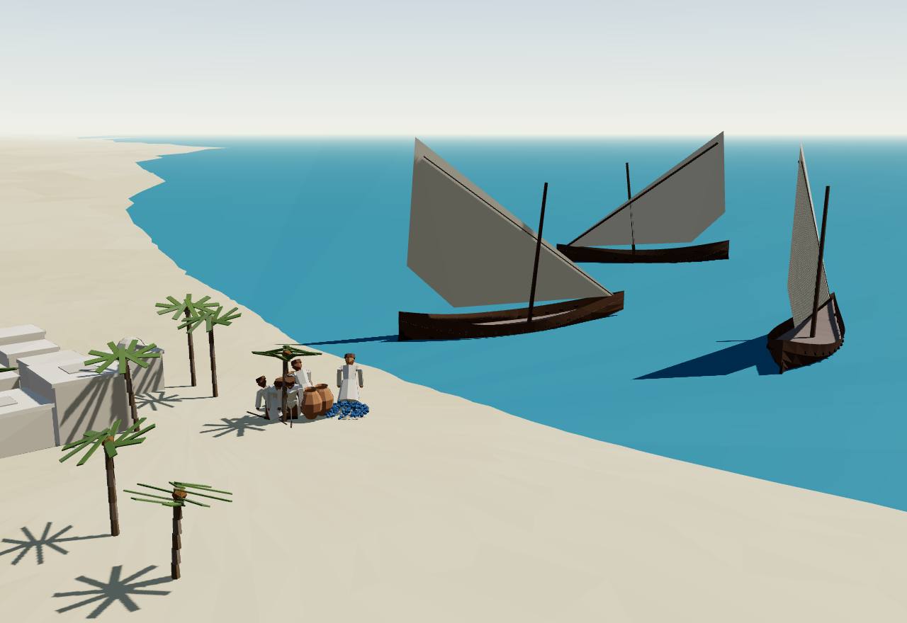
Ships of the monsoon off a coral-stone town
Gold, beads, stoneware: what the finds and the travellers place where
Data: excavated finds and travellers’ reports, each place cited
Places, not borders: each place sits where a cited record puts it (UNESCO’s World Heritage data, or Wikidata for a modern point), and each line is a journey, a trade or a relation a source describes. Choose a good to see where the finds and the travellers put it. Imports were never more than a small share of what people used: often 2–4 % of the pottery in the stone towns. 19
- trade or a traveller’s route
- subject to Kilwa (Barbosa)
- war: the Portuguese fleet, 1505
- the chosen good found or reported here
| Place | What | When |
|---|---|---|
| Mapungubwe and K2 | gold in 3 of 27 hilltop graves: a gold-plated rhinoceros, sceptre, bowl, headdress, at least 100 anklets and about 12,000 gold beads excavated 24 | 13th century |
| Sofala | “gold dust is brought to Sufála”, Ibn Baṭṭūṭa was told at Kilwa reported 4 | c. 1331 |
| Sofala | people of Benametapa bring gold and give it for cloth “without weighing it” reported 5 | c. 1518 |
| Kilwa | three gold coins of al-Hasan ibn Sulaiman, 3.58, 4.33 and 4.71 g excavated 21,13 | 1320s |
| Mombasa | booty of “bangles, bracelets, ear-rings and gold beads” when the town was sacked reported 5 | 1505 |
| Mogadishu | ships “carry away much gold, ivory, wax” reported 5 | c. 1518 |
| Place | What | When |
|---|---|---|
| Mapungubwe and K2 | “tens of thousands” of glass beads at K2, and “hundreds of thousands” on Mapungubwe Hill excavated 17 | 1000–1300 |
| Mapungubwe and K2 | about 26,000 glass beads in the Original Gold Grave alone excavated 24 | 13th century |
| Place | What | When |
|---|---|---|
| Great Zimbabwe | around 20 Longquan bowl and plate sherds, a Zhuangbian bowl fragment and 3 Jingdezhen blue-and-white sherds excavated 20 | 13th–16th centuries |
| Mapungubwe and K2 | 3 fragments of one small Longquan-style green-glazed vessel excavated 20 | 13th century |
| Chwaka | a mosque once set with 22 inset Chinese bowls excavated 19 | c. 1050–1500 |
| Kilwa | Kilwa distributed Chinese imports along the coast; Southeast Asian wares at Kilwa, Songo Mnara and Manda excavated 20 | 13th–early 16th centuries |
| Manda | imports at ten per cent of the domestic pottery by 1100, the highest on the coast excavated 18 | by 1100 |
| Place | What | When |
|---|---|---|
| Kilwa | more than 13,000 Kilwa copper coins known, of at least 20,000 Swahili coins excavated 21 | 11th–14th centuries |
| Mtambwe Mkuu | a hoard of more than 2,000 local silver coins and 12 foreign gold coins excavated 13 | after 1066 |
| Great Zimbabwe | one Kilwa coin excavated 21 | 14th century |
| Mogadishu | Kilwa-type coins found at Mogadishu excavated 21 | 11th–14th centuries |
| Place | What | When |
|---|---|---|
| Kilwa | gifts were mostly ivory: “l’on donne rarement de l’or” reported 42 | c. 1331 |
| Mapungubwe and K2 | the Mapungubwe kingdom harvested “gold and ivory” from its hinterland reported 25 | 13th century |
| Place | What | When |
|---|---|---|
| Sofala | the Moors of Sofala sell cloth to the people of Benametapa for gold reported 5 | c. 1518 |
| Great Zimbabwe | traders give “clothes, beads, and trinkets” on credit to gold-diggers inland reported 3 | c. 1552 |
All 18 places and their sources (21 finds and reports in all)
- Chibuene: 22.05° S, 35.32° E, 900–1000 43,18
- Unguja Ukuu: 6.30° S, 39.36° E, 900–1000 44,18
- Manda: 2.27° S, 40.97° E, 900–1220 45,18
- Mtambwe Mkuu: 5.07° S, 39.72° E, 1000–1220 46,13
- Chwaka: 4.96° S, 39.78° E, 1050–1500 47,19
- Mapungubwe and K2: 22.19° S, 29.24° E, 1000–1300 25,24
- Great Zimbabwe: 20.27° S, 30.93° E, 1200–1550 9,6
- Khami: 20.16° S, 28.38° E, 1400–1550 48,38
- Sofala: 20.15° S, 34.72° E, 1300–1550 49,4,5
- Kilwa: 9.05° S, 39.57° E, 950–1550 40,13
- Songo Mnara: 9.04° S, 39.55° E, 1300–1550 50,18
- Mozambique Island: 15.04° S, 40.73° E, 1450–1550 51,16
- Mombasa: 4.06° S, 39.68° E, 1300–1550 52,4,16
- Malindi: 3.22° S, 40.12° E, 1450–1550 53,16
- Pate: 2.10° S, 41.05° E, 1450–1550 54,5
- Lamu: 2.27° S, 40.90° E, 1450–1550 55,56
- Mogadishu: 2.04° N, 45.34° E, 1300–1550 57,4
- Aden: 12.80° N, 45.03° E, 1300–1450 58,18
7 links, each a journey or relation the cited text describes: Great Zimbabwe to Sofala (trade or a traveller’s route); Sofala to Kilwa (trade or a traveller’s route); Kilwa to Mozambique Island (subject to Kilwa); Mogadishu to Mombasa (trade or a traveller’s route); Mombasa to Kilwa (trade or a traveller’s route); Kilwa to Aden (trade or a traveller’s route); Kilwa to Mombasa (war (1505)). 18,5,4,3
1450 CE – 1550 CE
Khami, Mutapa and the Portuguese
By the fifteenth century the plateau had more than one centre: the Torwa kings at Khami in the south-west and the Mutapa in the north, while Great Zimbabwe lived on. In 1498 Portuguese ships sailed up this coast; in 1505 they sacked Kilwa and Mombasa, and by about 1518 they had a fort at Sofala, where the gold came down to the sea.
Great Zimbabwe did not fall at once. Chirikure and colleagues show that Khami “flourished as a major centre from the late fourteenth/early fifteenth century, long before Great Zimbabwe’s decline”, and that Great Zimbabwe “continued to be occupied into the late seventeenth and perhaps eighteenth centuries”; the two were rivals of equal standing, not a capital and its province. 38 Debated Dating Excavation
Da Gama’s ships came up the coast in 1498. At Mozambique the ruler “had the title of Sultan, and was like a vice-roy”; the Portuguese bombarded the town. At Mombasa a boat of armed men tried to board them, and the captain-major had two captives questioned “by dropping boiling oil upon their skin”. Malindi received them and gave them a pilot for India (the anonymous journal of the voyage). 16 Consensus Texts
Seven years later the Portuguese came to conquer. Francisco de Almeida’s fleet anchored off Kilwa on 22 July 1505; its king fled “by another door leading to a grove of palm trees”, the captains were sent “to sack the town”, and Almeida crowned a king of his own. On 13 August the fleet reached Mombasa, which it took and burnt (Barros). 3 Consensus Texts
The prize was Sofala’s gold. Barbosa, writing about 1518, describes the Moors of Sofala selling cloth to the people of the kingdom of Benametapa, “who came thither laden with gold which they gave in exchange for the said cloths without weighing it”; by then the king of Portugal had a fort beside the town. 5 Consensus Texts
Before the Portuguese, Kilwa had held the southern coast: Barbosa writes that “the Moors of Çofala, Cuama, Angoya and Moçambique were all subject to the King of Quiloa”. The fort the Portuguese then built at Kilwa was itself destroyed a few years later (Barbosa). 5 Debated Texts
These accounts are outsiders’ and must be read as such. Barbosa knew some towns only by report (his editor notes he “shows no personal acquaintance” with Pate), and Dames warned in 1918 that “the accounts given by the early Portuguese from native information were certainly exaggerated”. 5 Consensus Texts
Khami (Torwa)1450 CE – 1550Khami, near Bulawayo
Khami, in the south-west of the plateau, was the capital of the Butua state under the Torwa dynasty. Its builders did not raise free-standing walls like Great Zimbabwe’s: they terraced a hill into platforms, faced them with decorated stonework, and built their houses on top.
Terms: Great Zimbabwe and the Swahili coast: Khami, Mutapa and the Portuguese, Khami (Torwa)
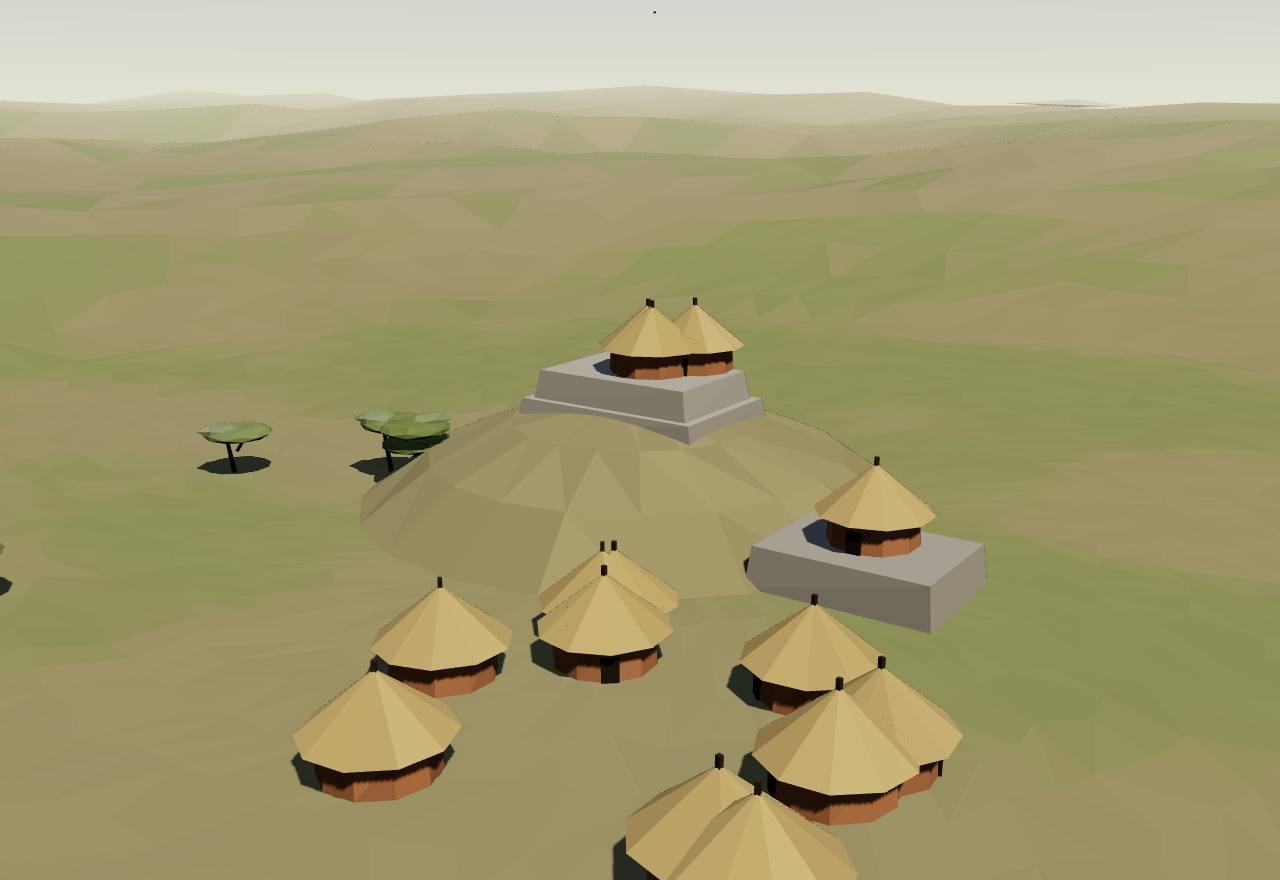
Khami: houses on stone-faced platforms
UNESCO’s record calls Khami “the capital of the Torwa dynasty”, with “the chief’s residence (Mambo)” on the Hill Ruin in the north of the site. Mukwende dates the Butua state AD 1400–1680 and Khami’s occupation to the fifteenth to seventeenth centuries. 48,59 Consensus Excavation Dating
Khami’s builders “employed terracing to produce platforms. Houses were then constructed on top of the platforms”, and the retaining walls were “profusely decorated in a number of patterns that include checker, herringbone, dentelle, cord and chevron” (Mukwende). UNESCO credits Khami with “the longest decorated wall in the entire sub-region”. 59,48 Consensus Excavation Survey
Khami was long read as Great Zimbabwe’s successor. Mukwende’s study concludes that “Khami is unlikely to have emerged out of Great Zimbabwe”, and Pikirayi and Chirikure see the two styles of building as “two competing political ideologies, which at some point were contemporaneous”. 59,7 Debated Excavation Dating
In Huffman’s scheme the Khami period runs AD 1400–1840, overlapping the Zimbabwe period, and only Great Zimbabwe and Khami are on record as headquarters of the highest rank of mambo; for him both belong to one Zimbabwe culture of “institutionalized class distinction linked to the ideology of sacred leadership”. 8 Debated Survey Ethnography
Portuguese writers knew the kingdom only by report. Barros, about 1552, places in the interior “a district called Toroa, which by another name is known as the kingdom of Butua, which is ruled by a prince called Burrom, a vassal of Benomotapa”. 3 Debated Texts
Butua was gold country: Mukwende notes the Portuguese called the state the “Mother of Gold”. Its end came long after this page, in the 1680s, “when Changamire, a Karanga chief from the north-east usurped power”. 59 Consensus Texts
How power worked King · Territorial state · A narrow elite · 3 unknown
How power worked
- Who rules
- King Debated
Why?
- How chosen
- Unknown
Why?
No source read says how Torwa kings came to the throne; Barros names only one ruler, Burrom.
- Limits on power
- Unknown
Why?
No text from Khami survives, and the sources read do not say what limited its kings.
- Scale
- Territorial state Debated
Why?
- Claim to rule
- Unknown
Why?
Khami’s builders set the king’s house on the Hill Ruin, above the others, but no source read says what Torwa kings claimed.
- Who has a say
- A narrow elite Speculative
Why?
Mutapa1450 CE – 1550
In the north of the plateau a dynasty of kings that the Portuguese called the Monomotapa ruled from the fifteenth century. What was written about their court before 1560 came from Portuguese who had not been there, from what traders told them.
Terms: Great Zimbabwe and the Swahili coast: Khami, Mutapa and the Portuguese, Mutapa
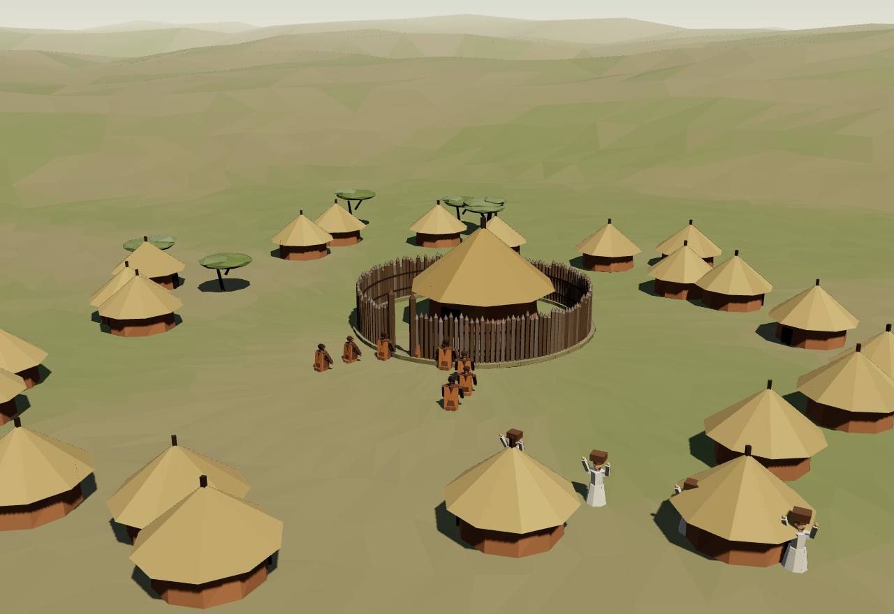
The Mutapa’s town, as the Portuguese heard of it
Mukwende dates the Mutapa state from AD 1450, in northern Zimbabwe, and reports Beach’s view of its rise as “a territorial expansion of the Karanga dynasties from Guruuswa”; Pikirayi and Chirikure call it “a direct successor of Great Zimbabwe on the northern Zimbabwe Plateau”. 59,7 Debated Excavation Texts
Every king claimed the same founder: “all those who became Mutapas had claims and links to the first Mutapa, Nyatsimba Mutota” (Pikirayi and Chirikure). They add that Great Zimbabwe itself came to be controlled “by a prince, or one of the sons or vassals of the Mutapa”. 7 Debated Texts Ethnography
Barbosa, about 1518, heard of “a great town called Zimbaoche”, fifteen or twenty days inland, with “many houses of wood [and of straw]”, where the king of Benametapa often stayed. The king, he was told, received people unseen: he “sees them through a window but they see him not, they only hear his voice”. 5 Debated Texts
Barbosa also reports that the king sent out “new fire” to his subjects, “that he may know whether they are obedient to him”: a rite of allegiance as an outsider understood it. 5 Speculative Texts
Barros, about 1552, calls the king “the same as an emperor among us”, whose insignia were “a very small hoe with an ivory handle” and assagais, and describes a stone fortress in the interior that local people called Symbaoe, kept by an officer called Symbacayo with some of the king’s wives inside. 3 Debated Texts
Coastal traders bound the gold-diggers by debt, as Barros tells it: the Moors “cover them and their wives with clothes, beads, and trinkets … give them all these things on credit, telling them to go and dig for gold”. 3 Debated Texts
After this page’s span, in 1561, the Jesuit Gonçalo da Silveira baptised a young Mutapa king and his mother, and was then strangled at the king’s order. Antonio Caiado, a Portuguese at the court, blamed “the malicious persuasion of the Moors”; the Jesuit account admits its description of the killing came from Caiado’s servants. 60 Debated Texts
Later still, in the 1590s, the friar João dos Santos wrote that the reigning Monomotapa “is called Mambo” and that his vassals swore “by his life”, and that in the neighbouring kingdom of Quiteve the people “do not choose the eldest or nearest prince as king, but the most skilful and prudent”. His book appeared in 1609 and describes a later court. 15 Debated Texts
How power worked King · Heredity · Custom and kin
How power worked
- Who rules
- King Consensus
Why?
- How chosen
- Heredity Debated
Why?
- Limits on power
- Custom and kin Speculative
Why?
- Scale
- Empire Speculative
Why?
- Claim to rule
- Kinship and descent Debated
Why?
- Who has a say
- A narrow elite Speculative
Why?
Mombasa, Malindi and the Portuguese1450 CE – 1550Mombasa (Fort Jesus)
In 1498 the towns of the coast met the Portuguese, and chose differently. Malindi made them welcome and gave them a pilot; Mombasa resisted, and in 1505 it was burnt. Kilwa was sacked and given a king of Portugal’s choosing.
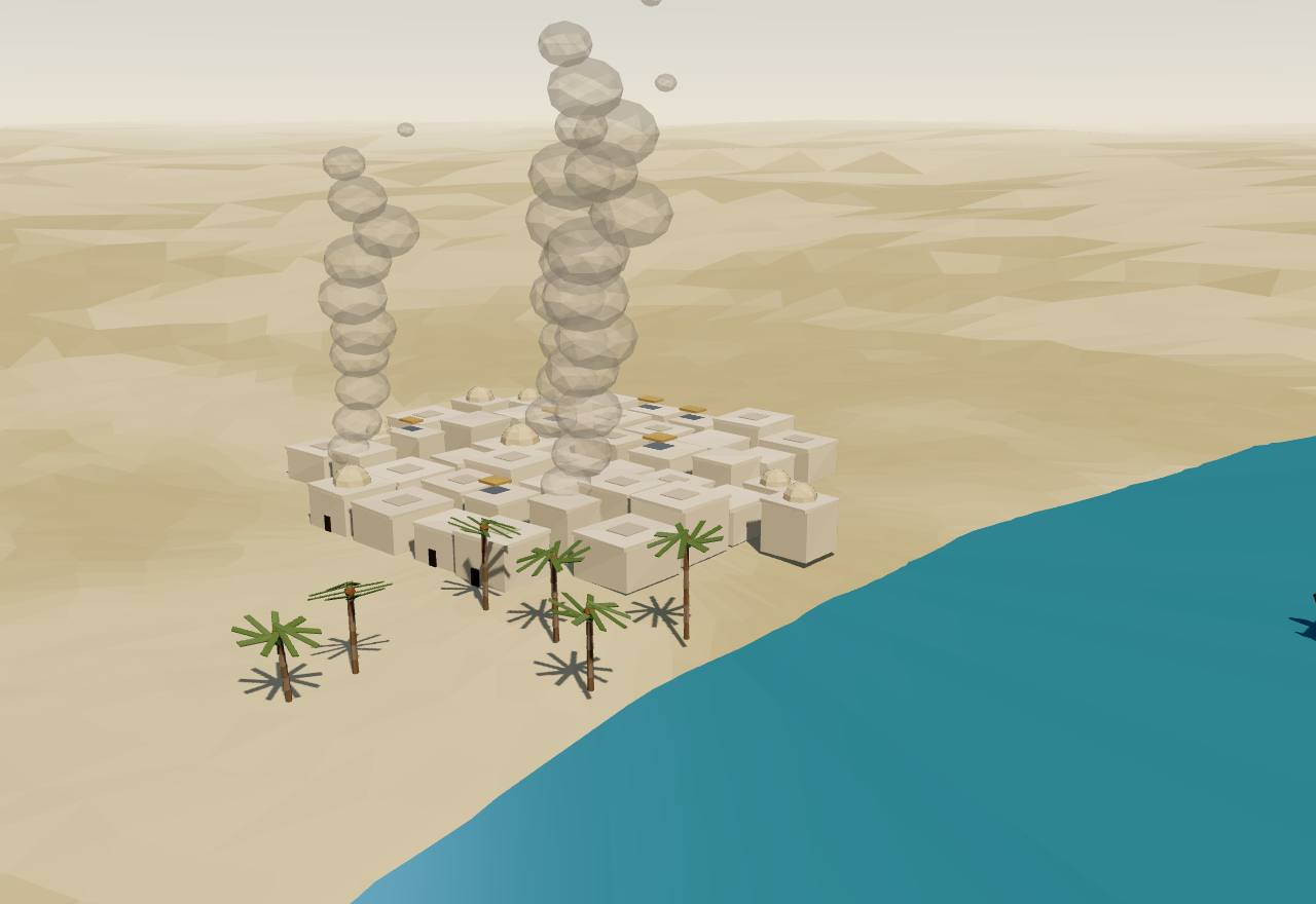
Mombasa burning, August 1505
Mombasa was “a large city seated upon an eminence washed by the sea” when da Gama came in 1498 (the journal), with “lofty stone and mortar houses, well aligned in streets” in Barbosa’s account. A boat of armed men tried to board his ships; two captives, questioned under torture, said the town meant to avenge what the Portuguese had done at Mozambique. 16,5 Consensus Texts
Malindi chose friendship. Its ruler, in fact the king’s son acting as regent (Ravenstein’s note), met da Gama under “a round sunshade of crimson satin” and sent him a pilot; its houses were “lofty and well white-washed”. Barbosa: “The king and people of this place ever were and are friends of the King of Portugal”. 16,5 Consensus Texts
In 1505 Almeida’s men set fire to Mombasa, which “burned so quickly, as the houses were built very close together” (Barros). Barbosa writes that it was “left ruined and plundered and burnt”, with great booty of gold and silver: “bangles, bracelets, ear-rings and gold beads”. 3,5 Consensus Texts
Kilwa as the Portuguese found it in 1505 was a town of stone: “The greater number of the houses are built of stone and mortar, with flat roofs … one can jump from one roof to the other” (Barros). Barbosa saw “many fair houses of stone and mortar … very well arranged in streets”, with carved wooden doors. 3,5 Consensus Texts
Kilwa’s own history records the newcomers too. The Arabic History dates the accession of Fudayl to AH 901 (1495–96) and tells how, in AH 904, three ships “of the Franks” passed Kilwa without stopping, met hostility at the next town and took a pilot at Malindi; its author adds that he was born that year (Strong’s summary). 14 Consensus Texts
Kilwa’s last kings before the conquest were made and unmade by its governors and its people. In Barros’s chronicle, governors set up kings, the people raised others, and when the Portuguese came the town was held by a governor, Mir Abraham, whom “the people did not give … the title of king”. 3 Debated Texts
Pate’s beginnings are disputed. The Pate chronicle, in Stigand’s version, has the Nabahans arrive from Oman “in the year 601” of the Hijra; Chittick argued that Pate was “of little importance before the sixteenth century” and that its origins “do not go back before the fourteenth century”. Barbosa describes Pate as “well walled with stone and mortar”, but only from report. 61,62,5 Debated Texts Excavation
How power worked King · Heredity · Custom and kin
How power worked
- Who rules
- King Consensus
Why?
- How chosen
- Heredity Debated
Why?
- Limits on power
- Custom and kin Speculative
Why?
- Scale
- City-state Consensus
Why?
- Claim to rule
- Force Debated
Why?
- Who has a say
- A narrow elite Debated
Why?
Artefacts
 Model, not a scan
 Model, not a scan
In numbers
- Marks, by Seshat polity:
- Great Zimbabwe
- Background bands, by phase:
- Coast and plateau take shape
- The gold age
- Khami, Mutapa and the Portuguese
Not coded in Seshat
Not coded in Seshat
| Seshat polity | Years | Value |
|---|---|---|
| Great Zimbabwe | 1270 CE – 1550 (whole period) | 50,000 |
| Seshat polity | Years | Value |
|---|---|---|
| Great Zimbabwe | 1270 CE – 1550 (whole period) | 1,000–20,000 |
| Seshat polity | Years | Value |
|---|---|---|
| Great Zimbabwe | 1270 CE – 1550 (whole period) | 5 |
| Seshat polity | Years | Value |
|---|---|---|
| Great Zimbabwe | 1270 CE – 1550 (whole period) | 3 |
Not coded in Seshat: population, military levels.
Values as Seshat codes them: bands are ranges, dots single values, flat bars values given for a whole period, hatching “unknown”; from one Seshat polity to the next, marks alternate between a light tone and a darker one with dashed joining lines (the key above names each polity). Source: Seshat Global History Databank (Equinox-2020), CC BY 4.0; and the Seshat Databank, seshat-db.com (no licence stated; attribution).
Governance fingerprint
Seshat's institutional variables, phase by phase. Hover or focus a cell for the values and years.
- Present
- Inferred present
- Absent
- Inferred absent
- Unknown
- Not coded in Seshat
- Mixed: present in one Seshat polity or period, absent in another
Not coded in Seshat: Coast and plateau take shape: The early Swahili towns, Coast and plateau take shape: K2 and the Limpopo valley, The gold age: Mapungubwe, The gold age: Kilwa, Khami, Mutapa and the Portuguese: Khami (Torwa), Khami, Mutapa and the Portuguese: Mutapa, Khami, Mutapa and the Portuguese: Mombasa, Malindi and the Portuguese. The Seshat Databank has no polity for them, so their six axes rest on the cited scholarship alone.
Source: Seshat Global History Databank (Equinox-2020), CC BY 4.0; Seshat Databank, seshat-db.com (no licence stated; attribution).
Compare
| Axis | Great Zimbabwe and the Swahili coast | Ghana, Mali and Songhai: Ghana (Wagadu) | Aksum, Zagwe and Solomonic Ethiopia: Aksum | The Tamil kingdoms: The Pallavas of Kanchi |
|---|---|---|---|---|
| Who rules | King | King | King | King |
| How chosen | Unknown | Heredity | Heredity | Heredity |
| Limits on power | Unknown | Custom and kin | Unknown | Council |
| Scale | City-state | Territorial state | Empire | Territorial state |
| Claim to rule | Unknown | Divine mandate | Divine mandate | Divine mandate |
| Who has a say | Unknown | A narrow elite | A narrow elite | A narrow elite |
Legacy
A country took its name from these walls. “The name ‘Zimbabwe’ comes from dzimbahwe, meaning houses of stone” (Chirikure and colleagues), and one of the soapstone birds from the Hill Complex “has become the national symbol”, used on flags since about 1924 (Ndoro). 10,31 Consensus Texts
Great Zimbabwe is still a sacred place. Ndoro writes that it “continues to be a revered national shrine”, where local communities hold rainmaking and spirit-appeasing ceremonies, and that the Nemanwa, Charumbira and Mugabe people keep trees there for “communicating with the ancestors”; under colonial rule they “had lost all access to and control of Great Zimbabwe”. 31,9 Consensus Ethnography Texts
Mapungubwe’s gold was declared a national treasure of South Africa in 1997, and in November 2007 the human remains taken from the hill were repatriated and reburied there (Woodborne and colleagues). The landscape has been a World Heritage site since 2003. 24,25 Consensus Texts
The coast’s language and towns live on: Kiswahili is “an African Bantu language with Asian loanwords”, Lamu has “continuously been inhabited for over 700 years”, and the ruins of Kilwa and Songo Mnara have been on the World Heritage List since 1981. 2,56,40 Consensus Texts
See also forms of government and the country edition.
Sources
Bibliography
62 sources, numbered as cited: 26 papers · 3 books · 19 datasets · 13 primary sources · 1 popular
- Paper Chirikure, S., Pikirayi, I. (2008). Inside and outside the dry stone walls: revisiting the material culture of Great Zimbabwe. Antiquity 82(318): 976–993. Read the whole article, pp. 976–993: the politics of research, the five periods, the walls and their chevron band, the soapstone birds, Huffman’s model and the authors’ sequence of successive seats.
- Paper Brielle, E. S., Fleisher, J., Wynne-Jones, S., Sirak, K., et al. (2023). Entwined African and Asian genetic roots of medieval peoples of the Swahili coast. Nature 615: 866–873. Main text and Discussion: the six towns sampled, the admixture dates, the Shirazi tradition, Kiswahili.
- Primary Barros, J. de, ed. and trans. G. M. Theal (1900). Records of South-Eastern Africa: collected in various libraries and archive departments in Europe, vol. VI. Cape Colony Government (archive.org scan). Barros, Da Asia, Dec. I, liv. VIII (pp. 86–90, 225–255: the Kilwa Chronicle, 1505) and liv. X cap. I (pp. 266–271: Sofala, Symbaoe, Benomotapa).
- Primary Ibn Baṭṭūṭa, trans. H. A. R. Gibb (1929). Travels in Asia and Africa (1325-1354). London: Routledge (Broadway Travellers); archive.org scan. Read ch. XIV, pp. 317–335 (Walata, Mali under Mansa Sulayman, 28 June 1352 – 27 February 1353, the pempi audience, Timbuktu, Gao) and Gibb's notes 6, 19 and 21 to that chapter, pp. 377–381 (the site of Malli, a summary chronology after Delafosse). Gibb's translation is probably still in copyright: linked and quoted briefly, not copied.
- Primary Barbosa, D., trans. M. L. Dames (1918). The Book of Duarte Barbosa, vol. 1. London: Hakluyt Society (archive.org scan). Read §§ 4–17, pp. 6–31, with Dames’s notes (Barbosa finished c. 1518): Sofala and its gold, Benametapa and Zimbaoche, Kilwa, Mombasa and its sack, Malindi, Pate, Mogadishu; Dames’s caution that the early Portuguese accounts “were certainly exaggerated” (p. 12 n. 1).
- Paper Chirikure, S., Pollard, M., Manyanga, M., Bandama, F. (2013). A Bayesian chronology for Great Zimbabwe: re-threading the sequence of a vandalised monument. Antiquity 87(337): 854–872. Read the abstract: walls from the end of the 12th or start of the 13th century, a peak in the 14th and 15th, occupation into the 16th and probably 17th, overlap with Mapungubwe, a polycentric model.
- Paper Pikirayi, I., Chirikure, S. (2011). Debating Great Zimbabwe. Azania 46(2): 221–231 (open: UPSpace accepted manuscript). Read the accepted manuscript (no publisher pages): their case against Huffman’s structural model and chronology, the Hill Complex, Khami and Mutapa as successors.
- Paper Huffman, T. N., Main, M. (2021). Zimbabwe Ruins in Botswana: Settlement Hierarchies, Political Boundaries and Symbolic Statements. Cambridge Archaeological Journal 32(3): 361–388 (open, CC BY). Read the abstract and pp. 361–367, 373–374, 379–380: the Zimbabwe culture as class distinction and sacred leadership, dzimbahwe, mambo, the settlement levels, the periods, the walling types.
- Dataset UNESCO World Heritage Centre (1986). Great Zimbabwe National Monument (World Heritage List no. 364). UNESCO open data, World Heritage List dataset whc001. Read the whole record and its coordinates: the city’s size and population, the steatite birds, its continued spiritual use. Parts of the record conflict with current dating (abandonment about 1450, the Valley Ruins in the 19th century) and are not used.
- Paper Chirikure, S., Manyanga, M., Pollard, A. M., Bandama, F., Mahachi, G., Pikirayi, I. (2014). Zimbabwe Culture before Mapungubwe: New Evidence from Mapela Hill, South-Western Zimbabwe. PLoS ONE 9(10): e111224. Read the whole article (cited by section): Mapela’s terraces from the 11th century, the dates of K2 and Mapungubwe, the beads (Table 1), the argument against a single cradle.
- Paper Huffman, T. N. (2009). Mapungubwe and Great Zimbabwe: The origin and spread of social complexity in southern Africa. Journal of Anthropological Archaeology 28(1): 37–54. Abstract, keywords and section openings only: rank at K2 into class at Mapungubwe, the cattle moved out of K2’s centre, the 13th-century climate, the elite at Great Zimbabwe taking over the gold and ivory trade, the Venda saying on a chief’s seclusion.
- Paper Huffman, T. N., Woodborne, S. (2021). New AMS dates for the Middle Iron Age in the Mapungubwe landscape. South African Journal of Science 117(3/4), Art. 8980. Read the whole article, pp. 1–5: over 500 Middle Iron Age sites (AD 900–1320), Zhizo, K2, Transitional K2 and Mapungubwe dates (Table 2), the population formula, the drought of about AD 1310 and the abandonment.
- Paper Horton, M., Olsen, J., Fleisher, J., Wynne-Jones, S. (2022). The Chronology of Kilwa Kisiwani, AD 800–1500. African Archaeological Review 39: 143–166 (open: White Rose accepted manuscript). Accepted manuscript, whole text: the coins of Ali bin al-Hasan in the tenth century, the regnal chronology, Hasan bin Sulaiman’s coins and buildings.
- Primary Strong, S. A. (1895). Art. XI.—The History of Kilwa. Journal of the Royal Asiatic Society 27(2): 385–430 (archive.org scan). Read the English introduction and summary, pp. 385–404: the British Museum manuscript Or. 2666 (copied 1877), the founding story, the succession with reign lengths, Fudayl’s accession in AH 901. The Arabic text (p. 405 on) is not quoted.
- Primary Santos, J. dos, in G. M. Theal (ed.) (1901). Records of South-Eastern Africa, vol. VII. Cape Colony Government (archive.org scan). Read João dos Santos, Ethiopia Oriental (Évora 1609; he describes the 1590s), English pp. 191–195, 274 and 288: Quiteve’s succession, the king’s fitness, the Monomotapa’s title and court, the kingdom’s break-up.
- Primary Anon., trans. E. G. Ravenstein (1898). A Journal of the First Voyage of Vasco da Gama, 1497–1499. London: Hakluyt Society (archive.org scan). Read pp. 22–46 with Ravenstein’s notes: Mozambique (its sultan, the bombardment), Mombasa (the attack, the torture of two captives, the town), Malindi (the king, in fact the regent; the pilot; the houses).
- Book Wood, M. (2012). Interconnections: Glass beads and trade in southern and eastern Africa and the Indian Ocean, 7th to 16th centuries AD. Uppsala University, Studies in Global Archaeology 17 (doctoral thesis, DiVA). Read the summary, pp. 16–17 and 40–53: K2 and its beads, the move to Mapungubwe, the bead series, the king on the hill, glass-working at K2.
- Paper Fleisher, J., Lane, P., LaViolette, A., Horton, M., Pollard, E., Quintana Morales, E., Vernet, T., Christie, A., Wynne-Jones, S. (2015). When Did the Swahili Become Maritime?. American Anthropologist 117(1): 100–115 (open: Europe PMC PMC4368416). Read the whole article: maritimity after c. CE 1000, Manda, Kilwa and the gold of the Zimbabwe plateau, Shanga’s fishing, coral and lime building from the fourteenth century, Songo Mnara’s sea mosques, the 1336 Kilwa ship at Aden.
- Paper LaViolette, A., Fleisher, J. B., Horton, M. C. (2023). Assembling Islamic practice in a Swahili urban landscape, 11th–16th centuries. Journal of Social Archaeology 23(1): 99–124 (open: RAU repository). Read pp. 99–119: Chwaka on Pemba (size, wattle-and-daub houses), its four coral mosques (Table 1), the first Friday mosques, Shanga’s superimposed mosques, imports as 2–4 % of ceramics, burials, the debate on why the coast converted.
- Paper Zhao, B. (2015). Chinese-style ceramics in East Africa from the 9th to 16th century: A case of changing value and symbols in the multi-partner global trade. Afriques 06 (OpenEdition). Read the whole article (cited by paragraph): four phases of Chinese imports, shares of Longquan ware, imports under 1 % of sherds, the finds at Mapungubwe and Great Zimbabwe, Kilwa’s role in distribution, elite control of imports.
- Paper Perkins, J. (2015). The Indian Ocean and Swahili Coast coins, international networks and local developments. Afriques 06 (OpenEdition). Read the whole article (cited by paragraph): Swahili coinage from the ninth century, Kilwa’s copper and al-Hasan ibn Sulaiman’s gold, sizes and weights, the find at Great Zimbabwe, the Marchinbar Island coins.
- Paper Wynne-Jones, S., Horton, M., Fleisher, J., et al. (2018). Dating Kilwa Kisiwani: A thousand years of East African history in an urban stratigraphy. In Urban Network Evolutions (Aarhus University Press), pp. 277–286; White Rose open copy. Read pp. 277–279: the Shirazi traditions as figurative rather than literal.
- Paper Kusimba, C. M., Walz, J. R. (2018). When Did the Swahili Become Maritime?: A Reply to Fleisher et al. (2015), and to the Resurgence of Maritime Myopia in the Archaeology of the East African Coast. American Anthropologist 120(3): 429–443. Read the abstract only: the reply that inland African societies were essential to Swahili urbanism and maritimity.
- Paper Woodborne, S., Pienaar, M., Tiley-Nel, S. (2009). Dating the Mapungubwe Hill Gold. Journal of African Archaeology 7(1): 99–105 (open: University of Pretoria repository). Read the whole pre-press: the move from K2 in 1220, the gold graves and their objects, the radiocarbon dates of the anklet fibres, the reburial of 2007.
- Dataset UNESCO World Heritage Centre (2003). Mapungubwe Cultural Landscape (World Heritage List no. 1099). UNESCO open data, World Heritage List dataset whc001. Read the whole record: the kingdom, its elite and secluded king, gold and ivory, imports, the fall in rainfall after 1300; the coordinates are the property’s point, not the hill’s.
- Paper Manyanga, M., Nyamushosho, R. T., Mukwende, T., Chirikure, S. (2026). Early State Formation in Southern Africa: A Reappraisal. Annual Review of Anthropology 55: 467–481. Read the abstract: a multicentric model of state formation from interacting regional polities.
- Paper Huffman, T. N., Woodborne, S. (2015). Archaeology, baobabs and drought: Cultural proxies and environmental data from the Mapungubwe landscape, southern Africa. The Holocene 26(3): 464–470. Read the abstract: the baobab record confirms an early 14th-century drought, and the abandonment owed as much to cultural factors.
- Paper Meyer, A., Cloete, C. (2010). Architectural traditions of Mapungubwe and Bambandyanalo (K2). TD: The Journal for Transdisciplinary Research in Southern Africa 6(1): 241–270. Read the abstract and pp. 241–243, 249–252: the landscape of K2 and the two hills, the phases of the hilltop’s occupation.
- Paper Huffman, T. N. (2014). Social Complexity in Southern Africa. African Archaeological Review 32(1): 71–91. Read the English abstract: Mapungubwe as the centre of the first state in southern Africa, against arguments for multiple and earlier centres.
- Popular Nyamushosho, R. T. (2026). Great Zimbabwe: debunking the myth of tyrants and forced labour. The Conversation (Africa edition). Read the whole article: Shona political units (nyika, dunhu, musha) and titles (madzimambo), against the picture of tyrants and forced labour.
- Book Ndoro, W. (2005). The Preservation of Great Zimbabwe: Your Monument our Shrine. ICCROM Conservation Studies 4, Rome (revised from the 2001 Uppsala thesis). Read chs 3, 4, 6, 7 (pp. 17–35, 55–57, 68, 71): the site and its walls, the colonial myth and the Rhodesian censorship, the communities’ spiritual use of the site.
- Primary Hall, R. N. (1905). Great Zimbabwe, Mashonaland, Rhodesia: an account of two years’ examination work in 1902–4 on behalf of the government of Rhodesia. London: Methuen (archive.org scan). Read pp. 13, 140, 151, 199, 240–241: the Semitic builders, the claimed age, the wall’s circumference, the conical tower’s heights and circumference.
- Paper Chirikure, S., Nyamushosho, R., Bandama, F., Dandara, C. (2018). Elites and commoners at Great Zimbabwe: archaeological and ethnographic insights on social power. Antiquity 92(364): 1056–1075. Read the abstract: elite and commoner as situational and transient categories.
- Paper Pikirayi, I., Sulas, F., Musindo, T. T., Chimwanda, A., Chikumbirike, J., Mtetwa, E., Nxumalo, B., Sagiya, M. E. (2016). Great Zimbabwe’s water. WIREs Water 3(2): 195–210 (open: Cambridge repository author manuscript). Read the abstract, introduction and the sections on water use and forms of water: springs and the decline argued for c. 1550.
- Primary Bent, J. T. (1892). The Ruined Cities of Mashonaland: being a record of excavation and exploration in 1891. London: Longmans (archive.org scan). Read chs VI–VII and pp. 32–33, 179, 186, 194–195, 209–210: his claims for Arabian builders and his report of Mauch’s Solomon and Sheba.
- Primary Hall, R. N., Neal, W. G. (1904). The Ancient Ruins of Rhodesia (Monomotapae Imperium), 2nd edition. London: Methuen (archive.org scan). Read the preface pp. viii–x and ch. X pp. 119–122: Keane’s Himyarite and Phoenician builders, the claim that local people had no tradition of the ruins.
- Primary Randall-MacIver, D. (1906). Mediæval Rhodesia. London: Macmillan (archive.org scan). Read the preface pp. vii–viii and pp. 37, 63, 85: the ruins as the work of native Africans, the Elliptical Temple dated to the 14th or 15th century.
- Paper Chirikure, S., Mukwende, T., Moffett, A. J., Nyamushosho, R. T., Bandama, F., House, M. (2017). No Big Brother Here: Heterarchy, Shona Political Succession and the Relationship between Great Zimbabwe and Khami, Southern Africa. Cambridge Archaeological Journal 28(1): 45–66. Read the abstract: Khami flourishing long before Great Zimbabwe’s decline, Great Zimbabwe occupied into the 17th century, a heterarchical relationship.
- Paper Huffman, T. N. (2010). Revisiting Great Zimbabwe. Azania 45(3): 321–328. Read the opening of the abstract: his reply that older historical data and other Zimbabwe settlements negate the successive-palaces reading.
- Dataset UNESCO World Heritage Centre (1981). Ruins of Kilwa Kisiwani and Ruins of Songo Mnara (World Heritage List no. 144). UNESCO open data, World Heritage List dataset whc001. Read the description and justification and the two coordinates: trade from the 13th to the 16th century, coinage, the Great Mosque, Husuni Kubwa (c. 1310–1333) and its octagonal pool.
- Paper Saad, E. (1979). Kilwa Dynastic Historiography: A Critical Study. History in Africa 6: 177–207. Read the abstract: the Portuguese and Arabic versions of the Kilwa Chronicle, the Portuguese one possibly composed for the Portuguese during their occupation of Kilwa in 1505–12; Chittick against Freeman-Grenville.
- Primary Ibn Baṭṭūṭa, ed. and trans. C. Defrémery and B. R. Sanguinetti (1874). Voyages d’Ibn Batoutah: texte arabe, accompagné d’une traduction, vol. 2. Paris: Imprimerie nationale (archive.org scan). Read the French pp. 180–196 (Mogadishu, Mombasa, Kilwa): the passages Gibb’s selection leaves out, among them the Mogadishu council (p. 190) and the gifts of ivory at Kilwa (p. 195).
- Dataset Wikidata contributors (2026). Chibuene (Wikidata Q1071760). Wikidata, entity data (CC0). Used for its coordinates only (a modern point).
- Dataset Wikidata contributors (2026). Unguja Ukuu (Wikidata Q4004662). Wikidata, entity data (CC0). Used for its coordinates only (a modern point).
- Dataset Wikidata contributors (2026). Manda Island (Wikidata Q1422538). Wikidata, entity data (CC0). Used for its coordinates only (a modern point).
- Dataset Wikidata contributors (2026). Mtambwe Mkuu (Wikidata Q11937766). Wikidata, entity data (CC0). Used for its coordinates only (a modern point).
- Dataset Wikidata contributors (2026). Chwaka, Pemba (Wikidata Q113480477). Wikidata, entity data (CC0). Used for its coordinates only (a modern point).
- Dataset UNESCO World Heritage Centre (1986). Khami Ruins National Monument (World Heritage List no. 365). UNESCO open data, World Heritage List dataset whc001. Read the whole record and its coordinates: the Torwa dynasty’s capital, the Hill Ruin, the decorated walls and revetments.
- Dataset Wikidata contributors (2026). Sofala (Wikidata Q1361151). Wikidata, entity data (CC0). Used for its coordinates only (a modern point).
- Dataset Wikidata contributors (2026). Songo Mnara (Wikidata Q2301527). Wikidata, entity data (CC0). Used for its coordinates only (a modern point).
- Dataset Wikidata contributors (2026). Island of Mozambique (Wikidata Q331099). Wikidata, entity data (CC0). Used for its coordinates only (a modern point).
- Dataset UNESCO World Heritage Centre (2011). Fort Jesus, Mombasa (World Heritage List no. 1295). UNESCO open data, World Heritage List dataset whc001. Read the description and the coordinates: built by the Portuguese in 1593–1596.
- Dataset Wikidata contributors (2026). Malindi (Wikidata Q271411). Wikidata, entity data (CC0). Used for its coordinates only (a modern point).
- Dataset Wikidata contributors (2026). Pate Island (Wikidata Q542168). Wikidata, entity data (CC0). Used for its coordinates only (a modern point).
- Dataset Wikidata contributors (2026). Lamu (Wikidata Q272799). Wikidata, entity data (CC0). Used for its coordinates only (a modern point).
- Dataset UNESCO World Heritage Centre (2001). Lamu Old Town (World Heritage List no. 1055). UNESCO open data, World Heritage List dataset whc001. Read the description and the coordinates: inhabited for over 700 years.
- Dataset Wikidata contributors (2026). Mogadishu (Wikidata Q2449). Wikidata, entity data (CC0). Used for its coordinates only (a modern point).
- Dataset Wikidata contributors (2026). Aden (Wikidata Q131694). Wikidata, entity data (CC0). Used for its coordinates only (a modern point).
- Book Mukwende, T. (2016). An archaeological study of the Zimbabwe culture capital of Khami, south-western Zimbabwe. PhD thesis, University of Cape Town (OpenUCT). Read the abstract and pp. 4–7, 37–39, 180, 188: the Butua state and Khami, the name Torwa, the platforms and decorated walls, the dates, the end of Khami, Mutapa’s founding.
- Primary Caiado, A., and the Jesuits of Goa, in G. M. Theal (ed.) (1898). Records of South-Eastern Africa, vol. II. Cape Colony Government (archive.org scan). Read pp. 101–104 (Antonio Caiado’s letter on Gonçalo da Silveira’s death at the Mutapa court, 1561) and the Jesuit account, English pp. 116–128, dated Goa, 15 December 1561.
- Primary Stigand, C. H. (1913). The Land of Zinj, being an account of British East Africa, its ancient history and present inhabitants. London: Constable (archive.org scan). Read p. 30: his version of the Pate chronicle, the Nabahans coming from Oman in the year 601 of the Hijra.
- Paper Chittick, N. (1969). A New Look at the History of Pate. Journal of African History 10(3): 375–391. Read the abstract and the footnotes shown on the Cambridge page: Pate of little importance before the sixteenth century, its origins not before the fourteenth; the chronicle’s reign count giving about 1400 for the Nabhani dynasty.
Quantitative values from the Seshat Global History Databank (Equinox-2020), licensed CC BY 4.0. Dataset: Seshat Equinox Packaged Data (v.1). See also Seshat: The Global History Databank (Turchin et al. 2015).
Values for polities Equinox-2020 does not cover come from the Seshat Databank at seshat-db.com (Seshat: Global History Databank), snapshotted from its API on 2026-11-16. No licence is stated on seshat-db.com; used with attribution. Snapshot: Seshat Databank API (seshat-db.com), social-complexity and general variables.